Bazman is a stratovolcano in a remote desert region of Sistan and Baluchestan Province in south-eastern Iran. A 500-m-wide crater caps the summit of the dominantly andesitic-dacitic volcano, the flanks of which are covered by monogenetic centres especially to the northwest. Bazman is a geologically young volcano which was made in the Quaternary, with the oldest dated rocks being 11.7 million years old and the youngest 0.6 million years. Although no historic eruptions have been reported from Bazman, it does contain fumaroles. Thus Bazman may be regarded as dormant, rather than extinct. Its satellite cones have been the source of basaltic lava flows.

Kambalny is a stratovolcano located in the southern part of Kamchatka Peninsula, Russia. It is the southernmost active volcano of Kamchatka. It has erupted mafic rocks. It has a summit crater as well as five cinder cones on its flanks which are the source of lava flows.
The Ḥarrat ash-Shāmah, or "Black Desert", is a volcanic field covering a total area of some 40,000 km2 (15,000 sq mi). This massive alkaline volcanic field extends from southern Syria, across Jordan, and into northwestern Saudi Arabia. This wide extended basaltic province contains more than 800 volcanic cones and around 140 dikes and ring dikes. The Jabal al-Druze, al-Safa and Dirat al-Tulul volcanic fields, among others, form the northern and Syrian part of the Harrat al-Shamah; Al-Harrah is in the southern, Saudi Arabian, third of the field.

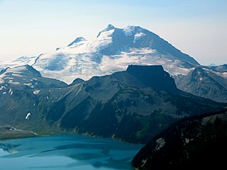
The Anahim hotspot is a volcanic hotspot located in the West-Central Interior of British Columbia, Canada. One of the few hotspots in North America, the Anahim plume is responsible for the creation of the Anahim Volcanic Belt. This is a 300 km (190 mi) long chain of volcanoes and other magmatic features that have undergone erosion. The chain extends from the community of Bella Bella in the west to near the small city of Quesnel in the east. While most volcanoes are created by geological activity at tectonic plate boundaries, the Anahim hotspot is located hundreds of kilometres away from the nearest plate boundary.
Volcanic activity, or volcanism, has played a significant role in the geologic evolution of Mars. Scientists have known since the Mariner 9 mission in 1972 that volcanic features cover large portions of the Martian surface. These features include extensive lava flows, vast lava plains, and the largest known volcanoes in the Solar System. Martian volcanic features range in age from Noachian to late Amazonian, indicating that the planet has been volcanically active throughout its history, and some speculate it probably still is so today. Both Earth and Mars are large, differentiated planets built from similar chondritic materials. Many of the same magmatic processes that occur on Earth also occurred on Mars, and both planets are similar enough compositionally that the same names can be applied to their igneous rocks and minerals.

The Macdonald hotspot is a volcanic hotspot in the southern Pacific Ocean. The hotspot was responsible for the formation of the Macdonald Seamount, and possibly the Austral-Cook Islands chain. It probably did not generate all of the volcanism in the Austral and Cook Islands as age data imply that several additional hotspots were needed to generate some volcanoes.

Ulysses Colles is an official name for conical edifices associated with flows in Ulysses Fossae in the Tharsis quadrangle of Mars. These conical edifices form small volcanic field which were interpreted as result of explosive eruptions on Mars where martian equivalents to terrestrial pyroclastic cones, cinder cones respectively, exist. This field is situated north of the shield volcanoes Biblis Patera and Ulysses Patera and it is superposed on an old, elevated window of fractured crust of Ulysses Fossae, probably of early Hesperian age, which survived flooding by younger lava flows associated with plain-style volcanism in Tharsis.
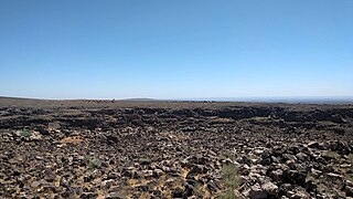
The Igwisi Hills are a volcanic field in Tanzania. Three tuff cones are found there, one of which is associated with a lava flow. They are one of the few locations of possibly kimberlitic lava flows on Earth.

The Tengchong Volcanic Field (TVF) is a Cenozoic volcanic field located in the Southeastern margin of the Tibetan Plateau around 40 km from the Chinese border with Myanmar. The TVF is uniquely the only region affected by Quaternary volcanism that is part of the Himalayan Geothermal Belt caused by the Indo-Asian continent-continent collision. The TVF is characterized by hydrothermal activity and large-scale eruptions last recorded in 1609CE. Although the volcanoes themselves are considered extinct, several geothermal fields geographically linked to the TVF are still highly active. Evidence for geothermal activity can be linked to several prevalent active hot-springs located predominantly within the vicinity of the volcanoes in the TVF. Holocene eruptions occurred predominantly in the three largest volcanoes in the TVF named the Dayingshan, Maa'nshan and Heikongshan, the highest of which (Dayingshan) reaches 2865 meters above sea level. The volcanoes are distributed in a string-like pattern clustered from North to South in the middle on the Tengchong basin and are characterized by post-collisional high-Potassium (K) calc-alkaline series eruptions. The TVF provides unique geographical and geological knowledge as understanding the geological processes of creation provides insight into aspects such as the history of volcanism during the Quaternary Era in the region and as well as compositional information of its source and crustal assimilants. The TVF can be visited in the Tengchong Volcanic Geothermal National Geological Park.`

The Udokan Plateau is a volcanic field in Transbaikalia, Russia. It covers a surface area of 3,000 square kilometres (1,200 sq mi) northeast of Lake Baikal in North Asia. Volcanism in the Udokan Plateau included both basaltic lava flows and later individual volcanic cones. Volcanism commenced in the Miocene and continued on into the Holocene.
Bus-Obo is a 1,162 metres (3,812 ft) high cinder cone in Mongolia. The 90 metres (300 ft) high cone is formed by basaltic rocks. It may be of Pleistocene or Holocene age.
Infiernillo is a volcanic field in Argentina. The field is located northwest of Malargue, at the Rio Salado. The volcanic field, part of the Southern Volcanic Zone, has formed three individual vents with associated lava flows.
Taryatu-Chulutu is a volcanic field in Mongolia. It is part of a volcanic area in Central Asia in the Hangai range that may be linked to the rifting of the Lake Baikal Rift. The field itself is located within the valleys of the Chuluut and Suman rivers. Volcanic activity occurred in the Miocene, Pliocene, Pleistocene and Holocene. The Khorgo cinder cone erupted during the Holocene and lava flows from it formed a lava dam generating Terkhiin Tsagaan Nuur lake.

Balagan-Tas is a cinder cone volcano in Russia. It was discovered by V.A. Zimin in 1939.

Kunlun volcanic group, also known as Ashikule, is a volcanic field in northwestern Tibet. Eight other volcanic fields are also in the area. The field is within a basin that also contains three lakes.
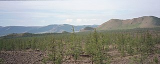
Longgang is a volcanic field in Jilin Province, China. It is also known as Chingyu, Longwan Group or Lung-wan Group. This volcanic field contains over 164 individual centres in the form of crater lakes, maars and volcanic cones and covers a surface area of 1,700 square kilometres (660 sq mi). The field is forested and mostly undisturbed by human activities.
Fueguino is a volcanic field in Chile. The southernmost volcano in the Andes, it lies on Tierra del Fuego's Cook Island and also extends over nearby Londonderry Island. The field is formed by lava domes, pyroclastic cones, and a crater lake.
Northern Tibet volcanic field is a volcanic field in China.

Tunkin Depression is a volcanic field in Russia.
Vitim Plateau is a volcanic landform in Russia. It consists of a plateau with a number of cinder cones and volcanoes, the last of which was active about 810,000 years before present.