| Hornsdale South Australia | |||||||||||||||
|---|---|---|---|---|---|---|---|---|---|---|---|---|---|---|---|
 Hornsdale | |||||||||||||||
| Coordinates | 33°04′05″S138°31′18″E / 33.0681°S 138.5217°E Coordinates: 33°04′05″S138°31′18″E / 33.0681°S 138.5217°E | ||||||||||||||
| Postcode(s) | 5491 | ||||||||||||||
| LGA(s) | Northern Areas Council | ||||||||||||||
| State electorate(s) | Stuart | ||||||||||||||
| Federal Division(s) | Grey | ||||||||||||||
| |||||||||||||||
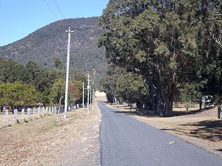
Hornsdale is a locality in the Mid North region of South Australia 226 kilometres (140 mi) north of Adelaide. [1]

The Mid North is a region of South Australia, north of the Adelaide Plains, but not as far north as the Far North, or the outback. It is generally accepted to extend from Spencer Gulf east to the Barrier Highway, including the coastal plain, the southern part of the Flinders Ranges, and the northern part of the Mount Lofty Ranges. The area was settled as early as 1840 and provided early farming and mining outputs for the fledgling colony. Farming is still significant in the area, particularly wheat, sheep and grapevines. There are not currently any significant mining activities in the Mid North.

South Australia is a state in the southern central part of Australia. It covers some of the most arid parts of the country. With a total land area of 983,482 square kilometres (379,725 sq mi), it is the fourth-largest of Australia's states and territories by area, and fifth largest by population. It has a total of 1.7 million people, and its population is the second most highly centralised in Australia, after Western Australia, with more than 77 percent of South Australians living in the capital, Adelaide, or its environs. Other population centres in the state are relatively small; Mount Gambier, the second largest centre, has a population of 28,684.

Adelaide is the capital city of the state of South Australia, and the fifth-most populous city of Australia. In June 2017, Adelaide had an estimated resident population of 1,333,927. Adelaide is home to more than 75 percent of the South Australian population, making it the most centralised population of any state in Australia.
Mount Lock, Mount Ngaduri, Mount Williams and Champion Hill within the Narien Range form the eastern boundary of Hornsdale locality from south to north.

The Narien Range is a range of hills in South Australia's Mid North. The range stretches from a point north of Jamestown northwards to Orroroo.
In October 1880, local landowner William Horne established the post office on section 195B, named Tarcowie East. It was renamed Hornsdale in 1882. [2]
The locality is now home to the 99-turbine Hornsdale Wind Farm operated by Neoen, and the Hornsdale Energy Reserve operated by Tesla, which is known as the world's largest lithium-ion battery.
The Hornsdale Wind Farm is an electricity generator in the locality of Hornsdale in the south-west of the Narien Range, north of Jamestown, South Australia. It consists of 99 wind turbines with a generation capacity of 315 megawatts (422,000 hp). The plant is owned and operated by Neoen, a French renewable energy company. The infobox includes storage capacity from adjoining Hornsdale Power Reserve.
Neoen is a renewable energy company headquartered in Paris, France.
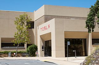
Tesla, Inc. is an American automotive and energy company based in Palo Alto, California. The company specializes in electric car manufacturing and, through its SolarCity subsidiary, solar panel manufacturing. It operates multiple production and assembly plants, notably Gigafactory 1 near Reno, Nevada, and its main vehicle manufacturing facility at Tesla Factory in Fremont, California. As of March 2019, Tesla sells the Model S, Model 3, Model X, Model Y, Roadster (2020) and Semi vehicles, Powerwall and Powerpack batteries, solar panels, solar roof tiles, and some related products.