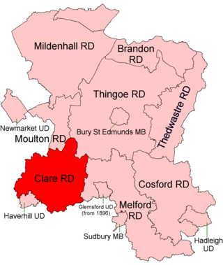
Clare Rural District was a rural district in the county of West Suffolk, England. It was created in 1894, comprising those parishes in the Risbridge rural sanitary district which were in Suffolk.
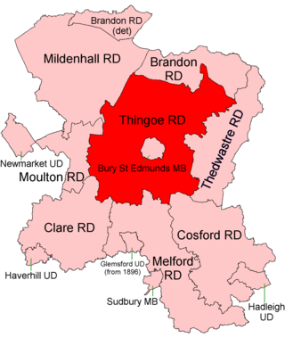
Thingoe Rural District was a rural district in the county of West Suffolk, England between 1894 and 1974. It was named after the ancient Hundred of Thingoe and administered from Bury St Edmunds, which it surrounded.

Gipping Rural District was a rural district in the county of East Suffolk, England. It was created in 1934 by the merger of the disbanded Bosmere and Claydon Rural District and the disbanded East Stow Rural District, under a County Review Order. It was named after the River Gipping and administered from Needham Market.
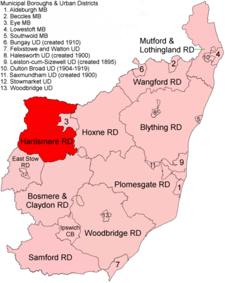
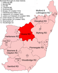
Hartismere Rural District was a rural district in the county of East Suffolk, England. It was expanded in 1934 by merging with the disbanded Hoxne Rural District with a slight readjustment of boundaries. It was named after the ancient Hundred of Hartismere and administered from Eye.

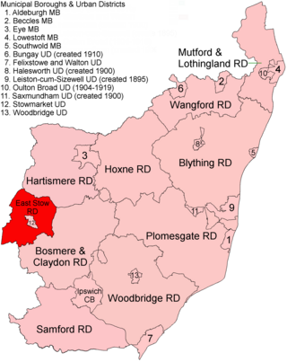
Lothingland was a rural district in East Suffolk, England, named after the ancient half-hundred of Lothingland which was merged with Mutford half-hundred in 1763 to form Mutford and Lothingland.

Thedwastre was a rural district in West Suffolk, England from 1894 to 1974. Thedwastre was formed under the Local Government Act 1894, from the part of the Stow Rural Sanitary District which was in West Suffolk. It was named after the historic hundred of Thedwastre.
East Stow was a rural district in East Suffolk, England from 1894 to 1934.

Deben Rural District was a rural district in the county of East Suffolk, England. It was created in 1934 by the merger of parts of the disbanded Bosmere and Claydon Rural District, the disbanded Plomesgate Rural District and the disbanded Woodbridge Rural District, under a County Review Order. It was named after the River Deben and administered from Woodbridge.

Marshland Rural District was a rural district in Norfolk, England from 1894 to 1974.

Depwade Rural District was a rural district in Norfolk, England from 1894 to 1974.

Brandon was a rural district in Suffolk, England from 1894 to 1935. The district was created in 1894 as the Suffolk part of the Thetford rural sanitary district, the Norfolk part becoming Thetford Rural District. This left the westernmost parishes of Brandon and Santon Downham detached from the rest of the district.
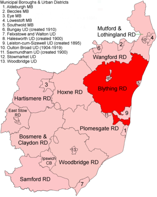
Blything Rural District was a rural district within the administrative county of East Suffolk between 1894 and 1934.
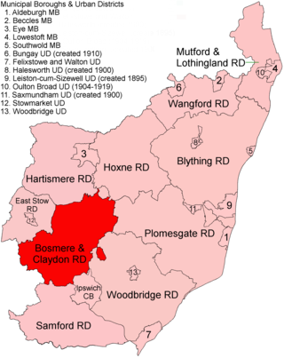
Bosmere and Claydon Rural District was a rural district within the administrative county of East Suffolk between 1894 and 1934. It was created out of the earlier Bosmere and Claydon rural sanitary district. It was named after the historic hundred of Bosmere and Claydon, although the rural district covered a significantly larger area than the hundred.

Mutford and Lothingland Rural District was a rural district within the administrative county of East Suffolk between 1894 and 1934. It was created out of the earlier Mutford and Lothingland rural sanitary district. It was named after the historic hundred of Mutford and Lothingland, whose boundaries it closely matched.
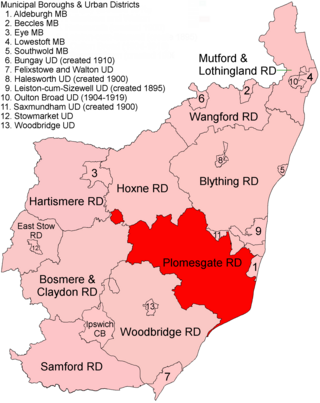
Plomesgate Rural District was a rural district within the administrative county of East Suffolk between 1894 and 1934.
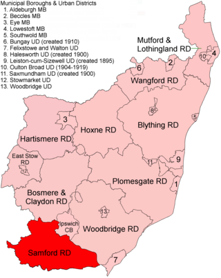
Samford Rural District was a rural district within the administrative county of East Suffolk between 1894 and 1974. It was created out of the earlier Samford rural sanitary district. It was named after the historic hundred of Samford, whose boundaries it closely matched.
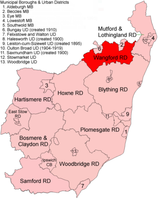
Wangford Rural District was a rural district within the administrative county of East Suffolk between 1894 and 1934. It was created out of the earlier Wangford rural sanitary district. It was named after the historic hundred of Wangford, whose boundaries it closely matched. It contained the group of small villages collectively known as The Saints.
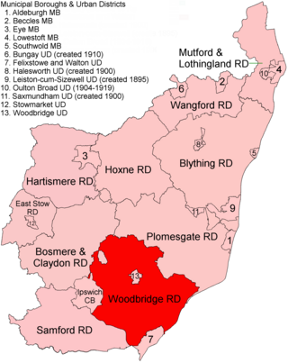
Woodbridge Rural District was a rural district within the administrative county of East Suffolk between 1894 and 1934. It was created out of the earlier Woodbridge rural sanitary district. It surrounded the town of Woodbridge, which had earlier been created as an urban district.
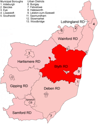
Blyth Rural District was a rural district in East Suffolk, England, between 1934 and 1974.
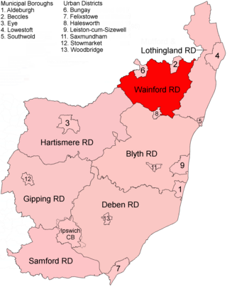
Wainford Rural District was a rural district in East Suffolk, England, between 1934 and 1974. It was created by a merger of the disbanded Wangford Rural District and parts of Blything Rural District, and contained the group of small villages collectively known as The Saints. The name Wainford is linked to that of Wangford, a historic hundred of Suffolk.