
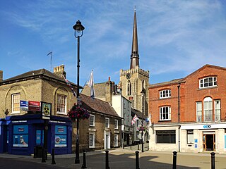
Suffolk Coastal was a local government district in Suffolk, England. Its council was based in Melton, having moved from neighbouring Woodbridge in 2017. Other towns include Felixstowe, Framlingham, Leiston, Aldeburgh, and Saxmundham.
Mid Suffolk is a local government district in Suffolk, England. The district is primarily a rural area, containing just three towns, being Stowmarket, Needham Market and Eye. Its council was based in Needham Market until 2017 when it moved to shared offices with neighbouring Babergh District Council in Ipswich, outside either district. In 2021 it had a population of 103,417.

Babergh District is a local government district in Suffolk, England. In 2021 it had a population of 92,300. The district is primarily a rural area, containing just two towns, being Sudbury and Hadleigh, which was the administrative centre until 2017 when the council moved to shared offices with neighbouring Mid Suffolk District Council in Ipswich, outside either district. The district is named after the medieval Babergh Hundred which covered part of the area.
West Suffolk was an administrative county of England created in 1889 from part of the county of Suffolk. It survived until 1974 when it was rejoined with East Suffolk. Its county town was Bury St Edmunds.

The Borough of Great Yarmouth is a local government district with borough status in Norfolk, England. It is named after its main town, Great Yarmouth, and also contains the town of Gorleston-on-Sea and a number of villages and rural areas, including part of The Broads. Other notable settlements include Caister-on-Sea, Hemsby, Hopton-on-Sea and Winterton-on-Sea.
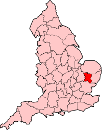
This article describes the history of Suffolk, the English county.
Suffolk Coastal is a parliamentary constituency in the county of Suffolk, England which has been represented in the House of Commons of the UK Parliament since 2010 by Thérèse Coffey, a Conservative Member of Parliament. She served as Secretary of State for Environment, Food and Rural Affairs from October 2022 to November 2023

Lothingland was a rural district in East Suffolk, England, named after the ancient half-hundred of Lothingland which was merged with Mutford half-hundred in 1763 to form Mutford and Lothingland.
Eye was a parliamentary constituency, represented in the House of Commons of the Parliament of the United Kingdom, encompassing an area around the market town and civil parish of Eye, Suffolk.
Lowestoft was a parliamentary constituency centred on the town of Lowestoft in Suffolk. It returned one Member of Parliament (MP) to the House of Commons of the Parliament of the United Kingdom, elected by the first past the post voting system.
Woodbridge was a county constituency centred on the town of Woodbridge in Suffolk. It returned one Member of Parliament (MP) to the House of Commons of the Parliament of the United Kingdom.
Sudbury and Woodbridge was a county constituency centred on the towns of Sudbury and Woodbridge in Suffolk. It returned one Member of Parliament (MP) to the House of Commons of the Parliament of the United Kingdom.
East Suffolk was a county constituency in Suffolk, England. It elected two Members of Parliament to the House of Commons of the Parliament of the United Kingdom by the bloc vote system of election.
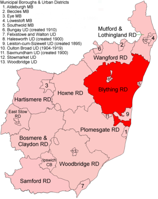
Blything Rural District was a rural district within the administrative county of East Suffolk between 1894 and 1934.
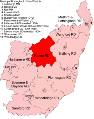
Hoxne Rural District was a rural district within the administrative county of East Suffolk between 1894 and 1934. It was created out of the earlier Hoxne rural sanitary district. It was named after the historic hundred of Hoxne, whose boundaries it closely matched. The hundred, in turn, took its name from the village of Hoxne.

Mutford and Lothingland Rural District was a rural district within the administrative county of East Suffolk between 1894 and 1934. It was created out of the earlier Mutford and Lothingland rural sanitary district. It was named after the historic hundred of Mutford and Lothingland, whose boundaries it closely matched.
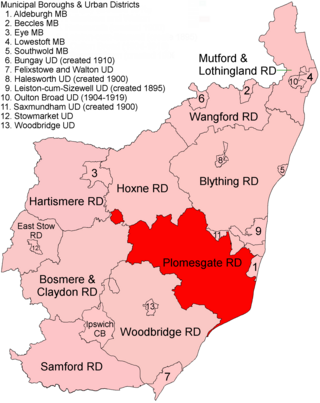
Plomesgate Rural District was a rural district within the administrative county of East Suffolk between 1894 and 1934.
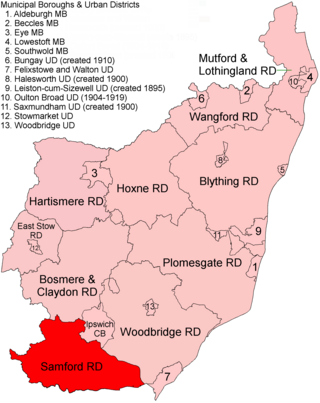
Samford Rural District was a rural district within the administrative county of East Suffolk between 1894 and 1974. It was created out of the earlier Samford rural sanitary district. It was named after the historic hundred of Samford, whose boundaries it closely matched, containing the same parishes.

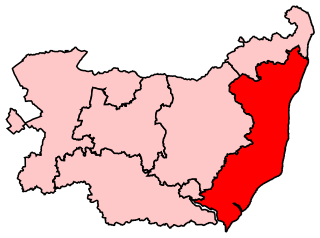
East Suffolk is a local government district in Suffolk, England. The largest town is Lowestoft, which contains Ness Point, the easternmost point of the United Kingdom. The second largest town is Felixstowe, which has the country's largest container port. On the district's south-western edge it includes parts of the Ipswich built-up area. The rest of the district is largely rural, containing many small towns and villages, including several seaside resorts. Its council is based in the village of Melton. The district was formed in 2019 as a merger of the two previous districts of Suffolk Coastal and Waveney. In 2021 it had a population of 246,058. It is the most populous district in the country not to be a unitary authority.

