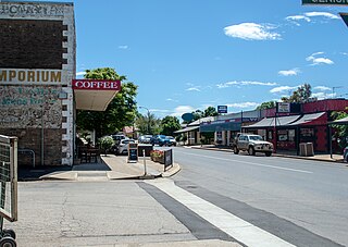
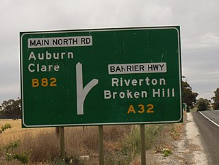
Riverton is a small town in the Mid North of South Australia, in the Gilbert Valley. It is situated on the Gilbert River, from which the town derives its name. Both the Gilbert Valley and Gilbert River were named after South Australian pioneer, Thomas Gilbert. Riverton was first settled in 1856, as a settlement along the bullock track from the mining town of Burra to the capital city Adelaide. It grew from a plan designed by a James Masters who had established the nearby town of Saddleworth. The streets of Riverton received their names chiefly from James Masters and his friends. They commemorate persons notable in the history of the district or the State. At the 2011 census, Riverton had a population of 810. Including the rural areas surrounding the town, the population was 1213.

The Clare and Gilbert Valleys Council is a local government area located in the Yorke and Mid North region of South Australia. The council was founded on 1 July 1997 with the amalgamation of the District Council of Clare, the District Council of Riverton and the District Council of Saddleworth and Auburn. The council seat is located at Clare; it also maintains branch offices at Riverton and Saddleworth.

The town of Clare is located in South Australia in the Mid North region, 136 km north of Adelaide. It gives its name to the Clare Valley wine and tourist region.

The Australian monastic town of Sevenhill is in the Clare Valley of South Australia, approximately 130 km north of Adelaide. The town was founded by members of the Jesuit order in 1850. The name, bestowed by Austrian Jesuit priest Aloysius Kranewitter, is in homage to the seven hills of Rome.

Armagh is a small historic village in the western Clare Valley, about 137 km north of Adelaide, South Australia.

Woolshed Flat is a locality near the southern end of the Clare Valley in South Australia. It is located in the District Council of Clare and Gilbert Valleys.

The Hill River is an ephemeral river located in the Mid North region of the Australian state of South Australia.

The Clare Valley is a valley located in South Australia about 100 kilometres north of Adelaide in the Clare and Gilbert Valleys council area. It is the river valley formed by the Hutt River but is also strongly associated with the roughly parallel Hill River. The valley is traversed by the Horrocks Highway and the towns in the valley along that route from south to north are Auburn, Leasingham, Watervale, Penwortham, Sevenhill and Clare. The geographical feature has given rise to the Clare Valley wine region designation, a notable winegrowing region of Australia.

Hill River is a locality in the Yorke and Mid North region of South Australia, about 127 kilometres north of the Adelaide city centre. It is bisected by the Hill River, an ephemeral stream from which it derives its name. Its boundaries were created in January 2001 for the “long established name.”

Hilltown is a locality in the District Council of Clare and Gilbert Valleys of South Australia. The former town centre is located on Hilltown Road, which runs north-south between Andrews and Hill River, while the unsealed Harvey Highway connects the former town centre to RM Williams Way. It is about 4 km east of RM Williams Way, on the former Spalding railway line.

The Hundred of Willunga is a cadastral unit of hundred covering the extreme south suburbs of the Adelaide metropolitan area. It is one of the eleven hundreds of the County of Adelaide. It was named in 1846 by Governor Frederick Robe probably deriving from a Kaurna/Ngarrindjeri place label willannga, meaning place of green trees.
The Hundred of Kuitpo is a cadastral unit of hundred in the Adelaide Hills. It is one of the 11 hundreds of the County of Adelaide. It was named in 1846 by Governor Frederick Robe and is presumed to be derived from an indigenous term ku-it-po, meaning reeds and referring to Blackfellow Creek in the contemporary locality of Yundi.
The Hundred of Gilbert is a cadastral unit of hundred in the northern Mount Lofty Ranges including the town of Riverton. It is one of the nine hundreds of the County of Light. It was proclaimed in 1851 by Governor Henry Young and named after the Gilbert River, which flows from north to south through the hundred. The river, in turn, was named in honour of South Australian pioneer Thomas Gilbert.

The Hundred of Barossa is a cadastral unit of hundred in South Australia in the northern Adelaide Hills. It lies west of the Barossa Range at the south end of the Barossa Valley and is bounded on the north and south by the North Para and South Para rivers, respectively. It is the most northern of the eleven hundreds of the County of Adelaide and was named in 1846 by Governor Frederick Robe after the Barossa Range.
The Hundred of Para Wirra is a cadastral hundred of the County of Adelaide, South Australia, spanning a portion of the Adelaide Hills north of the Torrens Valley including Mount Crawford.

The Hundred of Alma is a cadastral unit of hundred located on the northern Adelaide Plains of South Australia spanning the township of Alma and the Alma Plains. The hundred was proclaimed in 1856 in the County of Gawler and named by Governor Richard Graves MacDonnell for the River Alma on the Crimean Peninsula, the location of the Battle of the Alma, the first Allied victory in the Crimean War. The hundred is bounded on the north by the Wakefield River and on the south by the Light River

The Corporation and District Council of Clare were twin local government areas in South Australia centred on the town of Clare. The district council existed from 1853 until 1997, while the town corporation existed from 1868 until 1969.
The Hundred of Stanley is a cadastral unit of hundred in the northern Mount Lofty Ranges. It is one of the 16 hundreds of the County of Stanley.

The Hundred of Yackamoorundie is a cadastral unit of hundred in the County of Stanley, South Australia.
Black Springs is a locality and former township in South Australia's Mid North region. It lies on the east side of the Barrier Highway between Gawler to the south and Burra to the north. The source of the Wakefield River is a few hundred metres south of the old township.

