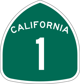
State Route 1 (SR 1) is a major north–south state highway that runs along most of the Pacific coastline of the U.S. state of California. At a total of just over 656 miles (1,056 km), it is the longest state route in California, and the second-longest in the US after Montana Highway 200. SR 1 has several portions designated as either Pacific Coast Highway (PCH), Cabrillo Highway, Shoreline Highway, or Coast Highway. Its southern terminus is at Interstate 5 (I-5) near Dana Point in Orange County and its northern terminus is at U.S. Route 101 (US 101) near Leggett in Mendocino County. SR 1 also at times runs concurrently with US 101, most notably through a 54-mile (87 km) stretch in Ventura and Santa Barbara counties, and across the Golden Gate Bridge.

McKinleyville is a census-designated place (CDP) in Humboldt County, California McKinleyville is located 5.25 miles (8.4 km) north of Arcata, at an elevation of 141 feet (43 m). The population was 15,177 at the 2010 census, up from 13,599 at the time of the 2000 census.

The Coquille River is a stream, about 36 miles (58 km) long, in southwestern Oregon in the United States. It drains a mountainous area of 1,059 square miles (2,740 km2) of the Southern Oregon Coast Range into the Pacific Ocean. Its watershed is between that of the Coos River to the north and the Rogue River to the south.
The Salmon River flows from the Central Oregon Coast Range to the Pacific Ocean coast of northwest Oregon in the United States. About 24 miles (39 km) long, it begins and ends in Lincoln County but also flows briefly through western Polk and southern Tillamook counties. Much of its course lies within the Siuslaw National Forest.

Wedderburn is an unincorporated coastal community in Curry County, Oregon, United States. It is to the north of, and across the mouth of the Rogue River from Gold Beach, on U.S. Route 101. The Isaac Lee Patterson Bridge connects Wedderburn with Gold Beach.

State Route 109 (SR 109) is a Washington state highway in Grays Harbor County. Beginning at its terminus at U.S. Route 101 (US 101) in Hoquiam, the highway travels west to intersect SR 115 near Ocean Shores and then turns north to continue along the Pacific coastline, terminating at the Quinault River Bridge in Taholah, located in the Quinault Indian Reservation. The Washington State Legislature extended the roadway north to end at US 101 south of Queets through tribal lands, although this segment has yet to be built. SR 109 was first established as Secondary State Highway 9C (SSH 9C) in 1937, which was on a more northern alignment until 1947, when it was switched to a Hoquiam to Quinault Indian Reservation route. In 1964, SSH 9C was renumbered to SR 109 and in 1983, a spur route of SR 109 that bypasses Hoquiam was added. SR 109 itself was extended by the legislature to US 101 near Queets in 1985, but the road has not been built.

U.S. Route 101 (US 101) is a United States Numbered Highway that runs along the West Coast from Los Angeles, California to Tumwater, Washington. Within the state of Washington, US 101 connects cities on the coast of the Pacific Ocean and encircles the Olympic Peninsula around the Olympic Mountains. It also serves as the main access for Olympic National Park, several state parks, and other scenic and recreational areas.

Stonefield Beach State Recreation Site is a state park in the U.S. state of Oregon, administered by the Oregon Parks and Recreation Department.

Ophir Beach is an undeveloped sandy beach on the Oregon Coast seven miles north of Gold Beach in Curry County, United States. It is more than 8.5 kilometres (5.3 mi) in length with the south end at Nesika Beach and the north end at a cape named the Devils Backbone. The beach is bounded by U.S. Route 101 on the east. Euchre Creek flows westward to the ocean cutting through the northern third of the beach.

Orick is a census-designated place situated on the banks of the Redwood Creek in Humboldt County, California. It is located 43 miles (69 km) north of Eureka, at an elevation of 26 feet. The population was 357 at the 2010 census.
Tijeras Canyon Creek is a watercourse in northeast Orange County, California and a tributary of Arroyo Trabuco. It originates in the foothills of the Santa Ana Mountains, and flows southwest through the suburban city of Rancho Santa Margarita for several miles as an underground culvert. Below State Route 241 it becomes a free-flowing creek, traveling through Cañada Vista Park and Tijeras Creek Golf Club before joining with Trabuco Creek in O'Neill Regional Park.
The Pistol River is a coastal stream that meanders for 21 miles (34 km) through the Southern Oregon Coast Range to the Pacific Ocean near the unincorporated community of Pistol River in the U.S. state of Oregon. Flowing generally southwest from its origin near Sugarloaf Mountain in the Siskiyou National Forest, the river enters the sea at Pistol River State Scenic Viewpoint, 10 miles (16 km) south of Gold Beach. The river received its name after pioneer James Mace lost his pistol in it in 1853.
Tenmile Creek is a stream in Lane County, in the U.S. state of Oregon. It flows west from the Siuslaw National Forest in the Oregon Coast Range into the Pacific Ocean at Stonefield Beach State Recreation Site, about 6 miles (10 km) south of Yachats.
Harney is an unincorporated community in Harney County, in the U.S. state of Oregon. It lies north of U.S. Route 20 between Burns and Buchanan near the site of historic Fort Harney. The community, county, and nearby geographic features such as Harney Lake are named for William S. Harney, a military officer popular in the Pacific Northwest in the mid-19th century.

Big Creek is a stream that enters the Pacific Ocean along the coast of Lane County in the U.S. state of Oregon. Beginning at Saddle Mountain Spring in the Central Oregon Coast Range, it flows generally west through the Siuslaw National Forest to the ocean north of Heceta Head. Near its mouth, it passes under Big Creek Bridge, which carries U.S. Route 101.
Bagnell Ferry is an unincorporated community in Curry County, Oregon, United States. It lies along the north bank of the Rogue River about 5 miles (8 km) upstream of Gold Beach.
Bitter Lick is an unincorporated community in Jackson County, Oregon, United States. It lies at the confluence of Bitter Lick Creek and Elk Creek, northwest of the ghost town of Persist. Bitter Lick is in the northern part of the county, north of Lost Creek Lake, a reservoir on the Rogue River.
Buckhorn Springs is an unincorporated community in Jackson County, Oregon, United States. It lies along Emigrant Creek in the Siskiyou Mountains southeast of Ashland. Buckhorn Springs Road connects the community to Oregon Route 66 near Emigrant Lake.
Dardanelles is an unincorporated community in Jackson County, Oregon, United States. It lies opposite the city of Gold Hill on the south side of the Rogue River. Interstate 5 and Oregon Route 99 pass by Gold Hill and Dardanelles.
Cascade Gorge is an unincorporated community in Jackson County, Oregon, United States. It lies along the Rogue River downstream of Prospect near the upper end of Lost Creek Lake. Oregon Route 62 passes through Cascade Gorge. The South Fork Rogue River enters the main stem slightly upstream of Cascade Gorge on the opposite bank.


