
The Mars Polar Lander, also known as the Mars Surveyor '98 Lander, was a 290-kilogram robotic spacecraft lander launched by NASA on January 3, 1999, to study the soil and climate of Planum Australe, a region near the south pole on Mars. It formed part of the Mars Surveyor '98 mission. On December 3, 1999, however, after the descent phase was expected to be complete, the lander failed to reestablish communication with Earth. A post-mortem analysis determined the most likely cause of the mishap was premature termination of the engine firing prior to the lander touching the surface, causing it to strike the planet at a high velocity.

Delta II was an expendable launch system, originally designed and built by McDonnell Douglas, and sometimes known as the Thorad Delta 1. Delta II was part of the Delta rocket family, derived directly from the Delta 3000, and entered service in 1989. There were two main variants, the Delta 6000 and Delta 7000, with the latter also having "Light" and "Heavy" subvariants. During its career, Delta II flew several notable payloads, including 24 Global Positioning System (GPS) Block II satellites, several dozen NASA payloads, and 60 Iridium communication satellites. The rocket flew its final mission, ICESat-2, on 15 September 2018, earning the launch vehicle a streak of 100 successful missions in a row, with the last failure being GPS IIR-1 in 1997. In the late 1990s, Delta II was developed further into the unsuccessful Delta III, which was in turn developed into the more capable and successful Delta IV, though the latter shares little heritage with the original Thor and Delta rockets.
CryoSat is an ESA programme to monitor variations in the extent and thickness of polar ice through use of a satellite in low Earth orbit. The information provided about the behaviour of coastal glaciers that drain thinning ice sheets will be key to better predictions of future sea level rise. The CryoSat-1 spacecraft was lost in a launch failure in 2005, however the programme was resumed with the successful launch of a replacement, CryoSat-2, launched on 8 April 2010.

Aeolus, or, in full, Atmospheric Dynamics Mission-Aeolus (ADM-Aeolus), was an Earth observation satellite operated by the European Space Agency (ESA). It was built by Airbus Defence and Space, launched on 22 August 2018, and operated until it was deorbited and re-entered the atmosphere over Antarctica on 28 July 2023. ADM-Aeolus was the first satellite with equipment capable of performing global wind-component-profile observation and provided much-needed information to improve weather forecasting. Aeolus was the first satellite capable of observing what the winds are doing on Earth, from the surface of the planet and into the stratosphere 30 km high.

CALIPSO was a joint NASA (US) and CNES (France) environmental satellite, built in the Cannes Mandelieu Space Center, which was launched atop a Delta II rocket on April 28, 2006. Its name stands for Cloud-Aerosol Lidar and Infrared Pathfinder Satellite Observations. CALIPSO launched alongside CloudSat.

United Launch Alliance, LLC (ULA) is an American launch service provider formed in December 2006 as a joint venture between Lockheed Martin Space and Boeing Defense, Space & Security. The company designs, assembles, sells and launches rockets, but the company subcontracts out the production of rocket engines and solid rocket boosters.

The Aeronomy of Ice in the Mesosphere is a NASA satellite launched in 2007 to conduct a planned 26-month study of noctilucent clouds (NLCs). It is the ninetieth Explorer program mission and is part of the NASA-funded Small Explorer program (SMEX).

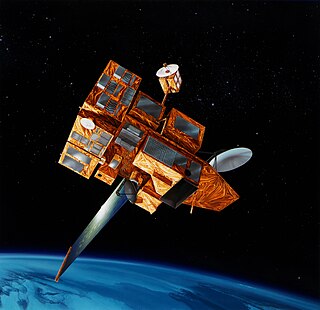
NOAA-19, known as NOAA-N' before launch, is the last of the American National Oceanic and Atmospheric Administration (NOAA) series of weather satellites. NOAA-19 was launched on 6 February 2009. NOAA-19 is in an afternoon Sun-synchronous orbit and is intended to replace NOAA-18 as the prime afternoon spacecraft.

CryoSat-1, also known as just CryoSat, was a European Space Agency satellite which was lost in a launch failure in 2005. The satellite was launched as part of the European Space Agency's CryoSat mission, which aims to monitor ice in the high latitudes. The second mission satellite, CryoSat-2, was successfully launched in April 2010.
Sea ice thickness spatial extent, and open water within sea ice packs can vary rapidly in response to weather and climate. Sea ice concentration are measured by satellites, with the Special Sensor Microwave Imager / Sounder (SSMIS), and the European Space Agency's Cryosat-2 satellite to map the thickness and shape of the Earth's polar ice cover. The sea ice volume is calculated with the Pan-Arctic Ice Ocean Modeling and Assimilation System (PIOMAS), which blends satellite-observed data, such as sea ice concentrations into model calculations to estimate sea ice thickness and volume. Sea ice thickness determines a number of important fluxes such as heat flux between the air and ocean surface—see below—as well as salt and fresh water fluxes between the ocean since saline water ejects much of its salt content when frozen—see sea ice growth processes. It is also important for navigators on icebreakers since there is an upper limit to the thickness of ice any ship can sail through.
ADEOS II was an Earth observation satellite (EOS) launched by NASDA, with contributions from NASA and CNES, in December 2002. and it was the successor to the 1996 mission ADEOS I. The mission ended in October 2003 after the satellite's solar panels failed.

Operation IceBridge (OIB) was a NASA mission to monitor changes in polar ice by utilizing airborne platforms to bridge the observational gap between the ICESat and ICESat-2 satellite missions. The program, which ran from 2009 to 2019, employed various aircraft equipped with advanced instruments to measure ice elevation, thickness, and underlying bedrock topography. The data collected helped scientists understand ice dynamics, contributing to predictive models of ice and sea-level rise. IceBridge played a crucial role in discovering the longest canyon on Earth beneath the Greenland ice sheet.
ICESat-2, part of NASA's Earth Observing System, is a satellite mission for measuring ice sheet elevation and sea ice thickness, as well as land topography, vegetation characteristics, and clouds. ICESat-2, a follow-on to the ICESat mission, was launched on 15 September 2018 onboard Delta II as the final flight from Vandenberg Air Force Base in California, into a near-circular, near-polar orbit with an altitude of approximately 496 km (308 mi). It was designed to operate for three years and carry enough propellant for seven years. The satellite orbits Earth at a speed of 6.9 kilometers per second (4.3 mi/s).

The Suomi National Polar-orbiting Partnership, previously known as the National Polar-orbiting Operational Environmental Satellite System Preparatory Project (NPP) and NPP-Bridge, is a weather satellite operated by the United States National Oceanic and Atmospheric Administration (NOAA). It was launched in 2011 and is currently in operation.

Meteor-3M No.1 was the first and only of the Meteor-3M series polar-orbiting weather satellites. It was launched on 10 December 2001 at 17:18:57 UTC from the Baikonur Cosmodrome in Kazakhstan. The satellite is in a Sun-synchronous orbit with an ascending node time of about 9AM.
Global Ecosystem Dynamics Investigation (GEDI, pronounced ) is a NASA mission to measure how deforestation has contributed to atmospheric CO2 concentrations. A full-waveform LIDAR was attached to the International Space Station to provide the first global, high-resolution observations of forest vertical structure. This will allow scientists to map habitats and biomass, particularly in the tropics, providing detail on the Earth's carbon cycle.

NOAA-21, designated JPSS-2 prior to launch, is the second of the United States National Oceanic and Atmospheric Administration (NOAA)'s latest generation of U.S. polar-orbiting, non-geosynchronous, environmental satellites called the Joint Polar Satellite System. NOAA-21 was launched on 10 November 2022 and joined NOAA-20 and Suomi NPP in the same orbit. Circling the Earth from pole-to-pole, it will cross the equator about 14 times daily, providing full global coverage twice a day. It was launched with LOFTID.

NOAA-20, designated JPSS-1 prior to launch, is the first of the United States National Oceanic and Atmospheric Administration's latest generation of U.S. polar-orbiting, non-geosynchronous, environmental satellites called the Joint Polar Satellite System. NOAA-20 was launched on 18 November 2017 and joined the Suomi National Polar-orbiting Partnership satellite in the same orbit. NOAA-20 operates about 50 minutes behind Suomi NPP, allowing important overlap in observational coverage. Circling the Earth from pole-to-pole, it crosses the equator about 14 times daily, providing full global coverage twice a day. This gives meteorologists information on "atmospheric temperature and moisture, clouds, sea-surface temperature, ocean color, sea ice cover, volcanic ash, and fire detection" so as to enhance weather forecasting including hurricane tracking, post-hurricane recovery by detailing storm damage and mapping of power outages.
Sinéad Louise Farrell is a British-American space scientist who is Professor of Geographic Sciences at the University of Maryland, College Park. Her research considers remote sensing and climate monitoring. She was science lead for the ICESat-2 Mission, which used laser altimetry to make height maps of Earth.
