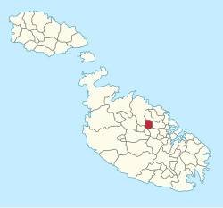
Iklin

Last updated
Residential Road, Iklin Iklin place 01.jpg
Residential Road, Iklin

Iklin
L-Iklin
St. Michael Chapel Iklin, Malta.jpeg
Chapel of St. Michael Archangel built in 1615
Flag of Iklin.svg
Iklin coa.svg
Iklin in Malta.svg
Coordinates: 35°54′15″N14°27′16″E / 35.90417°N 14.45444°E / 35.90417; 14.45444
Country Flag of Malta.svg  Malta
Region Central Region
District Western District
Established1954
Area
  Total1.7 km2 (0.7 sq mi)
Population
 (Jan. 2019)
  Total3,422
  Density2,000/km2 (5,200/sq mi)
Demonym(s) Ikliniż (m), Ikliniża (f), Ikliniżi (pl)
Time zone UTC+1 (CET)
  Summer (DST) UTC+2 (CEST)
Postal code
IKL
Dialing code 356
ISO 3166 code MT-19
Patron saint Holy Family
St. Michael
Day of festa Sunday before 29 September (St. Michael)
Website Official website

Iklin (Maltese : L-Iklin) is a village in the Central Region of Malta, with a population of 3,247 as at 2021. Iklin was established in the mid-20th century; however some archaeological sites [1] and a medieval chapel, named as St. Michael Chapel, are proof to earlier settlements. Until recently, the town was considered to form part of the Three villages of Malta, as part of Lija. With the separation of Iklin from Lija, Iklin is no longer part of the three villages. [2] It is bordered by Għargħur, San Ġwann, Birkirkara, Balzan and Naxxar.

Contents

Iklin is divided in Lower Iklin siding on the Birkirkara bypass and the Upper Iklin. In Lower Iklin houses are built side by side, in general villas and maisonettes but also recently some apartments. In Upper Iklin land is on a hill close to Naxxar and land is considered more expensive; in general the land consists of villas and farmhouses. The two sides share two common facts, the neighborhoods structural design and the general silence living areas. [3]

Etymology

The name of Iklin is derived from the herb Rosmarinus officinalis, which is known as l-iklin in Maltese. [4] The valley in which the herb grew has now been built up. [5] [6] The coat of arms depicts a shield on a blue background with Saint Michael in the centre and, the six roses of L-Iklin on the borders. [7]

History

Modern day Iklin began to develop in the mid-20th century, but the area still has a few minor sites of archaeological importance.[ citation needed ]

Pre-historic temple in Ta' Raddiena area Iklin pre-historic temple.jpg
Pre-historic temple in Ta' Raddiena area

Prehistorical temples

A megalithic site, perhaps the remains of a temple, was discovered in 1967 by the Teenagers Din l-Art Ħelwa group from St. Aloysius' College. Unfortunately, this site has never been seriously surveyed or studied. A second megalithic site was studied in 1986 during works on the new Birkirkara By-Pass, in the area known as Tar-Raddiena. Two large megaliths, and a few smaller ones are still visible (though often ignored) on this busy road. The ruins were dated, through pottery sherds found during excavation, to the Bronze Age. The foundations of a Roman Villa were excavated in 1975 during construction works. The site has had its own historic importance, but it was destroyed soon after the excavations when the development for housing estates proceeded. [8] [9] Various references can be found related to these pre-historic sites with documents penned by Maltese archeologist, Anthony Bonanno. [10] It is widely believed that further remains are still to be found and unearthed in the surrounding areas. [11]

Centre of Iklin - Community Parish dedicated to the Holy Family Iklin parish centre.jpeg
Centre of Iklin - Community Parish dedicated to the Holy Family

Old Chapel

In the 15th century, a chapel dedicated to St. Michael was built in what is now Iklin. Pietro Dusina visited the chapel during his Apostolic Visit of 1575, and he described it as being in a poor state. The chapel was rebuilt in 1615 by Gilormu Agius. Today it is open once a year for the feast of St. Michael, which is celebrated the Sunday before 29 September by the Lija fireworks team. [12] [13]

The first purposely-built residential house in modern Iklin was Dar il-Lewża, which was built in 1954, [3] suffered severe structural impact as outlined in 2012, [14] [15] and demolished in 2018. [16] A number of villas were constructed in the 1960s and early 1970s, and development increased rapidly between the late 1970s and the 1980s. [5] Iklin has had a local council since 1994, and the town became a separate parish in 2005. A new parish church named for the Holy Family was built for this purpose. [13]

Local Council

The Iklin Local Council was established by the Local Councils Act of 1993, along with the other local councils of Malta. [17] The first election was held on 19 March 1994.

The local council, elected in 2019, is made up of the following members: [18]

Church

The Holy Family Parish Church , situated in Pjazza Ninu Cremona, serves as the main church in this small locality. [19] In the 80s, the need for a church was evident with the growing population. The first steps were taken by the then Lija parish priest to set up locations where catechism could be taught and mass celebrated. On 23 July 1993, through the donation of a benefactor, a property was converted into a church and the new Pastoral Centre was officially inaugurated. [20] It was only in 2005 that this church became an officially recognised Parish church. [21] 360 Virtual tour of the church can be seen here.

Sport

The Lija/Iklin Football Nursery is fast gaining prominence on the local sports scene. Inaugurated in 2002, this association was co-founded by Lija and Iklin as a training nursery to eventually feed the best players to the Lija Athletic Football Club. [22] The need for better training and playing facilities continues to be felt in this locality. [23]

Zones in Iklin

The locality of Iklin includes the following zones:

Main roads

The main roads of Iklin are:

Village Squares

Ninu Cremona Square

Anton Buttigieg Square

Iklin Local Council

Related Research Articles

<span class="mw-page-title-main">Attard</span> Local council in Central Region, Malta

Attard is a town in the Central Region of Malta. Together with Balzan and Lija it forms part of "the Three Villages" and has been inhabited since the Classical Period. It has a population of 12,268 as of 2021. Attard's traditional Latin motto is Florigera rosis halo due to its many flower gardens and citrus orchards. Attard is abundant with public gardens. The inhabitants of Attard are known as saraċini.

<span class="mw-page-title-main">St. Julian's, Malta</span> Local council in Central Region, Malta

Saint Julian's is a town in the Central Region of Malta. As of 2020, its registered number of inhabitants stands at 13,792. It is situated along the coast, north of the country's capital, Valletta. It is known for tourism-oriented businesses, such as hotels, restaurants and nightclubs which are centred mainly in an area known as Paceville.

<span class="mw-page-title-main">Birkirkara</span> Local council in Central Region, Malta

Birkirkara is a city in the central region of Malta. It is the second most populous on the island, with 24,356 inhabitants as of 2020. The town consists of five autonomous parishes: Saint Helen, Saint Joseph the Worker, Our Lady of Mount Carmel, Saint Mary and San Gorg Preca. The city's motto is In hoc signo vinces, and its coat of arms is a plain red cross, surmounted by a crown.

<span class="mw-page-title-main">Balzan</span> Local council in Central Region, Malta

Balzan is a municipality in the Central Region of Malta, one of the so-called three villages, together with Attard and Lija. The village originally consisted of a group of small dwellings and farms but eventually grew, becoming a parish in the 17th century. As of 2021, the town registered a population of 4,774 inhabitants.

<span class="mw-page-title-main">Victoria, Malta</span> Town and Local council in Gozo Region, Malta

Victoria, also known among the native Maltese as Rabat or by its title Città Victoria, is an administrative unit of Malta, and the main town on Gozo. Victoria has a total population of 6,901, and by population, is the largest locality in Gozo.

<span class="mw-page-title-main">Żurrieq</span> Local council in Southern Region, Malta

Żurrieq is a town in the Southern Region of Malta. It is one of the oldest towns in the country, and it has a population of 11,823 inhabitants as of March 2014. Żurrieq is one of the 10 parishes to be documented in 1436 and it is dedicated to Saint Catherine. The island of Filfla is administratively a part of the town. The town stretches from Nigret to Ħal Far. In old times the town was had a border with Żejtun. The village of Qrendi used to be part of the parish of Żurrieq until 1618 when it was made into its own parish.

<span class="mw-page-title-main">St. Paul's Bay</span> Local council in Northern Region, Malta

St. Paul's Bay is a town in the Northern Region of Malta, sixteen kilometres northwest of the capital Valletta. Saint Paul's Bay is the largest town in the Northern Region and the seat of the Northern Regional Committee. It is the most populous settlement in Malta.

<span class="mw-page-title-main">Żebbuġ, Gozo</span> Local council in Gozo Region, Malta

Żebbuġ is an administrative unit of Malta, in the northwest coast of the island of Gozo. It is located close to Għarb and Għasri and is built on two hilltop plateaus, Ta' Abram and Ix-Xagħra taż-Żebbuġ. The fishing port and tourist resort of Marsalforn lies within the Żebbuġ Council. The village has a population of 2,956, which makes it the fifth largest in Gozo, after Xewkija.

<span class="mw-page-title-main">Lija</span> Local council in Central Region, Malta

Lija is a small village in the Central Region of Malta. It forms part of the Three villages of Malta, along with Attard and Balzan. Lija has a baroque parish church and seven other small chapels. The parish church is dedicated to Our Saviour. Lija became a parish in 1594, after the small community detached itself from the neighbouring town, Birkirkara. It has a population of 3,162 as of 2021.

<span class="mw-page-title-main">San Ġwann</span> Local council in Central Region, Malta

San Ġwann is a town in the Central Region of Malta, with a population of 14,244 as of 2021. Previous to its separate administration the town used to form part of two separate localities being Birkirkara and St. Julian's.

<span class="mw-page-title-main">Gudja</span> Local council in Southern Region, Malta

Gudja is a village in the Southern Region of Malta, with a population of 3,148 as of March 2017. The village is located on high grounds, south of Valletta. It is administered by the Gudja Local Council. A number of schools, clubs, public gardens and recreations places are found around the village.

<span class="mw-page-title-main">Kirkop</span> Local council in Southern Region, Malta

Kirkop is a village in the Southern Region of Malta. It is found near the Malta International Airport, and has been inhabited since pre-history. The parish church is dedicated to Saint Leonard. The football team of the village is the Kirkop United Football Club.

<span class="mw-page-title-main">Naxxar</span> Local council in Northern Region, Malta

Naxxar is a small city in the Northern Region of Malta, with a population of 14,891 people as of March 2014. The Naxxar Church is dedicated to Our Lady of Victories. The annual village feast is celebrated on 8 September. Naxxar was formerly known for hosting the Maltese International Trade Fair at Maltese International Trade Fair Grounds.

<span class="mw-page-title-main">Districts of Malta</span>

Malta is for non-local government purposes divided into districts as opposed to the local government localities. The three main types of such districts – statistical, electoral at national level, and policing – have no mainstream administrative effect as the local councils form the first-tier – moreover only administrative tier – divisions of the country.

This page list topics related to Malta.

<span class="mw-page-title-main">Roads in Malta</span> Overview of the various roads in Malta

In Malta most of the main roads are in the outskirts of the localities to connect one urban area with another urban area. The most important roads are those that connect the south of the island with the northern part, like Tal-Barrani Road, Aldo Moro Street in Marsa and Birkirkara Bypass.

<span class="mw-page-title-main">Central Region, Malta</span> Region of Malta

The Central Region is one of five regions of Malta. The region includes the central part of the main island of Malta. The region borders the Northern, Southern and South Eastern Regions.

<span class="mw-page-title-main">Ta' Ċieda Tower</span> Ancient tower in San Ġwann, Malta

Ta' Ċieda Tower, also known as San Ġwann Roman Tower, is a Punic-Roman tower in San Ġwann, Malta. The exact origins of the tower could date back to pre-history with different architecture. It is argued that the tower could be of Punic origins rather than Roman but the latter have adapted it. The site of the tower was used as a cemetery, or more, during the Muslim caliphate in the medieval times. Following the expulsion of the Muslims in Malta a church dedicated to St. Helen was built on the site.

References

  1. Sagona, Claudia (2015). The Archaeology of Malta. Cambridge University Press. p. 313. ISBN   9781107006690.
  2. S. Formosa; S. Scicluna; J. Azzopardi (January 2013). Saviour Formosa; Sandra Scicluna; Jacqueline Azzopardi (eds.). Realities of Crime, Society and Landuse in the Mediterranean: JANUS I (PDF). Msida: Department of Criminology, University of Malta. p. 79. doi:10.13140/2.1.1230.4322. ISBN   978-99957-834-0-2. Archived from the original on 15 March 2017.
  3. 1 2 "Malta-The George Cross Island - "Towns & Villages" (3)". English-studies.org. Archived from the original on 5 March 2016. Retrieved 4 January 2016.
  4. https://www.um.edu.mt/library/oar/bitstream/123456789/41627/1/L-ilsien_Malti_dokument_ta_l-Istorja_1989.pdf [ bare URL PDF ]
  5. 1 2 "L-Iklin". lc.gov.mt. Archived from the original on 24 September 2014.
  6. Caruana, Joseph (2009). "Toponomi f'Ghajnsielem" (PDF). L-Imnara. 4 (35): 187–188. Retrieved 10 July 2018..
  7. "COAT OF ARMS". Notes and Queries. 14 February 1880. doi:10.1093/notesj/s6-i.7.145-e. ISSN   1471-6941.
  8. Bonanno, Anthony (1981). "Two Archaeological Sites Discovered at l-Iklin" (PDF). Hyphen. Melitensia. 5 (2): 212–220. Archived from the original (PDF) on 6 March 2016. Retrieved 6 March 2016.
  9. Sagona, Claudia (2015). "The Archeology in Malta". Cambridge University Press. ISBN   1107006694, 9781107006690. p. 313.
  10. Bugeja, Anton. "Rediscovering Forgotten Sites: A Megalithic Site at L-Iklin". The Oracle. 1: 39–40.
  11. "Iklin Megaliths". www.oocities.org. Retrieved 28 July 2021.
  12. "National Inventory Register". National Inventory of the Cultural Property of the Maltese Islands. 27 August 2012. Archived from the original on 12 September 2016.
  13. 1 2 Scerri, John. "Iklin". malta-canada.com. Archived from the original on 12 November 2012.
  14. "Rose Zammit u b'digriet tas-17 ta' Settembru 2004 il- Qorti ordnat li l-gudizzju jghaddi fil-persuna ta' Elizabeth Galea wara l-mewt ta' ommha l-attrici fil- mori tal-kawza. vs 1. EneMalta 2. Maltacom".
  15. "Wires and cables fixed on property cause damage". Timesofmalta.com. 19 August 2013. Retrieved 11 July 2018.
  16. "Dar Lewza can be described as having a sober form of Modernist design which must have been quite daring when it was built (late 1950s/ early 1960s). It exemplifies a style of Maltese architecture of which few quality pieces remain. Sadly this was not recognised by the authorities and last month demolition works began, to be replaced by showrooms and offices. Photographs taken this afternoon". Modernist Architecture of Malta. facebook. 11 February 2018. Archived from the original on 10 July 2018.
  17. "About Local Government". Local Councils' Association. Archived from the original on 7 December 2014.
  18. "Electoral Commission of Malta". electoral.gov.mt. Retrieved 28 July 2021.
  19. "Familja Mqaddsa - Parish Church - Iklin, Malta". www.quddies.com.mt. Retrieved 28 July 2021.
  20. "Noti Storiċi". Parrocca Familja Mqaddsa Iklin. Retrieved 28 July 2021.
  21. "Iklin Parish Church in Malta-Pray, Visit and Experience". www.malta.com. Retrieved 28 July 2021.
  22. "Lija Iklin Football Academy, LIJA ATHLETIC Sports Complex R. Mifsud Bonnici Street,, Ħal Lija (2021)". www.findglocal.com. Retrieved 30 July 2021.
  23. "Iklin football ground still an unrealised dream". Times of Malta. 11 December 2008. Retrieved 28 July 2021.
  24. Abela, Giovanni Francesco (1647). Della Descrizione di Malta Isola nel Mare Siciliano con le sue Antichità, ed Altre Notizie (in Italian). Paolo Bonacota. p. 85.