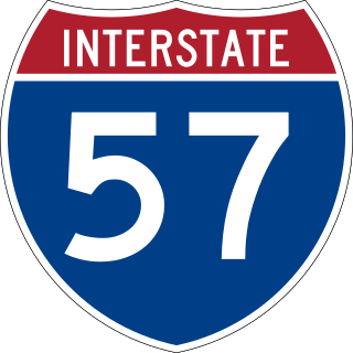
Interstate 57 (I-57) is a north–south Interstate Highway in Missouri and Illinois that parallels the old Illinois Central Railroad for much of its route. It runs from Sikeston, Missouri, at I-55 to Chicago, Illinois, at I-94. I-57 essentially serves as a shortcut route for travelers headed between the South and Chicago, bypassing St. Louis, Missouri and Springfield, Illinois. Between the junction of I-55 and I-57 in Sikeston and the junction of I-55 and I-90/I-94 in Chicago, I-55 travels for 436 miles (702 km), while the combination of I-57 and I-94 is only 396 miles (637 km) long between the same two points. In fact, both the control cities on the overhead signs and the destination mileage signs reference Memphis along southbound I-57, even as far north as its northern origin at I-94 in Chicago. Likewise, at its southern end, Chicago is the control city listed for I-57 on signs on northbound I-55 south of Sikeston, even though I-55 also goes to Chicago. A southward extension of I-57 from its current southern terminus to Little Rock, Arkansas is currently in various stages of development.
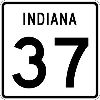
State Road 37 (SR 37) is a major route in the U.S. state of Indiana, running as a four-lane divided highway for 110 miles of its course.

State Highway 310 is an 8.3-mile (13.4 km) north–south state highway located mostly within Dallas. It is a portion of the old route of U.S. Highway 75 (US 75) along the Central Expressway, which now ends in downtown Dallas. The road, located within Hutchins and South Dallas, has been replaced as the major through route by Interstate 45 (I-45). SH 310 is known as the South Central Expressway south of its intersection with Loop 12 and the S. M. Wright Freeway north of it.
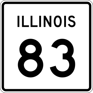
Illinois Route 83 (IL 83) is a 91.73-mile-long (147.63 km) major north–south state highway in northeast Illinois. It stretches from U.S. Route 30 by Lynwood and Dyer, Indiana, north to the Wisconsin border by Antioch at Wisconsin Highway 83 (WIS 83).

Illinois Route 53 (IL 53) is an arterial north–south state highway in northeast Illinois. IL 53 runs from Main Street west of historic U.S. Route 66 (US 66) in Gardner to IL 83 in Long Grove, a distance of 82.02 miles (132.00 km). It mainly cuts through the western suburbs of Chicago, passes through Bolingbrook, Romeoville, Crest Hill and Joliet, merging into I-55 at Gardner.

Illinois Route 60 is a 17.22-mile-long (27.71 km) east–west state highway in Lake County, in northeastern Illinois. It connects the village of Volo at Illinois Route 120 just east of Illinois Route 59 with the city of Lake Forest at U.S. Highway 41.
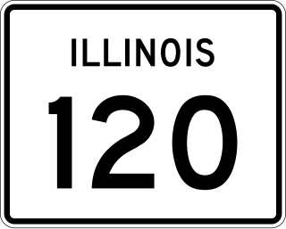
Illinois Route 120 (IL 120) is a major east–west state highway in northeastern Illinois. It runs from U.S. Route 14 near Woodstock to Illinois Route 131 in Waukegan. It travels a distance of 34.62 miles (55.72 km) and is one of the few roads that provides direct access from McHenry County to Interstate 94 in Lake County. Throughout its length, it shifts between two and four lanes as it passes through a setting that consists of open rural areas, as well as larger developments and heavy congestion.

Illinois Route 132 is an arterial state route that connects IL 59 at the village line between Fox Lake Hills and Lake Villa, with IL 131 in Waukegan. It is known as Grand Avenue for its entire length, and Grand Avenue extends west beyond Lindenhurst to near U.S. Route 12, 12 miles (19 km) west. Though IL 132 is one of the busiest state highways in Illinois, it is only 13.57 miles (21.84 km) long (21.83 km).
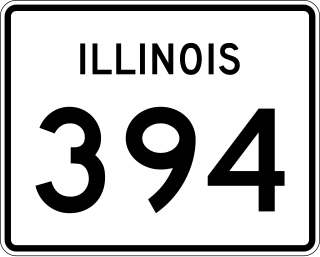
Illinois Route 394, also known as the Calumet Expressway, is a 14.6-mile-long (23.5 km) four-lane state highway that travels north from a junction with IL 1 south of Crete to an interchange in South Holland with Interstate 294/Interstate 94/Interstate 80. Although not an Interstate Highway, Illinois 394 is an Interstate-standard highway from its junction with Sauk Trail at Sauk Village to its northern terminus at the I-294/I-94/I-80 interchange in South Holland. IL 394 functions as a bypass of IL 1 to the west, of which it was formerly part, and provides access to southern suburbs of Chicago.

Illinois Route 59 is a north–south state highway in northeastern Illinois. It runs south from Illinois Route 173 in Antioch to I-55 in Shorewood, spanning the north–south width of Chicago's western suburbs. This is a distance of 71.13 miles (114.47 km).

Interstate 395 (I-395) is an auxiliary Interstate Highway in the US state of Maryland. Known as Cal Ripken Way, the highway runs 1.98 miles (3.19 km) from I-95 north to Howard Street and Camden Street in Downtown Baltimore, where it provides access to the Inner Harbor and the Baltimore Convention Center. The Interstate also serves the Camden Yards Sports Complex, which contains M&T Bank Stadium and Oriole Park at Camden Yards, homes of the Baltimore Ravens and Baltimore Orioles, respectively. I-395 also serves as the southern terminus of Martin Luther King Jr. Boulevard, an urban arterial that provides a western bypass of Downtown Baltimore and connects I-95 with U.S. Route 40 (US 40), US 1, and I-83. The Interstate is maintained by the Maryland Transportation Authority (MDTA) and, like all Interstates, is a part of the National Highway System.

Illinois Route 23 is a north–south state highway in northern Illinois. It runs from Illinois Route 116 in Pontiac north to U.S. Route 14 south of Harvard. This is a distance of 122.77 miles (197.58 km).
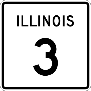
Illinois Route 3 (IL 3) is a 187.44-mile-long (301.66 km) major north–south arterial state highway in southwestern Illinois. It has its southern terminus at Cairo Junction at the intersection of U.S. Route 51 (US 51) and Illinois Route 37, and its northern terminus in Grafton at IL 100.

Interstate 270 (I-270) makes up a large portion of the outer belt freeway in Greater St. Louis. The counterclockwise terminus of I-270 is at the junction with I-55 and I-255 in Mehlville, Missouri; the clockwise terminus of the freeway is at the junction with I-55 and I-70 north of Troy, Illinois. The entire stretch of I-270 is 50.59 miles (81.42 km).

U.S. Route 12 (US 12) in the U.S. state of Illinois is an arterial highway that runs northwest to southeast through the Chicago metropolitan area. It enters Illinois at the Wisconsin border north of Richmond, and exits into Hammond, Indiana, from Chicago near the foot of the onramp to the Indiana Toll Road ; as it exits Illinois, the route is also concurrent with US 20 and US 41. Within Illinois, US 12 runs for a distance of 85.14 miles (137.02 km).

U.S. Route 41 (US 41) in the U.S. state of Illinois runs north from the Indiana border beneath the Chicago Skyway on Indianapolis Boulevard to the Wisconsin border north of the northern terminus of the Tri-State Tollway with Interstate 94. It is the only north–south U.S. Route to travel through a significant portion of the city of Chicago, carrying Lake Shore Drive through the central portion of the city along the lakefront. US 41 in Illinois is 64.81 miles (104.30 km) in length.
U.S. Route 41 (US 41) in the state of Indiana is a north–south US Highway that is parallel to the Illinois state line. It enters the state south of Evansville as a four-lane divided highway passing around Vincennes and traveling north to Terre Haute. In Terre Haute, it is known as 3rd Street. North of Terre Haute, it hooks east and becomes a two-lane surface road. Those wanting to stay on a four-lane divided highway can use State Road 63 to the west. It passes through Rockville, Veedersburg, and Attica before returning to a four-lane divided highway when SR 63 terminates in Warren County. It remains a four-lane divided highway until Lake County, where it becomes a main road known as Indianapolis Boulevard. It overlaps US 12 and US 20 in Hammond and exits Indiana into the South Side of Chicago.

Interstate 55 (I-55) is a major north–south Interstate Highway in the US state of Illinois that connects St. Louis, Missouri, to the Chicago metropolitan area. It enters the state from Missouri near East St. Louis, Illinois, and runs to U.S. Route 41 near Downtown Chicago, where the highway ends, a distance of 294.38 miles (473.76 km). The road also runs through the Illinois cities of Springfield, Bloomington, and Joliet. The section in Cook County is officially named the Stevenson Expressway, and in DuPage County its officially named the Joliet Freeway or the Will Rogers Freeway. The section from the south suburbs of Chicago to the area near Pontiac is officially named the Barack Obama Presidential Expressway after the 44th President, Barack Obama, who launched his political career from Illinois.

U.S. Route 67 is the portion of a north-south highway in Missouri that starts at the Arkansas state line south of Neelyville and ends at the Illinois state line northeast of West Alton.

U.S. Route 60 (US 60) is a part of the United States Numbered Highway System that runs from Brenda, Arizona, east to Virginia Beach, Virginia. In the state of Missouri, US 60 is a main east–west highway that runs through the southern part of the state, from the Oklahoma border to the Illinois border.

