
Will County is a county in the northeastern part of the state of Illinois. According to the 2020 census, it had a population of 696,355, an increase of 2.8% from 677,560 in 2010, making it Illinois's fourth-most populous county. The county seat is Joliet. Will County is one of the five collar counties of the Chicago–Naperville–Elgin, IL–IN–WI Metropolitan Statistical Area. The portion of Will County around Joliet uses area codes 815 and 779, while 630 and 331 are for far northern Will County and 708 is for central and eastern Will County.

Plainfield is a village in Will and Kendall counties, Illinois, United States. The population was 44,762 at the 2020 census.

The Chicago metropolitan area, also referred to as Chicagoland, is the largest metropolitan statistical area in the U.S. state of Illinois, and the Midwest, containing the City of Chicago along with its surrounding suburbs and satellite cities. Encompassing 10,286 square mi (28,120 km2), the metropolitan area includes the city of Chicago, its suburbs and hinterland, that span 13 counties across northeast Illinois and northwest Indiana. The MSA had a 2020 census population of 9,618,502 and the combined statistical area, which spans 19 counties and additionally extends into southeast Wisconsin, had a population of nearly 10 million people. The Chicago area is the third-largest metropolitan area in the United States and the fourth-largest metropolitan area in North America, and the largest in the Great Lakes megalopolis. Its urban area is one of the 40 largest in the world.
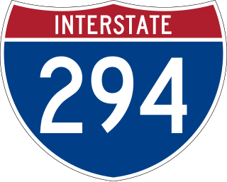
Interstate 294 (I-294) is a tolled auxiliary Interstate Highway in the northeastern part of the U.S. state of Illinois. Forming the southern portion of the Tri-State Tollway in Illinois, I-294 runs from South Holland at I-80/I-94 and Illinois Route 394 (IL 394) to Northbrook at I-94. I-294 is 53.42 miles (85.97 km) long; 5.32 miles (8.56 km) are shared with I-80. It serves as a bypass around the city of Chicago.

Illinois Route 19 is a major east–west arterial state highway in northeastern Illinois, United States. It runs from Illinois Route 25 in Elgin, to Lake Shore Drive on the north side of Chicago. Illinois 19 is 33.64 miles (54.14 km) long. From its western terminus to Schaumburg Road in Elgin, it's known as Chicago Road before becoming Irving Park Road until its eastern terminus.
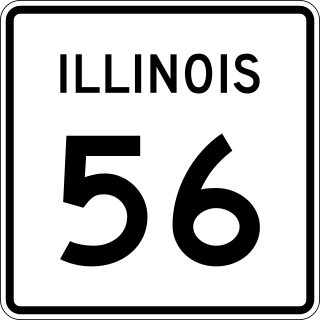
Illinois Route 56 is a 32.52-mile-long (52.34 km) east–west state highway in northern and northeastern Illinois. It runs from the interchange of Illinois Route 47 at U.S. Route 30 in Sugar Grove east to US 12/US 20/US 45 by Bellwood. It is one of only three state highways that require tolls.
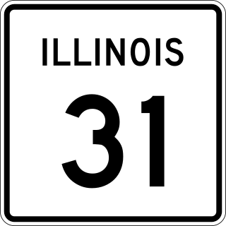
Illinois Route 31 (IL 31) is a 58.41-mile-long (94.00 km) north–south state highway in northeastern Illinois, United States. It travels from U.S. Route 34 (US 34) in Oswego north to US 12, near the Wisconsin state line, just south of Richmond.
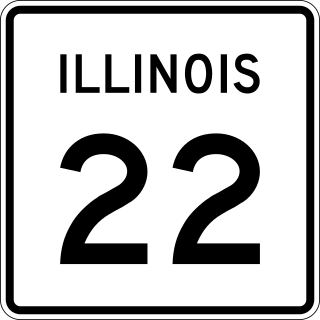
Illinois Route 22, also known as Half Day Road for part of its length, is an east–west state highway in northeastern Illinois. It runs from U.S. Route 14 in Fox River Grove to U.S. Route 41 in Highland Park. It travels a distance of 19.7 miles (31.7 km) and is one of the few roads that runs almost entirely across southern Lake County while also providing access to southeastern McHenry County. Throughout its length, it shifts between two and four lanes as it passes through a frequently changing setting of scenic forestry and smaller populations, as well as busy intersections and larger developments.
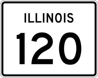
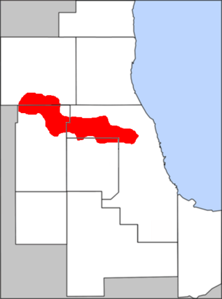
Illinois Route 120 (IL 120) is a major east–west state highway in northeastern Illinois. It runs from U.S. Route 14 near Woodstock to Illinois Route 131 in Waukegan. It travels a distance of 34.62 miles (55.72 km) and is one of the few roads that provides direct access from McHenry County to Interstate 94 in Lake County. Throughout its length, it shifts between two and four lanes as it passes through a setting that consists of open rural areas, as well as larger developments and heavy congestion.

Interstate 88 (I-88) is an Interstate Highway in the US state of Illinois that runs from an interchange with I-80 near Silvis and Moline to an interchange with I-290 and I-294 in Hillside, near Chicago. I-88 is 140.60 miles (226.27 km) long. This route is not contiguous with I-88 in New York. Since 2010, most of I-88 has been part of the Chicago–Kansas City Expressway. The highway also runs through the cities of Aurora, Naperville, DeKalb, and Dixon. East of Rock Falls, the route is a part of the Illinois Tollway system.

Lake Street is an east–west street in Chicago and part of its suburbs. A portion of Lake Street is designated as U.S. Route 20. Lake Street begins in downtown Chicago and travels west to the eastern terminus of the Elgin Bypass around suburban Elgin. The street travels west through the city and then begins to travel in a northwest fashion through several suburbs. The street is a distance of roughly 34.4 miles (55.4 km).

U.S. Route 20 (US 20) in the state of Illinois runs northwest to southeast in the northern end of the state. It crosses the Mississippi River into East Dubuque and exits Chicago south of the Chicago Skyway; the highway is 233.93 miles (376.47 km) long. From Rockford eastward, US 20 begins to parallel Interstate 90 (I-90), and both highways follow each other until their Massachusetts terminus.

U.S. Route 30 (US 30) is an east–west arterial surface road in northern Illinois. It runs from across the Mississippi River from Clinton, Iowa, to Lynwood at the Indiana state line. This is a distance of 153.79 miles (247.50 km).

U.S. Route 12 (US 12) in the U.S. state of Illinois is an arterial highway that runs northwest to southeast through the Chicago metropolitan area. It enters Illinois at the Wisconsin border north of Richmond, and exits into Hammond, Indiana, from Chicago near the foot of the onramp to the Indiana Toll Road ; as it exits Illinois, the route is also concurrent with US 20 and US 41. Within Illinois, US 12 runs for a distance of 85.14 miles (137.02 km).

Interstate 80 (I-80) is a part of the Interstate Highway System that runs from San Francisco, California, to Teaneck, New Jersey. I-80 enters Illinois from Iowa in the west, southwest of Rapids City, and runs generally eastward through East Moline, LaSalle, and Joliet, before entering Indiana in Lansing. The Interstate runs for approximately 163.52 miles (263.16 km) through the state.

The 11th congressional district of Illinois is represented by Democrat Bill Foster.
The Golden Corridor is the area around the Jane Addams Memorial Tollway, formerly known as the Northwest Tollway, in the Chicago metropolitan area. Its name refers to the "gold" mine of economic profit for communities in the area. Several Fortune 500 company headquarters, office parks, industrial parks, exhibition and entertainment centers, medical facilities, hotels, shopping centers, and restaurants are in the Golden Corridor. With the exception of the O'Hare area of Chicago, all the communities in this region are part of a larger region known as the "Northwest Suburbs".

U.S. Route 45 in the state of Illinois is a major north–south U.S. Highway that runs from the Brookport Bridge over the Ohio River at Brookport north through rural sections of eastern Illinois and then through the suburbs of Chicago to the Wisconsin state line east of Antioch. This is a distance of 428.99 miles (690.39 km). US 45 is the longest numbered route in Illinois.

Interstate 55 (I-55) is a major north–south Interstate Highway in the US state of Illinois that connects St. Louis, Missouri, to the Chicago metropolitan area. It enters the state from Missouri near East St. Louis, Illinois, and runs to U.S. Route 41 near Downtown Chicago, where the highway ends, a distance of 294.38 miles (473.76 km). The road also runs through the Illinois cities of Springfield, Bloomington, and Joliet. The section in Cook County is officially named the Stevenson Expressway for the governor, and in DuPage County it's officially named the Joliet Freeway or the Will Rogers Freeway for the humorist. The section from the south suburbs to the area near Pontiac is officially named the Barack Obama Presidential Expressway after the president, who launched his political career from Illinois.

Lake Cook Road is a major east–west highway in Cook, Lake, McHenry, and Kane Counties in Illinois. For much of its length, it marks the border between Cook and Lake Counties, hence the name of the road. In its western stretch, it marks the border between McHenry and Cook Counties, and further west, McHenry and Kane Counties. The road is approximately 25.5 miles (41.0 km) in length, from its western terminus at Illinois Route 62 in Algonquin to its eastern terminus at Sheridan Road in Highland Park and Glencoe, near Lake Michigan. The road is notable for its cross-section of Chicago's northern suburbs, balancing densely developed commercial, industrial, and residential land uses, with open space areas such as forest preserves, parks, golf courses, creeks, rivers, gardens, and Lake Michigan.


