Indian Island, Washington

Last updated

Indian Island, Washington
Juan de Fuca unmarked.png
Red pog.svg
Indian Island
USA Washington location map.svg
Red pog.svg
Indian Island
Usa edcp location map.svg
Red pog.svg
Indian Island
Coordinates: 48°03′07″N122°43′27″W / 48.05194°N 122.72417°W / 48.05194; -122.72417
Country United States
State Washington
County Jefferson
Time zone UTC-8 (Pacific (PST))
  Summer (DST) UTC-7 (PDT)
Area code 360

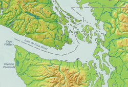
Indian Island is an unincorporated community in Jefferson County, Washington, United States. The whole island is covered by the Marrowstone CDP. It is located between Port Townsend Bay and Kilisut Harbor. Parts also border on Oak Bay and Scow Bay.

Contents

Until the construction of the Port Townsend Ship Canal (also known as Portage Canal) Indian Island was connected to the mainland by a broad sand flat and backshore marsh. Indian Island is the location of the Indian Island Naval Reserve, which covers the entire island. No civilian residences are allowed on Indian Island. Indian Island is attached to Marrowstone Island, and is often grouped with it. Indian Island is served by the ZIP code for Nordland. The entire island has a land area of 11.28 km2 (4.3553 sq mi) and a population of 44 persons as of the 2000 census.

Indian Island is a major U.S. Navy munitions handling facility. Navy combat ships and Military Sealift Command vessels frequent Indian Island's dock receiving and discharging munitions in support of U.S. military operations worldwide. The Navy also services refitted Ohio class missile submarines (formerly SSBN, now SSGN) at Indian Island. Environmental and peace activists have raised questions about Navy activities at Indian Island. [1]

Related Research Articles

<span class="mw-page-title-main">Kitsap County, Washington</span> County in Washington, United States

Kitsap County is a county in the U.S. state of Washington. As of the 2020 census, its population was 275,611. Its county seat is Port Orchard; its largest city is Bremerton. The county, formed out of King County and Jefferson County on January 16, 1857, is named for Chief Kitsap of the Suquamish Tribe. Originally named Slaughter County, it was soon renamed.

<span class="mw-page-title-main">Jefferson County, Washington</span> County in Washington, United States

Jefferson County is a county located in the U.S. state of Washington. As of the 2020 census, the population was 32,977. The county seat and only incorporated city is Port Townsend. The county is named for Thomas Jefferson.

<span class="mw-page-title-main">Marrowstone, Washington</span> CDP in Washington, United States

Marrowstone is a census-designated place (CDP) on Marrowstone Island in Jefferson County, Washington, United States. The population was 995 at the 2020 census. All Marrowstone addresses are in Nordland, Washington, and the ZIP code is 98358.

<span class="mw-page-title-main">Port Townsend, Washington</span> City in Washington, United States

Port Townsend is a city on the Quimper Peninsula in Jefferson County, Washington, United States. The population was 10,148 at the 2020 United States Census. It is the county seat and only incorporated city of Jefferson County.

<span class="mw-page-title-main">Quilcene, Washington</span> Census-designated place in Washington, United States

Quilcene is an unincorporated community and census-designated place (CDP) in Jefferson County, Washington, United States. The population was 598 at the 2020 census.

<span class="mw-page-title-main">Olympic Peninsula</span> Peninsula in Washington, United States

The Olympic Peninsula is a large arm of land in western Washington that lies across Puget Sound from Seattle, and contains Olympic National Park. It is bounded on the west by the Pacific Ocean, the north by the Strait of Juan de Fuca, and the east by Hood Canal. Cape Alava, the westernmost point in the contiguous United States, and Cape Flattery, the northwesternmost point, are on the peninsula. Comprising about 3,600 square miles (9,300 km2), the Olympic Peninsula contained many of the last unexplored places in the contiguous United States. It remained largely unmapped until Arthur Dodwell and Theodore Rixon mapped most of its topography and timber resources between 1898 and 1900.

<span class="mw-page-title-main">Fort Flagler State Park</span> State historic park in Washington state, United States

Fort Flagler State Park is a public recreation area that occupies the site of Fort Flagler, a former United States Army fort at the northern end of Marrowstone Island in Washington. The state park occupies 1,451 acres (587 ha) south of the entrance to Admiralty Inlet, and the Marrowstone Point Light stands adjacent. Port Townsend is visible to the northwest, the cranes at the Navy base on Indian Island to the west, and Whidbey Island to the east across Admiralty Inlet. Flagler Road terminates at the park entrance.

<span class="mw-page-title-main">Discovery Bay, Washington</span> Community in Jefferson County, Washington

Discovery Bay is an unincorporated community in Jefferson County, Washington. The community of Discovery Bay is an area near the intersection of U.S. Route 101 and State Route 20, at the foot of Discovery Bay – roughly midway between the larger communities of Port Townsend to the northeast and Sequim to the northwest. It is a mix of residential areas and commercial enterprises, including crabbing, oystering, clamming, timbering, security training and gravel extraction. A few restaurants and stores on US 101 near SR 20 primarily serve drivers and truckers along US 101.

<span class="mw-page-title-main">Washington State Route 19</span> State highway in Jefferson County, Washington, US

State Route 19 (SR 19) is a 14.09-mile-long (22.68 km) state highway serving rural Jefferson County on the Olympic Peninsula in the U.S. state of Washington. The highway travels from SR 104 south of Port Ludlow and travels north through Chimacum and Port Hadlock-Irondale, intersecting SR 116, to end at SR 20 southwest of Port Townsend near the Jefferson County International Airport. SR 19 was established in 1991 on a roadway that had been built in the 1950s and paved in the 1960s.

<span class="mw-page-title-main">Chimacum, Washington</span> Unincorporated community in Washington, United States

Chimacum is an unincorporated community in Jefferson County, Washington, United States, located in the center of the primary agricultural area of the eastern Olympic Peninsula.

<span class="mw-page-title-main">Marrowstone Point Light</span> Lighthouse

The Marrowstone Point Light is an active navigational aid overlooking Admiralty Inlet at the northern tip of Marrowstone Island, Jefferson County, Washington, in the United States. It lies adjacent to but is not part of Fort Flagler State Park; it may be viewed from the park's beach but is not open to the public.

Puget Sound Bridge and Dredging Company was a major shipbuilding and construction company, located in Seattle, Washington, on the southwestern corner of Harbor Island, an artificial island in Elliott Bay. The Bridge and Dredging Company created the island, completing its construction in 1909. It established itself in 1898 and engaged in construction projects around the United States and shipbuilding for the U.S. Navy during and after World War II. During the war it also operated under the name Associated Shipbuilders in a joint venture with the nearby Lake Union Dry Dock Company. In 1959 Lockheed purchased the shipyard and it became the Lockheed Shipbuilding and Construction Company. The Yard was permanently closed in 1987.

<span class="mw-page-title-main">United States naval districts</span> Regions and Districts of the U.S. Navy and U.S. Coast Guard

United States Naval Districts is a system created by the United States Navy to organize military facilities, numbered sequentially by geographic region, for the operational and administrative control of naval bases and shore commands in the United States and around the world. Established in 1903, naval districts became the foundational system for organizing U.S. naval forces ashore during the 20th century. The term "Naval" forces includes United States Marine Corps and current United States Coast Guard units.

<span class="mw-page-title-main">Port Townsend Ship Canal</span> Canal in Jefferson County, Washington

The Port Townsend Ship Canal is a 4,800-foot (1,500 m) canal connecting Port Townsend Bay and Oak Bay in Jefferson County, Washington. Built in 1915, the canal separates Indian Island from the Quimper Peninsula of mainland Washington. State Route 116 crosses the only bridge over the canal. There are no locks.

<span class="mw-page-title-main">Washington State Route 116</span> State highway in Jefferson County, Washington, US

State Route 116 (SR 116) is a 9.83-mile-long (15.82 km) state highway in the U.S. state of Washington, serving Indian and Marrowstone islands in Jefferson County. The two-lane highway travels east from SR 19 in Port Hadlock-Irondale across the Portage Canal to Indian Island and Marrowstone Island, turning north and ending at the entrance to Fort Flagler State Park. SR 116 was created in 1991 and follows the route of Flagler Road, built and paved in the 1960s.

USS Boxwood (YN-3/AN-8) was an Aloe-class net laying ship which was assigned to serve U.S. Navy ships and harbors during World War II with her protective anti-submarine nets.

<span class="mw-page-title-main">Puget Sound region</span> Coastal area in the U.S. state of Washington

The Puget Sound region is a coastal area of the Pacific Northwest in the U.S. state of Washington, including Puget Sound, the Puget Sound lowlands, and the surrounding region roughly west of the Cascade Range and east of the Olympic Mountains. It is characterized by a complex array of saltwater bays, islands, and peninsulas carved out by prehistoric glaciers.

<span class="mw-page-title-main">Operation Steel Box</span>

Operation Steel Box, also known as Operation Golden Python, was a 1990 joint U.S.–West German operation which moved over 100,000 U.S. chemical weapons from Germany to Johnston Atoll.

<span class="mw-page-title-main">Fort Townsend State Park</span> State park in Washington (state), United States

Fort Townsend State Park is a public recreation area located two miles south of Port Townsend in Jefferson County, Washington. The state park occupies a third of the site of the original Fort Townsend built in 1856. The park includes 3,960 feet (1,210 m) of shoreline on Port Townsend Bay, picnicking and camping areas, 6.5 miles (10.5 km) of hiking trails, and facilities for boating, fishing, and crabbing.

<i>Dode</i> (steamboat)

Dode was a steamboat that ran on Hood Canal and Puget Sound from 1898 to 1900.

References

  1. Does Navy depot pose a danger to public?, The Seattle Times, September 11, 2011