Isiala-Ngwa South

Last updated

Isiala-Ngwa South
LGA
Street View
Abia State Nigeria.png
CountryFlag of Nigeria.svg  Nigeria
State Abia State
Capital Omoba
Area
  Total100 sq mi (258 km2)
Population
 (2006)
  Total134,762
Time zone UTC+1 (WAT)
Website Official website
Isiala-Ngwa South

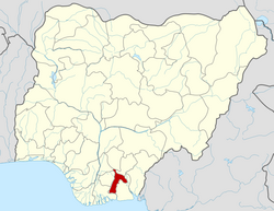
Isiala-Ngwa South is a Local Government Area of Abia State, Nigeria. Its headquarters are in the town of Omoba.

Contents

Omoba is a railway town 22 kilometres away from Aba city centre. After coal was discovered at Udi, the Eastern Railway with station in the town was built to Port Harcourt between 1913 and 1916. This railway was extended to Kaduna via Kafanchan in 1927, connecting the Eastern Railway to the Lagos–Kano Railway. The Eastern Railway was extended to its northeastern terminus of Maiduguri between 1958 and 1964.

The National Integrated Power Project [NIPP] saw the building of a sub-power station at the heart of Omoba which has improved power supply within the town in recent times.

The Clifford University Owerrinta, one of the 144 tertiary institutions owned and operated by the Seventh-day Adventist Church and the Eastern Polytechnic, Umuoko are among the tertiary education institutions in the local government.

According to the Audited Financial Statements Report for the year ended December 31, 2020, the total accrued revenue for the year amounted to ₦1,909,470,171.11. Over 63.70% of this amount, that is, ₦1,216,755,647.97 was realized as statutory revenue from Federal Accounts Allocation Committee (FAAC). A sum of ₦471,564,524.20 was internally generated. This amount constituted about 24.70% of the total accrued revenue. A sum of N10,206,459.83 represents Value Added Tax. This amount constituted about 0.54% of the total accrued revenue and other capital receipts of N200,235,294.12 representing 10.50%. The remaining 0.56% was Transfer from Consolidated Revenue Fund, which amounted to ₦10,708,244.99.

Total expenditure incurred during the year amounted to ₦2,038,246,642.26.This comprises ₦738,441,232.13 for Salary and ₦42,982,267.66 for Over Head; and N1,256,823,142.47 being Transfer Payments to Govt. Establishments.

It has an area of 258 km2 and a population of 134,762 based on the 2006 census. The first executive chairman is Chief Damian Ozurumba. [1]

Climate

List of Towns and Villages

Ovu-Ngwu

Osokwa – Nvosi

Isiala Nvosi

Ehi-Na-Uguru Nvosi

Ovu-Okwu

Omoba

Okporo Ahaba

Mbutu

Amaise-Ahaba

Ngwa

Amaise

See also

Note

The postal code of the area is 451. [2]

Related Research Articles

<span class="mw-page-title-main">Abia State</span> State of Nigeria

Abia State is a state in the South-East geopolitical zone of Nigeria, it is bordered to the northwest by Anambra State and northeast by the states of Enugu, and Ebonyi, Imo State to the west, Cross River State to the east, Akwa Ibom State to the southeast, and Rivers State to the south. Abia is the only Southeastern state that has boundaries with the other four Southeastern states in Nigeria. It takes its name from the acronym for four of the state's most populated regions: Aba, Bende, Isuikwuato, and Afikpo. The state capital is Umuahia while the largest city and commercial centre is Aba.

<span class="mw-page-title-main">Aba, Nigeria</span> City in Abia, Nigeria

Aba is a city in southeastern Nigeria and the commercial centre of Abia State. Upon the creation of Abia State in 1991, the old Aba township was divided into two local government areas: Aba South and Aba North, while the suburban township neighborhoods of then obioma ngwa L.G.A was divided into three 3 Local government areas for administrative conveniences, however Aba South is the main city centre of Aba and Abia State at large, being located on the Aba River. Aba is made up of many villages such as Aba-Ukwu, Eziukwu-Aba, Obuda-Aba, Umuokpoji-Aba and other villages that have been merged for administrative convenience. Aba was established by the Ngwa clan of the Igbo people in Nigeria as a market town. Later, a military post was placed there by the British colonial administration in 1901. It lies along the west bank of the Aba River and is at the intersection of roads leading to Port Harcourt, Owerri, Umuahia, Ikot Ekpene, and Ikot-Abasi. The city became a collection point for agricultural products following construction of a British-made railway running through it to Port Harcourt. Aba is a major urban settlement and commercial centre in its region, which is surrounded by small villages and towns. The indigenous people of Aba are the Ngwa. Aba is well known for its craftsmen and is the most populous city in southeastern Nigeria. As of 2016, Aba had an estimated population of 2,534,265.

<span class="mw-page-title-main">Umuahia</span> Capital city of Abia State, Nigeria

Umuahia is the capital city of Abia State in southeastern Nigeria. Umuahia is located along the rail road that lies between Port Harcourt to its south,and Enugu city to its north. Umuahia has a population of 359,230 according to the 2006 Nigerian census. Umuahia is indigenously Igbo.

Arochukwu Local Government Area, sometimes referred to as Arochuku or Aro Oke-Igbo, is the third largest local government area in Abia State in southeastern Nigeria and homeland of the Igbo subgroup, Aro people.

<span class="mw-page-title-main">Rivers State</span> State of Nigeria

Rivers State, also known as Rivers, is a state in the Niger Delta region of southern Nigeria. Formed in 1967, when it was split from the former Eastern Region, Rivers State borders include Imo and Anambra to the north, Abia and Akwa Ibom to the east, and Bayelsa and Delta to the west.The State capital, Port Harcourt, is a metropolis that is considered to be the commercial center of the Nigerian oil industry.

<span class="mw-page-title-main">Chengannur</span> Municipal Town in Kerala, India

Chengannur is a municipality and Town in Alappuzha district, Kerala, India. It is also the headquarters of the Chengannur Taluk. Chengannur is located in the south-eastern part of the district, in the region known as Odanad, along the banks of Pamba River. Chengannur is 36 kilometres (22 mi) southeast of the district headquarters Alappuzha and 117 kilometres (73 mi) north of the state capital Thiruvananthapuram. Both the NH 183 and Main Central Road pass through the town.

<span class="mw-page-title-main">Kafanchan</span> Town, chiefdom, sub-group, dialect in Kaduna State, Nigeria

Kafanchan is a town located in the southern part of Kaduna State, Nigeria. The town owes much of its development to the railway development in the area. The railway is situated at a particular junction of the Nigerian Railway Corporation (NRC) station built in 1927. It sits on the railtrack connecting Port Harcourt, Enugu, Kafanchan, Kuru, Bauchi and finally Maiduguri. As of 2007, Kafanchan had an estimated population of 83,092.

Ihite is a town in Orumba South Local Government Area in Anambra State, Nigeria. It is located south-east of the local government area on the Nnobi-Ekwulobia-Ufuma-Umunze-Ibinta-Okigwe federal trunk road. Ihite shares boundaries with Umunze in Anambra State, Aondizuogu, Ndiochi and Okannachi in Imo state, and Nneato in Abia State.

<span class="mw-page-title-main">Kingdom of Nri</span> Ancient African kingdom

The Kingdom of Nri was a medieval polity located in what is now Nigeria. The kingdom existed as a sphere of religious and political influence over a significant part of what is known today as Igboland prior to expansion, and was administered by a priest-king called an Eze Nri. The Eze Nri managed trade and diplomacy on behalf of the Nri people, a subgroup of the Igbo-speaking people, and possessed divine authority in religious matters.

Ohafia is an Igbo town in the Ohafia local government area (LGA) in Abia State, Nigeria. It is an Igbo speaking region. The ancestral capital of Ohafia town is the centrally located village of Elu. Ohafia Local Government Area, is an administrative jurisdiction assigned by the Nigeria Government, which covers the entire Ohafia villages and other towns such as Abiriba and Nkporo, with its Administrative Headquarters at Ebem Ohafia.

Ikwuano is a Local Government Area of Abia State, Nigeria. Its headquarters is in Isiala Oboro. The name 'Ikwuano' etymologically indicates that there are four different ancient kingdoms that make up the community called Ikwuano. These include Oboro, Ibere, Ariam/Usaka and Oloko.

Osisioma Ngwa is a Local Government Area of Abia state of Nigeria. Its headquarters are located in Osisioma town.

<span class="mw-page-title-main">Inyi, Nigeria</span>

Inyi is a town in Enugu State, Nigeria. The name "Inyi" refers to a metaphor, which is an essential component in the creation of proverbs. It is the Igbo name for the red water tree. Due to historical events connecting the tree and the town's founder, he was given the name, which subsequently became the town's name.

<span class="mw-page-title-main">Charles Thurstan Shaw</span>

Chief Charles Thurstan Shaw CBE FBA FSA was an English archaeologist, the first trained specialist to work in what was then British West Africa. He specialized in the ancient cultures of present-day Ghana and Nigeria. He helped establish academic institutions, including the Ghana National Museum and the archaeology department at the University of Ghana. He began working with the University of Ibadan in 1960, where he later founded and developed its archaeology department. He led this for more than 10 years before his retirement in 1974.

<span class="mw-page-title-main">Awka-Etiti</span> Town in Anambra State, Nigeria

Awka-Etiti, historically known as Awka-Diedo ; later mentioned as Awka-Nkakwu (Okankaku) by colonial authors, is an affluent town comprising seven villages in Idemili South local government area of Anambra state, Nigeria. The seven villages of Awka-Etiti in order of age established are: Nkolofia, Umunocha, Ejighinandu, Iruowelle, Umudunu, Nnaba and Ogunzele.

Amawom is a town in Oboro, Ikwuano Local Government Area of Abia State, Nigeria. The name is derived from two words; Ama meaning location and Awom meaning farm. Amawom is believed to have been discovered in the 18th century. Awom Oboro and Ibeuzo Ukwu are the autonomous communities of Amawom. English and Igbo are the languages spoken in the town.

Blessing Okwuchi Nwagba is a Nigerian politician. She is currently serving as a member of the Abia State House of Assembly as the committee chairman on women affairs, social welfare and health representing Aba North Constituency. She is a sociologist by profession and former director of Belzy Pharmaceuticals, Belzy Farms, Belzy Fashion and Fulfillment International Academy and College.

Anthony Obiagboso Enukeme was a Nigerian businessman from Anambra State, south-eastern Nigeria. He was the founder, Chairman and Managing Director of Tonimas Nigeria Limited, a local manufacturing and trading company. He was a Papal Knights of St. Gregory recipient, and member of the Knights of St. John International (KSJI). He was also a member of the Board of Trustees of the APGA political party in Nigeria.

Omoba is the Local Government Headquarters of Isiala Ngwa South, Abia State, Nigeria.

Ariam/Usaka is one of the four principal clans of Ikwuano Local Government Area, Abia State, Nigeria. Ariam/Usaka belongs to the Isuogu family. Ariam itself is made up of three subgroups namely; Ariam, Ekpiri and Usaka. This clan borders Ibere and Oboro to the north, Oloko to the west, as well as several Ibibio communities in Akwa Ibom State to its eastern and southern borders. Forde and Jones categorized the Isuogu family in the Ohuhu-Ngwa cluster of the Southern Igbo area.

References

  1. "CHIEF DAMIAN A. OZURUMBA V. CHINAGOROM NWANKPA & ORS". LawCareNigeria. 2020-01-23. Retrieved 2022-06-28.
  2. "Post Offices- with map of LGA". NIPOST. Archived from the original on 2009-09-26. Retrieved 2009-10-20.