Ukwa West

Last updated

Ukwa West
LGA
Nigeria Abia State Ukwa West LGA.png
LGA location in Nigeria (highlighted in red)
CountryFlag of Nigeria.svg  Nigeria
State Abia State
Capital Oke Ikpe
Area
  Total105 sq mi (271 km2)
Population
 (2006)
  Total88,555
Time zone UTC+1 (WAT)
National language Igbo
Ukwa West

Ukwa West is a Local Government Area in Abia State, Nigeria. Its headquarters is in the town of Oke Ikpe.

Contents

It has an area of 271 km2 and a population of 88,555 at the 2006 census.

The postal code of the area is 452. [1]

Ukwa west is bounded to the north by Osisioma local government area, to the north-east by Ugwunagbo local government area and to the east by Ukwa East local government area, all in Abia State. It is also bounded to west by Omuma local government area, to the south-west by Etche local government area, and to the south by Oyigbo local government area, all in Rivers State.

Climate

The overall area of Ukwa West LGA is 271 square kilometers, and its average annual temperature is 26 degrees Celsius. The average humidity in the LGA is 71 percent, and the region is home to a variety of rivers and streams. In Ukwa West LGA, the estimated average wind speed is 10 km/h. [2]

Economy

The local government is the only crude oil producing area in Abia state. Its oil-producing communities include: Owaza, Uzuaku, Umuokwor, Umuahala and Umuorie, amongst others.

The local government is divided into three main political groups; Ipu Group, Asa Group and Ozar Group. It practice what is called rotational leadership. Ipu West is one of the political Wards in it. Though it is one the crude oil producing area in Abia State, but some of its communities and wards are lacking the basic amenities, such as good roads, electricity, good health centres and schools. Asa and Ogwe group, including Asa North Wards and ozar, are lacking roads and security. Though, there exist economic hubs in almost all the towns. Example is the Afor Ogwe Market.

Asa people are predominantly farmers, with subsistence agriculture being the major practice, while small forms of commercial farming is also done. The main crop farmed in this area is Cassava, which is processed into garri, and consumed at home or sold in markets. The second important food crop is Yam, while Other crops like Groundnut, Maize, and Plantain are commonly farmed. The area is also blessed with palm trees which is processed to produce palm oil, kernel oil and other palm produce for direct consumption or trade.

Animals are also reared in this area, with goat and chicken being the most common. These are either for food or traded in the markets.

Language

The People of Ukwa West local government belong to the Asa clan and speak a dialect of Igbo language known as Asa. [3] Asa is spoken mostly in the southern part of Abia state and Northern Rivers state. In Abia state it is spoken in the entire Ukwa West Local Government Area, while in Rivers State, it is spoken in Oyigbo (Obigbo) Local Government Area in communities such as Mmirinwanyi Asa, Kom Kom, Oboama Asa, Uzuoma Asa, etc.

Locality

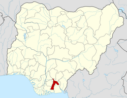
Villages and Town in Ukwa West Local Government Area. [4] [5]

Ozar-Ukwu

Ozar West

Ipu-South

Ipu-East

Ipu-West

Asa-South

Obokwe

Asa-North

Related Research Articles

<span class="mw-page-title-main">Abia State</span> State of Nigeria

Abia State is a state in the South-East geopolitical zone of Nigeria, it is bordered to the northwest by Anambra State and northeast by the states of Enugu, and Ebonyi, Imo State to the west, Cross River State to the east, Akwa Ibom State to the southeast, and Rivers State to the south. Abia is the only Southeastern state that has boundaries with the other four Southeastern states in Nigeria. It takes its name from the acronym for four of the state's most populated regions: Aba, Bende, Isuikwuato, and Afikpo. The state capital is Umuahia while the largest city and commercial centre is Aba.

<span class="mw-page-title-main">Cross River State</span> State of Nigeria

Cross River State is a state in the South-South geopolitical zone of Nigeria. Named for the Cross River, the state was formed from the eastern part of the Eastern Region on 27 May 1967. Its capital is Calabar, it borders to the north through Benue state, to the west through Ebonyi state and Abia state, and to the southwest through Akwa Ibom state, while its eastern border forms part of the national border with Cameroon. Originally known as the South-Eastern State before being renamed in 1976, Cross River state formerly included the area that is now Akwa Ibom state, which became a distinct state in 1987.

<span class="mw-page-title-main">Aba, Nigeria</span> City in Abia, Nigeria

Aba is a city in southeastern Nigeria and the commercial centre of Abia State. Upon the creation of Abia State in 1991, the old Aba township was divided into two local government areas, being Aba South and Aba North, while the suburban neighborhood of what was then known as Obioma Ngwa L.G.A. was divided into three L.G.A.s for administrative convenience. Aba South is the main city centre of Aba and Abia State at large, being located on the Aba River. Aba is made up of many villages such as Aba-Ukwu, Eziukwu-Aba, Obuda-Aba, Umuokpoji-Aba and other villages that have been merged for administrative convenience. Aba was established by the Ngwa clan of the Igbo people in Nigeria as a market town. Later, a military post was placed there by the British colonial administration in 1901. It lies along the west bank of the Aba River and is at the intersection of roads leading to Port Harcourt, Owerri, Umuahia, Ikot Ekpene, and Ikot-Abasi. The city became a collection point for agricultural products following construction of a British-made railway running through it to Port Harcourt. Aba is a major urban settlement and commercial centre in its region, which is surrounded by small villages and towns. The indigenous people of Aba are the Ngwa. Aba is well known for its craftsmen and is the most populous city in southeastern Nigeria. As of 2016, Aba had an estimated population of 2,534,265, making it the biggest city in South Eastern Nigeria.

<span class="mw-page-title-main">Ebonyi State</span> State of Nigeria

Ebonyi State is a state in the South-East geopolitical zone of Nigeria, bordered to the north and northeast by Benue State, Enugu State to the west, Cross River State to the east and southeast, and Abia State to the southwest. Named for the Abonyi (Aboine) River—a large part of which is in the state's south—Ebonyi State was formed from parts of Abia and Enugu state in 1996 and has its capital as Abakaliki.

<span class="mw-page-title-main">Rivers State</span> State of Nigeria

Rivers State, also known as Rivers, is a state in the Niger Delta region of southern Nigeria. Formed in 1967, when it was split from the former Eastern Region, Rivers State borders include Imo and Anambra to the north, Abia and Akwa Ibom to the east, and Bayelsa and Delta to the west.The State capital, Port Harcourt, is a metropolis that is considered to be the commercial center of the Nigerian oil industry.

Awgu is the Headquarters of Awgu Local Government Area (LGA) in Enugu State, Nigeria and the Headquarters of Awgu Catholic Diocese. The Catholic Cathedral is said to resemble a space ship when viewed with Google Earth. The town is also the Orientation Training Centre for National Youth Service corps members posted to Enugu State. Geographically, Awgu LGA is located approximately between latitudes 06 00’ and 06 19’ North of the Equator and longitudes 07 23’ and 07 35’ East of the Greenwich Meridian. Awgu LGA is bounded in the north by Udi and Nkanu West LGAs, in the west by Oji River LGA, Aninri LGA and Ivo LGA of Ebonyi State in the East and share border with umunneochi L.G.A of Abia State in the south. The name of the Traditional ruler is Egbeleli. The market is known as Orie Awgu.

Oyigbo is a Local Government Area located in Rivers State, Nigeria. It is a town, 30 kilometers from the Port city of Port Harcourt, 25km from the city of Aba. It's predominantly occupied by the indigenous Igbos of ASA who are also indigenous to Ukwa west L.G.A in Abia state and the Ndoki people who are also found in Ukwa East L.G.A of Abia state and Ukanafun L.G.A of Akwa ibom state

<span class="mw-page-title-main">Orsu</span> LGA in Imo State, Nigeria

Orsu is a local government area (LGA) and tribe in the Imo State of Nigeria. Orsu is also the name of the dialect of this people. They are an Igbo sub-group located west of Orlu, north of Oguta and in the general areas around Oru East, Oru West, Ihiala, Nnewi south and Oguta LGAs. Orsu LGA is made up of several autonomous communities including Ihitenansa, Amaruru, Amazu, Amaebu, Amannachi, Awo-Idemili, Asaa Ubirielem, Eziawa, Umuhu Okabia, Orsu Ihiteukwa, Okwu Ufuruaku, Okwu Amaraihe, and Okwu Etiti.

<span class="mw-page-title-main">Etche</span> Local Government Area in Rivers State, Nigeria

Echie administratively known as Etche is an indigenous Igbo group mostly found in the Niger Delta region of Nigeria. Presently, its people makeup Etche and Omuma, two of the 23 Local Government Areas of Rivers State the can also been found in Ngor Okpala L.G.A and Omuma town both in Imo state. They are part of the 13 federal constituencies representing River State in Nigeria's National Assembly and part of the Rivers East Senatorial District. Its people are mostly farmers, and they speak the Etche dialect of the Igbo language family.

Mbo is located in the South Eastern part of Nigeria and is a Local Government Area in Akwa Ibom State. Following the local government creation exercise of the federal government in 1989 Mbo Local Government Area was carved out of Oron Division same year.

Obot-Akara is in the south of Nigeria and is a Local Government Area of Akwa Ibom State whose headquarters is located at Nto Edino.

Aba North is a Local Government Area in Aba, Abia State, Nigeria. In the year (1991) Aba North local government was created. The headquarters is at Eziama Uratta. It is amongst the local governments that make up Abia South senatorial zone. Aba North is in the South East geopolitical zone of Nigeria. The Igbo ethnic group is predominant in the area. The people of the area are mostly Christians and traditional worshippers with Igbo and English as the commonly spoken languages. Aba North, an integral part of Ngwaland, consists of indigenes and migrants from other parts of the state who reside in Aba for entrepreneurial and other purposes.

Isiala-Ngwa North is a Local Government Area of Abia State, Nigeria. Its headquarters is Okpuala-Ngwa.

Osisioma Ngwa is a Local Government Area of Abia state of Nigeria. Its headquarters are located in Osisioma town.

Ugwunagbo is a local government area of Abia State, Nigeria.

<span class="mw-page-title-main">Ukwa East</span> LGA in Abia State, Nigeria

Ukwa East is a Local Government Area located in Abia State, Nigeria. Its headquarters is in the town of Akwete. Ukwa East is bordered by Akwa Ibom State and Rivers States.

The Ngwa people are an Igbo group living in the southern part of Igboland. The Ngwa people are found predominantly in Abia State with a population of 314,840 in 1963. They cover 1,328 square kilometres (513 sq mi) and are the largest subgroup of Igbo people.

Omuma town is the headquarters of Oru East Local Government Area of Imo State in the Southeastern part of Nigeria. It is one of the oldest towns in Imo State. Omuma is located at latitude 5.560° N and longitude 6.972° E. Its boundary to the west is Mgbidi, to the east by Akatta and Attah, to the north by Eleh and Nempi and to the south by Amiri and Otulu. Omuma has four communities: Abia-Omuma, Ozuh-Omuma, Umuhu-Omuma, and Etiti-Omuma. The current Imo state governor, Hope Uzodinma, is from Omuma.

Abayi Okoroato is a city in Obingwa local government area of Abia State, Nigeria.

Umuagbai town is one of the major settlements of the Ndoki people. These towns numbering 54 in total are grouped into seven clans they are Umu Ihueze 1, Umu Ihueze II, Obohia, Ikwueke, Umu Okobo, Ohuru and Mkporobo and Ikwu-Orie-Ato. Umuagbai town is located presently in Oyigbo Local Government Area of Rivers State and is part of the Umu Okobo clan. Umuagbai town is one of the larger communities within the local government area and constitutes an entire Ward on its own; Ward Six. Umuagbai town shares boundary with Akwete in Abia State and the two communities has strong cultural affinities. It is bounded to the south by Azuogu and to the north by Mgboji all in Oyigbo L.G.A while its boundary in the west is to Okwali in Khana Local Government of Rivers State.

References

  1. "Post Offices- with map of LGA". NIPOST. Archived from the original on 2009-10-07. Retrieved 2009-10-20.
  2. "Ukwa West Local Government Area". www.manpower.com.ng. Retrieved 2023-10-02.
  3. "Ukwa Carnival 2018". Ukwa Carnival. Retrieved 2020-08-31.
  4. "Ukwa West LGA". www.finelib.com. Retrieved 2023-10-25.
  5. places (1970-01-01). "Towns & Villages in Ukwa West « Abia State « Nigeria". Towns & Villages. Retrieved 2023-10-25.

4°59′18″N7°14′33″E / 4.9884°N 7.2425°E / 4.9884; 7.2425