This article may contain an excessive amount of intricate detail that may only interest a particular audience. Specifically, Formatting and pruning of excessive detail on non-notable local leaders. Please help by spinning off or relocating any relevant information, and removing excessive detail that may be against Wikipedia's inclusion policy.(December 2019) ( Learn how and when to remove this message )
It has an area of 198km2 (76sqmi) and a population of 219,632 as per 2006 census data of Nigeria.[2]
Origin of name
The name "Osisi" means tree, plant or wood and the name "Oma", means good, fine, beautiful in the Igbo language. Thus, Osisioma means: good tree or fine plant or beautiful wood. It is a name associated with tree and beauty which is derived from the popular ornamental flower tree called Delonix regia, a species of flowering plant in the bean family Fabaceae, and subfamily Caesalpinioideae. It is noted for its fern-like leaves and flamboyant display of flowers. In many tropical parts of the world, it is grown as an ornamental tree and in English, it is given the name royal poinciana, flamboyant, flame of the forest, or flame tree (one of several species given this name) which is typically planted to decorate courtyards in houses in Osisioma Ngwa. A greater part of Aba city is in Osisioma Ngwa stretching up to Faulks Road.
Culture
Osisioma people generally make a living as farmers, traders, artisans and craftsmen. The typical Osisioma Ngwa men in the old days usually wear what is called "ọgọdọ". Ọgọdọ is a type of white woven cloth tied around the waistline to cover nakedness and the women use the fabric as a wrapper to cover the body from chest flowing down to the knees. Contemporarily, just like most Igbo communities, men dress down in trousers and shirts with shoes, sandals or slippers to work, shop or office just like their female counterparts but the traditional male attire preferred for occasions and big celebrations in Osisioma culture consists of a special top called 'Isiagụ' and trousers of any colour usually worn with sandals or shoes and red cap to match.
Geography/Climate
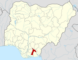
Osisioma Ngwa is a flat land without hills or mountains and has a headwater located at Okpu Umuobo that runs through the thick forest cutting across into the city of Aba River waterside in Ogbor Hill. The river is a tributary of the Imo River located in the Southern part of Nigeria. Osisioma Ngwa shares boundaries with Ukwa West and Ugwunagbo in the South, Aba South Local Government Area and Aba North Local Government Area in the East, Isiala Ngwa South Local Government Area in the North and Omuma Local Government Area, Rivers State in the West.[2]
Aba-Port Harcourt Expressway cuts through Osisioma Ngwa with the Aba-Owerri Road running through it from Aba Town Hall down to Olaz Oil filling station.[3]
It has other major routes such as the NNPC depot road which leads to Osisioma Ngwa local government headquarters as well as Osisioma Police Divisional Headquarters, High and Magistrates Court and Ekeakpara market down to Owerrinta the boundary between Abia State and Imo State.
Over the course of the year, Osisioma's average percentage of cloud-covered sky varies significantly by season.
In Osisioma, the clearer portion of the year lasts for 2.6 months, starting around November 24 and ending around February 12.[4]
December is the clearest month of the year in Osisioma, with 39% of the sky being clear, mostly clear, or partly overcast on average.[5]
Beginning about February 12 and lasting 9.4 months, the cloudier portion of the year ends around November 24.[6]
In Osisioma, April is the cloudiest month of the year, with 88% of the sky being cloudy or partly cloudy on average.[7]
Economy
Agriculture is the major occupation of the people of Osisioma Ngwa. They are mostly subsistence farmers and grow Cassava, Oil Palm, Rafia Palm, Vegetable, Ube (Local Pear), Plantain, Okra, Maize, melon, red pepper, yam, and cocoa yam. Some people rear animals such as goats, sheep, fowl and occasionally cattle, but largely don't grow crops or rear animals in commercial quantity.
Industries and companies
Tonimas Group
Chemlap Nigeria Ltd.
J. Udeagbala Holdings
Guinness Nigeria Plc
NNPC Aba Depot
Valleumbra Nigeria Limited
VON Nigeria Limited
Pitason Nigeria Limited
Nicen Nigeria Limited
Clover Paints Nigeria Limited
Adaobi Nig Ltd
Geometric Nigeria Limited
Polema Industries Limited, to mention but a few
Chriveld Petroleum Ltd.
Autonomous communities
Community leadership in Osisioma Ngwa is designated on the Traditional Ruler popularly called "Eze" which means King. The Eze is a person widely perceived to represent a community in its traditional religion and socio-economic development. The position of a traditional ruler is not hereditary and is subjected to the democratic process of nomination, selection, appointment and coronation of the eligible candidate among peers who contested for the post by the state Governor.
Various towns in Osisioma Ngwa LGA are divided into Autonomous communities which are spearheaded by a traditional ruler and they are as follows:
Abayi, Osisioma and Umungasi are the three major towns with Abayi-Ariaria, Umuojima-Ogbu and Umuakapara rapidly developing into towns. However, Osisioma Ngwa is divided into 10 wards and each ward has different villages in them and these villages also have kindred which are subdivided into clans and households called ‘onumara’. Thus, a village may be made up of 5 to 10 kindred and up to 20 to 30 clans and the household which uniformly constitutes what is called a village. The classification of these villages into wards was adopted by the colonial masters for effective administrative and political purpose and to ensure proper management and accountability. The wards are as follows:
1. Ama – Asaa Ward which comprises a. Amapu Village b. Amauzu Village c. Ibeku Village d. Mbutunta Village e. Umuagwu Village f. Umuihima Village g. Umuihioma Village h. Umuimo-Osisiasaa Village i. Umuimo-Amaogwugwu Village j. Umuimo-Egbelu Village k. Umuobasi Village l. Ekeobasi Village Square
2. Amaitolu/Mbutu/Umuojima Ward which comprises a. Ariaria Village b. Abayi Ogbuligba Village c. Umuechem Village d. Asamoka Village e. Mbutu Isiahia Village f. Mbutu Umugaa Village g. Umuozuo Village h. Umuikpo Village i. Oberete Village j. Ogbu Village k. Umudi Village l. Umuejijie Village m. Umuidigha Village n. Alaukwu-Asa Umumgbede Village o. Umuocheala Village p. Umuojima Ogbu Village q. Umuojima Okereke Village
3. Amasator Ward which comprises a. Abayi Village b. Ahiaba Village c. Umungasi Village d. Umule Village e. Umuode Village f. Umuochichi Village g. Umueze Village h. Umuocham Village
4. Amator Ward which comprise a. Amapu-Ife Village b. Amaogwugwu Village c. Umuagbai Village d. Umuoyoro Village e. Umuokiri Village f. Umuodu Village g. Umudike Village h. Umuokoro Village i. Umuigbe Village j. Umuokoroukwu Village
5. Amavo Ward which comprises a. Umuokorocha Village b. Umuekpe Village c. Osiloji Village d. Umuoyoronta Village e. Umunwankwoala Village f. Umuokika Village g. Umudaba Village h. Umuagbalugba Village
6. Aro-Ngwa Ward which comprises a. Obiekwesu Village b. Okpuala Aro Village c. Umuarakpa Village d. Umuekea Village e. Umuejie Village f. Umuoha Village g. Umuonyeukwu Village Village h. Umuotuo Village
7. Okpu – Umuobo Ward which comprises a. Amuzu Village b. Mgboko Umuete Village c. Umuobo Village d. Umuaba Village e. Umuagwa Village f. Umuara Village g. Uratta Village h. Amaekpu Village
8. Oso Okwa Ward which comprises a. Akpaa I Village b. Akpaa II Village c. Akpaa III Village d. Akpaa IV Village e. Amaiyi Village f. Amankwu I Village g. Amankwu II Village h. Amaugha Village i. OkpualaUkwu Village j. Umuaja Village k. Umuenyiukwu Village l. Umugala Village m. Umuncheagu Village n. Umunpata Village o. Umuobilohia I Village p. Umuobilohia II Village q. Umuohia Village’ r. Umuokerete Village
9. Umunneise Ward which comprises a. Amapu Village b. Amauzu Village c. Okpuala Village d. Umumba Village
10. Uratta Ward which comprises a. Amapu – Igbengwo Village b. Egbede Village c. Egbelu – Owo Village d. Ibibi Uratta Village e. Obuzor Village f. Okpokoroala Village g. Umuochor Village h. Umuaduru Village i. Umuagbara Village j. Umueji Village k. Umueke Village l. Umueze Village m. Umuigwe Village n. Umuikaa Village o. Umuodu – Ehichie Village p. Úmuokorogbu Village
Executive Chairmen
Names of Executive Chairmen that have governed Osisioma Ngwa Local Government Area and Communities of origin:
Chief Sylvanus Ejiasa Ubani - Obi Aro Ngwa
Chief Emeka Eneogwe - Uratta
Chief Allen Nwachukwu - Otuobi
Dr Kamalu Christian - Umuocham
Chief Iheyinna Mgbeahuru - Amavo Nkwogu
Institutions of learning
Education in Osisioma Ngwa receives little support from the State and Federal government, thereby opening up opportunities for private schools to thrive. However, these are some of the Secondary Schools:
City Laboratory Comprehensive Secondary School, Ariaria
St. Leo The Great Secondary School, Oberete
Uratta Comprehensive Secondary School, Egbede
Royal Foundation College, Osisioma
Mbutu Umuojima Community Secondary School, Umuojima Ogbu
Heritage Comprehensive Secondary School, Ariaria
Amator Technical Secondary School, Umuoyoro Ngwa
Boys Secondary School, Abayi-Umuocham
Community Secondary School, Umuojima Okereke
St. Anne's Secondary School, Umuobasi Amavo
Osisioma does not have any State or Federal government institution of higher learning, college or university despite its large population and size.
Healthcare
Isiala – Osokwa Health Center,
Akanu – Ukwu Health Center,
Okpuala Umugwor Health Center,
Umuoyoro Ngwa Health Center,
Owuala Primary Healthcare Center,
Mbutu Umuojima Health Center,
Umueze Health Center,
Etiti-Amavo Health Center,
Oberete Asa Health Center,
Amankwu Osokwa Health Center,
Eke Aro Health Center,
Umuobasi Health Center,
Umuagbara Health Center,
Otuobi Health Center,
Umuojima Okereke Health Center,
Okpu Umuobo Health Center,
World Bank Health Center,
Ekenwaobasi Health Center,
Umugaa Health Center.
Religion
Traditionally, the people of Osisioma Ngwa worship a god called “chi” and every household builds a shrine which houses the deity. However, there are other gods such as ‘agwu’ and ‘owu Miri’, but as a result of British colonialism, Christianity was introduced and most families embraced Christianity.
The major Christian denominations in Osisioma Ngwa are the Anglican Church, the Catholic Church, the Seventh-Day Adventist Church and the Jehovah's Witnesses. There are also other churches as well as traditional adherents in some quarters.
Adherents of cultural tradition and worshippers of “chi”, “agwu”, “ihi Njoku” and “owu Miri” perform rites to celebrate New Yam Festivals (popularly called ‘Iwaji’ or ‘Ji Oghoo’), Masquerade Festivals (popularly called ‘Ekpe, mmanwu or ekpo’) and New Year Festivals (popularly called ‘afo oghoo’ or ‘ichu afo’) in honour of their gods and goddesses to mark these events.
Traditional rulers who are the custodian of these cultural values and traditions are in charge of announcing dates as well as organizing the venues for such celebrations and performance of traditional rites.
Landmarks and tourist attractions
Osisioma is not naturally endowed as other localities, but here are the landmarks and tourist attractions.
Ariaria International Market, also referred to as Aba International Industrial Market, which is the centre of trade and commerce in the city of Aba.
NNPC Depot is a beehive of petroleum activity attracting other businesses such as hotels, banks and restaurants, although, due to the prevalence of pipeline vandalisation and oil bunkering, the federal government has not invested much in the development of the site.
Okpu Umuobo River is the only natural water body in Osisioma Ngwa and most of its natural potential is yet to be harnessed and developed.
The Ihumirinta of Ekeakpara is an ancient water source.
The Obu of Umuoyoro Ngwa is a sacred tree worshipped by adherents of "owu miri" marine spirit.
The Ihuada ala of Umuagbara is a sacred traditional site.
Onu Ehihe Ama Ukwu Umuobasi is a tourist site.
Major markets
Apart from Ariaria International Market, the current urbanisation of Osisioma Ngwa Local Government Area and the influx of companies within the Local Government has adversely affected the popular ancient traditional markets. However, there are:
Ahia Ekenwaobasi (Osisioma Ngwa Model Foam Market)
Afo Aro
Ahia Orie Amato
Eke Aro
Crime rate
Crime has been one of the major setbacks that has been detrimental to the development of Osisioma Ngwa. From armed robbery attacks to kidnapping, every community and village in Osisioma has had its share of criminal incidents. The prevalence of crime has been attributed to lack of government investment in security; there is only one police station serving the entire Osisioma Ngwa LGA.
This page is based on this Wikipedia article Text is available under the CC BY-SA 4.0 license; additional terms may apply. Images, videos and audio are available under their respective licenses.