
The Great Artesian Basin (GAB), located in Australia, is the largest and deepest artesian basin in the world, stretching over 1,700,000 square kilometres (660,000 sq mi), with measured water temperatures ranging from 30 to 100 °C. The basin provides the only source of fresh water through much of inland Australia.

Groundwater is the water present beneath Earth's surface in rock and soil pore spaces and in the fractures of rock formations. About 30 percent of all readily available freshwater in the world is groundwater. A unit of rock or an unconsolidated deposit is called an aquifer when it can yield a usable quantity of water. The depth at which soil pore spaces or fractures and voids in rock become completely saturated with water is called the water table. Groundwater is recharged from the surface; it may discharge from the surface naturally at springs and seeps, and can form oases or wetlands. Groundwater is also often withdrawn for agricultural, municipal, and industrial use by constructing and operating extraction wells. The study of the distribution and movement of groundwater is hydrogeology, also called groundwater hydrology.

The Swan Coastal Plain in Western Australia is the geographic feature which contains the Swan River as it travels west to the Indian Ocean. The coastal plain continues well beyond the boundaries of the Swan River and its tributaries, as a geological and biological zone, one of Western Australia's Interim Biogeographic Regionalisation for Australia regions. It is also one of the distinct physiographic provinces of the larger West Australian Shield division.

The Serpentine Dam is a major water supply dam for Perth, Western Australia. The dam is used to store water that is released at a controlled rate to regulate the level in the Serpentine Pipehead Dam reservoir, which in turn feeds water to the metropolitan trunk main network depending on demand. Construction of the dam was completed in 1961.

South Dandalup Dam is a dam in Western Australia. It is located where the South Dandalup River flows out of Lake Banksiadale. The dam was built in 1971 in response to rapid population growth in Perth, Western Australia's capital city, and a resources boom in the Pilbara.

The Canning Dam and reservoir are a major source of fresh water for the city of Perth, Western Australia. The dam is situated on the Darling Scarp and is an impoundment of the Canning River. It is noted for its innovative structural and hydraulic design that was considered to be at the forefront of concrete gravity dam design at the time of construction in from 1933 to its completion 1940.

The Gnangara Mound is an area north of Perth, Western Australia where a large mound of sandy soil reaches an elevation of about 60 metres (200 ft). It stores about 20 cubic kilometres of fresh water, about one hundred times Perth's current annual water usage. It is currently the single most important source of potable water for the city. Together with the Jandakot Mound in the south of Perth it supplies about 35%–50% of the city's drinking water.
The Yarragadee Aquifer is a significant freshwater aquifer located in the south west of Western Australia and predominantly beneath the Swan Coastal Plain west of the Darling Scarp. It has a north–south range from about Geraldton to the south coast, but with a split in the formation south of Perth, Western Australia. The southern part is known as the South West Yarragadee Aquifer.
Forrestdale Lake Nature Reserve is a lake nature reserve around Forrestdale Lake in the City of Armadale, Western Australia, approximately 25 kilometres (16 mi) south of the central business district of Perth, the state capital, and on the southern fringes of the Perth metropolitan area. It lies immediately south of the suburb of Forrestdale, and 8 kilometres (5.0 mi) south-east of Jandakot Airport. It is a still largely natural wetland, with some adjoining native vegetation, surrounded by land developed for housing and agriculture, that regularly supports large numbers of shorebirds and other waterbirds.
The Kimberley–Perth Canal was a proposal to channel water from the Fitzroy River in the Kimberley region of Western Australia via the Pilbara, to the southwestern capital of Perth, a distance of approximately 3,700 kilometres (2,300 mi).
Water supply and sanitation in Israel are intricately linked to the historical development of Israel. Because rain falls only in the winter, and largely in the northern part of the country, irrigation and water engineering are considered vital to the country's economic survival and growth. Large scale projects to desalinate seawater, direct water from rivers and reservoirs in the north, make optimal use of groundwater, and reclaim flood overflow and sewage have been undertaken. Among them is the National Water Carrier, carrying water from the country's biggest freshwater lake, the Sea of Galilee, to the northern part of the Negev desert through channels, pipes and tunnels. Israel's water demand today outstrips available conventional water resources. Thus, in an average year, Israel relies for about half of its water supply on unconventional water resources, including reclaimed water and desalination. A particularly long drought in 1998–2002 had prompted the government to promote large-scale seawater desalination. In 2022, 85% of the country's drinkable water was produced through desalination of saltwater and brackish water.
Aquifer storage and recovery (ASR) is the direct injection of surface water supplies such as potable water, reclaimed water, or river water into an aquifer for later recovery and use. The injection and extraction is often done by means of a well. In areas where the rainwater cannot percolate the soil or where it is not capable of percolating it fast enough and where the rainwater is thus diverted to rivers, rainwater ASR could help to keep the rainwater within an area. ASR is used for municipal, industrial and agricultural purposes.
As Australia's supply of freshwater is increasingly vulnerable to droughts, possibly as a result of climate change, there is an emphasis on water conservation and various regions have imposed restrictions on the use of water.
The Nambung River is a river in the Wheatbelt region of Western Australia, 170 kilometres (106 mi) north of Perth. The river drains an area between the towns of Cervantes and Badgingarra. In its lower reaches the Nambung River forms a chain of waterholes in the Nambung Wetlands where it disappears underground into a limestone karst system 5.5 kilometres (3 mi) from the Indian Ocean.
The Snake River Aquifer is a large reservoir of groundwater underlying the Snake River Plain in the southern part of the U.S. state of Idaho. Most of the water in the aquifer comes from irrigation recharge. Measuring about 400 miles (640 km) from east to west, it is an important water source for agricultural irrigation in the Plain. The Snake River Aquifer is commonly defined as two separate parts, separated by Salmon Falls Creek: the Eastern Snake River Plain Aquifer and Western Snake River Plain Aquifer.

Thomsons Lake Nature Reserve is a lake nature reserve around Thomsons Lake in the City of Cockburn, Western Australia, approximately 25 kilometres (16 mi) south of the central business district of Perth, the state capital, and on the southern fringes of the Perth metropolitan area. It is in the suburb of Beeliar, 7 kilometres (4.3 mi) south-west of Jandakot Airport. It is a still largely natural wetland, with adjoining native vegetation, surrounded by land developed for housing and agriculture, that regularly supports large numbers of shorebirds and other waterbirds.
The Leederville Aquifer is a significant freshwater aquifer located in the south west of Western Australia and predominantly beneath the Swan Coastal Plain west of the Darling Scarp.

North Dandalup Dam is a dam in Western Australia. It is located 63.8 kilometres (39.6 mi) south of Perth in the Darling Scarp, which forms the western border of the Darling Ranges. Constructed in 1994, it was opened by the then state Premier Richard Court in October of that year. It was the final project in a dam-building scheme that also includes the Victoria and Conjurunjup Dams.
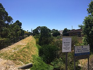
Bayswater Brook was a natural brook in the north-eastern suburbs of Perth, Western Australia, which discharges into the Swan River in the suburb of Bayswater. In the 1920s, due to urban development, the brook was turned into a network of drainage channels, which are partially covered and partially open. The brook's water source is runoff and groundwater. In the 1970s, the Eric Singleton Bird Sanctuary was built near the mouth of the brook. Water from the Bayswater Brook flows through the wetlands at the bird sanctuary before continuing to the Swan River. It has an average annual flow of 7.5 gigalitres.
