Jennings, Michigan

Last updated

Jennings, Michigan
Jennings (Missaukee), MI.jpg
Welcome sign along S. La Chance Road
Jennings, MI location.png
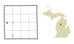
Location within Missaukee County and the state of Michigan
USA Michigan location map.svg
Red pog.svg
Jennings
Usa edcp location map.svg
Red pog.svg
Jennings
Coordinates: 44°19′58″N85°17′53″W / 44.33278°N 85.29806°W / 44.33278; -85.29806
CountryUnited States
State Michigan
County Missaukee
Townships Lake and Caldwell
Established1885
Area
[1]
  Total0.76 sq mi (1.97 km2)
  Land0.76 sq mi (1.97 km2)
  Water0.00 sq mi (0.00 km2)
Elevation
1,306 ft (398 m)
Population
 (2020) [2]
  Total229
  Density301.71/sq mi (116.54/km2)
Time zone UTC-5 (Eastern (EST))
  Summer (DST) UTC-4 (EDT)
ZIP Code
49651 (Lake City)
Area code 231
GNIS feature ID629259 [3]
FIPS Code 26-41720

Jennings is an unincorporated community and census-designated place (CDP) in Missaukee County in the U.S. state of Michigan. The population was 229 at the 2020 census, [2] down from 264 in 2010. [4] The CDP is located mostly in Lake Township with a small portion extending north into Caldwell Township.

Contents

History

Jennings was a lumbering center founded by Austin and William Mitchell, who named it for William Jennings Bryan. A post office opened on March 8, 1883, with J. Frank Schryer as the first postmaster. The office was discontinued on July 31, 1956. Jennings was a terminus of the Missaukee spur of the Grand Rapids and Indiana Railroad, with a junction on the main line named Round Lake. [5] [6]

The community of Jennings was listed as a newly-organized census-designated place for the 2010 census, meaning it now has officially defined boundaries and population statistics. [7]

Geography

Jennings is in western Missaukee County, bordered to the east by Crooked Lake. It is 7 miles (11 km) by road west of Lake City, the county seat, and 10 miles (16 km) northeast of Cadillac. According to the U.S. Census Bureau, the Jennings CDP has an area of 0.76 square miles (1.97 km2), all land. [1]

The census-designated place is defined as being within Caldwell and Lake townships. All 264 residents and 0.67 square miles (1.74 km2) of land were within Lake Township, while no residents and 0.09 square miles (0.23 km2) of land are within Caldwell Township to the north. [7]

Demographics

Historical population
CensusPop.Note
2010 264
2020 229−13.3%
U.S. Decennial Census [8]

Related Research Articles

<span class="mw-page-title-main">Caldwell Township, Michigan</span> Civil township in Michigan, United States

Caldwell Township is a civil township of Missaukee County in the U.S. state of Michigan. The population was 1,317 at the 2010 census.

<span class="mw-page-title-main">Lake Township, Missaukee County, Michigan</span> Civil township in Michigan, United States

Lake Township is a civil township of Missaukee County in the U.S. state of Michigan. The population was 2,800 at the 2010 census, which makes it the county's most-populated municipality.

<span class="mw-page-title-main">Dollar Bay, Michigan</span> Census-designated place & unincorporated community in Michigan, United States

Dollar Bay is a census-designated place (CDP) in Houghton County, Michigan, United States. The population was 1,082 at the 2010 census.

<span class="mw-page-title-main">Carp Lake, Michigan</span> Census-designated place & unincorporated community in Michigan, United States

Carp Lake is an unincorporated community and census-designated place (CDP) in Emmet County in the U.S. state of Michigan. As of the 2010 census, the CDP had a population of 357. It is located within Carp Lake Township.

<span class="mw-page-title-main">Levering, Michigan</span> Census-designated place & unincorporated community in Michigan, United States

Levering is an unincorporated community and census-designated place (CDP) in Emmet County in the U.S. state of Michigan. As of the 2010 census, the CDP had a population of 215.

<span class="mw-page-title-main">Watersmeet, Michigan</span> Census-designated place & unincorporated community in Michigan, United States

Watersmeet is an unincorporated community and census-designated place (CDP) in Watersmeet Township, Michigan. As of the 2010 census, the CDP had a population of 428, out of a total population in the township of 1,417. The community was platted in 1884, designated as a station of the Milwaukee Lake Shore and Western Railroad.

<span class="mw-page-title-main">Eagle River, Michigan</span> Census-designated place & unincorporated community in Michigan, United States

Eagle River is an unincorporated community and census-designated place (CDP) in the U.S. state of Michigan. It is the county seat of Keweenaw County. Its population was 65 at the 2020 census, which makes it by far the least-populated county seat in the state of Michigan. As an unincorporated community, Eagle River has no legal autonomy and is part of Allouez Township and Houghton Township.

<span class="mw-page-title-main">Rapid City, Michigan</span> Census-designated place & unincorporated community in Michigan, United States

Rapid City is an unincorporated community and census-designated place (CDP) in Kalkaska County in the U.S. state of Michigan. At the 2020 census, the CDP had a population of 1,357. Rapid City is located within Clearwater Township, and is about 8 miles (13 km) northwest of Kalkaska.

<span class="mw-page-title-main">Eastport, Michigan</span> Census-designated place & unincorporated community in Michigan, United States

Eastport is an unincorporated community and census-designated place (CDP) located in Antrim County in the U.S. state of Michigan. The population of the CDP was 206 at the 2020 census. It is located in Torch Lake Township, and lies on an isthmus between Torch Lake and Grand Traverse Bay.

<span class="mw-page-title-main">Hudson Lake, Indiana</span> Census-designated place in Indiana, United States

Hudson Lake is an unincorporated community and census-designated place (CDP) in Hudson Township, LaPorte County, Indiana, United States. The town sits on the dividing line between Central and Eastern time zones. It is the site of the Hudson Lake station stop of the South Shore Line. As of the 2010 census, the population of the CDP was 1,297.

<span class="mw-page-title-main">Conway, Michigan</span> Census-designated place & unincorporated community in Michigan, United States

Conway is an unincorporated community and census-designated place (CDP) in Emmet County in the U.S. state of Michigan. As of the 2010 census, the CDP had a population of 204.

<span class="mw-page-title-main">Falmouth, Michigan</span> Census-designated place in Michigan, United States

Falmouth is an unincorporated community and census-designated place (CDP) in Missaukee County in the U.S. state of Michigan. The community is located within Clam Union Township. Its population was 183 at the 2020 census.

<span class="mw-page-title-main">Lakes of the North, Michigan</span> Census-designated place & unincorporated community Association in Michigan, United States

Lakes of the North is an unincorporated community and census-designated place (CDP) in Antrim County in the U.S. state of Michigan. The CDP is located in Mancelona Township to the south and Star Township to the north. The population of the CDP was 1,044 at the 2020 census.

<span class="mw-page-title-main">Pilgrim, Michigan</span> Census-designated place & unincorporated community in Michigan, United States

Pilgrim is an unincorporated community and census-designated place (CDP) in Benzie County in the U.S. state of Michigan. As of the 2020 census, the CDP had a permanent population of 44. Pilgrim is located within Crystal Lake Township.

<span class="mw-page-title-main">Lake Victoria, Michigan</span> Census-designated place & unincorporated community in Michigan, United States

Lake Victoria is an unincorporated community and census-designated place (CDP) in Clinton County in the U.S. state of Michigan. It is located in Victor Township. As of the 2010 census, it had a population of 930.

Country Squire Lakes is an unincorporated community and census-designated place (CDP) in Geneva Township, Jennings County, Indiana, United States. As of the 2010 census it had a population of 3,571.

<span class="mw-page-title-main">Manistee Lake, Michigan</span> Census-designated place & unincorporated community in Michigan, United States

Manistee Lake is an unincorporated community and census-designated place (CDP) in Kalkaska County in the U.S. state of Michigan. At the 2010 census, the CDP had a population of 456. Manistee Lake is located within Coldsprings Township to the north and a small portion extending south into Excelsior Township.

<span class="mw-page-title-main">Bear Lake, Kalkaska County, Michigan</span> Census-designated place & unincorporated community in Michigan, United States

Bear Lake is an unincorporated community and census-designated place (CDP) in Kalkaska County in the U.S. state of Michigan. At the 2010 census, the CDP had a population of 327. Bear Lake is located within Bear Lake Township.

<span class="mw-page-title-main">Presque Isle Harbor, Michigan</span> Census-designated place & unincorporated community in Michigan, United States

Presque Isle Harbor is an unincorporated community and census-designated place (CDP) in Presque Isle County in the U.S. state of Michigan. Its population was 600 as of the 2010 census. The CDP is located along the shores of Lake Huron within Presque Isle Township.

<span class="mw-page-title-main">Vineyard Lake, Michigan</span> Census-designated place & unincorporated community in Michigan, United States

Vineyard Lake is an unincorporated community and census-designated place (CDP) in Jackson County in the U.S. state of Michigan. The CDP had a population of 980 at the 2010 census. It is located within Columbia Township to the west and Norvell Township to the east.

References

  1. 1 2 "2023 U.S. Gazetteer Files: Michigan". United States Census Bureau. Retrieved October 23, 2023.
  2. 1 2 "P1. Race – Jennings CDP, Michigan: 2020 DEC Redistricting Data (PL 94-171)". U.S. Census Bureau. Retrieved October 23, 2023.
  3. "Jennings". Geographic Names Information System . United States Geological Survey, United States Department of the Interior.
  4. "2010 Census Gazetteer Files - Places: Michigan". U.S. Census Bureau . Retrieved May 6, 2018.
  5. U.S. Geological Survey Geographic Names Information System: Jennings Post Office (historical)
  6. Romig, Walter (1986) [1973]. Michigan Place Names. Detroit, Michigan: Wayne State University Press. ISBN   0-8143-1838-X.
  7. 1 2 "Michigan: 2010 Population and Housing Unit Counts 2010 Census of Population and Housing" (PDF). 2010 United States Census . United States Census Bureau. September 2012. p. 34 Michigan. Retrieved July 22, 2020.
  8. "Census of Population and Housing". Census.gov. Retrieved June 4, 2016.