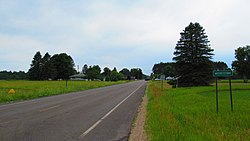
Norwich Township, Michigan | |
---|---|
Coordinates: 44°28′50″N84°57′19″W / 44.48056°N 84.95528°W | |
Country | United States |
State | Michigan |
County | Missaukee |
Government | |
• Supervisor | Penny Blair |
• Clerk | Lois Whipple |
Area | |
• Total | 72.60 sq mi (188.0 km2) |
• Land | 71.92 sq mi (186.3 km2) |
• Water | 0.68 sq mi (1.8 km2) |
Elevation | 1,191 ft (363 m) |
Population | |
• Total | 631 |
• Density | 8.77/sq mi (3.39/km2) |
Time zone | UTC-5 (Eastern (EST)) |
• Summer (DST) | UTC-4 (EDT) |
ZIP Codes | |
Area code | 231 |
FIPS code | 26-113-59280 [3] |
GNIS feature ID | 1626823 [4] |
Norwich Township is a civil township of Missaukee County in the U.S. state of Michigan. The population was 631 at the 2020 census. [2]
Norwich Township is in the northeast corner of Missaukee County, bordered to the north by Kalkaska County, to the east by Roscommon County, and at its northeast corner by Crawford County. According to the U.S. Census Bureau, the township has a total area of 72.60 square miles (188.03 km2), of which 71.92 square miles (186.27 km2) are land and 0.68 square miles (1.76 km2), or 0.94%, are water. [1]
Kalkaska 11SE is a weather station 8.5 miles (13.7 km) north of Norwich Township. [7]
Climate data for Kalkaska 11SE, Michigan, 1991–2020 normals: 1083ft (330m) | |||||||||||||
---|---|---|---|---|---|---|---|---|---|---|---|---|---|
Month | Jan | Feb | Mar | Apr | May | Jun | Jul | Aug | Sep | Oct | Nov | Dec | Year |
Record high °F (°C) | 51 (11) | 59 (15) | 86 (30) | 85 (29) | 93 (34) | 94 (34) | 96 (36) | 96 (36) | 91 (33) | 88 (31) | 74 (23) | 59 (15) | 96 (36) |
Mean maximum °F (°C) | 43.3 (6.3) | 46.3 (7.9) | 58.5 (14.7) | 75.3 (24.1) | 86.7 (30.4) | 88.5 (31.4) | 90.1 (32.3) | 88.4 (31.3) | 85.4 (29.7) | 75.5 (24.2) | 61.6 (16.4) | 47.7 (8.7) | 91.8 (33.2) |
Mean daily maximum °F (°C) | 23.9 (−4.5) | 27.4 (−2.6) | 37.4 (3.0) | 51.1 (10.6) | 65.3 (18.5) | 74.0 (23.3) | 76.6 (24.8) | 75.7 (24.3) | 68.2 (20.1) | 54.6 (12.6) | 41.0 (5.0) | 30.2 (−1.0) | 52.1 (11.2) |
Daily mean °F (°C) | 16.8 (−8.4) | 17.7 (−7.9) | 26.7 (−2.9) | 39.7 (4.3) | 52.6 (11.4) | 61.6 (16.4) | 64.6 (18.1) | 63.9 (17.7) | 55.8 (13.2) | 44.4 (6.9) | 33.2 (0.7) | 23.9 (−4.5) | 41.7 (5.4) |
Mean daily minimum °F (°C) | 9.8 (−12.3) | 8.0 (−13.3) | 16.0 (−8.9) | 28.3 (−2.1) | 39.8 (4.3) | 49.2 (9.6) | 52.5 (11.4) | 52.1 (11.2) | 43.4 (6.3) | 34.3 (1.3) | 25.3 (−3.7) | 17.6 (−8.0) | 31.4 (−0.4) |
Mean minimum °F (°C) | −11.9 (−24.4) | −11.2 (−24.0) | −8.0 (−22.2) | 12.5 (−10.8) | 24.9 (−3.9) | 33.1 (0.6) | 40.8 (4.9) | 38.7 (3.7) | 31.1 (−0.5) | 22.8 (−5.1) | 11.1 (−11.6) | 0.9 (−17.3) | −15.1 (−26.2) |
Record low °F (°C) | −25 (−32) | −33 (−36) | −26 (−32) | −5 (−21) | 18 (−8) | 29 (−2) | 37 (3) | 32 (0) | 26 (−3) | 19 (−7) | 1 (−17) | −19 (−28) | −33 (−36) |
Average precipitation inches (mm) | 2.26 (57) | 1.99 (51) | 2.14 (54) | 3.49 (89) | 3.65 (93) | 3.55 (90) | 3.27 (83) | 3.57 (91) | 3.54 (90) | 3.77 (96) | 3.03 (77) | 2.22 (56) | 36.48 (927) |
Average snowfall inches (cm) | 28.50 (72.4) | 25.30 (64.3) | 15.40 (39.1) | 9.50 (24.1) | 0.50 (1.3) | 0.00 (0.00) | 0.00 (0.00) | 0.00 (0.00) | 0.00 (0.00) | 2.60 (6.6) | 14.00 (35.6) | 30.50 (77.5) | 126.3 (320.9) |
Source 1: NOAA [8] | |||||||||||||
Source 2: XMACIS (records & monthly max/mins) [9] |
Census | Pop. | Note | %± |
---|---|---|---|
1890 | 441 | — | |
1900 | 789 | 78.9% | |
1910 | 695 | −11.9% | |
1920 | 417 | −40.0% | |
1930 | 299 | −28.3% | |
1940 | 443 | 48.2% | |
1950 | 361 | −18.5% | |
1960 | 307 | −15.0% | |
1970 | 321 | 4.6% | |
1980 | 418 | 30.2% | |
1990 | 505 | 20.8% | |
2000 | 646 | 27.9% | |
2010 | 611 | −5.4% | |
2020 | 631 | 3.3% | |
U.S. Decennial Census [10] |
As of the census [3] of 2000, there were 646 people, 258 households, and 186 families residing in the township. The population density was 9.0 per square mile (3.5/km2). There were 547 housing units at an average density of 7.6 per square mile (2.9/km2). The racial makeup of the township was 97.83% White, 0.15% African American, 0.46% Native American, 0.31% Asian, 0.15% from other races, and 1.08% from two or more races. Hispanic or Latino of any race were 0.93% of the population.
There were 258 households, out of which 29.1% had children under the age of 18 living with them, 60.5% were married couples living together, 5.4% had a female householder with no husband present, and 27.9% were non-families. 24.8% of all households were made up of individuals, and 10.1% had someone living alone who was 65 years of age or older. The average household size was 2.50 and the average family size was 2.96.
In the township the population was spread out, with 25.5% under the age of 18, 6.3% from 18 to 24, 24.8% from 25 to 44, 26.8% from 45 to 64, and 16.6% who were 65 years of age or older. The median age was 40 years. For every 100 females, there were 104.4 males. For every 100 females age 18 and over, there were 107.3 males.
The median income for a household in the township was $27,788, and the median income for a family was $32,045. Males had a median income of $29,318 versus $14,167 for females. The per capita income for the township was $16,460. About 13.8% of families and 18.2% of the population were below the poverty line, including 26.5% of those under age 18 and 23.0% of those age 65 or over.
Missaukee County is a county located in the U.S. state of Michigan. As of the 2020 census, the population was 15,052. The county seat is Lake City.
Fife Lake Township is a civil township of Grand Traverse County in the U.S. state of Michigan. As of the 2020 census, the township population was 1,526, a slight increase from 1,517 at the 2000 census. The township forms the southeastern corner of Grand Traverse County. The township contains the village of Fife Lake, which lies upon the lake of the same name.
Whitewater Township is a civil township of Grand Traverse County in the U.S. state of Michigan. The population was 2,688 at the 2020 census, an increase from 2,597 at the 2010 census. Whitewater Township includes shores on Elk Lake and Lake Skegemog, two large lakes in the Chain of Lakes. A portion of the township is within the Grand Traverse Indian Reservation.
Kalkaska Township is a civil township of Kalkaska County in the U.S. state of Michigan. The population was 2,895 at the 2020 census. The township contains the village of Kalkaska, which serves as the county seat. The western half of the township was formerly a separate township, known as Wilson Township.
Rapid River Township is a civil township of Kalkaska County in the U.S. state of Michigan. The population was 1,245 at the 2020 census.
Bloomfield Township is a civil township of Missaukee County in the U.S. state of Michigan. As of the 2020 census, the township population was 574.
Butterfield Township is a civil township of Missaukee County in the U.S. state of Michigan. As of the 2020 census, the township population was 473.
Clam Union Township is a civil township of Missaukee County in the U.S. state of Michigan. The population was 907 at the 2020 census.
Enterprise Township is a civil township of Missaukee County in the U.S. state of Michigan. The population was 174 at the 2020 census.
Forest Township is a civil township of Missaukee County in the U.S. state of Michigan. The population was 1,184 at the 2020 census.
Lake Township is a civil township of Missaukee County in the U.S. state of Michigan. The population was 2,827 at the 2020 census, which makes it the county's most-populated municipality.
Pioneer Township is a civil township of Missaukee County in the U.S. state of Michigan. The population was 508 at the 2020 census, up from 451 in 2010.
Reeder Township is a civil township of Missaukee County in the U.S. state of Michigan. As of the 2020 census, the township population was 1,199.
Riverside Township is a civil township of Missaukee County in the U.S. state of Michigan. The population was 1,124 at the 2020 census.
Oliver Township is a civil township of Kalkaska County in the U.S. state of Michigan. The population was 292 at the 2020 census, making it the least-populous township in Kalkaska County. Oliver Township is part of the Traverse City micropolitan area, and is considered part of Northern Michigan.
Orange Township is a civil township of Kalkaska County in the U.S. state of Michigan. The population was 1,250 at the 2020 census.
Springfield Township is a civil township of Kalkaska County in the U.S. state of Michigan. The population was 1,562 at the 2020 census.
Aetna Township is a civil township of Missaukee County in the U.S. state of Michigan. As of the 2020 census, the township population was 429.
Richland Township is a civil township of Missaukee County in the U.S. state of Michigan. The population was 1,489 at the 2020 census.
West Branch Township is a civil township of Missaukee County in the U.S. state of Michigan. The population was 452 at the 2020 census.