Lake Township, Missaukee County, Michigan

Last updated

Lake Township, Michigan
Lake Township Hall (Missaukee), MI.jpg
Lake Township Hall
Lake Township (Missaukee), MI location.png
Left: location within Missaukee County and an administered portion of the Jennings CDP (pink); Right: Location in the state of Michigan
USA Michigan location map.svg
Red pog.svg
Lake Township
Usa edcp location map.svg
Red pog.svg
Lake Township
Coordinates: 44°17′18″N85°16′32″W / 44.28833°N 85.27556°W / 44.28833; -85.27556
CountryUnited States
State Michigan
County Missaukee
Established1883
Government
  SupervisorRob Hall
   Clerk Korinda Winkelmann
Area
[1]
  Total36.04 sq mi (93.3 km2)
  Land31.56 sq mi (81.7 km2)
  Water4.47 sq mi (11.6 km2)
Elevation
1,253 ft (382 m)
Population
 (2020) [2]
  Total2,827
  Density89.6/sq mi (34.6/km2)
Time zone UTC-5 (Eastern (EST))
  Summer (DST) UTC-4 (EDT)
ZIP Codes
49651 (Lake City)
49601 (Cadillac)
49657 (McBain)
Area code 231
FIPS code 26-113-44380 [3]
GNIS feature ID1626577 [4]
Website laketownshipmissaukee.com
Lake Sapphire within Lake Township Sapphiremini.GIF
Lake Sapphire within Lake Township

Lake Township is a civil township of Missaukee County in the U.S. state of Michigan. The population was 2,827 at the 2020 census, [2] which makes it the county's most-populated municipality.

Contents

Communities

Geography

Lake Township is in western Missaukee County, bordered to the northeast by Lake City, the county seat, and to the west by Wexford County. The township center is 7 miles (11 km) by road southwest of Lake City and the same distance northeast of the city of Cadillac.

According to the U.S. Census Bureau, the township has a total area of 36.04 square miles (93.34 km2), of which 31.56 square miles (81.74 km2) are land and 4.47 square miles (11.58 km2), or 12.41%, are water. [1]

Lake Township includes several large lakes, including Lake Missaukee, Crooked Lake, Lake Sapphire, and Round Lake. The Clam River, a tributary of the Muskegon River, flows west to southeast across the southern part of the township.

Highways

Demographics

Historical population
CensusPop.Note
1890 636
1900 1,09972.8%
1910 1,40527.8%
1920 1,207−14.1%
1930 351−70.9%
1940 41016.8%
1950 4335.6%
1960 427−1.4%
1970 52422.7%
1980 1,345156.7%
1990 1,98047.2%
2000 2,46824.6%
2010 2,80013.5%
2020 2,8271.0%
U.S. Decennial Census [6]

As of the census [3] of 2000, there were 2,468 people, 1,005 households, and 756 families residing in the township. The population density was 77.9 inhabitants per square mile (30.1/km2). There were 1,689 housing units at an average density of 53.3 per square mile (20.6/km2). The racial makeup of the township was 97.61% White, 0.12% African American, 0.53% Native American, 0.49% Asian, 0.04% from other races, and 1.22% from two or more races. Hispanic or Latino of any race were 1.09% of the population.

There were 1,005 households, out of which 28.9% had children under the age of 18 living with them, 64.1% were married couples living together, 7.0% had a female householder with no husband present, and 24.7% were non-families. 20.2% of all households were made up of individuals, and 8.6% had someone living alone who was 65 years of age or older. The average household size was 2.45 and the average family size was 2.78.

In the township the population was spread out, with 22.9% under the age of 18, 6.2% from 18 to 24, 27.3% from 25 to 44, 27.2% from 45 to 64, and 16.5% who were 65 years of age or older. The median age was 42 years. For every 100 females, there were 98.7 males. For every 100 females age 18 and over, there were 99.5 males.

The median income for a household in the township was $36,934, and the median income for a family was $42,059. Males had a median income of $30,339 versus $22,148 for females. The per capita income for the township was $18,332. About 7.0% of families and 9.4% of the population were below the poverty line, including 11.3% of those under age 18 and 6.9% of those age 65 or over.

Related Research Articles

<span class="mw-page-title-main">Osceola County, Michigan</span> County in Michigan, United States

Osceola County is a county in the U.S. state of Michigan. As of the 2020 United States Census, the population was 22,891. The county seat is Reed City.

<span class="mw-page-title-main">Missaukee County, Michigan</span> County in Michigan, United States

Missaukee County is a county located in the U.S. state of Michigan. As of the 2020 Census, the population was 15,052. The county seat is Lake City.

<span class="mw-page-title-main">Fife Lake Township, Michigan</span> Civil township in Michigan, United States

Fife Lake Township is a civil township of Grand Traverse County in the U.S. state of Michigan. As of the 2020 census, the township population was 1,526, a slight increase from 1,517 at the 2000 census. The township forms the southeastern corner of Grand Traverse County. The township contains the village of Fife Lake, which lies upon the lake of the same name.

<span class="mw-page-title-main">Rapid River Township, Michigan</span> Civil township in Michigan, United States

Rapid River Township is a civil township of Kalkaska County in the U.S. state of Michigan. The population was 1,245 at the 2020 census.

<span class="mw-page-title-main">Bloomfield Township, Missaukee County, Michigan</span> Civil township in Michigan, United States

Bloomfield Township is a civil township of Missaukee County in the U.S. state of Michigan. As of the 2020 census, the township population was 574.

<span class="mw-page-title-main">Butterfield Township, Michigan</span> Civil township in Michigan, United States

Butterfield Township is a civil township of Missaukee County in the U.S. state of Michigan. As of the 2020 census, the township population was 473.

<span class="mw-page-title-main">Caldwell Township, Michigan</span> Civil township in Michigan, United States

Caldwell Township is a civil township of Missaukee County in the U.S. state of Michigan. The population was 1,394 at the 2020 census.

<span class="mw-page-title-main">Clam Union Township, Michigan</span> Civil township in Michigan, United States

Clam Union Township is a civil township of Missaukee County in the U.S. state of Michigan. The population was 907 at the 2020 census.

<span class="mw-page-title-main">Enterprise Township, Michigan</span> Civil township in Michigan, United States

Enterprise Township is a civil township of Missaukee County in the U.S. state of Michigan. The population was 174 at the 2020 census.

<span class="mw-page-title-main">Forest Township, Missaukee County, Michigan</span> Civil township in Michigan, United States

Forest Township is a civil township of Missaukee County in the U.S. state of Michigan. The population was 1,184 at the 2020 census.

<span class="mw-page-title-main">Pioneer Township, Michigan</span> Civil township in Michigan, United States

Pioneer Township is a civil township of Missaukee County in the U.S. state of Michigan. The population was 508 at the 2020 census, up from 451 in 2010.

<span class="mw-page-title-main">Reeder Township, Michigan</span> Civil township in Michigan, United States

Reeder Township is a civil township of Missaukee County in the U.S. state of Michigan. As of the 2020 census, the township population was 1,199.

<span class="mw-page-title-main">Riverside Township, Michigan</span> Civil township in Michigan, United States

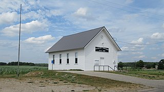
Riverside Township is a civil township of Missaukee County in the U.S. state of Michigan. The population was 1,124 at the 2020 census.

<span class="mw-page-title-main">Haring Township, Michigan</span> Township in Wexford County, Michigan

Haring Township is a charter township of Wexford County in the U.S. state of Michigan. The population was 3,173 at the 2010 census.

<span class="mw-page-title-main">Springfield Township, Kalkaska County, Michigan</span> Civil township in Michigan, United States

Springfield Township is a civil township of Kalkaska County in the U.S. state of Michigan. The population was 1,562 at the 2020 census.

<span class="mw-page-title-main">Aetna Township, Missaukee County, Michigan</span> Civil township in Michigan, United States

Aetna Township is a civil township of Missaukee County in the U.S. state of Michigan. As of the 2020 census, the township population was 429.

<span class="mw-page-title-main">Holland Township, Missaukee County, Michigan</span> Civil township in Michigan, United States

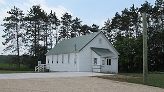
Holland Township is a civil township of Missaukee County in the U.S. state of Michigan. The population was 221 at the 2020 census.

<span class="mw-page-title-main">Norwich Township, Missaukee County, Michigan</span> Civil township in Michigan, United States

Norwich Township is a civil township of Missaukee County in the U.S. state of Michigan. The population was 631 at the 2020 census.

<span class="mw-page-title-main">Richland Township, Missaukee County, Michigan</span> Civil township in Michigan, United States

Richland Township is a civil township of Missaukee County in the U.S. state of Michigan. The population was 1,489 at the 2020 census.

<span class="mw-page-title-main">West Branch Township, Missaukee County, Michigan</span> Civil township in Michigan, United States

West Branch Township is a civil township of Missaukee County in the U.S. state of Michigan. The population was 452 at the 2020 census.

References

  1. 1 2 "2023 U.S. Gazetteer Files: Michigan". United States Census Bureau. Retrieved October 25, 2023.
  2. 1 2 "P1. Race – Lake township, Missaukee County, Michigan: 2020 DEC Redistricting Data (PL 94-171)". U.S. Census Bureau. Retrieved October 25, 2023.
  3. 1 2 "U.S. Census website". United States Census Bureau . Retrieved January 31, 2008.
  4. U.S. Geological Survey Geographic Names Information System: Lake Township, Missaukee County, Michigan
  5. U.S. Geological Survey Geographic Names Information System: Jennings, Michigan
  6. "Decennial Census Official Publications". U.S. Census Bureau. Retrieved October 25, 2023.