Jones, Alabama

Last updated

Jones, Alabama
USA Alabama location map.svg
Red pog.svg
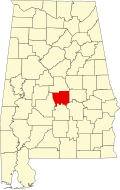
Jones
Location within the state of Alabama
Usa edcp location map.svg
Red pog.svg
Jones
Jones (the United States)
Coordinates: 32°35′2″N86°53′50″W / 32.58389°N 86.89722°W / 32.58389; -86.89722
Country Flag of the United States (23px).png  United States
State Flag of Alabama.svg  Alabama
County Autauga
Elevation
60 m (200 ft)
Time zone UTC-6 (Central (CST))
  Summer (DST) UTC-5 (CDT)
ZIP code
36749
Area code 334

Jones, originally Jones Switch, is an unincorporated community in Autauga County, Alabama, United States. [1] The name was officially shortened on May 1, 1903. The community has a post office, with postmasters appointed from 1878 to 2006. [2] [3] The post office also serves unincorporated areas of Autauga County such as Vine Hill, Fremont, Bethel, Salem, Milton, and Fig Tree.

Contents

Geography

Jones is located at 32°35′02″N86°53′51″W / 32.58402°N 86.89748°W / 32.58402; -86.89748 and has an elevation of 200 feet (61 m). [1] Mulberry Creek is located to the west and rolling hills are located to the east.

Emergency Services

Fire protection is provided by the Jones Volunteer Fire Department.

Emergency Medical Services are provided by Haynes Ambulance.

Law enforcement agency is the Autauga County Sheriffs Office.

References

  1. 1 2 U.S. Geological Survey Geographic Names Information System: Jones
  2. U.S. Geological Survey Geographic Names Information System: Jones Post Office
  3. "Postmasters by City". Postmaster Finder. United States Postal Service. Retrieved July 27, 2011.