Marbury, Alabama

Last updated

Marbury, Alabama
Autauga County Alabama Incorporated and Unincorporated areas Marbury Highlighted 0146600.svg
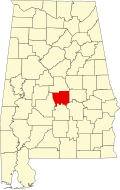
Location of Marbury in Autauga County, Alabama.
USA Alabama location map.svg
Red pog.svg
Location of Marbury in Alabama
Coordinates: 32°42′04″N86°28′16″W / 32.70111°N 86.47111°W / 32.70111; -86.47111
Country United States
State Alabama
County Autauga
Area
[1]
  Total23.23 sq mi (60.17 km2)
  Land23.15 sq mi (59.97 km2)
  Water0.08 sq mi (0.20 km2)
Elevation
[2]
522 ft (159 m)
Population
 (2020)
  Total1,427
  Density61.63/sq mi (23.80/km2)
Time zone UTC-6 (Central (CST))
  Summer (DST) UTC-5 (CDT)
ZIP code
36051
Area code 334
FIPS code 01-46600 [2]
GNIS feature ID152222 [2]
Other nameBozeman [2]
[3]

Marbury is an unincorporated community and census-designated place (CDP) in Autauga County, Alabama, United States. As of the 2010 census, its population was 1,418. [4]

Contents

Geography

Marbury is located at 32°42′04″N86°28′16″W / 32.701241°N 86.471088°W / 32.701241; -86.471088 (32.701241, -86.471088). [2] It lies 522 feet (159 m) above sea level.

Demographics

Historical population
CensusPop.Note
2020 1,427
U.S. Decennial Census [5]
1850-1870 [6] 1870-1880 [7]
1890-1910 [8] 1920 [9] 1930 [10]
1940 [11] 1950 [12] 1960 [13]
1970 [14] 1980 [15] 1990 [16]
2000 [17] 2010 [18]

Education

Marbury is served by the Autauga County School System. Marbury High School was located in Marbury, Alabama, although it was turned into a junior high for the 2010-2011 school year. A new Marbury High School has been built just south of Marbury in Deatsville. The new MHS has top-of-the-line technology including laptops and smartboards in every room.

Emergency Services

Fire protection is provided by the Marbury Volunteer Fire Department.

Emergency Medical Services are provided by Haynes Ambulance.

Law enforcement agency is the Autauga County Sheriffs Office.

Marbury in movies

Tim Burton shot a scene in his movie Big Fish at a church in Marbury. The scene is when the main characters father is being buried.[ citation needed ].

Notable people

Related Research Articles

<span class="mw-page-title-main">Autauga County, Alabama</span> County in Alabama, United States

Autauga County is a county located in the central portion of the U.S. state of Alabama. As of the 2020 census the population was 58,805. Its county seat is Prattville.

<span class="mw-page-title-main">Autaugaville, Alabama</span> Town in Alabama, United States

Autaugaville is a town in Autauga County, Alabama, United States. At the 2020 census, the population was 795. It is part of the Montgomery Metropolitan Statistical Area.

<span class="mw-page-title-main">Huguley, Alabama</span> Census-designated place in Alabama, United States

Huguley is a census-designated place (CDP) and unincorporated community in Chambers County, Alabama, United States. At the 2020 census, the population was 2,470.

<span class="mw-page-title-main">Arlington, Georgia</span> City in Georgia, United States

Arlington is a city in Calhoun and Early counties, Georgia, United States. Per the 2020 census, the population was 1,209.

<span class="mw-page-title-main">Danville, Georgia</span> Town in Georgia, United States

Danville is a town in Twiggs and Wilkinson counties in the U.S. state of Georgia. The population was 238 at the 2010 census, down from 373 in 2000.

<span class="mw-page-title-main">Jeffersonville, Georgia</span> City in Georgia, United States

The city of Jeffersonville is the largest city and county seat of Twiggs County, Georgia, United States. The population was 1,035 at the 2010 census, down from 1,209 in 2000.

<span class="mw-page-title-main">Lincoln Park, Georgia</span> Place in Georgia, United States

Lincoln Park is an unincorporated community and census-designated place (CDP) in Upson County, Georgia, United States. The population was 1,122 at the 2000 census.

<span class="mw-page-title-main">Deenwood, Georgia</span> Place in Georgia, United States

Deenwood is an unincorporated community and census-designated place (CDP) in Ware County, Georgia, United States. The population was 2,207 at the 2020 census. It is part of the Waycross micropolitan statistical area. Deenwood Baptist Church is named after this geographical area.

<span class="mw-page-title-main">Alamo, Georgia</span> Town in Georgia, United States

Alamo is a town in Wheeler County, Georgia, United States. As of the 2020 census, the town had a population of 771. The town is the county seat of Wheeler County.

Cataula is an unincorporated community and census-designated place (CDP) in Harris County, Georgia, United States.

<span class="mw-page-title-main">Knoxville, Georgia</span> Place in Georgia, United States

Knoxville is an unincorporated community and census-designated place in Crawford County, Georgia, United States. It is the county seat of Crawford County. The community is part of the Macon Metropolitan Statistical Area. As of the 2020 census, Knoxville had a population of 65.

<span class="mw-page-title-main">Pine Level, Autauga County, Alabama</span> Place in Alabama, United States

Pine Level is a town and former census-designated place (CDP) in Autauga County, Alabama, north of Prattville and west of Deatsville. As of the 2010 census, the CDP's population was 4,183. The town is part of the Montgomery Metropolitan Statistical Area.

<span class="mw-page-title-main">Fredonia, Alabama</span> Census-designated place in Alabama, United States

Fredoniafree-DOH-nia is an unincorporated community and census-designated place in Chambers County, Alabama, United States. Its elevation is 794 feet (242 m), and it is located at 32°59′23″N85°17′19″W. As of the 2010 census, its population was 199. Other names for the community have included "Freedona" and "Hursts Store". It is the location of the New Hope Rosenwald School, which is listed on the National Register of Historic Places.

<span class="mw-page-title-main">Bristol, Georgia</span> Place in Georgia, United States

Bristol is an unincorporated community and census-designated place (CDP) in Pierce County, Georgia, United States. Bristol is located at the intersection of the concurrent Georgia State Route 15 and Georgia State Route 121, which runs north–south through Bristol, and Georgia State Route 32, which runs east–west. Bristol is 10 miles (16 km) north of Blackshear. Bristol is also known as Lightsey.

Seville is an unincorporated community and census-designated place (CDP) in Wilcox County, Georgia, United States. Per the 2020 census, the population was 197. It lies approximately 0.5 miles (0.80 km) away from the Crisp County line, and about 4 miles (6.4 km) away from Pitts.

<span class="mw-page-title-main">Abanda, Alabama</span> Census-designated place in Alabama, United States

Abanda is a census-designated place and unincorporated community in Chambers County, Alabama, United States. Its population was 133 as of the 2020 census.

<span class="mw-page-title-main">Penton, Alabama</span> Census-designated place in Alabama, United States

Penton is a census-designated place and unincorporated community in Chambers County, Alabama, United States. Its population was 163 as of the 2020 census.

<span class="mw-page-title-main">Standing Rock, Alabama</span> Census-designated place in Alabama, United States

Standing Rock is a census-designated place and unincorporated community in Chambers County, Alabama, United States. Its population was 132 as of the 2020 census.

Epworth is an unincorporated community and census-designated place (CDP) in Fannin County, Georgia, United States. As of the 2010 census it had a population of 480. It lies at an elevation of 1,703 feet (519 m) in the north-central part of the county. A former name was Atalla. The ZIP code is 30541.

Empire is an unincorporated community and census-designated place in Dodge and Bleckley counties in the U.S. state of Georgia. As of the 2020 census, the CDP had a population of 319.

References

  1. "2020 U.S. Gazetteer Files". United States Census Bureau. Retrieved October 29, 2021.
  2. 1 2 3 4 5 U.S. Geological Survey Geographic Names Information System: Marbury, Alabama. Retrieved on November 9, 2013.
  3. "ZIP Code Lookup" . Retrieved July 1, 2008.
  4. "U.S. Census website". United States Census Bureau . Retrieved May 14, 2011.
  5. "Decennial Census of Population and Housing by Decade". United States Census Bureau.
  6. "1870 Census of Population - Alabama - Population of Civil Divisions less than Counties" (PDF). United States Census Bureau. 1870.
  7. "1880 Census of Population - Alabama - Population of Civil Divisions less than Counties" (PDF). United States Census Bureau. 1880.
  8. "1910 Census of Population - Alabama" (PDF). United States Census Bureau. 1910.
  9. "1920 Census of Population - Alabama" (PDF). United States Census Bureau. 1920. p. 178-179.
  10. "1930 Census of Population - Alabama" (PDF). United States Census Bureau. 1930. p. 139.
  11. "1940 Census of Population - Alabama" (PDF). United States Census Bureau. 1940.
  12. "1950 Census of Population - Alabama" (PDF). United States Census Bureau. 1950.
  13. "1960 Census of Population - Population of all incorporated places; and all unincorporated places of 1,000 or more - Alabama" (PDF). United States Census Bureau. 1960.
  14. "1970 Census of Population - Alabama" (PDF). United States Census Bureau. 1970.
  15. "1980 Census of Population - Alabama" (PDF). United States Census Bureau. 1980.
  16. "1990 Census of Population - Alabama" (PDF). United States Census Bureau. 1990.
  17. "2000 Census of Population - Summary Population and Housing Characteristics - Alabama" (PDF). United States Census Bureau. 2000.
  18. "2010 Census of Population - General Population Characteristics - Alabama" (PDF). United States Census Bureau. 2010.
  19. . Pro Football Reference.