Pine Level | |
---|---|
Coordinates: 32°35′01″N86°27′56″W / 32.58361°N 86.46556°W | |
Country | United States |
State | Alabama |
County | Autauga |
Incorporated | 2023 |
Government | |
• Type | Mayor-council |
• Mayor | Zachary Bigley |
Area CDP [1] | |
• Total | 25.22 sq mi (65.33 km2) |
• Land | 25.17 sq mi (65.20 km2) |
• Water | 0.05 sq mi (0.13 km2) |
Elevation | 574 ft (175 m) |
Population (CDP 2020) | |
• Total | 4,885 |
• Density | 194.05/sq mi (74.92/km2) |
Time zone | UTC-6 (Central (CST)) |
• Summer (DST) | UTC-5 (CDT) |
ZIP code | CDP includes 36067,36066,36022 |
Area code | 334 |
GNIS feature ID | 124826 [2] |
Pine Level is a town and former census-designated place (CDP) in Autauga County, Alabama, north of Prattville and west of Deatsville. As of the 2010 census, the CDP's population was 4,183. [3] The town is part of the Montgomery Metropolitan Statistical Area.
The town is located along U.S. Route 31, 18 mi (29 km) northwest of Montgomery and 77 mi (124 km) south of Birmingham, both via I-65. The Town's current boundaries center on the U.S. Route 31 and Autauga County Roads 40 and 107 vicinity.
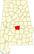
The Town is located just south of a large (approximately 2 square mile) geographic flat in an otherwise moderately hilly region that gave the area and community its name.
From 1941-1945, the large flat area adjacent to town was home to the Deatsville Auxiliary Field, an auxiliary Air Corps/Army Air Force pilot training air field associated with Gunter Field in Montgomery, Alabama. After WWII it was converted back to farmland.
The community of Pine Level held a local referendum on September 26, 2023. [4] [5] [6] Of the 300-plus eligible voters in the Pine Level community, 59 voted for incorporation and 43 voted against. The ballots were tallied at the Autauga County Probate Office that evening. The outcome came after more than a year of work and campaigning. Residents who favored incorporation stated that the establishment of a town would help keep tax dollars local and prevent another municipality from annexing Pine Level. A census of the residents located within the town's proposed boundaries was subsequently conducted before municipal elections were ordered to be held on December 5, 2023. [7] On that day, the inaugural mayor and five at-large town council members were elected. Mayor Zachary Bigley and the five council members were all were sworn into office on December 11, 2023. [8]
Pine Level CDP is home to Pine Level Elementary School and Marbury High School, part of the Autauga County School System. Both schools are located outside of the Town's official boundaries.
Fire protection is provided by the Pine Level Fire Department.
Emergency Medical Services are provided by Haynes Ambulance.
Law enforcement agency is the Autauga County Sheriffs Office.
Census | Pop. | Note | %± |
---|---|---|---|
2010 | 4,183 | — | |
2020 | 4,885 | 16.8% | |
U.S. Decennial Census [9] 1850-1870 [10] 1870-1880 [11] 1890-1910 [12] 1920 [13] 1930 [14] 1940 [15] 1950 [16] 1960 [17] 1970 [18] 1980 [19] 1990 [20] 2000 [21] 2010 [22] 2020 [23] |
Pine level was first listed as a census designated place in the 2010 U.S. Census. [22] [21]
Race / Ethnicity (NH = Non-Hispanic) | Pop 2010 [24] | Pop 2020 [23] | % 2010 | % 2020 |
---|---|---|---|---|
White alone (NH) | 3,813 | 4,251 | 91.15% | 87.02% |
Black or African American alone (NH) | 191 | 321 | 4.57% | 6.57% |
Native American or Alaska Native alone (NH) | 9 | 12 | 0.22% | 0.25% |
Asian alone (NH) | 19 | 10 | 0.45% | 0.20% |
Pacific Islander alone (NH) | 4 | 0 | 0.10% | 0.00% |
Some Other Race alone (NH) | 5 | 3 | 0.12% | 0.06% |
Mixed Race or Multi-Racial (NH) | 70 | 183 | 1.67% | 3.75% |
Hispanic or Latino (any race) | 72 | 105 | 1.72% | 2.15% |
Total | 4,183 | 4,885 | 100.00% | 100.00% |
Montgomery County is located in the State of Alabama. As of the 2020 census, its population was 228,954, making it the seventh-most populous county in Alabama. Its county seat is Montgomery, the state capital. Montgomery County is included in the Montgomery Metropolitan Statistical Area.
Autauga County is a county located in the central portion of the U.S. state of Alabama. As of the 2020 census the population was 58,805. Its county seat is Prattville.
Chilton County is a county located in the central portion of the U.S. state of Alabama. As of the 2020 census, the population was 45,014. The county seat is Clanton. Its name is in honor of William Parish Chilton, Sr. (1810–1871), a lawyer who became Chief Justice of the Alabama Supreme Court and later represented Montgomery County in the Congress of the Confederate States of America.
Montgomery is an unincorporated community and census-designated place (CDP) in Chatham County, Georgia, United States. The population was 4,443 at the 2020 United States census, down slightly from 4,523 in 2010. It is a suburb of Savannah and is part of the Savannah metropolitan area.
Georgetown is a city in Quitman County, Georgia, United States. It is on the Alabama-Georgia state line next to Walter F. George Lake and across the Chattahoochee River from Eufaula, Alabama. Per the 2020 census, the population was 2,235. In 2006, Georgetown and Quitman County voted to consolidate their governments, becoming the smallest such consolidated entity in the Lower 48 states.
Calverton is an unincorporated area and census-designated place located on the boundary between Montgomery and Prince George's counties, Maryland, in the United States. At the 2020 census, it had a population of 17,316.
Peppermill Village is an unincorporated community near Maryland Route 214 in Prince George's County, Maryland, United States. Per the 2020 census, the population was 5,264. FedExField, Metrorail's Blue Line, and Hampton Mall shopping center are all located nearby. Because it is not formally incorporated, it has no official boundaries, but the United States Census Bureau has defined a census-designated place (CDP) consisting of Peppermill Village and the adjacent community of Carmody Hills, for statistical purposes.
Magnet Cove is a census-designated place (CDP) and former town in Hot Spring County, Arkansas, United States. It is located in the Ouachita Mountains southeast of Hot Springs, on Arkansas Highway 51 north of U.S. Highway 270. As of the 2020 census, the town of Magnet Cove had a population of 692.
Nelsonia is a census-designated place (CDP) in Accomack County, Virginia, United States. Per the 2020 census, the population was 451.
Fitzpatrick is an unincorporated community and census-designated place in Bullock County, Alabama, United States. It first appeared as a CDP in the 2010 census with a population of 83. The community is served by Alabama State Route 110.
Konterra is an unincorporated area and census-designated place (CDP) in Prince George's County, Maryland, United States. The population was 3,158 at the 2020 census.
Catherine is an unincorporated community and census-designated place in Wilcox County, Alabama, United States. As of the 2020 census, its population was 65.
Equality is a census-designated place in Coosa County, Alabama, United States. It was first named as a CDP in the 2020 Census which listed a population of 150. The Equality post office serves the ZIP Code of 36026, and its delivery area includes rural land to the south in Elmore County.
Calvert is an unincorporated community and census-designated place (CDP) in Mobile and Washington counties, Alabama, United States. It is located in the extreme northeast corner of Mobile County and southeast corner of Washington County near the Tombigbee River, along U.S. Route 43. As of the 2020 census, the population of Calvert was 255.
Fairwood is an unincorporated area and census-designated place (CDP) in Prince George's County, Maryland, United States. The population was 7,983 at the 2020 census.
Marlboro Village is an unincorporated community and census-designated place (CDP) in Prince George's County, Maryland, United States. Per the 2020 census, the population was 9,221.
Butlertown is an unincorporated community and census-designated place in Kent County, Maryland, United States. Per the 2020 census, the population was 520.
Stewart is a census-designated place and unincorporated community in Montgomery County, Mississippi, United States. As of the 2020 census, it had a population of 99.
Pueblo East is an unincorporated community and census-designated place (CDP) in Webb County, Texas, United States. This was a new CDP formed from parts of the Ranchitos Las Lomas CDP prior to the 2010 census. Despite being a new CDP, the population was listed as zero in 2010.
Flower Hill is a census-designated place in Montgomery County, Maryland, United States. It has a population of 14,108 as of its first recording in the 2020 census.