Jonestown, Columbia County, Pennsylvania | |
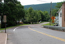
---|---|
Coordinates: 41°7′43″N76°18′12″W / 41.12861°N 76.30333°W | |
Country | United States |
State | Pennsylvania |
County | Columbia |
Township | Fishing Creek |
Area | |
• Total | 0.39 sq mi (1.00 km2) |
• Land | 0.37 sq mi (0.95 km2) |
• Water | 0.02 sq mi (0.06 km2) |
Elevation | 696 ft (212 m) |
Population | |
• Total | 115 |
• Density | 313.35/sq mi (121.08/km2) |
Time zone | UTC-5 (Eastern (EST)) |
• Summer (DST) | UTC-4 (EDT) |
FIPS code | 42-38392 |
GNIS feature ID | 1178161 |
Jonestown is a census-designated place (CDP) in Columbia County, Pennsylvania, United States. It is part of Northeastern Pennsylvania. The population was 64 at the 2010 census. [3] It is part of the Bloomsburg-Berwick micropolitan area.
Jonestown was established by Benjamin Jones in 1809, when he built a sawmill in the community, followed by a gristmill in 1811. The gristmill was used until 1968. A path between Wilkes-Barre and Muncy once passed through Jonestown. [4]
Historically, the Susquehanna and Tioga Turnpike passed through Jonestown. [5] [6] As of 1915, there was a hotel in Jonestown. [4]
Jonestown is located in northeastern Columbia County at 41°7′36″N76°18′9″W / 41.12667°N 76.30250°W (41.126639, -76.302364), [7] at the foot of the north side of Huntington Mountain (also known as Knob Mountain). It is in southeastern Fishing Creek Township, on both sides of Huntington Creek, which runs southwest along the foot of Knob Mountain to join Fishing Creek, which in turn flows to the Susquehanna River.
According to the United States Census Bureau, the Jonestown CDP has a total area of 0.4 square miles (1.0 km2), of which 0.37 square miles (0.95 km2) is land and 0.02 square miles (0.06 km2), or 5.49%, is water. [8]
Census | Pop. | Note | %± |
---|---|---|---|
2020 | 115 | — | |
U.S. Decennial Census [9] |
As of the census [10] of 2010, there were 64 people, 28 households, and 19 families residing in the CDP. The population density was 213.3 inhabitants per square mile (82.4/km2). There were 36 housing units at an average density of 120 per square mile (46/km2). The racial makeup of the CDP was 100.00% White.
There were 28 households, out of which 17.9% had children under the age of 18 living with them, 60.7% were married couples living together, 7.1% had a female householder with no husband present, and 32.1% were non-families. 21.4% of all households were made up of individuals, and 14.3% had someone living alone who was 65 years of age or older. The average household size was 2.29 and the average family size was 2.74. [3]
In the CDP, the population was spread out, with 18.7% age 19 and under, 1.6% from 20 to 24, 31.3% from 25 to 44, 36.1% from 45 to 64, and 12.5% who were 65 years of age or older. The median age was 44.7 years. For every 100 females, there were 78.9 males. The population was composed of 44.8% males and 56.3% females.
The median income for a household in the CDP was $32,500, and the median income for a family was $42,143. The per capita income for the CDP was $7,878. There were no families and 4.2% of the population living below the poverty line, including no under eighteens and 0.0% of those over 64. [11]
Almedia is a census-designated place (CDP) in Columbia County, Pennsylvania, United States. It is part of Northeastern Pennsylvania. The population was 1,078 at the 2010 census. It is part of the Bloomsburg-Berwick micropolitan area.
Beaver Township is a township in Columbia County, Pennsylvania. It is part of Northeastern Pennsylvania. The population was 879 at the 2020 census. Beaver Township is named for Beaver Run, a tributary of Catawissa Creek, both of which run through the township.
Buckhorn is a census-designated place (CDP) in Columbia County, Pennsylvania, United States. It is part of Northeastern Pennsylvania. The population was 318 at the 2010 census. It is part of the Bloomsburg-Berwick micropolitan area. It uses the Bloomsburg ZIP code of 17815.
Fernville is a census-designated place (CDP) in Columbia County, Pennsylvania, United States. It is part of Northeastern Pennsylvania. The population was 556 at the 2010 census. It is part of the Bloomsburg-Berwick micropolitan area.
Foundryville is a census-designated place (CDP) in Columbia County, Pennsylvania, United States. It is part of Northeastern Pennsylvania. The population was 256 at the 2010 census. It is part of the Bloomsburg-Berwick micropolitan area.
Hemlock Township is a township in Columbia County, Pennsylvania. It is part of Northeastern Pennsylvania. As of the 2020 census the population was 2,218, a decline from the figure of 2,249 tabulated in 2010.
Iola is a census-designated place in Columbia County, Pennsylvania, United States. It is part of Northeastern Pennsylvania. The population was 144 at the 2010 census. It is part of the Bloomsburg-Berwick micropolitan area.
Jamison City is a census-designated place in Sugarloaf Township, Columbia County, Pennsylvania, United States. It is part of Northeastern Pennsylvania. The population was 134 at the 2010 census. It is part of the Bloomsburg-Berwick micropolitan area.
Jerseytown is a census-designated place (CDP) that is located in Madison Township, Columbia County, Pennsylvania, United States. It is part of Northeastern Pennsylvania and of the Bloomsburg-Berwick micropolitan area.
Lightstreet is a census-designated place (CDP) in Columbia County, Pennsylvania, United States. It is part of Northeastern Pennsylvania. The population was 1,093 at the 2010 census. It is part of the Bloomsburg-Berwick micropolitan area. The CDP is named after a street in Baltimore.
Lime Ridge is a census-designated place (CDP) in Columbia County, Pennsylvania, United States. It is part of Northeastern Pennsylvania. The population was 890 at the 2010 census. It is part of the Bloomsburg-Berwick micropolitan area.
Locustdale is a census-designated place (CDP) that is located on the border of Columbia and Schuylkill counties, Pennsylvania, United States. It is part of Northeastern Pennsylvania.
Madison Township is a township in Columbia County, Pennsylvania. It is part of Northeastern Pennsylvania. The population was 1,566 at the 2020 census.
Mainville is a census-designated place in Columbia County, Pennsylvania, United States. It is part of Northeastern Pennsylvania. The population was 132 at the 2010 census. It is part of the Bloomsburg-Berwick micropolitan area.
Mifflinville is an unincorporated community and census-designated place (CDP) in Columbia County, Pennsylvania, United States. It is part of Northeastern Pennsylvania. The population was 1,253 at the 2010 census. It is part of the Bloomsburg-Berwick micropolitan area.
Numidia is a census-designated place (CDP) in Columbia County, Pennsylvania, United States. It is part of Northeastern Pennsylvania. The population was 244 at the 2010 census. It is part of the Bloomsburg-Berwick metropolitan area.
Rohrsburg is a census-designated place (CDP) in Columbia County, Pennsylvania, United States. It is part of Northeastern Pennsylvania. The population was 145 at the 2010 census. It is part of the Bloomsburg-Berwick micropolitan area.
Rupert is a census-designated place (CDP) in Columbia County, Pennsylvania, United States. It is part of Northeastern Pennsylvania. The population was 183 at the 2010 census. It is part of the Bloomsburg-Berwick micropolitan area.
Wilburton Number Two is a census-designated place (CDP) in Columbia County, Pennsylvania, United States. It is part of Northeastern Pennsylvania. The population was 96 at the 2010 census. It is part of the Bloomsburg-Berwick micropolitan area.
Progress is an unincorporated community and census-designated place (CDP) mainly in Susquehanna Township but also in Lower Paxton Township, Dauphin County, Pennsylvania, United States. The population was 9,765 at the 2010 census. It is part of the Harrisburg–Carlisle Metropolitan Statistical Area.