Hemlock Township, Columbia County, Pennsylvania

Last updated

Hemlock Township,
Columbia County,
Pennsylvania
Wanich Covered Bridge 9.JPG
The western end of Wanich Covered Bridge No. 69 is in the township; the bridge crosses Fishing Creek into Mount Pleasant Township.
Motto(s): 
"Tradition, progress, community"
Map of Hemlock Township, Columbia County, Pennsylvania Highlighted.png
Map of Columbia County, Pennsylvania highlighting Hemlock Township
Map of Pennsylvania highlighting Columbia County.svg
Map of Columbia County, Pennsylvania
Country United States
State Pennsylvania
County Columbia
Settled1770
Incorporated1801
Area
[1]
  Total17.64 sq mi (45.70 km2)
  Land17.55 sq mi (45.47 km2)
  Water0.09 sq mi (0.23 km2)
Population
 (2020) [2]
  Total2,218 Decrease2.svg
  Estimate 
(2021) [2]
2,228
  Density128.68/sq mi (49.68/km2)
Time zone UTC-5 (Eastern (EST))
  Summer (DST) UTC-4 (EDT)
Area code 570
FIPS code 42-037-33760
Website www.hemlocktownship.org

Hemlock Township is a township in Columbia County, Pennsylvania. It is part of Northeastern Pennsylvania. As of the 2020 census the population was 2,218, [2] a decline from the figure of 2,249 tabulated in 2010. [3]

Contents

History

The Wanich Covered Bridge No. 69 was listed on the National Register of Historic Places in 1979. [4]

Geography

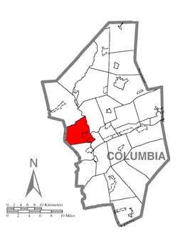
Hemlock Township is in western Columbia County, bordered by Montour County to the west, Montour Township to the south, Bloomsburg to the southeast, Mount Pleasant Township to the northeast, and Madison Township to the north. Little Fishing Creek and Fishing Creek, flowing south towards the Susquehanna River, form the eastern boundary of the township. The unincorporated community of Buckhorn is in the east-center of the township, and Fernville, a densely settled neighborhood adjacent to Bloomsburg, is in the southeast corner.

Interstate 80 crosses the township from west to east, with access from Exit 232 (Pennsylvania Route 42) at Buckhorn. The Columbia Colonnade (formerly Columbia Mall) is next to the exit.

According to the United States Census Bureau, the township has a total area of 17.6 square miles (45.7 km2), of which 17.6 square miles (45.5 km2) is land and 0.08 square miles (0.2 km2), or 0.51%, is water. [3]

Demographics

Historical population
CensusPop.Note
2010 2,249
2020 2,218−1.4%
2021 (est.)2,228 [2] 0.5%
U.S. Decennial Census [5]

As of the census [6] of 2000, there were 1,874 people, 712 households, and 548 families residing in the township. The population density was 106.5 inhabitants per square mile (41.1/km2). There were 747 housing units at an average density of 42.5 per square mile (16.4/km2). The racial makeup of the township was 98.13% White, 0.32% African American, 0.48% Asian, 0.32% from other races, and 0.75% from two or more races. Hispanic or Latino of any race were 0.69% of the population.

There were 712 households, out of which 32.7% had children under the age of 18 living with them, 68.3% were married couples living together, 5.1% had a female householder with no husband present, and 22.9% were non-families. 17.4% of all households were made up of individuals, and 7.3% had someone living alone who was 65 years of age or older. The average household size was 2.63 and the average family size was 2.97.

In the township the population was spread out, with 25.6% under the age of 18, 5.1% from 18 to 24, 31.8% from 25 to 44, 24.3% from 45 to 64, and 13.3% who were 65 years of age or older. The median age was 38 years. For every 100 females, there were 101.1 males. For every 100 females age 18 and over, there were 96.6 males.

The median income for a household in the township was $42,292, and the median income for a family was $49,097. Males had a median income of $33,229 versus $23,750 for females. The per capita income for the township was $21,125. About 4.1% of families and 5.6% of the population were below the poverty line, including 5.7% of those under age 18 and 9.9% of those age 65 or over.

Related Research Articles

<span class="mw-page-title-main">Columbia County, Pennsylvania</span> County in Pennsylvania, United States

Columbia County is a county in the Commonwealth of Pennsylvania. It is located in Northeastern Pennsylvania. As of the 2020 census, the population was 64,727. Its county seat is Bloomsburg. The county was created on March 22, 1813, from part of Northumberland County. It was named Columbia, alluding to the United States and Christopher Columbus.

<span class="mw-page-title-main">Benton, Columbia County, Pennsylvania</span> Borough in Pennsylvania, United States

Benton is a borough in Columbia County, Pennsylvania, United States. It is part of Northeastern Pennsylvania. The population was 824 at the 2020 census. It is part of the Bloomsburg-Berwick micropolitan area.

<span class="mw-page-title-main">Bloomsburg, Pennsylvania</span> Town in Pennsylvania, United States

Bloomsburg is a town and the county seat of Columbia County, Pennsylvania, United States. It is part of Northeastern Pennsylvania and is located 40 miles (64 km) southwest of Wilkes-Barre along the Susquehanna River. It is the only Pennsylvania municipality incorporated as a town. As of the 2010 census, Bloomsburg had a population of 14,855, with an estimated population of 13,811 in 2019.

<span class="mw-page-title-main">Buckhorn, Pennsylvania</span> Census-designated place in Pennsylvania, United States

Buckhorn is a census-designated place (CDP) in Columbia County, Pennsylvania, United States. It is part of Northeastern Pennsylvania. The population was 318 at the 2010 census. It is part of the Bloomsburg-Berwick micropolitan area. It uses the Bloomsburg ZIP code of 17815.

<span class="mw-page-title-main">Catawissa Township, Pennsylvania</span> Township in Pennsylvania, United States

Catawissa Township is a township near the borough of Catawissa, Columbia County, Pennsylvania. It is part of Northeastern Pennsylvania. The population was 904 at the 2020 census.

<span class="mw-page-title-main">Fernville, Pennsylvania</span> Census-designated place in Pennsylvania, United States

Fernville is a census-designated place (CDP) in Columbia County, Pennsylvania, United States. It is part of Northeastern Pennsylvania. The population was 556 at the 2010 census. It is part of the Bloomsburg-Berwick micropolitan area.

Foundryville is a census-designated place (CDP) in Columbia County, Pennsylvania, United States. It is part of Northeastern Pennsylvania. The population was 256 at the 2010 census. It is part of the Bloomsburg-Berwick micropolitan area.

<span class="mw-page-title-main">Iola, Pennsylvania</span> Census-designated place in Pennsylvania, United States

Iola is a census-designated place in Columbia County, Pennsylvania, United States. It is part of Northeastern Pennsylvania. The population was 144 at the 2010 census. It is part of the Bloomsburg-Berwick micropolitan area.

<span class="mw-page-title-main">Jerseytown, Pennsylvania</span> Census-designated place in Pennsylvania, United States

Jerseytown is a census-designated place (CDP) that is located in Madison Township, Columbia County, Pennsylvania, United States. It is part of Northeastern Pennsylvania and of the Bloomsburg-Berwick micropolitan area.

<span class="mw-page-title-main">Jonestown, Columbia County, Pennsylvania</span> Census-designated place in Pennsylvania, United States

Jonestown is a census-designated place (CDP) in Columbia County, Pennsylvania, United States. It is part of Northeastern Pennsylvania. The population was 64 at the 2010 census. It is part of the Bloomsburg-Berwick micropolitan area.

<span class="mw-page-title-main">Lightstreet, Pennsylvania</span> Census-designated place in Pennsylvania, United States

Lightstreet is a census-designated place (CDP) in Columbia County, Pennsylvania, United States. It is part of Northeastern Pennsylvania. The population was 1,093 at the 2010 census. It is part of the Bloomsburg-Berwick micropolitan area. The CDP is named after a street in Baltimore.

<span class="mw-page-title-main">Lime Ridge, Pennsylvania</span> Census-designated place in Pennsylvania, United States

Lime Ridge is a census-designated place (CDP) in Columbia County, Pennsylvania, United States. It is part of Northeastern Pennsylvania. The population was 890 at the 2010 census. It is part of the Bloomsburg-Berwick micropolitan area.

<span class="mw-page-title-main">Madison Township, Columbia County, Pennsylvania</span> Township in Pennsylvania, United States

Madison Township is a township in Columbia County, Pennsylvania. It is part of Northeastern Pennsylvania. The population was 1,566 at the 2020 census.

<span class="mw-page-title-main">Montour Township, Pennsylvania</span> Township in Pennsylvania, United States

Montour Township is a township in Columbia County, Pennsylvania. It is part of Northeastern Pennsylvania.

<span class="mw-page-title-main">Numidia, Pennsylvania</span> Census-designated place in Pennsylvania, United States

Numidia is a census-designated place (CDP) in Columbia County, Pennsylvania, United States. It is part of Northeastern Pennsylvania. The population was 244 at the 2010 census. It is part of the Bloomsburg-Berwick metropolitan area.

<span class="mw-page-title-main">Rohrsburg, Pennsylvania</span> Census-designated place in Pennsylvania, United States

Rohrsburg is a census-designated place (CDP) in Columbia County, Pennsylvania, United States. It is part of Northeastern Pennsylvania. The population was 145 at the 2010 census. It is part of the Bloomsburg-Berwick micropolitan area.

<span class="mw-page-title-main">Rupert, Pennsylvania</span> Census-designated place in Pennsylvania, United States

Rupert is a census-designated place (CDP) in Columbia County, Pennsylvania, United States. It is part of Northeastern Pennsylvania. The population was 183 at the 2010 census. It is part of the Bloomsburg-Berwick micropolitan area.

<span class="mw-page-title-main">South Centre Township, Pennsylvania</span> Township in Pennsylvania, United States

South Centre Township is a township in Columbia County, Pennsylvania. It is part of Northeastern Pennsylvania. The population was 1,908 at the 2020 census.

<span class="mw-page-title-main">West Hemlock Township, Pennsylvania</span> Township in Pennsylvania, United States

West Hemlock Township is a township in Montour County, Pennsylvania, United States.

<span class="mw-page-title-main">Bloomsburg–Berwick metropolitan area</span> Metropolitan area in Pennsylvania, United States

The Bloomsburg–Berwick Metropolitan Statistical Area (MSA), as defined by the United States Census Bureau, is an area consisting of two counties in Pennsylvania, anchored by the town of Bloomsburg and the borough of Berwick. As of the 2010 census, the MSA had a population of 85,562.

References

  1. "2016 U.S. Gazetteer Files". United States Census Bureau. Retrieved August 13, 2017.
  2. 1 2 3 4 Bureau, US Census. "City and Town Population Totals: 2020—2021". Census.gov. US Census Bureau. Retrieved July 28, 2022.
  3. 1 2 "Geographic Identifiers: 2010 Census Summary File 1 (G001): Hemlock township, Columbia County, Pennsylvania". U.S. Census Bureau, American Factfinder. Archived from the original on February 13, 2020. Retrieved May 21, 2015.
  4. "National Register Information System". National Register of Historic Places . National Park Service. July 9, 2010.
  5. "Census of Population and Housing". Census.gov. Retrieved June 4, 2016.
  6. "U.S. Census website". United States Census Bureau . Retrieved January 31, 2008.

41°01′30″N76°31′29″W / 41.02500°N 76.52472°W / 41.02500; -76.52472