Beaver Township, Columbia County, Pennsylvania

Last updated

Beaver Township,
Columbia County,
Pennsylvania
Beaver Twp Roadside View (2).jpg
Map of Beaver Township, Columbia County, Pennsylvania Highlighted.png
Map of Columbia County, Pennsylvania highlighting Beaver Township
Map of Pennsylvania highlighting Columbia County.svg
Map of Columbia County, Pennsylvania
Country United States
State Pennsylvania
County Columbia
Settled1774
Incorporated1845
Area
[1]
  Total35.79 sq mi (92.70 km2)
  Land35.39 sq mi (91.67 km2)
  Water0.40 sq mi (1.03 km2)
Population
 (2020) [2]
  Total879 Decrease2.svg
  Estimate 
(2021) [2]
886
  Density25.94/sq mi (10.01/km2)
Time zone UTC-5 (Eastern (EST))
  Summer (DST) UTC-4 (EDT)
Area code 570
FIPS code 42-037-04704

Beaver Township is a township in Columbia County, Pennsylvania. It is part of Northeastern Pennsylvania. The population was 879 at the 2020 census. [2] Beaver Township is named for Beaver Run, a tributary of Catawissa Creek, both of which run through the township. [3]

Contents

History

Beaver Township was first settled in 1774 by Alexander McCauley. However, McCauley left the township in 1776, and the township was not settled again until 1799. In 1810, a tannery and sawmill were built in Beaver Township. Beaver Township was formed from Catawissa Township. [3]

Geography

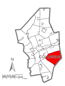
Beaver Township is in southeastern Columbia County and is bordered to the east by Luzerne County and to the southeast by Schuylkill County. The northern border of the township follows the ridgecrest of Nescopeck Mountain. Other mountains in the township are McCauley Mountain in the center, the western end of Buck Mountain on the east side, and the slopes of Catawissa Mountain along the southwestern border.

According to the United States Census Bureau, the township has a total area of 35.8 square miles (92.7 km2), of which 35.4 square miles (91.7 km2) is land and 0.39 square miles (1.0 km2), or 1.11%, is water. [4] Catawissa Creek, a tributary of the Susquehanna River, flows from southeast to northwest across the southwestern side of the township.

Unincorporated communities in the township include Mifflin Cross Roads, Shumans, and Dogtown. [5]

Demographics

Historical population
CensusPop.Note
2010 917
2020 879−4.1%
2021 (est.)886 [2] 0.8%
U.S. Decennial Census [6]

As of the census [7] of 2000, there were 885 people, 342 households, and 254 families residing in the township. The population density was 24.8 people per square mile (9.6/km2). There were 437 housing units at an average density of 12.2/sq mi (4.7/km2). The racial makeup of the township was 99.44% White, 0.11% Native American, 0.11% Asian, 0.11% from other races, and 0.23% from two or more races. Hispanic or Latino of any race were 0.11% of the population.

There were 342 households, out of which 28.1% had children under the age of 18 living with them, 62.9% were married couples living together, 7.3% had a female householder with no husband present, and 25.7% were non-families. 22.2% of all households were made up of individuals, and 7.6% had someone living alone who was 65 years of age or older. The average household size was 2.59 and the average family size was 3.05.

In the township the population was spread out, with 22.3% under the age of 18, 6.6% from 18 to 24, 28.9% from 25 to 44, 27.3% from 45 to 64, and 14.9% who were 65 years of age or older. The median age was 41 years. For every 100 females, there were 103.0 males. For every 100 females age 18 and over, there were 100.6 males.

The median income for a household in the township was $34,524, and the median income for a family was $39,231. Males had a median income of $30,227 versus $21,842 for females. The per capita income for the township was $15,225. About 4.1% of families and 7.5% of the population were below the poverty line, including 9.7% of those under age 18 and 7.1% of those age 65 or over.

Related Research Articles

<span class="mw-page-title-main">Forward Township, Allegheny County, Pennsylvania</span> Township of Allegheny County, Pennsylvania

Forward Township is a township in Allegheny County, Pennsylvania, United States. The population was 3,068 at the 2020 census. The township is named after Walter Forward, U.S. Secretary of the Treasury from 1841 to 1843.

<span class="mw-page-title-main">Banks Township, Carbon County, Pennsylvania</span> Township in Pennsylvania, United States

Banks Township is a township in Carbon County, Pennsylvania. It is part of Northeastern Pennsylvania.

<span class="mw-page-title-main">Marion Township, Centre County, Pennsylvania</span> Township in Pennsylvania, United States

Marion Township is a township that is located in Centre County, Pennsylvania, United States. It is part of the State College, Pennsylvania Metropolitan Statistical Area.

<span class="mw-page-title-main">Briar Creek Township, Pennsylvania</span> Township in Pennsylvania, United States

Briar Creek Township is a township in Columbia County, Pennsylvania. It is part of Northeastern Pennsylvania. The population was 2,992 at the 2020 census.

<span class="mw-page-title-main">Catawissa, Pennsylvania</span> Borough in Pennsylvania, United States

Catawissa is a borough in Columbia County, Pennsylvania, United States. It is part of Northeastern Pennsylvania. The population was 1,539 at the 2020 census. It is part of the Bloomsburg-Berwick micropolitan area.

<span class="mw-page-title-main">Catawissa Township, Pennsylvania</span> Township in Pennsylvania, United States

Catawissa Township is a township near the borough of Catawissa, Columbia County, Pennsylvania. It is part of Northeastern Pennsylvania. The population was 904 at the 2020 census.

<span class="mw-page-title-main">Main Township, Columbia County, Pennsylvania</span> Township in Pennsylvania, United States

Main Township is a township in Columbia County, Pennsylvania. It is part of Northeastern Pennsylvania. The population was 1,272 at the 2020 census. Main Township was settled in 1772 and incorporated in 1844. The iron industry was once preeminent in the township.

<span class="mw-page-title-main">Mainville, Pennsylvania</span> Census-designated place in Pennsylvania, United States

Mainville is a census-designated place in Columbia County, Pennsylvania, United States. It is part of Northeastern Pennsylvania. The population was 134 at the 2020 census. It is part of the Bloomsburg-Berwick micropolitan area.

<span class="mw-page-title-main">Mifflin Township, Columbia County, Pennsylvania</span> Township in Pennsylvania, United States

Mifflin Township is a township in Columbia County, Pennsylvania. It is part of Northeastern Pennsylvania. The population was 2,277 at the 2020 census.

<span class="mw-page-title-main">Roaring Creek Township, Pennsylvania</span> Township in Pennsylvania, United States

Roaring Creek Township is a township in Columbia County, Pennsylvania. It is part of Northeastern Pennsylvania. The population was five hundred and forty-five at the time of the 2010 census.

<span class="mw-page-title-main">Scott Township, Columbia County, Pennsylvania</span> Township in Pennsylvania, United States

Scott Township is a township in Columbia County, Pennsylvania. It is part of Northeastern Pennsylvania. The population was 5,527 at the 2020 census, an increase over the figure of 5,113 tabulated in 2000.

<span class="mw-page-title-main">Sugarloaf Township, Columbia County, Pennsylvania</span> Township in Pennsylvania, United States

Sugarloaf Township is a township in Columbia County, Pennsylvania. It is part of Northeastern Pennsylvania.

<span class="mw-page-title-main">Hopewell Township, Huntingdon County, Pennsylvania</span> Township in Pennsylvania, United States

Hopewell Township is a township in Huntingdon County, Pennsylvania, United States. The population was 455 at the 2020 census.

<span class="mw-page-title-main">Ceres Township, Pennsylvania</span> Township in Pennsylvania, United States

Ceres Township is a township in McKean County, Pennsylvania, United States. The population was 842 at the 2020 census.

<span class="mw-page-title-main">Liberty Township, McKean County, Pennsylvania</span> Township in Pennsylvania, United States

Liberty Township is a township in McKean County, Pennsylvania, United States. The population was 1,604 at the time of the census.

<span class="mw-page-title-main">Fairview Township, Mercer County, Pennsylvania</span> Township in Pennsylvania, United States

Fairview Township is a township in Mercer County, Pennsylvania, United States. The population was 950 at the 2020 census, a decline from the figure of 1,085 in 2010.

<span class="mw-page-title-main">Norwegian Township, Pennsylvania</span> Township in Pennsylvania, United States

Norwegian Township is a township that is located in Schuylkill County, Pennsylvania, United States. The population was 2,167 at the time of the 2020 census.

<span class="mw-page-title-main">Morris Township, Tioga County, Pennsylvania</span> Township in Pennsylvania, United States

Morris Township is a township in Tioga County, Pennsylvania, United States. The population was 562 at the 2020 census.

<span class="mw-page-title-main">Nelson Township, Pennsylvania</span> Township in Pennsylvania, United States

Nelson Township is a township in Tioga County, Pennsylvania, United States. The population was 545 at the 2020 census.

<span class="mw-page-title-main">Farmington Township, Warren County, Pennsylvania</span> Township in Pennsylvania, United States

Farmington Township is a township in Warren County, Pennsylvania, United States. The population was 1,281 at the 2020 census, up from 1,259 in 2010.

References

  1. "2016 U.S. Gazetteer Files". United States Census Bureau. Retrieved August 13, 2017.
  2. 1 2 3 4 Bureau, US Census. "City and Town Population Totals: 2020—2021". Census.gov. US Census Bureau. Retrieved July 24, 2022.
  3. 1 2 "Chapter XIX, Beaver Township, History of Columbia and Montour Counties, Pennsylvania".
  4. "Geographic Identifiers: 2010 Census Summary File 1 (G001): Beaver township, Columbia County, Pennsylvania". U.S. Census Bureau, American Factfinder. Archived from the original on February 13, 2020. Retrieved May 20, 2015.
  5. U.S. Geological Survey 7.5-minute topographic maps
  6. "Census of Population and Housing". Census.gov. Retrieved June 4, 2016.
  7. "U.S. Census website". United States Census Bureau . Retrieved January 31, 2008.

41°00′01″N76°13′59″W / 41.00028°N 76.23306°W / 41.00028; -76.23306