Jamison City, Pennsylvania

Last updated
Jamison City, Pennsylvania
Jamison City, Pennsylvania bird's-eye view.png
Jamison City from the air
Map of Jamison City, Columbia County, Pennsylvania Highlighted.png
Location within Columbia County
USA Pennsylvania location map.svg
Red pog.svg
Jamison
City
Location within the U.S. state of Pennsylvania
Coordinates: 41°18′5″N76°21′59″W / 41.30139°N 76.36639°W / 41.30139; -76.36639
Country United States
State Pennsylvania
County Columbia
Township Sugarloaf
Area
[1]
  Total0.39 sq mi (1.01 km2)
  Land0.39 sq mi (1.01 km2)
  Water0.00 sq mi (0.00 km2)
Elevation
[2]
1,070 ft (330 m)
Population
 (2020) [3]
  Total111
  Density286.08/sq mi (110.38/km2)
Time zone UTC-5 (Eastern (EST))
  Summer (DST) UTC-4 (EDT)
ZIP Code
17814
FIPS code 42-37728
GNIS feature ID1177983
Jamison City station on the Bloomsburg and Sullivan Railroad. Building is one of the few remaining stations that is in the original location and is still standing. The station is still standing as of 2021. A monument in the front yard commemorating the 100th year Centennial of Jamison City Area in 1989 (dedicated to E. William (Bill) and Pauline Mather who owned the station grounds until 2012) and the Mather General Store building to the right of the train station that his father ran when Jamison City was in its heyday circa 1889. Bloomsburg Sullivan Railroad Jamison City Train Station 02.jpg
Jamison City station on the Bloomsburg and Sullivan Railroad. Building is one of the few remaining stations that is in the original location and is still standing. The station is still standing as of 2021. A monument in the front yard commemorating the 100th year Centennial of Jamison City Area in 1989 (dedicated to E. William (Bill) and Pauline Mather who owned the station grounds until 2012) and the Mather General Store building to the right of the train station that his father ran when Jamison City was in its heyday circa 1889.
Historical Marker on the door of the Jamison City station on the Bloomsburg and Sullivan railroad. Historical marker was placed for the Jamison City Centennial celebration that occurred in July 1989. Bloomsburg Sullivan Railroad Jamison City Train Station 01.jpg
Historical Marker on the door of the Jamison City station on the Bloomsburg and Sullivan railroad. Historical marker was placed for the Jamison City Centennial celebration that occurred in July 1989.
Jamison City Bloomsburg and Sullivan railroad station Centennial marker on the grounds of the Jamison City train station on the Bloomsburg and Sullivan railroad commemorating the Jamison City Area Centennial celebration that occurred in July 1989.  Marker was dedicated to Bill and Pauline Mather who owned the land of the train station until 2012. Jamison City Bloomsburg and Sullivan railroad station Centennial marker.jpg
Jamison City Bloomsburg and Sullivan railroad station Centennial marker on the grounds of the Jamison City train station on the Bloomsburg and Sullivan railroad  commemorating the Jamison City Area Centennial celebration that occurred in July 1989.  Marker was dedicated to Bill and Pauline Mather who owned the land of the train station until 2012.

Jamison City is a census-designated place in Sugarloaf Township, Columbia County, Pennsylvania, United States. It is part of Northeastern Pennsylvania. The population was 134 at the 2010 census. [4] It is part of the Bloomsburg-Berwick micropolitan area.

Contents

Geography

Jamison City is located at 41°18′5″N76°21′59″W / 41.30139°N 76.36639°W / 41.30139; -76.36639 (41.301523, -76.366443), [5] in the northern reaches of Columbia County. It is in northern Sugarloaf Township and is bordered on the north by Davidson Township in Sullivan County. According to the United States Census Bureau, the CDP has a total area of 0.4 square miles (1.0 km2), all land. [4]

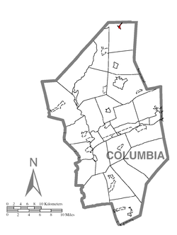
The CDP is situated on mostly level terrain, and surrounded on the north, east, and west by mountains. The East Branch of Fishing Creek runs through Jamison City. [6]

History

Station on the defunct Bloomsburg and Sullivan Railroad at its northern terminus in Jamison City Bloomsburg and Sullivan Railroad Jamison City station.JPG
Station on the defunct Bloomsburg and Sullivan Railroad at its northern terminus in Jamison City
B. Frank Mather General Merchandise, a store that operated in Jamison City from 1903 to 1926. B. Frank Mather General Merchandise building.JPG
B. Frank Mather General Merchandise, a store that operated in Jamison City from 1903 to 1926.

Jamison City was formed at the northern terminus of the Bloomsburg and Sullivan Railroad. In 1889 a sawmill was built in Jamison City. However, it stopped producing wood in 1912, and the final load of lumber from it was shipped to Bloomsburg in 1914. [7] A tannery was built in Jamison City, but it was closed in 1925. [8]

Demographics

Historical population
CensusPop.Note
2020 111
U.S. Decennial Census [9]

As of the census [10] of 2000, there were 102 people, 46 households, and 28 families residing in the CDP. The population density was 417.1 inhabitants per square mile (161.0/km2). There were 96 housing units at an average density of 392.6 per square mile (151.6/km2). The racial makeup of the CDP was 100.00% White.

There were 46 households, out of which 23.9% had children under the age of 18 living with them, 50.0% were married couples living together, 6.5% had a female householder with no husband present, and 39.1% were non-families. 30.4% of all households were made up of individuals, and 21.7% had someone living alone who was 65 years of age or older. The average household size was 2.22 and the average family size was 2.79.

In the CDP, the population was spread out, with 19.6% under the age of 18, 7.8% from 18 to 24, 34.3% from 25 to 44, 12.7% from 45 to 64, and 25.5% who were 65 years of age or older. The median age was 40 years. For every 100 females, there were 100.0 males. For every 100 females age 18 and over, there were 110.3 males.

The median income for a household in the CDP was $36,250, and the median income for a family was $36,250. Males had a median income of $35,000 versus $20,156 for females. The per capita income for the CDP was $17,873. There were 6.3% of families and 4.2% of the population living below the poverty line, including 12.0% of under eighteens and none of those over 64.

Related Research Articles

<span class="mw-page-title-main">Standing Stone Township, Bradford County, Pennsylvania</span> Township in Pennsylvania, United States

Standing Stone Township is a township in Bradford County, Pennsylvania, United States. The population was 642 at the 2010 census.

<span class="mw-page-title-main">Almedia, Pennsylvania</span> Census-designated place in Pennsylvania, United States

Almedia is a census-designated place (CDP) in Columbia County, Pennsylvania, United States. It is part of Northeastern Pennsylvania. The population was 1,078 at the 2010 census. It is part of the Bloomsburg-Berwick micropolitan area.

<span class="mw-page-title-main">Buckhorn, Pennsylvania</span> Census-designated place in Pennsylvania, United States

Buckhorn is a census-designated place (CDP) in Columbia County, Pennsylvania, United States. It is part of Northeastern Pennsylvania. The population was 318 at the 2010 census. It is part of the Bloomsburg-Berwick micropolitan area. It uses the Bloomsburg ZIP code of 17815.

<span class="mw-page-title-main">Espy, Pennsylvania</span> Census-designated place in Pennsylvania, United States

Espy is a census-designated place (CDP) in Columbia County, Pennsylvania, United States. It is part of Northeastern Pennsylvania. The population was 1,642 at the 2010 census. It is part of the Bloomsburg-Berwick micropolitan area. Espy was first settled in the late 18th century. It was home to a boatyard in the 19th century.

<span class="mw-page-title-main">Fernville, Pennsylvania</span> Census-designated place in Pennsylvania, United States

Fernville is a census-designated place (CDP) in Columbia County, Pennsylvania, United States. It is part of Northeastern Pennsylvania. The population was 556 at the 2010 census. It is part of the Bloomsburg-Berwick micropolitan area.

Foundryville is a census-designated place (CDP) in Columbia County, Pennsylvania, United States. It is part of Northeastern Pennsylvania. The population was 256 at the 2010 census. It is part of the Bloomsburg-Berwick micropolitan area.

<span class="mw-page-title-main">Hemlock Township, Columbia County, Pennsylvania</span> Township in Pennsylvania, United States

Hemlock Township is a township in Columbia County, Pennsylvania. It is part of Northeastern Pennsylvania. As of the 2020 census the population was 2,218, a decline from the figure of 2,249 tabulated in 2010.

<span class="mw-page-title-main">Iola, Pennsylvania</span> Census-designated place in Pennsylvania, United States

Iola is a census-designated place in Columbia County, Pennsylvania, United States. It is part of Northeastern Pennsylvania. The population was 144 at the 2010 census. It is part of the Bloomsburg-Berwick micropolitan area.

<span class="mw-page-title-main">Jerseytown, Pennsylvania</span> Census-designated place in Pennsylvania, United States

Jerseytown is a census-designated place (CDP) that is located in Madison Township, Columbia County, Pennsylvania, United States. It is part of Northeastern Pennsylvania and of the Bloomsburg-Berwick micropolitan area.

<span class="mw-page-title-main">Lightstreet, Pennsylvania</span> Census-designated place in Pennsylvania, United States

Lightstreet is a census-designated place (CDP) in Columbia County, Pennsylvania, United States. It is part of Northeastern Pennsylvania. The population was 1,093 at the 2010 census. It is part of the Bloomsburg-Berwick micropolitan area. The CDP is named after a street in Baltimore.

<span class="mw-page-title-main">Mainville, Pennsylvania</span> Census-designated place in Pennsylvania, United States

Mainville is a census-designated place in Columbia County, Pennsylvania, United States. It is part of Northeastern Pennsylvania. The population was 132 at the 2010 census. It is part of the Bloomsburg-Berwick micropolitan area.

<span class="mw-page-title-main">Mifflinville, Pennsylvania</span> Census-designated place in Pennsylvania, United States

Mifflinville is an unincorporated community and census-designated place (CDP) in Columbia County, Pennsylvania, United States. It is part of Northeastern Pennsylvania. The population was 1,253 at the 2010 census. It is part of the Bloomsburg-Berwick micropolitan area.

<span class="mw-page-title-main">Numidia, Pennsylvania</span> Census-designated place in Pennsylvania, United States

Numidia is a census-designated place (CDP) in Columbia County, Pennsylvania, United States. It is part of Northeastern Pennsylvania. The population was 244 at the 2010 census. It is part of the Bloomsburg-Berwick metropolitan area.

<span class="mw-page-title-main">Rohrsburg, Pennsylvania</span> Census-designated place in Pennsylvania, United States

Rohrsburg is a census-designated place (CDP) in Columbia County, Pennsylvania, United States. It is part of Northeastern Pennsylvania. The population was 145 at the 2010 census. It is part of the Bloomsburg-Berwick micropolitan area.

<span class="mw-page-title-main">Rupert, Pennsylvania</span> Census-designated place in Pennsylvania, United States

Rupert is a census-designated place (CDP) in Columbia County, Pennsylvania, United States. It is part of Northeastern Pennsylvania. The population was 183 at the 2010 census. It is part of the Bloomsburg-Berwick micropolitan area.

<span class="mw-page-title-main">Slabtown, Pennsylvania</span> Census-designated place in Pennsylvania, United States

Slabtown is a census-designated place in Columbia County, Pennsylvania, United States. It is part of Northeastern Pennsylvania. The population was 156 at the 2010 census. It is part of the Bloomsburg-Berwick micropolitan area.

<span class="mw-page-title-main">Sugarloaf Township, Columbia County, Pennsylvania</span> Township in Pennsylvania, United States

Sugarloaf Township is a township in Columbia County, Pennsylvania. It is part of Northeastern Pennsylvania.

<span class="mw-page-title-main">Waller, Pennsylvania</span> Census-designated place in Pennsylvania, United States

Waller is a census-designated place (CDP) in Columbia County, Pennsylvania, United States. It is part of Northeastern Pennsylvania. The population was 48 at the 2010 census. It is part of the Bloomsburg-Berwick micropolitan area.

<span class="mw-page-title-main">Wilburton Number Two, Pennsylvania</span> Census-designated place in Pennsylvania, United States

Wilburton Number Two is a census-designated place (CDP) in Columbia County, Pennsylvania, United States. It is part of Northeastern Pennsylvania. The population was 96 at the 2010 census. It is part of the Bloomsburg-Berwick micropolitan area.

<span class="mw-page-title-main">Cherry Township, Sullivan County, Pennsylvania</span> Township in Pennsylvania, United States

Cherry Township is a township in Sullivan County, Pennsylvania, United States. The population was 1,475 at the 2020 census.

References

  1. "ArcGIS REST Services Directory". United States Census Bureau. Retrieved October 12, 2022.
  2. "Jamison City, Pennsylvania (PA 17814) profile: Population, maps, real estate, averages, homes, statistics, relocation, travel, jobs, hospitals, schools, crime, moving, houses, news, sex offenders".
  3. "Census Population API". United States Census Bureau. Retrieved Oct 12, 2022.
  4. 1 2 "Geographic Identifiers: 2010 Census Summary File 1 (G001): Jamison City CDP, Pennsylvania". U.S. Census Bureau, American Factfinder. Archived from the original on February 13, 2020. Retrieved May 28, 2015.
  5. "US Gazetteer files: 2010, 2000, and 1990". United States Census Bureau. 2011-02-12. Retrieved 2011-04-23.
  6. Jamison City on Google Maps
  7. "Jamison City, Sugarloaf Township, Columbia County, Benton PA, 17814".
  8. "Bentonnews.net".
  9. "Census of Population and Housing". Census.gov. Retrieved June 4, 2016.
  10. "U.S. Census website". United States Census Bureau . Retrieved 2008-01-31.