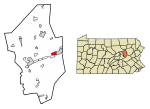
Briar Creek, Pennsylvania | |
---|---|
Coordinates: 41°03′10″N76°16′42″W / 41.05278°N 76.27833°W | |
Country | United States |
State | Pennsylvania |
County | Columbia |
Incorporated | 1917 |
Government | |
• Type | Borough Council |
Area | |
• Total | 1.84 sq mi (4.77 km2) |
• Land | 1.65 sq mi (4.28 km2) |
• Water | 0.19 sq mi (0.49 km2) |
Elevation | 495 ft (151 m) |
Population | |
• Total | 597 |
• Density | 361.60/sq mi (139.61/km2) |
Time zone | UTC-5 (Eastern (EST)) |
• Summer (DST) | UTC-4 (EDT) |
Area code | 570 |
FIPS code | 42-08472 |
Briar Creek is a borough in Columbia County, Pennsylvania, United States. It is part of Northeastern Pennsylvania. The population was 597 at the 2020 census. [3] It is part of the Bloomsburg-Berwick micropolitan area.
Briar Creek is located in eastern Columbia County at 41°3′10″N76°16′42″W / 41.05278°N 76.27833°W (41.052639, -76.278369), on the north side of the Susquehanna River. [4] It is bordered to the east by Berwick, to the north by Briar Creek Township, to the west by South Centre Township, and to the south, across the Susquehanna, by Mifflin Township. Mifflinville is across the river southwest of Briar Creek, accessible by Market Street Bridge west of the borough limits.
According to the U.S. Census Bureau, the borough of Briar Creek has a total area of 1.9 square miles (4.8 km2), of which 1.7 square miles (4.3 km2) is land and 0.2 square miles (0.5 km2), or 10.38%, is water. [3] Briar Creek is served by U.S. Route 11, which follows the Susquehanna River, leading east into Berwick and southwest 10 miles (16 km) to Bloomsburg, the county seat. Although Briar Creek is one of the smaller boroughs in Pennsylvania, it is home to many acres of farmland, a golf course, and a lake. A creek with the same name as the borough flows through Briar Creek.
Census | Pop. | Note | %± |
---|---|---|---|
1920 | 295 | — | |
1930 | 249 | −15.6% | |
1940 | 316 | 26.9% | |
1950 | 348 | 10.1% | |
1960 | 399 | 14.7% | |
1970 | 456 | 14.3% | |
1980 | 637 | 39.7% | |
1990 | 616 | −3.3% | |
2000 | 651 | 5.7% | |
2010 | 660 | 1.4% | |
2020 | 597 | −9.5% | |
2021 (est.) | 597 | [5] | 0.0% |
Sources: [6] [7] [8] [9] [2] |
Race | Num. | Perc. |
---|---|---|
White | 554 | 92.8% |
Black or African American | 6 | 1.0% |
Native American | 0 | 0.0% |
Asian | 6 | 1.0% |
Pacific Islander | 0 | 0.0% |
Other/Mixed | 31 | 5.2% |
Hispanic or Latino | 21 | 3.5% |
As of the 2020 United States census, there were 597 people residing in the borough. The population density was 361.8 inhabitants per square mile (139.7/km2), with 331 housing units at an average density of 200.6 per square mile (77.5/km2).
As of the 2010 United States census, there were 660 people, 276 households, and 142 families residing in the borough. The population density was 400 inhabitants per square mile (150/km2), with 314 housing units at an average density of 190.4 per square mile (73.5/km2). The racial makeup of the borough was 643 (97.4%) white, 2 (0.3%) African American, 1 (0.2%) Native American, 3 (0.5%) Asian, 0 (0.0%) Pacific Islander, and 11 (1.6%) of two or more races. 4 people (0.6%) of any race were Hispanic or Latino.
There were 276 households, out of which 63 (22.8%) had children under the age of 18 living with them, 97 (35.1%) were married couples living together, 33 (12.0%) had a female householder with no husband present, and 12 (4.3%) had a male householder with no wife present. There were 23 (8.3%) unmarried opposite-sex partnerships and 1 (7.6%) unmarried same-sex partnership. 134 (48.6%) households were non-families. 117 (42.4%) of all households were made up of individuals, and 85 (30.8%) had someone living alone who was 65 years of age or older. The average household size was 2.14, and the average family size was 2.94. 12 people (4.3%) lived in non-institutionalized group quarters, and 58 (21.0%) were institutionalized.
The population was spread out, with 116 people (17.6%) under the age of 18, 47 (7.1%) aged 18 to 24, 131 (19.8%) aged 25 to 44, 153 (23.2%) aged 45 to 64, and 213 (32.3%) who were 65 years of age or older. The median age was 43.9 years. For every 100 females, there were 78.4 males.
As of the census [7] of 2000, there were 651 people, 250 households, and 162 families residing in the borough. The population density was 408.2 inhabitants per square mile (157.6/km2). There were 280 housing units at an average density of 175.6 per square mile (67.8/km2). The racial makeup of the borough was 98.00% White, 0.15% African American, 0.61% Asian, 0.31% from other races, and 0.92% from two or more races. Hispanic or Latino of any race were 0.46% of the population.
There were 250 households, out of which 25.2% had children under the age of 18 living with them, 46.8% were married couples living together, 12.0% had a female householder with no husband present, and 35.2% were non-families. 30.0% of all households were made up of individuals, and 11.2% had someone living alone who was 65 years of age or older. The average household size was 2.38 and the average family size was 2.91.
In the borough the population was spread out, with 20.7% under the age of 18, 8.1% from 18 to 24, 26.3% from 25 to 44, 21.0% from 45 to 64, and 23.8% who were 65 years of age or older. The median age was 41 years. For every 100 females, there were 86.0 males. For every 100 females age 18 and over, there were 81.7 males.
The median income for a household in the borough was $23,594, and the median income for a family was $27,833. Males had a median income of $22,150 versus $19,583 for females. The per capita income for the borough was $13,009. About 11.6% of families and 17.6% of the population were below the poverty line, including 31.3% of those under age 18 and 15.3% of those age 65 or over.
Ashville is a borough in Cambria County, Pennsylvania, United States. It is part of the Johnstown, Pennsylvania Metropolitan Statistical Area. However, it is much closer to Altoona and is often considered a suburb of the latter. The population was 213 at the 2020 census.
Driftwood is a borough in Cameron County, Pennsylvania, United States. The population was 36 at the 2020 census.
Glen Hope is a borough in Clearfield County, Pennsylvania, United States. The population was 127 at the 2020 census.
Irvona is a borough in Clearfield County, Pennsylvania, United States. The population was 549 at the 2020 census.
New Washington is a borough in Clearfield County, Pennsylvania, United States. The population was 50 at the 2020 census.
Westover is a borough in Clearfield County, Pennsylvania, United States. The population was 361 at the 2020 census.
Beech Creek is a borough in Clinton County, Pennsylvania, United States. The population was 701 at the 2010 census. It is the setting for Fun Home, a 2006 graphic memoir by Alison Bechdel, who grew up there. Brittani Kline, winner of America's Next Top Model, Cycle 16, was born there.
Berwick is a borough in Columbia County, Pennsylvania, United States. It is part of Northeastern Pennsylvania and is located 28 miles (45 km) southwest of Wilkes-Barre. As of the 2020 census, Berwick had a population of 10,355. It is one of the two principal communities of the Bloomsburg–Berwick metropolitan area, which covers Columbia and Montour counties, and had a combined population of 85,562 at the 2010 census.
Briar Creek Township is a township in Columbia County, Pennsylvania. It is part of Northeastern Pennsylvania. The population was 2,992 at the 2020 census.
Foundryville is a census-designated place (CDP) in Columbia County, Pennsylvania, United States. It is part of Northeastern Pennsylvania. The population was 256 at the 2010 census. It is part of the Bloomsburg-Berwick micropolitan area.
Orangeville is a borough in Columbia County, Pennsylvania, United States. It is part of Northeastern Pennsylvania. The population was 478 at the 2020 census. It is part of the Bloomsburg-Berwick micropolitan area.
Rohrsburg is a census-designated place (CDP) in Columbia County, Pennsylvania, United States. It is part of Northeastern Pennsylvania. The population was 145 at the 2010 census. It is part of the Bloomsburg-Berwick micropolitan area.
South Centre Township is a township in Columbia County, Pennsylvania. It is part of Northeastern Pennsylvania. The population was 1,908 at the 2020 census.
Stillwater is a borough in Columbia County, Pennsylvania, United States. It is part of Northeastern Pennsylvania. The population was 200 at the 2020 census. It is part of the Bloomsburg-Berwick micropolitan area.
Halifax is a borough in Dauphin County, Pennsylvania, United States. Halifax was incorporated as a borough on May 29, 1785. It is situated at the confluence of Armstrong Creek and the Susquehanna River. The population was 795 at the 2020 census. It is part of the Harrisburg–Carlisle Metropolitan Statistical Area.
East Berwick is a census-designated place (CDP) in Salem Township, Luzerne County, Pennsylvania, United States. The population was 2,007 at the 2010 census.
Nescopeck is a borough in Luzerne County, Pennsylvania, United States. The population was 1,480 as of the 2020 census.
Lanesboro is a borough in Susquehanna County, Pennsylvania, United States. The population was 485 at the 2020 census.
Oakland is a borough in Susquehanna County, Pennsylvania, United States. The population of Oakland borough was 564 at the 2020 census.
Union Dale is a borough in Susquehanna County, Pennsylvania, United States. The borough was incorporated in 1885. Union Dale's population was 267 at the 2010 census.