Scott Township, Columbia County, Pennsylvania

Last updated

Scott Township,
Columbia County,
Pennsylvania
View of Scott Township, Columbia County, Pennsylvania.JPG
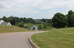
A housing development in Scott Township
Map of Scott Township, Columbia County, Pennsylvania Highlighted.png
Map of Columbia County, Pennsylvania highlighting Scott Township
Map of Pennsylvania highlighting Columbia County.svg
Map of Columbia County, Pennsylvania
Country United States
State Pennsylvania
County Columbia
Settled1774
Incorporated1853
Area
[1]
  Total7.46 sq mi (19.33 km2)
  Land7.00 sq mi (18.12 km2)
  Water0.47 sq mi (1.21 km2)
Population
 (2020) [2]
  Total5,527 Increase2.svg
  Estimate 
(2021) [2]
5,528
  Density721.52/sq mi (278.59/km2)
Time zone UTC-5 (Eastern (EST))
  Summer (DST) UTC-4 (EDT)
Area code 570
FIPS code 42-037-68392
Website scott-township.com

Scott Township is a township in Columbia County, Pennsylvania. It is part of Northeastern Pennsylvania. The population was 5,527 at the 2020 census, an increase over the figure of 5,113 tabulated in 2000.

Contents

Geography

Scott Township is at the geographic center of Columbia County and is bordered to the west by the town of Bloomsburg (the county seat), to the northwest by Mount Pleasant Township, to the north by Orange Township, to the east by North Centre and South Centre townships, and to the south by the Susquehanna River, across which are Main Township to the south and Catawissa Township to the southwest. Unincorporated communities in Scott Township include Lightstreet in the north, Almedia in the southeast, and Espy in the southwest.

Interstate 80 crosses the township from east to west, with access from Exit 236 (Pennsylvania Route 487) between Lightstreet and Bloomsburg. U.S. Route 11 runs through the southern part of the township parallel to the Susquehanna, passing along the northern edges of Espy and Almedia.

According to the United States Census Bureau, the township has a total area of 7.5 square miles (19.3 km2), of which 7.0 square miles (18.1 km2) is land and 0.46 square miles (1.2 km2), or 6.28%, is water. [3]

History

Scott Township was first settled in the 1770s, mostly by people of English descent who came to the township from New Jersey. The soil in the township was fertile, but the biggest wealth in the township came from iron ore mining. From 1780 to 1850, there were fisheries along the Susquehanna River that brought wealth to the township. The fishing industry ceased circa 1850 because of overfishing. [4]

Demographics

Historical population
CensusPop.Note
2010 5,113
2020 5,5278.1%
2021 (est.)5,528 [2] 0.0%

As of the census [5] of 2000, there were 4,768 people, 2,010 households, and 1,404 families residing in the township. The population density was 671.8 inhabitants per square mile (259.4/km2). There were 2,090 housing units at an average density of 294.5 units per square mile (113.7 units/km2). The racial makeup of the township was 97.50% White, 0.29% African American, 0.06% Native American, 1.41% Asian, 0.06% Pacific Islander, 0.17% from other races, and 0.50% from two or more races. Hispanic or Latino of any race were 0.63% of the population.

There were 2,010 households, out of which 26.4% had children under the age of 18 living with them, 60.3% were married couples living together, 7.1% had a female householder with no husband present, and 30.1% were non-families. 26.1% of all households were made up of individuals, and 13.9% had someone living alone who was 65 years of age or older. The average household size was 2.31 and the average family size was 2.78.

In the township the population was spread out, with 20.1% under the age of 18, 5.7% from 18 to 24, 23.3% from 25 to 44, 29.5% from 45 to 64, and 21.4% who were 65 years of age or older. The median age was 46 years. For every 100 females, there were 88.2 males. For every 100 females age 18 and over, there were 85.5 males.

The median income for a household in the township was $42,123, and the median income for a family was $52,286. Males had a median income of $37,010 versus $29,063 for females. The per capita income for the township was $24,791. About 4.2% of families and 7.8% of the population were below the poverty line, including 7.2% of those under age 18 and 8.5% of those age 65 or over.

Communities

+ This community is partly in an adjacent township.

Related Research Articles

<span class="mw-page-title-main">Columbia County, Pennsylvania</span> County in Pennsylvania, United States

Columbia County is a county in the Commonwealth of Pennsylvania. It is located in Northeastern Pennsylvania. As of the 2020 census, the population was 64,727. Its county seat is Bloomsburg. The county was created on March 22, 1813, from part of Northumberland County. It was named Columbia, alluding to the United States and Christopher Columbus. The county is part of the Central Pennsylvania region of the state.

<span class="mw-page-title-main">Almedia, Pennsylvania</span> Census-designated place in Pennsylvania, United States

Almedia is a census-designated place (CDP) in Columbia County, Pennsylvania, United States. It is part of Northeastern Pennsylvania. The population was 1,040 at the 2020 census. It is part of the Bloomsburg-Berwick micropolitan area.

<span class="mw-page-title-main">Benton, Pennsylvania</span> Borough in Pennsylvania, United States

Benton is a borough in Columbia County, Pennsylvania, United States. It is part of Northeastern Pennsylvania. The population was 824 at the 2020 census. It is part of the Bloomsburg-Berwick micropolitan area.

<span class="mw-page-title-main">Bloomsburg, Pennsylvania</span> Town in Pennsylvania, United States

Bloomsburg is a town and the county seat of Columbia County, Pennsylvania, United States. It is part of Northeastern Pennsylvania and is located 40 miles (64 km) southwest of Wilkes-Barre along the Susquehanna River. It is the only Pennsylvania municipality incorporated as a town. As of the 2010 census, Bloomsburg had a population of 14,855, with an estimated population of 13,811 in 2019.

<span class="mw-page-title-main">Briar Creek, Pennsylvania</span> Borough in Pennsylvania, United States

Briar Creek is a borough in Columbia County, Pennsylvania, United States. It is part of Northeastern Pennsylvania. The population was 597 at the 2020 census. It is part of the Bloomsburg-Berwick micropolitan area.

<span class="mw-page-title-main">Buckhorn, Pennsylvania</span> Census-designated place in Pennsylvania, United States

Buckhorn is a census-designated place (CDP) in Columbia County, Pennsylvania, United States. It is part of Northeastern Pennsylvania. The population was 332 at the 2020 census. It is part of the Bloomsburg-Berwick micropolitan area. It uses the Bloomsburg ZIP code of 17815.

<span class="mw-page-title-main">Catawissa Township, Pennsylvania</span> Township in Pennsylvania, United States

Catawissa Township is a township near the borough of Catawissa, Columbia County, Pennsylvania. It is part of Northeastern Pennsylvania. The population was 904 at the 2020 census.

<span class="mw-page-title-main">Espy, Pennsylvania</span> Census-designated place in Pennsylvania, United States

Espy is a census-designated place (CDP) in Columbia County, Pennsylvania, United States. It is part of Northeastern Pennsylvania. The population was 1,620 at the 2020 census. It is part of the Bloomsburg-Berwick micropolitan area. Espy was first settled in the late 18th century. It was home to a boatyard in the 19th century.

<span class="mw-page-title-main">Hemlock Township, Columbia County, Pennsylvania</span> Township in Pennsylvania, United States

Hemlock Township is a township in Columbia County, Pennsylvania. It is part of Northeastern Pennsylvania. As of the 2020 census the population was 2,218, a decline from the figure of 2,249 tabulated in 2010.

<span class="mw-page-title-main">Lightstreet, Pennsylvania</span> Census-designated place in Pennsylvania, United States

Lightstreet is a census-designated place (CDP) in Columbia County, Pennsylvania, United States. It is part of Northeastern Pennsylvania. The population was 1,098 at the 2020 census. It is part of the Bloomsburg-Berwick micropolitan area. The CDP is named after a street in Baltimore.

<span class="mw-page-title-main">Lime Ridge, Pennsylvania</span> Census-designated place in Pennsylvania, United States

Lime Ridge is a census-designated place (CDP) in Columbia County, Pennsylvania, United States. It is part of Northeastern Pennsylvania. The population was 823 at the 2020 census. It is part of the Bloomsburg-Berwick micropolitan area.

<span class="mw-page-title-main">Mifflin Township, Columbia County, Pennsylvania</span> Township in Pennsylvania, United States

Mifflin Township is a township in Columbia County, Pennsylvania. It is part of Northeastern Pennsylvania. The population was 2,277 at the 2020 census.

<span class="mw-page-title-main">Mifflinville, Pennsylvania</span> Census-designated place in Pennsylvania, United States

Mifflinville is an unincorporated community and census-designated place (CDP) in Columbia County, Pennsylvania, United States. It is part of Northeastern Pennsylvania. The population was 1,233 at the 2020 census. It is part of the Bloomsburg-Berwick micropolitan area.

<span class="mw-page-title-main">Mount Pleasant Township, Columbia County, Pennsylvania</span> Township in Pennsylvania, United States

Mount Pleasant Township is a township in Columbia County, Pennsylvania. It is part of Northeastern Pennsylvania. As of the 2020 census, the township population was 1,506.

<span class="mw-page-title-main">Orange Township, Pennsylvania</span> Township in Pennsylvania, United States

Orange Township is a township in Columbia County, Pennsylvania. It is part of Northeastern Pennsylvania. The population was 1,163 at the 2020 census.

<span class="mw-page-title-main">Rohrsburg, Pennsylvania</span> Census-designated place in Pennsylvania, United States

Rohrsburg is a census-designated place (CDP) in Columbia County, Pennsylvania, United States. It is part of Northeastern Pennsylvania. The population was 150 at the 2020 census. It is part of the Bloomsburg-Berwick micropolitan area.

<span class="mw-page-title-main">Rupert, Pennsylvania</span> Census-designated place in Pennsylvania, United States

Rupert is a census-designated place (CDP) in Columbia County, Pennsylvania, United States. It is part of Northeastern Pennsylvania. The population was 154 at the 2020 census. It is part of the Bloomsburg-Berwick micropolitan area.

<span class="mw-page-title-main">South Centre Township, Pennsylvania</span> Township in Pennsylvania, United States

South Centre Township is a township in Columbia County, Pennsylvania. It is part of Northeastern Pennsylvania. The population was 1,908 at the 2020 census.

<span class="mw-page-title-main">Stillwater, Pennsylvania</span> Borough in Pennsylvania, United States

Stillwater is a borough in Columbia County, Pennsylvania, United States. It is part of Northeastern Pennsylvania. The population was 200 at the 2020 census. It is part of the Bloomsburg-Berwick micropolitan area.

<span class="mw-page-title-main">Nescopeck Township, Pennsylvania</span> Township in Pennsylvania, United States

Nescopeck Township is a township in Luzerne County, Pennsylvania, United States. As of the 2020 census, the township population was 1,080.

References

  1. "2016 U.S. Gazetteer Files". United States Census Bureau. Retrieved August 13, 2017.
  2. 1 2 3 Bureau, US Census. "City and Town Population Totals: 2020—2021". Census.gov. US Census Bureau. Retrieved July 28, 2022.
  3. "Geographic Identifiers: 2010 Census Summary File 1 (G001): Scott township, Columbia County, Pennsylvania". U.S. Census Bureau, American Factfinder. Archived from the original on February 13, 2020. Retrieved May 27, 2015.
  4. "Scott Township, Columbia County, Pennsylvania (PA)".
  5. "U.S. Census website". United States Census Bureau . Retrieved January 31, 2008.
  6. "Google Maps". 2012.

41°02′00″N76°24′59″W / 41.03333°N 76.41639°W / 41.03333; -76.41639