Related Research Articles

Signy Island is a small subantarctic island in the South Orkney Islands of Antarctica. It was named by the Norwegian whaler Petter Sørlle (1884–1933) after his wife, Signy Therese.

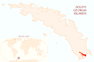
The Willis Islands are a small archipelago to the west of South Georgia Island in the South Georgia Islands. They are 2 miles (3.2 km) west of Bird Island, separated by the Stewart Strait. They were discovered on 14 January 1775 by Captain James Cook and named for Cook's midshipman Thomas Willis, the crew member who first sighted them. The Willis Islands were charted in greater detail and individually named by Discovery Investigations (DI) personnel between 1926 and 1930.

Right Whale Bay is a bay 1.5 miles (2.4 km) wide, entered between Craigie Point and Nameless Point along the north coast of South Georgia Island. The bay is named for the southern right whales found in the area. South Georgia has historically been well known for whaling. The bay is linked to Morsa Bay on the island's south coast by a mountain pass called Ernesto Pass.
Drygalski Fjord is a bay 1 mile (1.6 km) wide which recedes northwestwards 7 miles (11 km), entered immediately north of Nattriss Head along the southeast coast of South Georgia. It was charted by the Second German Antarctic Expedition, 1911–12, under Wilhelm Filchner, and named for Professor Erich von Drygalski, the leader of the First German Antarctica Expedition, 1901–03.

Salisbury Plain is a broad coastal plain found with the Bay of Isles on the north coast of South Georgia. It lies between the mouths of Grace and Lucas glaciers on the southern coast of the bay, with Mount Ashley south of it. Best known as the breeding site for as many as 60,000 King penguins, its beaches are also covered with many Southern elephant seals and Antarctic fur seals.

The Bay of Isles is a bay 9 miles (14 km) wide and receding 3 miles (5 km), lying between Cape Buller and Cape Wilson along the north coast of South Georgia. It was discovered in 1775 by a British expedition under James Cook and so named by him because numerous islands lie in the bay. Of South Georgia's 31 breeding bird species, 17 are found here.
Bird Sound is a hazardous but navigable sound, 1 nautical mile (2 km) long and 0.5 nautical miles (1 km) wide, separating Bird Island from the west end of South Georgia. The names "La Roche Strait" and "Bird Sound" were used interchangeably for this feature on charts for many years. Bird Sound, which takes its name from nearby Bird Island, is approved on the basis of local usage.
Cook Bay is an irregular bay, 1.3 nautical miles (2.4 km) wide at its entrance between Cape Crewe and Black Head, narrowing into two western arms, Lighthouse Bay and Prince Olav Harbour, along the north coast of South Georgia. It was charted by Discovery Investigations (DI) personnel during the period 1926–30, and named by them for Captain James Cook, who explored South Georgia and landed in this general vicinity in 1775.
The Cordall Stacks are two conspicuous rock stacks, the eastern one joined to Bird Island, South Georgia, by a low isthmus, lying on the northwest side of the island 0.3 nautical miles (0.6 km) northwest of Jordan Cove. They were named by the UK Antarctic Place-Names Committee for Peter A. Cordall, a member of the South Georgia Biological Expedition, 1958–59, who made a plane table survey of Bird Island.
Diver Point is a point midway along the north shore of Bird Island, South Georgia. The name, by the UK Antarctic Place-Names Committee, derives from the South Georgia diving petrel which nests nearby.
Pio Point is a point forming the north side of the entrance to Johnson Cove at the west end of Bird Island, South Georgia. Roughly charted by DI personnel on the Discovery in the period 1926-30 and surveyed by HMS Owen in 1960–61. Named by the United Kingdom Antarctic Place-Names Committee (UK-APC) in 1963. "Pio" is an old sailors' name for the light-mantled sooty albatross, a bird which breeds on Bird Island.
Elliott Rock is a rock lying in Stewart Strait, close west of Bird Island, off the west end of South Georgia. It was positioned by Discovery Investigations personnel under Lieutenant Commander J.M. Chaplin in the period 1926–30, and was named in 1957 by the UK Antarctic Place-Names Committee for Henry W. Elliott (1846–1930), an American naturalist who was a pioneer of fur seal studies in the North Pacific and a lifelong champion of fur seal protection. Fur seals breed on nearby Bird Island.
Evermann Cove is a cove 0.2 nautical miles (0.4 km) long, lying just southwest of Jordan Cove along the south side of Bird Island, South Georgia. It was surveyed by the South Georgia Biological Expedition, 1958–59, and was named by the UK Antarctic Place-Names Committee in 1960 for Barton W. Evermann, an American zoologist on the staff of the United States Fish Commission from 1891 to 1903 and its successor, the United States Bureau of Fisheries, from 1903 to 1914, and a specialist in administrative and legal problems relating to the fur seal.
Fantome Rock is a dangerous rock in the middle of Bird Sound, South Georgia, lying 0.1 nautical miles (0.2 km) south of Gony Point, Bird Island. It was charted by Discovery Investigations personnel on the Discovery in the period 1926–30 and named by the UK Antarctic Place-Names Committee in 1963 for HMS Owen's motor cutter, used in a survey of this area in February–March 1961, and lost in heavy seas near this rock.
Payne Creek is a narrow cove just south of Goldcrest Point along the west side of Bird Island, South Georgia. Named by United Kingdom Antarctic Place-Names Committee (UK-APC) for Michael R. Payne, British Antarctic Survey (BAS) principal investigator on fur seals, Bird Island, 1971–74.
Ferguson Peak is a peak, 560 metres (1,840 ft) high, standing close west of the head of Cooper Bay in the eastern extremity of South Georgia. It was photographed by Niall Rankin during his visit to South Georgia in 1947. Rankin did not disclose the locality because he wished to protect the fur seals found there and shown in his photo. The photo was identified as the feature now described by the British South Georgia Expedition, 1954–55, and the peak was unofficially named "Fur Seal Peak". Since Bird Island, at the west end of South Georgia, is now the only place where fur seals breed, this name is misleading. A new name, "Ferguson Peak" was recommended by the UK Antarctic Place-Names Committee in 1957 for David Ferguson, a Scottish geologist, who carried out geological investigations in South Georgia in 1911–12 for Messrs. Christian Salvesen and Company.
Freshwater Inlet is the small eastern arm of Jordan Cove on the south side of Bird Island, South Georgia, with Wanderer Valley to the southwest. It was charted by the South Georgia Survey in the period 1951–57 and was named in 1956 by W.N. Bonner, a British government biologist and sealing inspector, because the feature is fed by freshwater streams.
Gazella Peak is a peak rising over 120 metres (390 ft) between Roche Peak and the Cordall Stacks on the north side of Bird Island, South Georgia. It was charted by the South Georgia Survey in the period 1951–57, and was named by the UK Antarctic Place-Names Committee in 1963 after the species name of the Antarctic fur seal, which breeds in considerable numbers on Bird Island.
Stejneger Peak is a conspicuous rocky peak, 190 m, at the head of Evermann Cove on Bird Island, South Georgia. Surveyed by the South Georgia Biological Expedition, 1958–59. Named by the United Kingdom Antarctic Place-Names Committee (UK-APC) in 1960 for Leonhard Stejneger (1851–1943), American zoologist who made important investigations of fur seals and birds in the islands of the Bering Sea at the end of the 19th century; member of the Joint British-American Commission for Fur Seal Investigation in the Bering Sea, 1896.
Hornaday Rock is a rock lying in Bird Sound, 0.6 nautical miles (1.1 km) west-southwest of Cape Alexandra at the west end of South Georgia. The feature appears on charts dating back to the 1930s. It was recharted by the South Georgia Survey in the period 1951–57, and named by the UK Antarctic Place-Names Committee for William T. Hornaday, an American zoologist who was Director of the New York Zoological Park, 1896–1926. From 1907 he was a leader in the fight to introduce protective legislation for fur seals; fur seals breed on nearby Bird Island.
References
- ↑ "Jordan Cove". Geographic Names Information System . United States Geological Survey, United States Department of the Interior . Retrieved 8 April 2013.
- ↑ "Main Bay". Geographic Names Information System . United States Geological Survey, United States Department of the Interior . Retrieved 29 July 2013.
- ↑ "Barracouta Rock". Geographic Names Information System . United States Geological Survey, United States Department of the Interior . Retrieved 19 May 2011.
![]() This article incorporates public domain material from websites or documents of the United States Geological Survey .
This article incorporates public domain material from websites or documents of the United States Geological Survey .
Capital: King Edward Point | |||||||
| General | |||||||
| Settlements / Whaling stations | |||||||
| South Georgia islands | |||||||
| South Sandwich Islands |
| ||||||
| Seamounts | |||||||
| Landmarks |
| ||||||
| | This South Georgia and the South Sandwich Islands location article is a stub. You can help Wikipedia by expanding it. |