Jozini

Last updated
Jozini
South Africa KwaZulu-Natal location map.svg
Red pog.svg
Jozini
South Africa adm location map.svg
Red pog.svg
Jozini
Coordinates: 27°25′48″S32°04′01″E / 27.430°S 32.067°E / -27.430; 32.067 Coordinates: 27°25′48″S32°04′01″E / 27.430°S 32.067°E / -27.430; 32.067
Country South Africa
Province KwaZulu-Natal
District Umkhanyakude
Municipality Jozini
Area
[1]
  Total4.16 km2 (1.61 sq mi)
Population
(2011) [1]
  Total2,267
  Density540/km2 (1,400/sq mi)
Racial makeup (2011)
[1]
   Black African 90.6%
   Coloured 0.3%
   Indian/Asian 4.3%
   White 3.2%
  Other1.6%
First languages (2011)
[1]
   Zulu 84.2%
   English 5.8%
   Afrikaans 1.9%
  Other8.1%
Time zone UTC+2 (SAST)
PO box
3969
Area code 035

Jozini is a settlement in Umkhanyakude District Municipality in the KwaZulu-Natal province of South Africa.

Umkhanyakude District Municipality District municipality in KwaZulu-Natal, South Africa

uMkhanyakude is the northernmost of the 11 districts of the KwaZulu-Natal province of South Africa. Its seat is Mkuze. It is a very rural district, the largest town being Mtubatuba in the south, with Hluhluwe, Mkuze, Jozini, Kwangwanase and Ingwavuma further to the north. The majority of its 573,353 people speak IsiZulu. The district code is DC27.

KwaZulu-Natal Province of South Africa

KwaZulu-Natal is a province of South Africa that was created in 1994 when the Zulu bantustan of KwaZulu and Natal Province were merged. It is located in the southeast of the country, enjoying a long shoreline beside the Indian Ocean and sharing borders with three other provinces and the countries of Mozambique, Eswatini and Lesotho. Its capital is Pietermaritzburg and its largest city is Durban. It is the 2nd most populous province in South Africa, with slightly fewer residents than Gauteng.

South Africa Republic in the southernmost part of Africa

South Africa, officially the Republic of South Africa (RSA), is the southernmost country in Africa. It is bounded to the south by 2,798 kilometres (1,739 mi) of coastline of Southern Africa stretching along the South Atlantic and Indian Oceans; to the north by the neighbouring countries of Namibia, Botswana, and Zimbabwe; and to the east and northeast by Mozambique and Eswatini (Swaziland); and it surrounds the enclaved country of Lesotho. South Africa is the largest country in Southern Africa and the 25th-largest country in the world by land area and, with over 57 million people, is the world's 24th-most populous nation. It is the southernmost country on the mainland of the Old World or the Eastern Hemisphere. About 80 percent of South Africans are of Sub-Saharan African ancestry, divided among a variety of ethnic groups speaking different African languages, nine of which have official status. The remaining population consists of Africa's largest communities of European (White), Asian (Indian), and multiracial (Coloured) ancestry.

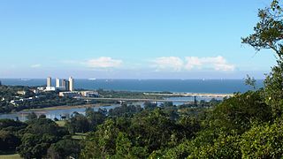
Jozini is a small town on the main route to Mozambique, and it is close to the Jozini or Pongolapoort Dam. Lake Jozini, as the dam is called, has become very popular as a Tiger fishing destination. [2]

Pongolapoort Dam, commonly referred to as Lake Jozini, is an arch type dam in northern KwaZulu-Natal, South Africa located on the Phongolo River. The dam is situated 280 km north-east of the port city of Durban. The dam was constructed in 1973 at the eastern end of the narrow gorge separating the Lebombo and Ubombo ranges and was the largest dam in South Africa at the time of its construction. The dam mainly serves for irrigation purposes and its hazard potential has been ranked high (3). The Phongolo River is the dams largest feeder as well as the dams only perennial feeder.

Related Research Articles

The Zulu are a Bantu ethnic group of Southern Africa and the largest ethnic group in South Africa, with an estimated 10–12 million people living mainly in the province of KwaZulu-Natal. Small numbers also live in Zimbabwe, Zambia, Tanzania and Mozambique.

Natal (province) province of South Africa

The Province of Natal, commonly called Natal, was a province of South Africa from 1910 until 1994. Its capital was Pietermaritzburg. During this period rural areas inhabited by the black African population of Natal were organized into the bantustan of KwaZulu, which was progressively separated from the province, becoming partially autonomous in 1981. Of the white population, the majority were English-speaking, causing Natal to become the only province to vote "no" to the creation of a republic in the referendum of 1960. In the latter part of the 1980s, Natal was in a state of violence that only ended with the first multiracial election in 1994.

Ingwavuma Place in KwaZulu-Natal, South Africa

Ingwavuma is a town in the Umkhanyakude District Municipality of KwaZulu-Natal Province, South Africa. It is unclear where the name of the town came from; one theory is that it was named after the Ngwavuma River while another is that there was a leader called Vuma, the name then meaning "Vuma's place" in Zulu. Trees found on the river bank are also named Ngwavuma but it is unclear which entity was named after which. It is over 700 metres above sea level in the Lebombo Mountains and boasts several highly scenic spots. The town is three kilometres from the country's border with Swaziland and overlooks the plains of Maputaland to the East. It falls within the Mngomezulu Tribal Authority.

Tugela River river in South Africa

The Tugela River is the largest river in KwaZulu-Natal Province, South Africa. It is one of the most important rivers of the country.

University of KwaZulu-Natal university in KwaZulu-Natal, South Africa

The University of KwaZulu-Natal (UKZN) is a university with five campuses in the province of KwaZulu-Natal in South Africa. It was formed on 1 January 2004 after the merger between the University of Natal and the University of Durban-Westville.

<i>Kniphofia</i> genus of plants

Kniphofia, also called tritoma, red hot poker, torch lily, knofflers or poker plant, is a genus of perennial flowering plants in the family Asphodelaceae, first described as a genus in 1794. It is native to Africa.

Umgeni River river in KwaZulu-Natal

The Umgeni River or Mgeni River, is a river in KwaZulu-Natal, South Africa. It rises in the "Dargle" in the KZN midlands, and its mouth is at Durban, some distance north of Durban's natural harbour. The name is taken to mean the river of entrance in Zulu, though other meanings have been proposed.

University of Natal university in South Africa

The University of Natal was a university in Natal and later became KwaZulu-Natal in South Africa. The University of Natal no longer exists as a distinct legal entity, as it was incorporated into the University of KwaZulu-Natal on 1 January 2004. It was founded in 1910 as the Natal University College in Pietermaritzburg and expanded to include a campus in Durban in 1931. In 1947, the university opened a medical school for non-white students in Durban. The Pietermaritzburg campus was known for its agricultural engineering programmes, hence the nickname "the farmers" whilst the Durban campus was known as "the engineers," as it concentrated on other engineering programmes.

KwaZulu-Natal Legislature legislature of KwaZulu-Natal Province

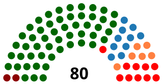
The KwaZulu-Natal Legislature is the primary legislative body of the South African province of KwaZulu-Natal. It is unicameral in its composition, and elects the premier and the provincial cabinet from among the members of the leading party or coalition in the parliament.

Spioenkop Dam Nature Reserve

Spioenkop Dam Nature Reserve or Spion Kop Nature Reserve is a protected area in KwaZulu-Natal, South Africa. It lies close to Ladysmith with Winterton being the closest town, and is about 4,400 hectares (17 sq mi). The historic battlefield site can be reached by road, and the 360 degree views from the summit of Spioenkop hill are breathtaking.

Mhlathuze River river in South Africa

The Mhlathuze River is a river in South Africa. Located in KwaZulu-Natal, its catchment area has a surface area of 4,209 km2. It rises in the west in the Babanango hills at an altitude of 1,519 m and flows over 100 km eastwards to the sea forming an estuary. The deep-sea port of Richards Bay is situated at the mouth of the Mhlathuze River and all industrial development is focused within the Empangeni / Richards Bay complex.

Jozini Local Municipality Local municipality in KwaZulu-Natal, South Africa

Jozini is an administrative area in the Umkhanyakude District of KwaZulu-Natal in South Africa. Significant portions of Jozini have been neglected in terms of economic development. There is a great disparity between the level of service and infrastructure provision between settlement nodes, such as the towns of Mkuze and Jozini, and the surrounding rural areas. Most of the rural area is associated with a lack of development, poverty and poor service provision.

eSikhawini Place in KwaZulu-Natal, South Africa

eSikhawini is a town in King Cetshwayo District Municipality in the KwaZulu-Natal province of South Africa.

Spion Kop (mountain) Hill in South Africa

Spion Kop is a mountain in the province of KwaZulu-Natal, South Africa. It is located near the town of Ladysmith, 27 km to the WSW and about 2.5 km to the north of the Spioenkop Dam, a reservoir for the waters of the Tugela River.

There have been a number of political assassinations in post-apartheid South Africa. In 2013 it was reported that there had been more than 450 political assassinations in the province of KwaZulu-Natal since the end of apartheid in 1994. In July 2013 the Daily Maverick reported that there had been "59 political murders in the last five years". In August 2016 it was reported that there had been at least twenty political assassinations in the run up to the local government elections on the 3rd of August that year, most of them in KwaZulu-Natal.

The Klip River is a main tributary of the Tugela River in KwaZulu-Natal, South Africa. The river originates on the west side of KwaZulu-Natal, initially flows eastward and then swings southward. It flows into the Windsor Dam, and then into the larger Qedusizi Dam before flowing east again. The river passes through Ladysmith before joining the Tugela River.

References

  1. 1 2 3 4 "Main Place Jozini". Census 2011.
  2. "Jozini, KwaZulu-Natal". SA Travel Directory. Archived from the original on 4 January 2014. Retrieved 4 January 2014.