Umkhanyakude District Municipality

Last updated

uMkhanyakude
North Uthungulu
Umkhanyakude CoA.png
Map of South Africa with uMkhanyakude highlighted (2011).svg
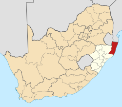
Location in South Africa
Country South Africa
Province KwaZulu-Natal
Seat Mkuze [1]
Local municipalities
Government
[2]
  Type Municipal council
  MayorCllr.Solomon Mkhombo
Area
  Total
12,821 km2 (4,950 sq mi)
Population
 (2011) [3]
  Total
625,846
  Density49/km2 (130/sq mi)
Racial makeup (2011)
[3]
   Black African 98.8%
   Coloured 0.2%
   Indian/Asian 0.2%
   White 0.7%
First languages (2011)
[3]
   Zulu 94.6%
   English 1.7%
   Southern Ndebele 1.2%
  Other2.5%
Time zone UTC+2 (SAST)
Municipal codeDC27

The uMkhanyakude District Municipality (Zulu : UMasipala wesiFunda sase uMkhanyakude) is the northernmost of the 11 districts of the KwaZulu-Natal province of South Africa. Its seat is Mkuze. It is a very rural district, the largest town being Mtubatuba in the south, with Hluhluwe, Mkuze, Jozini, Kwangwanase and Ingwavuma further to the north. The majority of its 573,353 inhabitants spoke isiZulu as of 2001.

Contents

Geography

Neighbours

uMkhanyakude is surrounded by:

Local municipalities

The district contains the following local municipalities:

Local municipalityPopulation%Dominant language
Jozini 184 09332.11% Zulu
Hlabisa 176 89930.85%Zulu
Umhlabuyalingana 140 96224.59%Zulu
Mtubatuba 35 2166.14%Zulu
The Big 5 False Bay 31 1025.42%Zulu
St Lucia Park 5 0800.89%

Demographics

The following statistics are from the 2001 census.

LanguagePopulation%
IsiZulu 559 94997.66%
SiSwati 3 7480.65%
English 3 1820.55%
Afrikaans 2 3040.40%
IsiNdebele 1 3780.24%
Sesotho 9030.16%
Sepedi 5820.10%
IsiXhosa 5610.10%
Setswana 2590.05%
Xitsonga 2300.04%
Other 2080.04%
Tshivenda 480.01%

Gender

GenderPopulation%
Female313 95454.76%
Male259 39945.24%

Ethnic group

Ethnic groupPopulation%
Black African568 85399.22%
White3 2350.56%
Coloured8980.16%
Indian/Asian3670.06%

Age

AgePopulation%
000 - 00476 95613.42%
005 - 00985 37514.89%
010 - 01486 94815.16%
015 - 01978 24813.65%
020 - 02450 0068.72%
025 - 02936 9836.45%
030 - 03430 8835.39%
035 - 03927 3824.78%
040 - 04423 0844.03%
045 - 04916 6952.91%
050 - 05413 4812.35%
055 - 0599 6541.68%
060 - 06411 1991.95%
065 - 0698 5431.49%
070 - 0748 8691.55%
075 - 0794 0490.71%
080 - 0843 0170.53%
085 - 0891 0040.18%
090 - 0945790.10%
095 - 0992920.05%
100 plus1060.02%

Politics

Election results

Election results for Umkhanyakude in the South African general election, 2004.

PartyVotes%
Inkhata Freedom Party 104 72169.56%
African National Congress 36 89324.51%
Democratic Alliance 3 3572.23%
African Christian Democratic Party 1 3810.92%
United Democratic Movement 1 0380.69%
Azanian People's Organisation 4230.28%
New National Party 3740.25%
Freedom Front Plus 3430.23%
Independent Democrats 3080.20%
Pan African Congress 2340.16%
PJC 2040.14%
SOPA 1770.12%
KISS 1760.12%
CDP 1630.11%
United Christian Democratic Party 1390.09%
EMSA 1350.09%
UF 1130.08%
Minority Front 1120.07%
TOP 1060.07%
NA 910.06%
NLP 550.04%
Total150 543100.00%

References

  1. KwaZulu-Natal Top Business | uMkhanyakude District Municipality
  2. "Contact list: Executive Mayors". Government Communication & Information System. Archived from the original on 14 July 2010. Retrieved 22 February 2012.
  3. 1 2 3 "Statistics by place". Statistics South Africa. Retrieved 27 September 2015.

Wikivoyage-Logo-v3-icon.svg Elephant Coast travel guide from Wikivoyage

27°37′S32°02′E / 27.617°S 32.033°E / -27.617; 32.033