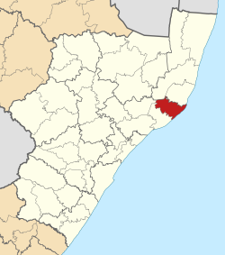
Msunduzi Local Municipality is a local municipality in Umgungundlovu District Municipality, KwaZulu-Natal, South Africa. It encompasses the city of Pietermaritzburg, which is the capital of the KwaZulu-Natal province and the main economic hub of Umgungundlovu District Municipality.
The Big Five False Bay was an administrative area in the Umkhanyakude District of KwaZulu-Natal in South Africa.

Endumeni Local Municipality is an administrative area in the Umzinyathi District of KwaZulu-Natal in South Africa. Endumeni is an isiZulu name meaning "a place of thunderstorm". The municipality shares its name with the Endumeni hill.

Maphumulo Local Municipality is an administrative area in the iLembe District of KwaZulu-Natal in South Africa. Maphumulo is an isiZulu name meaning "place of rest".

uMdoni Local Municipality is an administrative area in the Ugu District of KwaZulu-Natal in South Africa. Umdoni is an isiZulu name for the indigenous tree, Mdoni.

Dannhauser Local Municipality is an administrative area in the Amajuba District of KwaZulu-Natal in South Africa. The municipality is named after Renier Dannhauser, a German settler who in 1872 purchased four farms in the area from the then owner, the Natal government.

Umzimkhulu Local Municipality is an administrative area in the Harry Gwala District of KwaZulu-Natal in South Africa. Umzimkhulu is a Xhosa and Zulu name meaning “Big/Great house”. Prior to the Twelfth Amendment of the Constitution of South Africa in 2005, confirmed by the Thirteenth in 2007, it was part of the Eastern Cape.

Jozini is an administrative area in the Umkhanyakude District of KwaZulu-Natal in South Africa. Significant portions of Jozini have been neglected in terms of economic development. There is a great disparity between the level of service and infrastructure provision between settlement nodes, such as the towns of Mkuze and Jozini, and the surrounding rural areas. Most of the rural area is associated with a lack of development, poverty and poor service provision.

Greater Kokstad Local Municipality is an administrative area in the Harry Gwala District of KwaZulu-Natal in South Africa. Kokstad is derived from Dutch, and it means "town of Kok". It was named after Adam Kok III.
uMlalazi Local Municipality is an administrative area in the King Cetshwayo District of KwaZulu-Natal in South Africa. The municipality is named after the uMlalazi River.
Nquthu Local Municipality is an administrative area in the Umzinyathi District of KwaZulu-Natal in South Africa. Nquthu is an isiZulu name meaning "the back of the head".

Impendle Local Municipality is an administrative area in the UMgungundlovu District of KwaZulu-Natal in South Africa.

Mthonjaneni is an administrative area in the King Cetshwayo District of KwaZulu-Natal in South Africa.

Ntambanana Local Municipality was a local municipality within the uThungulu District of KwaZulu-Natal in South Africa. In 2016, the municipality was dissolved and its territory divided between Mthonjaneni Local Municipality, uMhlathuze Local Municipality and uMfolozi Local Municipality.

Mandeni Local Municipality is an administrative area in the iLembe District of KwaZulu-Natal in South Africa.

Ndwedwe Local Municipality is an administrative area in the iLembe District of KwaZulu-Natal in South Africa.

Ubuhlebezwe Local Municipality is an administrative area in the Harry Gwala District of KwaZulu-Natal in South Africa. Ubuhlebezwe is an isiZulu name meaning "The Beauty of the Land". The name is derived from Alan Paton's novel, Cry, The Beloved Country.

Mkhambathini Local Municipality is an administrative area in the UMgungundlovu District of KwaZulu-Natal in South Africa. Mkhabathini is the isiZulu name derived from the Zulu word eMkhambathini meaning the place of acacia trees.

Umvoti Local Municipality is an administrative area in the Umzinyathi District of KwaZulu-Natal in South Africa.
The uMfolozi Local Municipality council consists of thirty-five members elected by mixed-member proportional representation. Eighteen councillors are elected by first-past-the-post voting in eighteen wards, while the remaining seventeen are chosen from party lists so that the total number of party representatives is proportional to the number of votes received.
