UMhlabuyalingana Local Municipality

Last updated
uMhlabuyalingana
UMhlabuyalingana CoA.png
Map of KwaZulu-Natal with Umhlabuyalingana highlighted.svg
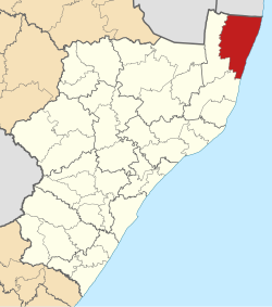
Location of UMhlabuyalingana Local Municipality within KwaZulu-Natal
Coordinates: 27°1′S32°44′E / 27.017°S 32.733°E / -27.017; 32.733
Country South Africa
Province KwaZulu-Natal
District uMkhanyakude
Seat Kwangwanase
Wards 17
Government
[1]
  Type Municipal council
  MayorD. A. Ncube
Area
  Total3,964 km2 (1,531 sq mi)
Population
 (2011) [2]
  Total156,736
  Density40/km2 (100/sq mi)
Racial makeup (2011)
[2]
   Black African 99.3%
   Coloured 0.1%
   Indian/Asian 0.1%
   White 0.3%
First languages (2011)
[3]
   Zulu 95.7%
   English 1.2%
   Southern Ndebele 1.0%
  Other2.1%
Time zone UTC+2 (SAST)
Municipal codeKZN271

uMhlabuyalingana Municipality (Zulu : UMasipala wakwa Mhlabuyalingana) is a local municipality within the uMkhanyakude District Municipality, in the northeastern part of the KwaZulu-Natal province of South Africa. The municipality is one of the poorest in the country. It encompasses a World Heritage Site and several areas under environmental protection. [4] Areas of conservation and environmental interest within or adjacent to the uMhlabuyalingana area include the Tembe Elephant Park, iSimangaliso Wetland Park (a World Heritage Site), the Suni-Ridge Sand Forest Park, and the Phongolo Nature Reserve.

Contents

The municipality was approximately 98% rural in 2001, with a population of 140,963 inhabitants according to Statistics South Africa. The municipality is made up of at least 99% Black South Africans, most of whom are isiZulu-speaking. The population is very young: 44% were younger than 15, and 77% were younger than 35 years old. Because of its youth, the population is particularly vulnerable to the impact of HIV/AIDS. [4] Towns and major settlement nodes in the area include Emanguzi, Mbazwana, Kwangwanase, Maputa, Mboza, Mseleni and Skhemelele.

Missing funds

On 8 April 2009, the Inkatha Freedom Party (IFP), which controls the municipality, summoned its entire caucus to a meeting aimed at determining the veracity of reports alleging more than R3,000,000 (US$403,390) in funds unaccounted for. Professor Themba Msimang, chairman of the party's Policy Oversight Committee (POC), and also current chair of South Africa's Heraldry Council, called for uMhlabuyalingana to accept a forensic audit. According to an IFP press release, Msimang stated that the party was "highly agitated" by the reports, "not simply because of the implication of corruption but also because it transgressed everything the party stands for... We will have to await the process that entails the municipality's council calling for such a forensic audit. I can assure you, though, our party will get to the bottom of this, and, if heads have to roll, so be it: they will." [5]

Main places

The 2001 census divided the municipality into the following main places: [6]

PlaceCodeArea (km2)Population
Mabaso 53201 543.4119,398
Manukuza/Jobe 53202 20.79314
Mashabane 53203 708.0126,620
Ndumu Game Reserve 53204 13.696
Tembe Elephant Reserve 53206 275.2736
Tembe 53205 1,909.1579,111
Zikhali/Mbila 53207 202.2415,489

Politics

The municipal council consists of thirty-nine members elected by mixed-member proportional representation. Twenty councillors are elected by first-past-the-post voting in twenty wards, while the remaining nineteen are chosen from party lists so that the total number of party representatives is proportional to the number of votes received.

In the election of 1 November 2021 the African National Congress (ANC) lost its majority, winning a plurality of eighteen seats on the council.

PartyWardListTotal
seats
Votes%SeatsVotes%Seats
African National Congress 21,61944.951221,88446.34618
Inkatha Freedom Party 16,66734.65817,84937.79715
Economic Freedom Fighters 2,0784.3202,1674.5922
Independent candidates 2,9506.1300
Abahlali Base Mkhanyakude Movement 1,0422.1701,1132.3611
Democratic Alliance 8881.8509512.0111
National Freedom Party 7241.5107281.5411
African Christian Democratic Party 6411.3306991.4811
Abantu Batho Congress 5901.2306161.3000
African Independent Congress 5351.1106541.3800
Justice and Employment Party 1210.2502080.4400
Black First Land First 820.170940.2000
United Christian Democratic Party 730.150530.1100
African Transformation Movement 510.110690.1500
People's Freedom Party 200.040720.1500
African People's Movement 120.020450.1000
Umnotho Democratic Front 50.010260.0600
Zulu Royal Property 10.0000
Total48,099100.002047,228100.001939
Valid votes48,09997.5447,22897.06
Invalid/blank votes1,2122.461,4292.94
Total votes49,311100.0048,657100.00
Registered voters/turnout85,43157.7285,43156.95

Related Research Articles

<span class="mw-page-title-main">Inkatha Freedom Party</span> Right-wing political party in South Africa

The Inkatha Freedom Party is a right-wing political party in South Africa. Although registered as a national party, it has had only minor electoral success outside its home province of KwaZulu-Natal. Mangosuthu Buthelezi, who served as chief minister of KwaZulu during the Apartheid period, founded the party in 1975 and led it until 2019. He was succeeded as party president in 2019 by Velenkosini Hlabisa.

<span class="mw-page-title-main">2006 South African municipal elections</span>

Municipal elections were held in South Africa on 1 March 2006, to elect members to the local governing councils in the municipalities of South Africa. The municipalities form the local government of South Africa and are subdivisions of the provinces, thus making them responsible for local service delivery, such as electricity, water and fire services.

<span class="mw-page-title-main">Nongoma Local Municipality</span> Local municipality in KwaZulu-Natal, South Africa

Nongoma Municipality is a local municipality within the northeastern part of the Zululand District Municipality, in the KwaZulu-Natal province of South Africa. It is Zululand's second largest municipality in terms of population and the second largest in terms of area. It shares its name with the town of Nongoma, which serves as the seat of the municipality.

<span class="mw-page-title-main">Ulundi Local Municipality</span> Local municipality in KwaZulu-Natal, South Africa

Ulundi Municipality is a local municipality within the southern part of the Zululand District Municipality, in the KwaZulu-Natal province of South Africa. It is a mainly rural municipality, and its seat is Ulundi.

uPhongolo Local Municipality Local municipality in KwaZulu-Natal, South Africa

uPhongolo Municipality is a local municipality within the northern area of the Zululand District Municipality, in the KwaZulu-Natal province of South Africa.

<span class="mw-page-title-main">2011 South African municipal elections</span> South African municipal elections held on 18 August 2011

Municipal elections were held in South Africa on 18 May 2011, electing new councils for all municipalities in the country. Municipal elections are held every five years, and the previous municipal elections were held in 2006. The first municipal elections following the reorganisation of municipalities took place in December 2000.

<span class="mw-page-title-main">Okhahlamba Local Municipality</span> Local municipality in KwaZulu-Natal, South Africa

Okhahlamba Municipality is a local municipality within the uThukela District Municipality, in the KwaZulu-Natal province of South Africa.

<span class="mw-page-title-main">Nkandla Local Municipality</span> Local municipality in KwaZulu-Natal, South Africa

Nkandla Local Municipality is an administrative area in the King Cetshwayo District of KwaZulu-Natal province in South Africa. The town of Nkandla is the home town of the former President of South Africa, Jacob Zuma.

uMhlathuze Local Municipality Local municipality in KwaZulu-Natal, South Africa

uMhlathuze Local Municipality is an administrative area in the King Cetshwayo District Municipality of KwaZulu-Natal in South Africa. The municipality is named after the Mhlatuze River.

<span class="mw-page-title-main">Indaka Local Municipality</span> Local municipality in KwaZulu-Natal, South Africa

Indaka Local Municipality was an administrative area in the Uthukela District of KwaZulu-Natal in South Africa. The municipality is named after the Indaka River that runs through the municipal area.

<span class="mw-page-title-main">Msinga Local Municipality</span> Local municipality in KwaZulu-Natal, South Africa

Msinga Municipality is a local municipality within the Umzinyathi District Municipality, in the KwaZulu-Natal province of South Africa. Msinga is an isiZulu word meaning "a current in the sea where air movement causes ripples on top of the water surface and ends up influencing the nearby climatic conditions through its breeze". The municipality is largely located in deep gorges of the Tugela and Buffalo rivers, isolated from the immediate surrounding municipal areas. The population dynamics result in a growing rural area and a declining urban area in the municipality, contrary to most other areas in the country. This can be attributed to the fact that the urban areas of municipality are very small and are unable to provide the normal range of goods and services provided in urban areas.

<span class="mw-page-title-main">Mtubatuba Local Municipality</span> Local municipality in KwaZulu-Natal, South Africa

Mtubatuba Municipality is a local municipality within the Umkhanyakude District Municipality, in the KwaZulu-Natal province of South Africa.

<span class="mw-page-title-main">Jozini Local Municipality</span> Local municipality in KwaZulu-Natal, South Africa

Jozini Municipality is a local municipality within the Umkhanyakude District Municipality, in the KwaZulu-Natal province of South Africa. Significant portions of the municipality have been neglected in terms of economic development. There is a great disparity between the level of service and infrastructure provision between settlement nodes, such as the towns of Mkuze and Jozini, and the surrounding rural areas. Most of the rural area is associated with a lack of development, poverty and poor service provision.

uMlalazi Local Municipality Local municipality in KwaZulu-Natal, South Africa

uMlalazi Local Municipality is an administrative area in the King Cetshwayo District of KwaZulu-Natal in South Africa. The municipality is named after the uMlalazi River.

uMuziwabantu Local Municipality Local municipality in KwaZulu-Natal, South Africa

uMuziwabantu Municipality is a local municipality within the Ugu District Municipality, in the KwaZulu-Natal province of South Africa. uMuziwabantu is an isiZulu word meaning "the people's home", or "a home with wide open doors where everyone is welcome". The main source of income for the area is derived from the municipality's extensive wattle, gum, pine and poplar plantations, and associated industries, including saw mills and furniture-making factories.

<span class="mw-page-title-main">Umtshezi Local Municipality</span> Local municipality in KwaZulu-Natal, South Africa

Umtshezi Local Municipality was an administrative area in the Uthukela District of KwaZulu-Natal in South Africa. uMtshezi is an isiZulu name word for Bushman or San. The name uMtshezi refers to the Bushman River. After municipal elections on 3 August 2016, it was merged into the larger Inkosi Langalibalele Local Municipality.

<span class="mw-page-title-main">Mthonjaneni Local Municipality</span> Local municipality in KwaZulu-Natal, South Africa

Mthonjaneni is an administrative area in the King Cetshwayo District of KwaZulu-Natal in South Africa.

uMfolozi Local Municipality Local municipality in KwaZulu-Natal, South Africa

uMfolozi Local Municipality is a local municipality within the King Cetshwayo District Municipality of KwaZulu-Natal in South Africa. It is situated around the town of KwaMbonambi, to the north of Richard's Bay, stretching from the Indian Ocean to the edge of the Hluhluwe–Imfolozi Park.

<span class="mw-page-title-main">Inkosi Langalibalele Local Municipality</span> Local municipality in KwaZulu-Natal, South Africa

Inkosi Langalibalele Municipality is a local municipality within the uThukela District Municipality, in the KwaZulu-Natal province of South Africa. It was established after the 2016 South African municipal elections by merging the Imbabazane and uMtshezi local municipalities.

<span class="mw-page-title-main">Big Five Hlabisa Local Municipality</span> Local municipality in KwaZulu-Natal, South Africa

Big Five Hlabisa Municipality is a local municipality within the uMkhanyakude District Municipality, in the KwaZulu-Natal province of South Africa. It was established for the August 2016 local elections by merging the The Big 5 False Bay and Hlabisa local municipalities.

References

  1. "Contact list: Executive Mayors". Government Communication & Information System. Archived from the original on 14 July 2010. Retrieved 22 February 2012.
  2. 1 2 "Statistics by place". Statistics South Africa. Retrieved 27 September 2015.
  3. "Statistics by place". Statistics South Africa. Retrieved 27 September 2015.
  4. 1 2 Integrated Development Plan 2008-2009. uMhlabuyalingana Local Municipality. Retrieved on Oct 12, 2009.
  5. IFP Press Statement. "IFP Calls for Forensic Audit into uMhlabuyalingana Municipality." Inkatha Freedom Party, 9 April 2009.
  6. Lookup Tables - Statistics South Africa