
uMhlathuze Local Municipality is an administrative area in the King Cetshwayo District Municipality of KwaZulu-Natal in South Africa. The municipality is named after the Mhlatuze River.

Endumeni Municipality is a local municipality within the Umzinyathi District Municipality, in the KwaZulu-Natal province of South Africa. Endumeni is an isiZulu word meaning "a place of thunderstorm". The municipality shares its name with the Endumeni hill.

Maphumulo Local Municipality is an administrative area in the iLembe District of KwaZulu-Natal in South Africa. Maphumulo is an isiZulu name meaning "place of rest".

eMadlangeni Municipality, previously known as Utrecht Municipality, is a local municipality within the Amajuba District Municipality, in the KwaZulu-Natal province of South Africa.

uMdoni Municipality is a local municipality within the Ugu District Municipality, in the KwaZulu-Natal province of South Africa. uMdoni is the isiZulu name for the indigenous forest waterberry plant.

Dannhauser Municipality is a local municipality within the Amajuba District Municipality, in the KwaZulu-Natal province of South Africa. The municipality is named after Renier Dannhauser, a German settler who in 1872 purchased four farms in the area from the Natal Government. The major economic sectors are agriculture and mining. Mining, however, is undergoing a movement away from large scale operations to smaller operations.

Mpofana Municipality is a local municipality within the Umgungundlovu District Municipality, in the KwaZulu-Natal province of South Africa.

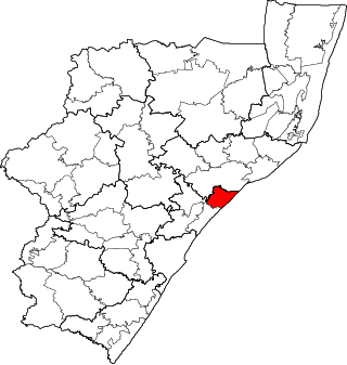
Mtubatuba Municipality is a local municipality within the Umkhanyakude District Municipality, in the KwaZulu-Natal province of South Africa.

eDumbe Municipality is a local municipality within the Zululand District Municipality, in the KwaZulu-Natal province of South Africa. The municipality is named after the Dumbe mountain.

Greater Kokstad Municipality is a local municipality within the Harry Gwala District Municipality, in the KwaZulu-Natal province of South Africa. Kokstad is derived from Dutch, meaning "town of Kok". It was named after Adam Kok III.

uMuziwabantu Municipality is a local municipality within the Ugu District Municipality, in the KwaZulu-Natal province of South Africa. uMuziwabantu is an isiZulu word meaning "the people's home", or "a home with wide open doors where everyone is welcome". The main source of income for the area is derived from the municipality's extensive wattle, gum, pine and poplar plantations, and associated industries, including saw mills and furniture-making factories.

Umzumbe Municipality is a local municipality within the Ugu District Municipality, in the KwaZulu-Natal province of South Africa. The municipality is named after the Umzumbe River. Towns within the municipal boundaries include Friedenau, KwaDweshula, St Faith’s, and Umzumbe.

Nquthu Municipality is a local municipality within the Umzinyathi District Municipality, in the KwaZulu-Natal province of South Africa. Nquthu is an isiZulu word meaning "the back of the head".

Richmond Municipality is a local municipality within the Umgungundlovu District Municipality, in the KwaZulu-Natal province of South Africa.

Impendle Municipality is a local municipality wirhin the Umgungundlovu District Municipality, in the KwaZulu-Natal province of South Africa. During the 18th century, the Griquas ("Abatwas") used to hide in the mountain in the area because they were accused of stealing livestock from the farmers who decided to fight the Griquas in order to protect their livestock. The Griquas used war spears, and this conflict was called "an outside war", i.e. impiyasendle or impiendle.
Mandeni Local Municipality is an administrative area in the iLembe District of KwaZulu-Natal in South Africa.

Ndwedwe Local Municipality is an administrative area in the iLembe District of KwaZulu-Natal in South Africa.

Ubuhlebezwe Municipality is a local municipality within the Harry Gwala District Municipality, in the KwaZulu-Natal province of South Africa. Ubuhlebezwe is an isiZulu word meaning "the beauty of the land". The name is derived from Alan Paton's novel, Cry, The Beloved Country.

uMfolozi Local Municipality is a local municipality within the King Cetshwayo District Municipality of KwaZulu-Natal in South Africa. It is situated around the town of KwaMbonambi, to the north of Richard's Bay, stretching from the Indian Ocean to the edge of the Hluhluwe–Imfolozi Park.

Umvoti Municipality is a local municipality within the Umzinyathi District Municipality, in the KwaZulu-Natal province of South Africa.

