Judson Township, Blue Earth County, Minnesota

Last updated

Judson Township
USA Minnesota location map.svg
Red pog.svg
Judson Township
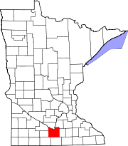
Location within the state of Minnesota
Usa edcp location map.svg
Red pog.svg
Judson Township
Judson Township (the United States)
Coordinates: 44°9′7″N94°11′28″W / 44.15194°N 94.19111°W / 44.15194; -94.19111
Country United States
State Minnesota
County Blue Earth
Area
  Total37.2 sq mi (96.4 km2)
  Land36.6 sq mi (94.9 km2)
  Water0.6 sq mi (1.5 km2)
Elevation
991 ft (302 m)
Population
 (2000)
  Total591
  Density16.1/sq mi (6.2/km2)
Time zone UTC-6 (Central (CST))
  Summer (DST) UTC-5 (CDT)
FIPS code 27-32210 [1]
GNIS feature ID0664590 [2]

Judson Township is a township in Blue Earth County, Minnesota, United States. The population was 591 as of the 2000 census. [3]

Contents

History

Judson Township was organized in 1858, and named for Adoniram Judson, an American missionary. [4]

Notable people

Geography

Judson Township Plat Map from the Standard Atlas, Blue Earth County, Minnesota Judson Township Plat Map from the Standard Atlas, Blue Earth County, Minnesota.jpg
Judson Township Plat Map from the Standard Atlas, Blue Earth County, Minnesota

Public Land Survey System (PLSS) of the United States: Township 108 North, Range 28 West, Fifth Meridian, 23,193 Acres. According to the United States Census Bureau, the township has a total area of 37.2 square miles (96 km2), of which 36.6 square miles (95 km2) is land and 0.6 square miles (1.6 km2) (1.61%) is water.

The north quarter of the city of Lake Crystal is within this township geographically but is a separate entity.

Unincorporated community

Major highways

Lakes

Adjacent townships

Cemeteries

The township includes the following cemeteries: Holy Family and Jerusalem.

Demographics

The 2000 census [1] enumerated 591 people, 232 households, and 168 families residing in the township. The population density was 16.1 people per square mile (6.2/km2). There were 238 housing units at an average density of 6.5/sq mi (2.5/km2). The racial makeup of the township was 99.66% White and 0.34% Asian. Hispanic or Latino of any race were 0.17% of the population.

There were 232 households, out of which 32.8% had children under the age of 18 living with them, 66.4% were married couples living together, 3.4% had a female householder with no husband present, and 27.2% were non-families. 21.1% of all households were made up of individuals, and 10.8% had someone living alone who was 65 years of age or older. The average household size was 2.53 and the average family size was 2.96.

In the township the population was spread out, with 23.2% under the age of 18, 7.3% from 18 to 24, 23.7% from 25 to 44, 30.3% from 45 to 64, and 15.6% who were 65 years of age or older. The median age was 43 years. For every 100 females, there were 98.3 males. For every 100 females age 18 and over, there were 105.4 males.

The median income for a household in the township was $46,071, and the median income for a family was $53,958. Males had a median income of $35,197 versus $21,176 for females. The per capita income for the township was $19,917. About 2.4% of families and 3.8% of the population were below the poverty line, including 1.4% of those under age 18 and 8.2% of those age 65 or over.

Related Research Articles

<span class="mw-page-title-main">Sibley County, Minnesota</span> County in Minnesota, United States

Sibley County is a county in the South Central part of the U.S. state of Minnesota. As of the 2020 census, the population was 14,836. Its county seat is Gaylord. Sibley County was part of the Minneapolis-St. Paul-Bloomington, MN-WI Metropolitan Statistical Area from 2013 to September 2018.

<span class="mw-page-title-main">Nicollet County, Minnesota</span> County in Minnesota, United States

Nicollet County is a county in the U.S. state of Minnesota. As of the 2020 census, the population was 34,454. Its county seat is St. Peter.

Butternut Valley Township is a township in Blue Earth County, Minnesota, United States. The population was 382 as of the 2000 census.

Cambria Township is a township in Blue Earth County, Minnesota, United States. The population was 271 as of the 2000 census.

<span class="mw-page-title-main">Garden City Township, Blue Earth County, Minnesota</span> Township in Minnesota, United States

Garden City Township is a township in Blue Earth County, Minnesota, United States. The population was 700 as of the 2000 census.

Lime Township is a township in Blue Earth County, Minnesota, United States. The population was 1,395 as of the 2010 census.

Lincoln Township is a township in Blue Earth County, Minnesota, United States. The population was 227 as of the 2000 census.

South Bend Township is a township in Blue Earth County, Minnesota, United States. The population was 1,682 as of the 2010 census.

Cottonwood Township is a township in Brown County, Minnesota, United States. The population was 938 as of the 2000 census.

Eden Township is a township in Brown County, Minnesota, United States. The population was 321 as of the 2000 census.

Home Township is a township in Brown County, Minnesota, United States. The population was 800 as of the 2000 census. Home Township was organized in 1866.

<span class="mw-page-title-main">Milford Township, Brown County, Minnesota</span> Township in Minnesota, United States

Milford Township is a township in Brown County, Minnesota, United States. The population was 793 as of the 2000 census.

Lima Township is a township in Cass County, Minnesota, United States. The population was 111 as of the 2000 census. Lima Township was probably named after Lima, Ohio.

<span class="mw-page-title-main">Pike Bay Township, Cass County, Minnesota</span> Township in Minnesota, United States

Pike Bay Township is a township in Cass County, Minnesota, United States. The population was 1,643 as of the 2000 census. Pike Bay Township was named for Pike Bay of Cass Lake, and indirectly for Zebulon Pike, an explorer.

Powers Township is a township in Cass County, Minnesota, United States. The population was 918 at the 2000 census. Powers Township was named for Gorham Powers, a Minnesota politician who owned land there.

Remer Township is a township in Cass County, Minnesota, United States. The population was 183 as of the 2000 census. Remer Township was named for two brothers, E. N. and William P. Remer.

Lake Prairie Township is a township in Nicollet County, Minnesota, United States. The population was 652 at the 2000 census.

<span class="mw-page-title-main">Nicollet, Minnesota</span> City in Minnesota, United States

Nicollet is a city in Nicollet County, Minnesota, United States. The population was 1,143 at the 2020 census.

Nicollet Township is a township in Nicollet County, Minnesota, United States. The population was 511 at the 2000 census.

Ridgely Township is a township in Nicollet County, Minnesota, United States. The population was 126 at the 2000 census.

References

  1. 1 2 "U.S. Census website". United States Census Bureau . Retrieved January 31, 2008.
  2. "US Board on Geographic Names". United States Geological Survey. October 25, 2007. Retrieved January 31, 2008.
  3. "U.S. Census website" . Retrieved December 30, 2008.
  4. Upham, Warren (1920). Minnesota Geographic Names: Their Origin and Historic Significance. Minnesota Historical Society. p.  60.
  5. Minnesota Legislators: Past & Present-Ronald G. Evans
  6. Minnesota Legislators Past & Present-Richard E. "Dick" Wigley