South Bend Township, Blue Earth County, Minnesota

Last updated
South Bend Township
USA Minnesota location map.svg
Red pog.svg
South Bend Township
Location within the state of Minnesota
Coordinates: 44°8′50″N94°4′50″W / 44.14722°N 94.08056°W / 44.14722; -94.08056 Coordinates: 44°8′50″N94°4′50″W / 44.14722°N 94.08056°W / 44.14722; -94.08056
Country United States
State Minnesota
County Blue Earth
Area
  Total16.9 sq mi (43.7 km2)
  Land16.4 sq mi (42.5 km2)
  Water0.4 sq mi (1.1 km2)
Elevation
958 ft (292 m)
Population
 (2010)
  Total1,682
  Density102/sq mi (39.5/km2)
Time zone UTC-6 (Central (CST))
  Summer (DST) UTC-5 (CDT)
FIPS code 27-61240 [1]
GNIS feature ID0665644 [2]

South Bend Township is a township in Blue Earth County, Minnesota, United States. The population was 1,682 as of the 2010 census. [3]

Contents

History

South Bend Township was organized in 1858, and named from a meander in the Minnesota River. [4]

Geography

Public Land Survey System (PLSS) of the United States: Township 108 North, Range 27 West, Fifth Meridian, 23,092 Acres. According to the United States Census Bureau, the township has a total area of 16.9 square miles (43.7 km2), of which 16.4 square miles (42.5 km2) is land and 0.42 square miles (1.1 km2), or 2.62%, is water. [3] The Minnesota River forms the township's northern border, and one of its tributaries, the Blue Earth River, forms the eastern boundary. South Bend is bordered by Judson Township on the west side, Rapidan Township on the south side, and Mankato Township on the east side (separated by the Blue Earth River). In the late 1800s the portion of South Bend Township east of the Blue Earth River was designated as part of Mankato Township.

Local government

South Bend Township has a governing Board of Supervisors. There are five Supervisors, elected at-large by the electorate of the township, each serving a three-year term. The Board appoints a Township Clerk who also serves as Township Treasurer. The township is the only township of the 23 Blue Earth County townships to support its own volunteer fire department. A portion of the township is served by township sanitary sewer and potable water.

The west half of the city of Skyline is within this township geographically but is a separate entity.

Unincorporated community

Major highways

Lake

Adjacent townships

Cemetery

The township contains Minneopa Cemetery.

Demographics

As of the census [1] of 2000, there were 1,491 people, 527 households, and 359 families residing in the township. The population density was 88.2 inhabitants per square mile (34.1/km2). There were 559 housing units at an average density of 33.1 per square mile (12.8/km2). The racial makeup of the township was 97.32% White, 0.13% African American, 0.27% Native American, 0.47% Asian, 1.14% from other races, and 0.67% from two or more races. Hispanic or Latino of any race were 2.62% of the population.

There were 527 households, out of which 31.9% had children under the age of 18 living with them, 55.6% were married couples living together, 8.2% had a female householder with no husband present, and 31.7% were non-families. 22.6% of all households were made up of individuals, and 6.1% had someone living alone who was 65 years of age or older. The average household size was 2.60 and the average family size was 3.04.

In the township the population was spread out, with 22.8% under the age of 18, 9.9% from 18 to 24, 26.4% from 25 to 44, 22.7% from 45 to 64, and 18.2% who were 65 years of age or older. The median age was 40 years. For every 100 females, there were 104.0 males. For every 100 females age 18 and over, there were 102.3 males.

The median income for a household in the township was $42,083, and the median income for a family was $46,719. Males had a median income of $33,889 versus $23,239 for females. The per capita income for the township was $18,038. About 5.5% of families and 7.2% of the population were below the poverty line, including 7.0% of those under age 18 and 4.1% of those age 65 or over.

Related Research Articles

<span class="mw-page-title-main">Nicollet County, Minnesota</span> County in Minnesota, United States

Nicollet County is a county in the U.S. state of Minnesota. As of the 2020 census, the population was 34,454. Its county seat is St. Peter.

<span class="mw-page-title-main">Brown County, Minnesota</span> County in Minnesota, United States

Brown County is a county in the U.S. state of Minnesota. As of the 2020 census, the population was 25,912. Its county seat is New Ulm. The county was formed in 1855 and organized in 1856.

<span class="mw-page-title-main">Blue Earth County, Minnesota</span> County in Minnesota, United States

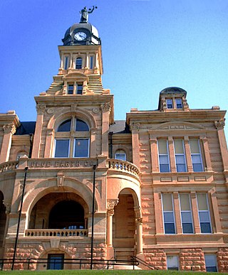
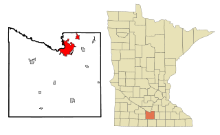
Blue Earth County is a county in the State of Minnesota. As of the 2020 census, the population was 69,112. Its county seat is Mankato. The county is named for the Blue Earth River and for the deposits of blue-green clay once evident along the banks of the Blue Earth River.

<span class="mw-page-title-main">Amboy, Minnesota</span> City in Minnesota, United States

Amboy is a city in Blue Earth County, Minnesota, United States. The population was 535 at the 2020 census. It is part of the Mankato-North Mankato Metropolitan Statistical Area. The city was founded in 1879. It celebrated its 125th anniversary in September 2004.

Beauford Township is a township in Blue Earth County, Minnesota, United States. The population was 442 as of the 2000 census.

Cambria Township is a township in Blue Earth County, Minnesota, United States. The population was 271 as of the 2000 census.

Decoria Township is a township in Blue Earth County, Minnesota, United States. The population was 1,104 as of the 2010 census.

<span class="mw-page-title-main">Garden City Township, Blue Earth County, Minnesota</span> Township in Minnesota, United States

Garden City Township is a township in Blue Earth County, Minnesota, United States. The population was 700 as of the 2000 census.

Jamestown Township is a township in Blue Earth County, Minnesota, United States. The population was 628 as of the 2000 census.

Judson Township is a township in Blue Earth County, Minnesota, United States. The population was 591 as of the 2000 census.

Le Ray Township is a township in Blue Earth County, Minnesota, United States. The population was 846 as of the 2000 census.

Lime Township is a township in Blue Earth County, Minnesota, United States. The population was 1,395 as of the 2010 census.

Mankato Township is a township in Blue Earth County, Minnesota, United States. The population was 1,969 as of the 2010 census.

Rapidan Township is a township in Blue Earth County, Minnesota, United States. The population was 1,101 as of the 2010 census.

Vernon Center Township is a township in Blue Earth County, Minnesota, United States. The population was 301 as of the 2000 census.

Cottonwood Township is a township in Brown County, Minnesota, United States. The population was 938 as of the 2000 census.

Home Township is a township in Brown County, Minnesota, United States. The population was 800 as of the 2000 census. Home Township was organized in 1866.

Little Rock Township is a township in Nobles County, Minnesota, United States. The population was 260 at the 2000 census.

<span class="mw-page-title-main">Mankato, Minnesota</span> City in Minnesota, United States

Mankato is a city in Blue Earth, Nicollet, and Le Sueur counties in the state of Minnesota. The population was 44,488 according to the 2020 census, making it the 21st-largest city in Minnesota, and the 5th-largest outside of the Minneapolis–Saint Paul metropolitan area. It is along a large bend of the Minnesota River at its confluence with the Blue Earth River. Mankato is across the Minnesota River from North Mankato. Mankato and North Mankato have a combined population of 58,763 according to the 2020 census. It completely encompasses the town of Skyline. North of Mankato Regional Airport, a tiny non-contiguous part of the city lies within Le Sueur County. Most of the city is in Blue Earth County.

<span class="mw-page-title-main">North Mankato, Minnesota</span> City in Minnesota, United States

North Mankato is a city in Nicollet and Blue Earth counties in the State of Minnesota. The population was 14,275 at the 2020 census.

References

  1. 1 2 "U.S. Census website". United States Census Bureau . Retrieved 2008-01-31.
  2. "US Board on Geographic Names". United States Geological Survey. 2007-10-25. Retrieved 2008-01-31.
  3. 1 2 "Geographic Identifiers: 2010 Demographic Profile Data (G001): South Bend township, Blue Earth County, Minnesota". U.S. Census Bureau, American Factfinder. Archived from the original on February 12, 2020. Retrieved January 21, 2014.
  4. Upham, Warren (1920). Minnesota Geographic Names: Their Origin and Historic Significance. Minnesota Historical Society. p.  63.