
The Cypress Hills are a geographical region of hills in southwestern Saskatchewan and southeastern Alberta, Canada. The hills are part of the Missouri Coteau upland. The hills cover an area of approximately 2,500 km2 (970 sq mi). About 400 km2 (150 sq mi) or 16% of this area is an interprovincial park.

Meadow Lake is a city in the boreal forest of northwestern Saskatchewan, Canada. Its location is about 246 kilometres (153 mi) northeast of Lloydminster and 156 kilometres (97 mi) north of North Battleford. Founded as a trading post in 1799, it became a village in 1931 and a town in 1936. On November 9, 2009, it officially became Saskatchewan's 14th city.
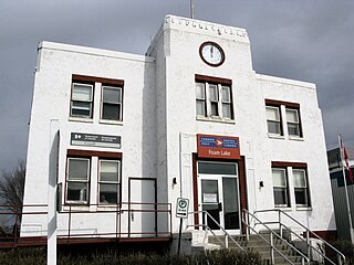
Foam Lake is a town in the Canadian province of Saskatchewan. It had a population of 1,123 in 2006. It is located in a mixed agricultural area approximately 220 km south-east of Saskatoon on the Yellowhead Highway. Foam Lake, the lake for which the town is named, is located about 5 kilometres (3.1 mi) to the north-west.
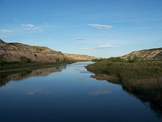
The Red Deer River is a river in Alberta and a small portion of Saskatchewan, Canada. It is a major tributary of the South Saskatchewan River and is part of the larger Saskatchewan / Nelson system that empties into Hudson Bay.

Cypress Hills Interprovincial Park is a natural park in Canada straddling the Alberta / Saskatchewan boundary and jointly administered by the two provinces. Located south-east of Medicine Hat in the Cypress Hills, it became Canada's first interprovincial park in 1989.
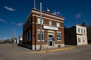
Gull Lake is a town in Saskatchewan, Canada, situated on the junction of the Trans-Canada Highway and Highway 37, west of Swift Current.
Plenty is a village in the Canadian province of Saskatchewan within the Rural Municipality of Winslow No. 319 and Census Division No. 13. Plenty is located equidistant among Kindersley, Biggar, Kerrobert, and Rosetown and approximately 150 kilometres (93 mi) southwest of the city of Saskatoon.

The Fishing Lakes, also called the Calling Lakes or the Qu'Appelle Lakes, are a chain of four lakes in the Qu'Appelle Valley cottage country about 40 miles (64 km) to the north-east of Regina in the Canadian province of Saskatchewan. The lakes are in a region called the Prairie Pothole Region of North America, which extends throughout three Canadian provinces and five U.S. states. It is also within Palliser's Triangle and the Great Plains ecoregion. The Fishing Lakes all follow the course of the Qu'Appelle River, which flows from the west to the east and is part of the Hudson Bay drainage basin. The lakes sit in the deep-cut Qu'Appelle Valley that was formed about 14,000 years ago during the last ice age. Meltwater from the glaciers carved out the valley and as water levels rose and fell, alluvium was left in the wake. These piles of alluvium are what created the separations between the lakes.

The geography of Saskatchewan is unique among the provinces and territories of Canada in some respects. It is one of only two landlocked regions and it is the only region whose borders are not based on natural features like lakes, rivers, or drainage divides. The borders of Saskatchewan, which make it very nearly a trapezoid, were determined in 1905 when it became a Canadian province. Saskatchewan has a total area of 651,036 square kilometres (251,366 sq mi) of which 591,670 km2 (228,450 sq mi) is land and 59,366 km2 (22,921 sq mi) is water.

Last Mountain Lake, also known as Long Lake, is a prairie lake formed from glaciation 11,000 years ago. It is located in south central Saskatchewan, Canada, about 40 kilometres (25 mi) north-west of the city of Regina. It flows into the Qu'Appelle River via Last Mountain Creek, which flows past Craven. It is approximately 93 km (58 mi) long, and 3 km (1.9 mi) across at its widest point. It is the largest naturally occurring body of water in southern Saskatchewan. Only Lake Diefenbaker, which is man-made, is larger. The lake is a popular resort area for residents of south-eastern Saskatchewan.
Drake is a village in the Canadian province of Saskatchewan within the Rural Municipality of Usborne No. 310 and Census Division No. 11. The village lies west of Highway 20, approximately 11 km (6.8 mi) south of its intersection with the Yellowhead Highway.

Duck Mountain Provincial Park is a provincial park, located in the Canadian province of Saskatchewan 14 kilometres (8.7 mi) east of the town of Kamsack and stretches about 12 kilometres (7.5 mi) eastward to the Saskatchewan / Manitoba boundary. The park covers approximately 150 km2 (58 sq mi). Road access to the park is via Highway 57, which connects Saskatchewan Highway 5 to Manitoba Highway 83.
Beauval, Saskatchewan is a northern village located in Northern Saskatchewan, near Lac Île-à-la-Crosse. It was founded in the early 20th century as a Roman Catholic mission and as a transportation centre.
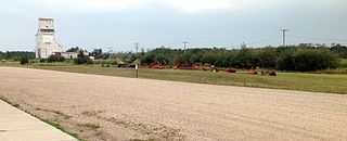
Rama is a village in the Canadian province of Saskatchewan within the Rural Municipality of Invermay No. 305 and Census Division No. 9. It is located 44 km west of Canora and 60 km east of Wadena at the intersection of Highway 5 and Highway 754.
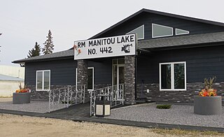
The Rural Municipality of Manitou Lake No. 442 is a rural municipality (RM) in the Canadian province of Saskatchewan within Census Division No. 13 and SARM Division No. 6.
Gladmar is a Dissolved village in the Canadian province of Saskatchewan located 2 kilometres (1.2 mi) north of Highway 18 as it runs east from Highway 6 towards Lake Alma. Gladmar is approximately 18.4 kilometres (11.4 mi) north of the Canada–United States border. It is part of the Rural Municipality of Surprise Valley No. 9 and Census Division No. 2.
Lake Alma is a special service area within the Rural Municipality of Lake Alma No. 8, Saskatchewan, Canada that held village status prior to August 2018. The community shares its name with the nearby Alma Lake and surrounding rural municipality. Lake Alma had a population of 30 in the 2016, 2011 and 2006 Censuses).
Rush Lake is a village in the Canadian province of Saskatchewan within the Rural Municipality of Excelsior No. 166 and Census Division No. 7. Surrounding communities include Waldeck, Herbert, and the City of Swift Current.
Moose Mountain Upland, Moose Mountain Uplands, or commonly Moose Mountain, is a hilly plateau located in the south-east corner of the Canadian province of Saskatchewan, that covers an area of about 13,000 square kilometres (5,000 sq mi). The upland rises about 200 metres (660 ft) above the broad, flat prairie which is about 600 metres (2,000 ft) above sea level. The highest peak is "Moose Mountain" at 830 metres (2,720 ft) above sea level. The upland was named Moose Mountain because of the large number of moose that lived in the area. When it was originally used by fur traders, Métis, and the Indigenous peoples, the plateau was called Montagne a la Bosse, which is French for "The Mountain of the Bump or Knob".


