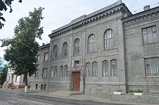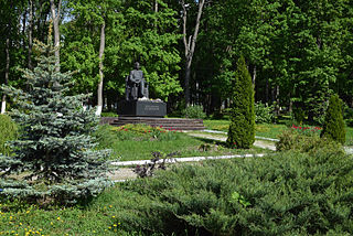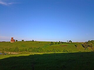
Mikhaylov is a town and the administrative center of Mikhaylovsky District in Ryazan Oblast, Russia, located on the Pronya River, 68 kilometers (42 mi) southwest of Ryazan, the administrative center of the oblast. Population: 11,784 (2010 Census); 13,295 (2002 Census); 15,302 (1989 Census).

Shatsk is a town and the administrative center of Shatsky District in Ryazan Oblast, Russia, located on the Shacha River 145 kilometers (90 mi) southeast of Ryazan, the administrative center of the oblast. Population: 6,561 (2010 Census); 7,563 (2002 Census); 8,181 (1989 Census).

Chuchkovsky District is an administrative and municipal district (raion), one of the twenty-five in Ryazan Oblast, Russia. It is located in the eastern central part of the oblast. The area of the district is 896 square kilometers (346 sq mi). Its administrative center is the urban locality of Chuchkovo. Population: 8,700 ; 11,244 (2002 Census); 12,294 (1989 Census). The population of Chuchkovo accounts for 35.9% of the district's total population.

Kasimovsky District is an administrative and municipal district (raion), one of the twenty-five in Ryazan Oblast, Russia. It is located in the north of the oblast. The area of the district is 2,969 square kilometers (1,146 sq mi). Its administrative center is the town of Kasimov. Population: 29,602 ; 35,365 (2002 Census); 41,422 (1989 Census).

Klepikovsky District is an administrative and municipal district (raion), one of the twenty-five in Ryazan Oblast, Russia. It is located in the north of the oblast. The area of the district is 3,235 square kilometers (1,249 sq mi). Its administrative center is the town of Spas-Klepiki. Population: 25,476 ; 29,391 (2002 Census); 34,766 (1989 Census). The population of Spas-Klepiki accounts for 23.2% of the district's total population.

Korablinsky District is an administrative and municipal district (raion), one of the twenty-five in Ryazan Oblast, Russia. It is located in the southwestern central part of the oblast. The area of the district is 1,171 square kilometers (452 sq mi). Its administrative center is the town of Korablino. Population: 22,941 ; 26,026 (2002 Census); 28,144 (1989 Census). The population of Korablino accounts for 55.2% of the district's total population.

Mikhaylovsky District is an administrative and municipal district (raion), one of the twenty-five in Ryazan Oblast, Russia. It is located in the west of the oblast. The area of the district is 1,841 square kilometers (711 sq mi). Its administrative center is the town of Mikhaylov. Population: 35,223 ; 38,377 (2002 Census); 45,144 (1989 Census). The population of Mikhaylov accounts for 33.5% of the district's total population.

Miloslavsky District is an administrative and municipal district (raion), one of the twenty-five in Ryazan Oblast, Russia. It is located in the southwest of the oblast. The area of the district is 1,397 square kilometers (539 sq mi). Its administrative center is the urban locality of Miloslavskoye. Population: 13,455 ; 16,564 (2002 Census); 20,808 (1989 Census). The population of Miloslavskoye accounts for 33.3% of the district's total population.

Pitelinsky District is an administrative and municipal district (raion), one of the twenty-five in Ryazan Oblast, Russia. It is located in the northeast of the oblast. The area of the district is 953 square kilometers (368 sq mi). Its administrative center is the urban locality of Pitelino. Population: 5,893 ; 7,250 (2002 Census); 9,228 (1989 Census). The population of Pitelino accounts for 38.3% of the district's total population.

Pronsky District is an administrative and municipal district (raion), one of the twenty-five in Ryazan Oblast, Russia. It is located in the west of the oblast. The area of the district is 1,070 square kilometers (410 sq mi). Its administrative center is the urban locality of Pronsk. Population: 31,393 ; 34,467 (2002 Census); 34,527 (1989 Census). The population of Pronsk accounts for 12.6% of the district's total population.

Putyatinsky District is an administrative and municipal district (raion), one of the twenty-five in Ryazan Oblast, Russia. It is located in the southeastern central part of the oblast. The area of the district is 1,008 square kilometers (389 sq mi). Its administrative center is the rural locality of Putyatino. Population: 7,511 ; 8,745 (2002 Census); 10,398 (1989 Census). The population of Putyatino accounts for 40.6% of the district's total population.

Sapozhkovsky District is an administrative and municipal district (raion), one of the twenty-five in Ryazan Oblast, Russia. It is located in the southern central part of the oblast. The area of the district is 960 square kilometers (370 sq mi). Its administrative center is the urban locality of Sapozhok. Population: 10,901 ; 12,542 (2002 Census); 16,065 (1989 Census). The population of Sapozhok accounts for 35.6% of the district's total population.

Sarayevsky District is an administrative and municipal district (raion), one of the twenty-five in Ryazan Oblast, Russia. It is located in the south of the oblast. The area of the district is 2,117 square kilometers (817 sq mi). Its administrative center is the urban locality of Sarai. Population: 17,810 ; 22,725 (2002 Census); 28,819 (1989 Census). The population of Sarai accounts for 32.6% of the district's total population.

Shilovsky District is an administrative and municipal district (raion), one of the twenty-five in Ryazan Oblast, Russia. It is located in the center of the oblast. The area of the district is 2,390 square kilometers (920 sq mi). Its administrative center is the urban locality of Shilovo. Population: 40,334 ; 44,197 (2002 Census); 52,202 (1989 Census). The population of Shilovo accounts for 38.9% of the district's total population.

Skopinsky District is an administrative and municipal district (raion), one of the twenty-five in Ryazan Oblast, Russia. It is located in the southwest of the oblast. The area of the district is 1,720 square kilometers (660 sq mi). Its administrative center is the town of Skopin. Population: 27,080 ; 31,142 (2002 Census); 40,965 (1989 Census).

Spassky District is an administrative and municipal district (raion), one of the twenty-five in Ryazan Oblast, Russia. It is located in the center of the oblast. The area of the district is 2,684 square kilometers (1,036 sq mi). Its administrative center is the town of Spassk-Ryazansky. Population: 30,388 ; 34,024 (2002 Census); 41,458 (1989 Census). The population of Spassk-Ryazansky accounts for 25.5% of the district's total population.

Starozhilovsky District is an administrative and municipal district (raion), one of the twenty-five in Ryazan Oblast, Russia. It is located in the center of the oblast. The area of the district is 1,007 square kilometers (389 sq mi). Its administrative center is the urban locality of Starozhilovo. Population: 17,136 ; 17,954 (2002 Census); 17,762 (1989 Census). The population of Starozhilovo accounts for 29.7% of the district's total population.

Ukholovsky District is an administrative and municipal district (raion), one of the twenty-five in Ryazan Oblast, Russia. It is located in the south of the oblast. The area of the district is 956 square kilometers (369 sq mi). Its administrative center is the urban locality of Ukholovo. Population: 9,532 ; 11,725 (2002 Census); 13,509 (1989 Census). The population of Ukholovo accounts for 52.1% of the district's total population.

Yermishinsky District is an administrative and municipal district (raion), one of the twenty-five in Ryazan Oblast, Russia. It is located in the northeast of the oblast. The area of the district is 1,342 square kilometers (518 sq mi). Its administrative center is the urban locality of Yermish. Population: 8,879 ; 10,926 (2002 Census); 13,288 (1989 Census). The population of Yermish accounts for 48.9% of the district's total population.

Alexandro-Nevsky is an urban locality and the administrative center of Alexandro-Nevsky District of Ryazan Oblast, Russia. Population: 4,013 (2010 Census); 4,133 (2002 Census); 4,447 (1989 Census).


