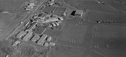
Dargaville is a town located in the North Island of New Zealand. It is situated on the bank of the Northern Wairoa River in the Kaipara District of the Northland region. Dargaville is located 55 kilometres (34 mi) southwest of Whangārei, and 174 kilometres (108 mi) north of Auckland.

Kumeū is a town in the Auckland Region, situated 25 kilometres (16 mi) north-west of the City Centre in New Zealand. State Highway 16 and the North Auckland Line pass through the town. Huapai lies to the west, Riverhead to the north, Whenuapai to the east, and Taupaki to the south.

Helensville is a town in the North Island of New Zealand. It is sited 40 kilometres (25 mi) northwest of Auckland, close to the southern extremity of the Kaipara Harbour. State Highway 16 passes through the town, connecting it to Waimauku 16 kilometres (10 mi) to the south, and Kaukapakapa about 12 kilometres (7.5 mi) to the north-east. Parakai is two kilometres (1.2 mi) to the north-west. The Kaipara River runs through the town and into the Kaipara Harbour to the north.

Wellsford is a town on the Northland Peninsula in the northern North Island of New Zealand. It is the northernmost major settlement in the Auckland Region, and is 77 kilometres (48 mi) northwest of the Auckland CBD. It is a major regional centre, being located at the junction of State Highways 1 and 16, almost halfway between Auckland and the Northland city of Whangārei.

Macleans College is a co-educational state secondary school located in Eastern Beach, Auckland, New Zealand. The school is named after the Scottish MacLean family who lived and farmed the land of the school and surrounding reserves, and the school emblem contains the castle from their family crest along with six waves which symbolise the seaside location of the school. Metro placed Macleans College as the number one Auckland high school in 2010 among those in the Cambridge International Examinations system. In 2014, Macleans College ranked 2nd nationally in the Cambridge International Examinations.

James Hargest College is a large school of 1,882 students, in Invercargill, New Zealand. The school caters for students from year 7–13.
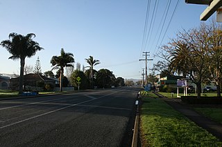
Parakai is a town in the North Island of New Zealand, sited 43 kilometres northwest of Auckland, close to the southern extremity of the Kaipara Harbour. Helensville is about 3 km (1.9 mi) to the south-east, and Waioneke is 22 km (14 mi) to the north-west.

Riverhead is a small, historically predominantly working-class town located at the head of the Waitematā Harbour in the north-west of Auckland, New Zealand. It is located on the northwestern shores of the Upper Waitematā Harbour, north-east of the towns of Kumeū and Huapai.

Huapai is a locality north-west of Auckland, New Zealand. State Highway 16 and the North Auckland Railway Line pass through it. Kumeū is adjacent to the east, Riverhead is to the north-east, and Waimauku to the west.
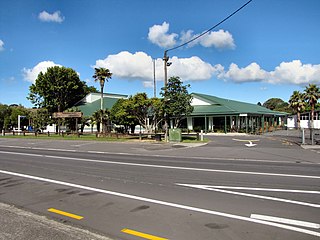
Waimauku is a small locality in the Auckland Region of New Zealand. It comes under the jurisdiction of Auckland Council, and is in the council's Rodney ward. Waimauku is approximately 4 kilometres west of Huapai on State Highway 16 at the junction with the road to Muriwai Beach. Helensville is 16 km to the north-west. Waimauku is a Māori word which is literally translated as wai: stream and mauku: varieties of small ferns.

Kaukapakapa is a town in the North Island of New Zealand. It is situated in the Rodney ward of the Auckland Region and is around 50 kilometres (31 mi) northwest of Auckland. State Highway 16 passes through the town, connecting it to Helensville about 12 kilometres (7.5 mi) to the south-west, and Araparera about 14 kilometres (8.7 mi) to the north. The North Auckland Line also passes through Kaukapakapa. The Kaukapakapa River flows from the town to the Kaipara Harbour to the west.
Heretaunga College is a state coeducational secondary school located in Upper Hutt, New Zealand. The school has approximately 838 students from Years 9 to 13.
Newlands College is a state coeducational secondary school located in the Wellington, New Zealand, suburb of Newlands. Opened in February 1970, the school has a roll of 1,231 students as of November 2024.

Pakuranga College is a co-educational secondary school in east Auckland, New Zealand. The college is named after the suburb it is located in, Pakuranga. The school emblem is the pegasus and the motto "Caelum Certe Patet".
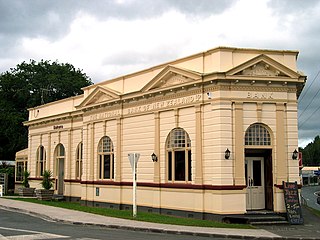
Paparoa is a settlement in Northland, New Zealand. The Paparoa Stream flows from the east, through the settlement, and into the Paparoa Creek to the south, which joins the Arapaoa River which is part of the Kaipara Harbour. State Highway 12 passes through Paparoa. Matakohe is 6 km to the south west, and Maungaturoto is 12 km east.

Kaipara Flats is a locality in the Rodney District of New Zealand. Warkworth is 12 km to the east, Ahuroa to the south, and Tauhoa to the north-west. The North Auckland railway line passes through the area.

Waioneke is a locality on the Te Korowai-o-Te-Tonga Peninsula of the Kaipara Harbour, in the Rodney District of New Zealand. Parakai is 22 km to the south-east, and the road continues another 14 km to the north-west. Rangitira Beach and Woodhill Forest are to the west, and Omokoiti Flats and the southern Kaipara Harbour are to the east.
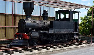
Helensville railway station formerly served the town of Helensville, 60.47 km (37.57 mi) northwest of Auckland Strand, in the North Island of New Zealand. It was a stop on the North Auckland Line, and was the next major station north of Waitākere. Occasionally it was called the Helensville North Railway Station.

Te Korowai-o-Te-Tonga Peninsula, also known as South Head and by its former name of the South Kaipara Peninsula, is a long peninsula in the North Island of New Zealand, extending north along the western edge of the Kaipara Harbour for some 35 kilometres (22 mi) from near Helensville to the harbour's mouth. The peninsula was officially renamed in 2013 as part of a Treaty of Waitangi settlement. The name, which is Māori for "The cloak of the south", reflects the peninsula's geographical role in guarding the southern half of the Kaipara Harbour from the Tasman Sea and prevailing westerly winds. The mouth of the Kaipara Harbour separates the peninsula from the larger Pouto Peninsula to the north.

Kaipara ki Mahurangi is an electorate to the New Zealand House of Representatives. It was created for the 2020 election.
