
Idukki (ഇടുക്കി), IPA: [iɖukːi], is a district in the Indian state of Kerala. It was constituted on 26 January 1972, by splitting the district of Kottayam into two parts. Its division was previously headquartered at Kottayam city, but moved to Kuyilimala near Painavu and Cheruthoni in June 1976. Idukki district lies amid the Cardamom Hills of Western Ghats in Kerala.

Kanhirode is a census town in Kannur district of Kerala state, India. Kanhirode is located 13 km east of Kannur city on Kannur-Mattanur road.

Peermade, also spelt Peerumedu is a village, Grama Panchayat and hill station in the state of Kerala, India. It lies 915 metres (3,002 ft) above sea level in the Western Ghats (Sahyadri) about 85 kilometres (53 mi) east of Kottayam on the way to Thekkady through the nearby city of Kanjirappally.

Devikulam is a Grama Panchayat and small hill station of about 8 kilometres (5.0 mi) from Munnar in the Idukki District of Kerala State, India. It lies 1,800 metres (5,900 ft) above sea level.

Kumily also spelt as Kumaly is a revenue village and Gram Panchayat in the Idukki district of Kerala. It is a town in Cardamom Hills near Thekkady and Periyar Tiger Reserve. Kumily is gateway town into Kerala from Tamil Nadu.

Kattappana is a municipal town in the Sahyadri of Kerala state, India. It is the main urban centre in the high ranges of Idukki district, situated about 2,788.71–2,952.76 feet (850.00–900.00 m) above mean sea level, in the High Ranges, the high altitude region of Kerala has recently raised to the status of municipality. Kattappana is a class III urban centre. It is the first municipality in high range of Idukki district with the real mountainous touch of Idukki as Thodupuzha municipality is situated in low range. It is a major commercial town and flourished with the boost in production of agriculture and spices. Thopramkudy is the nearest town.
Udumbanchola is a taluk in Idukki district of Kerala state in India. This is in the high ranges. Nedumkandam is the major town and capital of Udumbanchola taluk. Mathikettan Shola National Park is located in Udumbanchola.
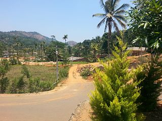
Anavilasam is a village in Idukki district in the Indian state of Kerala.
Anaviratty is a village in Idukki district in the Indian state of Kerala.

Ayyappancoil, also spelt Ayyappankovil is a village in newly formed Idukki taluk in Idukki district in the Indian state of Kerala. It is highly noted for the newly constructed suspension bridge with a length of 200 meters and the old historic Sastha temple on the banks of Periyar river.

Bison valley is a village in Udumbanchola Taluk in the Idukki district of the southwestern Indian state of Kerala. Bison valley is situated at around 914 metres (3000 ft) above mean sea level, in the Western Ghats range of mountains.

Chathurangapara is a village in Idukki district in the Indian state of Kerala. The village is part of Udumbanchola and Senapathy Panchayats.

Chinnakanal is a village in Idukki district in the Indian state of Kerala. The waterfalls here are popularly known as Power House Waterfalls.

Elappara is a village in Idukki district in the Indian state of Kerala. It is one of the panchayaths in Peerumedu taluk. The area is marked by a cool climate as the region is situated at an elevation of more than 1,000 m (3,300 ft) above the sea level. Elappara is famous for its vast tea plantations.

Pallivasal is a village in Idukki district in the Indian state of Kerala.
Upputhode is a village in Idukki district in the Indian state of Kerala.
Kandamkunnu is a census town in Kannur district in the Indian state of Kerala.

Kanichar is a village and Grama Panchayat in Kannur district in the Indian state of Kerala.
Mokeri is a Census Town in Mokeri panchayat of Kannur district in the Indian state of Kerala.
Thankamany is a village at Idukki district, in Kerala state, India. There is a small town associated with this village. In regional language thankamany is a name of a lady. It is a belief that an older jungle king Thopran gave dowry as land for his three daughters Thankamony, Kamashi, and Neeli. The place got for Thankamony is now known as Thankamony, other nearby places are also known as Kamashi and Neelivayal. Thankamany town is located in a valley of three small hills Thamprankunnu, Kattadikavala and Kurishupara respectively. One of the interesting thing is that, even though Kamashi is a different place, the panchayath of thankamany is called Kamashy panchayath and the office is situated in the middle of thankamany town.Sometimes in official documents thankamony is also written as thankamony. Nearest towns are Kattappana and Nedumkandam.


