Kasagala Central Forest Reserve

Last updated
Kasagala Central Forest Reserve
Kasagala Forest
Uganda relief map.svg
Red pog.svg
Located in Uganda
Location Nakasongola District, Central Region, Uganda
Coordinates 1°19′N32°14′E / 1.317°N 32.233°E / 1.317; 32.233

Kasagala Central Forest Reserve is a protected area located in central Uganda. It was gazetted in 1963 and is known for its diverse ecosystem and significant contribution to the region's biodiversity conservation efforts. Kasagala Forest Reserve was established to provide ecosystem services and watershed protection to Lake Kyoga, an inland body of water that is slowly drying up owing to loss of surrounding plant cover. [1] [2] [3] [4] [5] [6]

Contents

Location and geography

Kasagala Forest Reserve is located in Bululi county. The elevation ranges from 1067 to 1097m above sea level, with the highest peak (Kasagala Hill) reaching 1159m.

The southern limit is 94 kilometers and the northern line is 110 kilometers from Kampala. The reserve is located east of the Kampala-Gulu trunk road. This reserve is one of 59 in Uganda that are larger than 50 km2 and have a biodiversity plan. [7] Kasagala Central Forest Reserve has an area of 10,298 acres. It covers an extensive land area and forms an integral part of the country's natural heritage. [8] The reserve is bounded on the west by the main road north from Kampala, which is stopped by the NFA Katugo Plantation Forest. Several enclaves are located within the reserve's limits. [8]

Topography

The landscape is composed of relatively flat hill tops and flat broad valleys that are seasonal swamps that flood twice a year during the two rainy seasons.  Kasagala Reserve is separated into five Class Zones based on soil qualities and geographical elements inside the forest reserve, as follows:

  1. Zone 1 (499ha): This zone occurs on seasonally waterlogged bogs that cover a substantial section of the reserve. Every rainy season, or twice a year, the zone undergoes water logging. The amount of water relies on the amount of rain received, as well as its regularity and durability during the rainy season. The valleys' flatness and luxuriant growth of Loadetiaphragmitoides grass prevent fast flow of rain water, which stays longer after the rain has ended.
  2. Zone 2: The zone found on both sides of the wetlands. It is 808ha in size, with most of the trees removed and replaced by a lot of grass that sustains cattle during the dry seasons.
  3. Zone 3: (1682ha) occurs on the flanks of hills where the ground rises gently and has a 5% slope. Natural forest woodland can still be found on certain hills, particularly in the east and away from the major road. Around the hills, the zone is 400-500m broad.
  4. Zone 4: This zone (92ha) is comparable to zones V above and III below, but it has been separated from the other two due to the presence of solid laterite rock outcrops and shallow stony soils with a high proportion of laterite and quartzite pebbles. It is a tiny area of around 20m round hills.
  5. Zone 5: Hill top sites (3659ha), which eventually combine with forest and woodland sites on the hills' slopes, create a distinct and distinctive site type. The majority of the woodland that covered the zone has been gone, and grazing has also removed the grasses, leaving the soil barren and vulnerable to erosion. It encompasses the majority of the forest reserve. [8]

Ecology

There are many different types of flora including trees, bushes, and other vegetation in the reserve. According to studies, the forest supports a variety of plant species and is crucial to preserving the area's ecological balance. [2]

The Kasagala Central Forest Reserve is home to a wide variety of fauna including mammal, bird, reptile, and insect species. The ecological importance and richness of the reserve are enhanced by the species that have evolved to the specific habitat conditions present there. [2]

Conservation and management

The Ugandan government has classified the Kasagala Central Forest Reserve as a Protected Area. Due to this classification, its natural resources and ecosystem integrity are protected legally and via conservation efforts. A thorough forest management plan has been put in place to direct sustainable use and conservation procedures inside the reserve. This plan describes many land use classifications, each fulfilling particular conservation and use goals, such as strict nature reserves, carbon sequestration zones, and producing regions. [9] [10] [11]

For the reserve, an environmental impact assessment has been carried out to guarantee responsible management. This assessment aids in identifying potential environmental effects of human activity and directs decision-making for sustainable development inside and beyond the reserve. [9] The reserve's distinctive ecology is home to a wide variety of plant and animal species, including numerous endangered and endemic ones. The preservation of Kasagala Central Forest Reserve supports regional and international efforts to conserve biodiversity. [12]

There are several ecosystem services such as soil preservation, carbon sequestration, and flood control, are provided by the reserve in crucial amounts. Its preservation benefits the local community as well as the larger environment by assisting in the maintenance of the ecological balance. Kasagala Central Forest Reserve is a useful location for ecological research. The reserve's flora, fauna, and ecological processes are studied by scientists and researchers to improve their comprehension of ecosystems and advance the body of knowledge in the field of conservation biology.

Kasagala forest reserve was established in 1963 solely for the aim of developing plantations to produce saw timber to supply the ever-increasing need for industrial timber.  NFA and other private planters' investments in tree planting will create jobs in the surrounding communities. The dominant vegetation type, savanna woodland, has provided raw material for charcoal production for many centuries, but the woodland is being harvested unsustainablely, and the time has come when charcoal production can no longer provide employment as it has for many decades. Another source of revenue-generating activity is desperately needed in this area. [13] [14]

Threats and interventions

The forest has been severely damaged as a result of widespread grazing, settlement, and cultivation. Settlement near Namwanga, Mitanzi, Kalungu, and Kitaleba settlements has largely contributed to the forest's devastation. Cattle keeping settlements have been recorded in Kigogwe, Kalungu, Katugo, Kasaigala, Mayirye, Kyaluweza, Kiraka, Mitanzi, and Kyabasonga, primarily near marshes. [15] [13] Efforts are being made to involve the neighborhood in the maintenance and preservation of the Kasagala Central Forest Reserve. The long-term effectiveness of conservation activities, including chances for sustainable living and environmental education programs, depends on community support and involvement. [12] Kasagala forest reserve is reported to be losing essential tree species and suffering from a lack of species diversity. This habitat has been severely impacted by forest degradation for charcoal and firewood. [16] Continued and uncontrolled deforestation, particularly of tree species such as Combretum for firewood and charcoal, would change the composition and structure of the woodland forest, harming biodiversity and ecosystem processes. [1] While various woodlands around Lake Kyoga were gazetted in the 1930s to safeguard the lake system's watershed, the Kasagala forest is critically threatened by the exploitation of its woodland resources for charcoal, firewood, and poles.

See also

Related Research Articles

<span class="mw-page-title-main">Ecoregion</span> Ecologically and geographically defined area that is smaller than a bioregion

An ecoregion is an ecologically and geographically defined area that is smaller than a bioregion, which in turn is smaller than a biogeographic realm. Ecoregions cover relatively large areas of land or water, and contain characteristic, geographically distinct assemblages of natural communities and species. The biodiversity of flora, fauna and ecosystems that characterise an ecoregion tends to be distinct from that of other ecoregions. In theory, biodiversity or conservation ecoregions are relatively large areas of land or water where the probability of encountering different species and communities at any given point remains relatively constant, within an acceptable range of variation . Ecoregions are also known as "ecozones", although that term may also refer to biogeographic realms.

<span class="mw-page-title-main">Forestry</span> Science and craft of managing woodlands

Forestry is the science and craft of creating, managing, planting, using, conserving and repairing forests and woodlands for associated resources for human and environmental benefits. Forestry is practiced in plantations and natural stands. The science of forestry has elements that belong to the biological, physical, social, political and managerial sciences. Forest management plays an essential role in the creation and modification of habitats and affects ecosystem services provisioning.

This is an index of conservation topics. It is an alphabetical index of articles relating to conservation biology and conservation of the natural environment.

<span class="mw-page-title-main">Afrotropical realm</span> One of Earths eight biogeographic realms

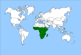
The Afrotropical realm is one of the Earth's eight biogeographic realms. It includes Sub-Saharan Africa, the southern Arabian Peninsula, the island of Madagascar, and the islands of the western Indian Ocean. It was formerly known as the Ethiopian Zone or Ethiopian Region.

<span class="mw-page-title-main">Guinean forest–savanna mosaic</span> Tropical forest, savanna, and grassland ecoregion in West Africa

The Guinean forest-savanna mosaic, also known as the Guinean forest-savanna transition, is a distinctive ecological region located in West Africa. It stretches across several countries including Guinea, Sierra Leone, Liberia, Ivory Coast, Ghana, Togo, Benin, Nigeria, and Cameroon. This region is characterized by a unique blend of forested areas and savannas, creating a diverse and dynamic landscape.

Forest management is a branch of forestry concerned with overall administrative, legal, economic, and social aspects, as well as scientific and technical aspects, such as silviculture, protection, and forest regulation. This includes management for timber, aesthetics, recreation, urban values, water, wildlife, inland and nearshore fisheries, wood products, plant genetic resources, and other forest resource values. Management objectives can be for conservation, utilisation, or a mixture of the two. Techniques include timber extraction, planting and replanting of different species, building and maintenance of roads and pathways through forests, and preventing fire.

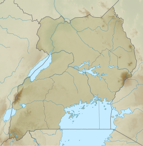
Today, forest and woodland cover in Uganda stands at 49,000 km² or 24% of the total land area. Of these 9,242.08 km² is tropical rainforest, 350.60 km² are forest plantations and 39,741.02 km² is woodland. 30% of these areas are protected as national parks, wildlife reserves or central forest reserves.

<span class="mw-page-title-main">Deforestation in Sri Lanka</span>

Deforestation is one of the most serious environmental issues in Sri Lanka. Sri Lanka's current forest cover as of 2017 was 29.7%. In the 1920s, the island had a 49 percent forest cover but by 2005 this had fallen by approximately 26 percent. Between 1990 and 2000, Sri Lanka lost an average of 26,800 ha of forests per year. This amounts to an average annual deforestation rate of 1.14%. Between 2000 and 2005 the rate accelerated to 1.43% per annum. However, with a long history of policy and laws towards environmental protection, deforestation rates of primary cover have decreased 35% since the end of the 1990s thanks to a strong history of conservation measures. The problem of deforestation in Sri Lanka is not as significant in the southern mountainous regions as it is in northern and lowland southern Sri Lanka, largely due to the nature of environmental protection.

Akure Forest Reserve is a protected area in southwest Nigeria, covering 66 km2 (25 sq mi). The Akure Forest Reserve, established in 1948 and spanning approximately 32 hectares. It was created with the primary aim of safeguarding the genetic diversity of the forest ecosystem. About 11.73% is estimated to be cleared for cocoa farming and other food crops. Aponmu and Owena Yoruba speaking communities owned the forest, though, there are also minor settlements surrounding the forest. They include Ipogun, Kajola/ Aponmu, Kajola, Ago Petesi, Akika Camp, Owena Town, Ibutitan/Ilaro Camp, Elemo Igbara Oke Camp and Owena Water new Dam.

<span class="mw-page-title-main">Forest restoration</span>

Forest restoration is defined as “actions to re-instate ecological processes, which accelerate recovery of forest structure, ecological functioning and biodiversity levels towards those typical of climax forest” i.e. the end-stage of natural forest succession. Climax forests are relatively stable ecosystems that have developed the maximum biomass, structural complexity and species diversity that are possible within the limits imposed by climate and soil and without continued disturbance from humans. Climax forest is therefore the target ecosystem, which defines the ultimate aim of forest restoration. Since climate is a major factor that determines climax forest composition, global climate change may result in changing restoration aims. Additionally, the potential impacts of climate change on restoration goals must be taken into account, as changes in temperature and precipitation patterns may alter the composition and distribution of climax forests.

<span class="mw-page-title-main">Budongo Forest</span> Forest in Uganda

The Budongo Forest in Uganda is northwest of the capital city Kampala on the way to Murchison Falls National Park and is located on the escarpment northeast of Lake Albert. It covers parts of Hoima and Kikuube. It is known for its former abundance of East African mahogany trees as well as being home to a population of chimpanzees. An exceptionally large mahogany tree is still found here and is more than 80 meters tall and some 20 meters in circumference. The forest covers 82,530 hectares and is a catchment for Lake Albert. It is managed by National Forestry Authority (NFA).

<span class="mw-page-title-main">Niger Delta mangroves</span> Mangrove forest within a deltaic depositional environment

Nigeria has extensive mangrove forests in the coastal region of the Niger Delta. Considered one of the most ecologically sensitive regions in the world, the Niger Delta mangrove forest is situated within a deltaic depositional environment. These mangrove forests serve a critical role in regional ecological and landscape composition, and support subsistence gathering practices, and market-based income opportunities. Anthropogenic development threatens the survival of Niger Delta mangrove populations.

Mafuga Central Forest Reserve is a protected area nestled within the landscapes of Rubanda district and Rukungiri district in Western Uganda. This forest reserve, managed by the National Forestry Authority (NFA), is renowned for its biodiversity, stunning mountain scenery, and ecological features. As a key component of Uganda's Central Forest Reserves system, Mafuga Central Forest Reserve plays a crucial role in conservation efforts and serves as a haven for numerous plant and animal species.

Rwensama Central Forest Reserve is a tropical high forest found in Masindi District in Uganda. It covers 127 hectares and it is meant for ecological and environmental purposes.

Nyamakere Central Forest Reserve is a protected area located in the Kiryandongo District of Uganda. It is one of the many Central Forest Reserves managed by the National Forestry Authority (NFA) of Uganda. Nyamakere Central Forest Reserve covers an extensive stretch of over 3.4 kilometers.

Mubuku Central Forest Reserve is a forest located in the Rwenzori Mountains region of Western Uganda, situated near the villages of Nyakalengija and Kilembe. The forest reserve covers a significant area and plays a vital role in the conservation of biodiversity and ecosystem services in the region.

Namatale Central Forest Reserve is a forest located in Mbale district, Uganda. It is a significant natural resource that plays a crucial role in the region's ecosystem and biodiversity conservation efforts.

Muhangi Central Forest Reserve is a protected area located in Western Uganda's Kyenjojo district. Muhangi forest is a closed tropical forest that protects the banks of river Muzizi. It spans an area of 2,044 hectares. It is also located in the Ugandan Albertine Rift, Muzizi River Catchment Area since the River Muzizi runs along the northern part of Muhangi Central Forest Reserve.

Rwoho Forest Reserve is a protected area located to the south of Bugamba Central Forest Reserve in Rwampara and Isingiro districts in south western Uganda. The reserve covers extensive high ground and numerous valleys, including the majority of the Kyezo valley's western watershed. Rwoho Forest Reserve has an area of 91 square kilometers and is maintained on behalf of the Government of Uganda by the National Forestry Authority (NFA) under the National Forestry Authority and Tree Planting Act 8/2003.

References

  1. 1 2 Samson Gwali, Paul Okullo, David Hafashimana, and Denis Mujuni Byabashaija,. 2010. Taxonomic diversity, distinctness, and abundance of tree and shrub species in Kasagala forest reserve in Uganda: implications for management and conservation policy decisions. Tropical Conservation Science Vol. 3 (3): 319-333.
  2. 1 2 3 Gwali, Samson; Okullo, Paul; Hafashimana, David; Byabashaija, Denis Mujuni (September 2010). "Taxonomic Diversity, Distinctness, and Abundance of Tree and Shrub Species in Kasagala Forest Reserve in Uganda: Implications for Management and Conservation Policy Decisions". Tropical Conservation Science. 3 (3): 319–333. doi: 10.1177/194008291000300306 . ISSN   1940-0829. S2CID   89537558.
  3. Aganyira, K., Kabumbuli, R., Muwanika, V. B., Nampanzira, D., Tabuti, J. R. S., & Sheil, D. (2019). Learning from failure: lessons from a forest based carbon and charcoal project. International Forestry Review, 21(1), 1-10.
  4. Jagger, P. (2008). Forest Incomes after Uganda's forest sector reform: Are the rural poor gaining? (No. 577-2016-39168).
  5. Estrada, A., & Butler, R. (2010). Conservation multitasking in the tropics. TROPICAL CONSERVATION SCIENCE, 3(3), I-III.
  6. Jagger, P. (2006). THE SCRAMBLE FOR PROPERTY RIGHTS: RENEGOTIATING LIVELIHOODS AND SUSTAINABILITY AFTER UGANDA’S FOREST SECTOR GOVERNANCE REFORM1.
  7. Ministry of Water, Lands and Environment, Forest Department (2019-02-28). "Uganda Forestry Nature Conservation Master Plan 2002".{{cite journal}}: Cite journal requires |journal= (help)CS1 maint: multiple names: authors list (link)
  8. 1 2 3 World Bank. (2011). Environmental Impact Assessment for Kasagala Central Forest Reserve Final Report. www.documents1.worldbank.org. Retrieved June 12, 2023, from https://documents1.worldbank.org/curated/pt/722051468308650356/pdf/E28840v50EA0P0071B0AFR0EA0P073089v5.pdf
  9. 1 2 Dr, Koojo, Amooti Charles (2011). "Environmental Impact Assessment for Kasagala Central Forest Reserve Final Report" (PDF). Environmental Impact Assessment (5).
  10. Maria, Mutagamba (July 1, 2008 – June 30, 2018). "Forest Management Plan for Katugo Management Plan Area (Katugo and Kasagala Central Forestreserves)" (PDF). National Forestry Authority. 2.
  11. "Executive order No3: Museveni bans charcoal trade, guides on the Balaalo". Monitor. 2023-05-25. Retrieved 2023-05-29.
  12. 1 2 "Ugandan forest being stripped for fuel wood". Mongabay Environmental News. 2010-09-27. Retrieved 2023-05-26.
  13. 1 2 World Bank. "Forest management plan for Katugo management plan area (Katugo and Kasagala central forest reserves)". World Bank. Retrieved 2023-06-12.
  14. Gwali S, Okullo P, Hafashimana D, Byabashaija DM. Taxonomic Diversity, Distinctness, and Abundance of Tree and Shrub Species in Kasagala Forest Reserve in Uganda: Implications for Management and Conservation Policy Decisions. Tropical Conservation Science. 2010;3(3):319-333. doi : 10.1177/194008291000300306
  15. Kayanja, F. I. B.; Byarugaba, D. (2001). "Disappearing forests of Uganda: The way forward". Current Science. 81 (8): 936–947. ISSN   0011-3891. JSTOR   24106518.
  16. "Tropical Conservation Science - September 2010 Issue". tropicalconservationscience.mongabay.com. Retrieved 2023-06-12.