
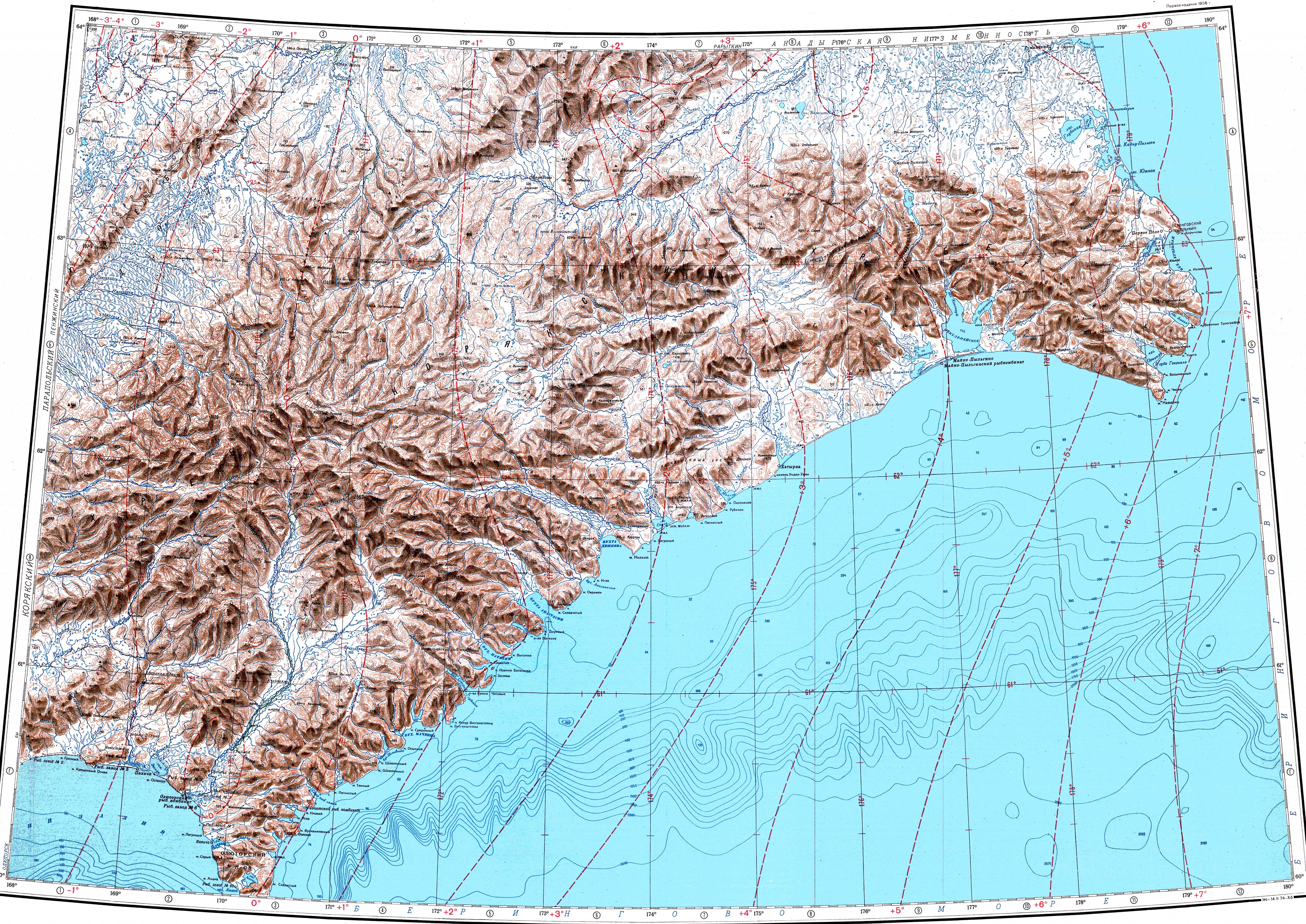
The Anadyr is a river in the far northeast of Siberia which flows into the Gulf of Anadyr of the Bering Sea and drains much of the interior of Chukotka Autonomous Okrug. Its basin corresponds to the Anadyrsky District of Chukotka.

Kamchatka Oblast was, until being incorporated into Kamchatka Krai on July 1, 2007, a federal subject of Russia. To the north, it bordered Magadan Oblast and Chukotka Autonomous Okrug. Koryak Autonomous Okrug was located in the northern part of the oblast. Including the autonomous okrug, the total area of the oblast was 472,300 square kilometres (182,400 sq mi), encompassing the southern half of the Kamchatka Peninsula. The administrative center of Kamchatka Oblast was the city of Petropavlovsk-Kamchatsky. Population: 358,801 (2002 Census); 466,096 (1989 Soviet census).

The Koryak Mountains or Koryak Highlands are an area of mountain ranges in Far-Eastern Siberia, Russia, located in Chukotka Autonomous Okrug and in Kamchatka Krai, with a small part in Magadan Oblast. The highest point in the system is the 2,562-metre high (8,406 ft) Mount Ledyanaya, located in the Ukelayat Range, in the central part of the mountains.

The Chantalvergyrgyn, also called the Chantalveergyn, is a stream located in Chukotka Autonomous Okrug, Russian Far East. It is 222 kilometres (138 mi) long, and has a drainage basin of 6,620 square kilometres (2,560 sq mi).
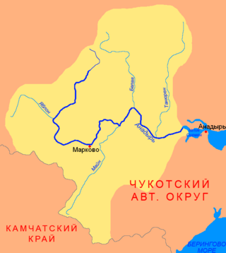
The Mayn is a river in Chukotka Autonomous Okrug in Russia, one of the major tributaries of the Anadyr. The length of the river is 475 kilometres (295 mi). The area of is drainage basin is 32,800 square kilometres (12,700 sq mi).

The Chegitun is a river located in the Chukotka Peninsula in Far East Siberia. It is the easternmost river flowing into the Chukchi Sea from the Siberian side, which makes it the easternmost significant river of the Eurasian continent. It is 137 kilometres (85 mi) long, and has a drainage basin of 4,120 square kilometres (1,590 sq mi).

Khatyrka is a rural locality in Anadyrsky District of Chukotka Autonomous Okrug, Russia, located on the shore of the Bering Sea southwest of Beringovsky. Population: 377 (2010 Census); with an estimated population of 323 as of 2018. Municipally, it is incorporated as Khatyrka Rural Settlement.

The Penzhina is a river in Kamchatka Krai, Russia. It is 713 kilometres (443 mi) long, and has a drainage basin of 73,500 square kilometres (28,400 sq mi).
The Ukelayat is a river in Kamchatka Krai, Russia. The length of the river is 118 kilometres (73 mi) and the area of is drainage basin 6,820 square kilometres (2,630 sq mi).

The Komeutyuyam Range is a range of mountains in Chukotka Autonomous Okrug and Kamchatka Krai, Russian Far East.
The Iomrautvaam is a river in Chukotka Autonomous Okrug, Russia. The length of the river is 103 kilometres (64 mi) and the area of is drainage basin 1,310 square kilometres (510 sq mi).
Khatyrka is a meteorite found in 2011 in the valley of the Iomrautvaam, a tributary of the Khatyrka river, Chukotka Autonomous Okrug, Russian Far East. It is a CV3 (oxidized) chondrite meteorite.
The Ukelayat Range is a range of mountains in Kamchatka Krai, Russian Far East. The range is part of the Koryak Highland system and administratively it belongs to Olyutorsky District.
The Oklan is a river in Kamchatka Krai, Russia. The length of the river is 272 kilometres (169 mi) and the area of is drainage basin 12,600 square kilometres (4,900 sq mi). It is the second most important tributary of the Penzhina after the Belaya.
The Yeropol is a river in Chukotka Autonomous Okrug, Russia. It has a length of 261 kilometres (162 mi) and a drainage basin of 10,700 square kilometres (4,100 sq mi).

The Kedon is a river in Magadan Oblast, Russia. It has a length of 296 kilometres (184 mi) and a drainage basin of 10,300 square kilometres (4,000 sq mi).
Pychgynmygytgyn is a freshwater lake in Providensky District, Chukotka Autonomous Okrug, Russian Federation. It has an area of 13.1 km2 (5.1 sq mi).

Ervynaygytgyn is a freshwater lake in Iultinsky District, Chukotka Autonomous Okrug, Russian Federation. It has an area of about 15 km2 (5.8 sq mi).

Yanragytgyn is a freshwater lake in Anadyr District, Chukotka Autonomous Okrug, Russian Federation. It has an area of 79 km2 (31 sq mi).

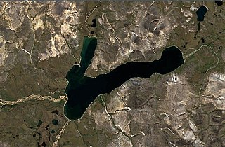
Maynits is a freshwater lake in Anadyr District, Chukotka Autonomous Okrug, Russian Federation. It has an area of almost 50 km2 (19 sq mi). There are no permanent settlements on the shores of the lake.


