
Alwar is a city located in India's National Capital Region (NCR) and the administrative headquarters of Alwar District in the state of Rajasthan. It is located 150 km south of Delhi and 150 km north of Jaipur.
Mewat is a historical and cultural region which encompasses parts of the modern-day states of Haryana, Rajasthan, and Uttar Pradesh in northwestern India.
Rewari is a city and a municipal council in Rewari district in the Indian state of Haryana. It is district headquarter of Rewari district. It is located in south-west Haryana around 82 km from Delhi and 51 km from Gurgaon. It lies in Ahirwal region.

Alwar is a district in the state of Rajasthan in northern India, whose district headquarters is Alwar city. The district covers 8,337 km2. It is bound on the north by Rewari district of Haryana, on the east by Bharatpur district of Rajasthan and Nuh district of Haryana, on the south by Dausa district, and on the west by Jaipur district.

Bhiwadi is a planned city in Khairthal- Tijara district in the Indian state of Rajasthan and a Part of National Capital Region of Delhi. It is located 32 from Khairthal-Tijara city, the district headquarters, 85 km away from the city of Alwar and situated on the Rajasthan-Haryana border. Bhiwadi is considered to be a hub for Taiwanese and Japanese companies. The city is divided into three separate zones, which are the residential, industrial and commercial zones. In recent years, it also became one of the most polluted cities in the world in terms of air pollution.
Mandawar is a town in the Dausa district in the Indian state of Rajasthan. It is located about 140 km (87 mi) from the state capital, Jaipur and 250 km (160 mi) from Delhi.for ro sale and service please make call 9024242690
Tijara is a city and a municipality in Khairthal-Tijara district of the Indian state of Rajasthan. Tijara comes under the NCR area and is situated 55 km to the northeast of Alwar. The nearest railway station to Tijara is Khairthal. Bhiwadi is a census town in Tijara. It is the biggest industrial area of Rajasthan and part of the historical Ahirwal Mewat region. Tijara is dominated by Ahir and Meo community. The new political map has not erased the ancient Ahirwal-Mewat boundaries.Ahirwal was a post-Mughal principality ruled by Ahirs or Yadavs.
Ahirwal is a region spanning parts of southern Haryana, north-eastern Rajasthan, and South-Western Delhi The region was once a small principality based from the town of Rewari and controlled by members of the Yaduvanshi Ahir community from around the time when the Mughal empire was in decline.
Kotkasim is a City and Nagar Palika, near Tijara City in Khairthal-Tijara district of the Indian state of Rajasthan.
Kotia is a village located in Kanina tehsil, district Mahendragarh, Haryana state of India. It is on the Kosli–Kanina road and is 17 kilometres from Kosli and 3 kilometres from Kanina.

Bawwa is a village in the Nahar Block of the Rewari District in Haryana, India. It is located 50 kilometres (31 mi) northwest of the district headquarters of Rewari, 10 kilometres (6.2 mi) west-southwest of Nahar, and 320 kilometres (200 mi) from the state capital Chandigarh. Karoli, Garhs, Sihor, Bahala, Naya-Gaon, and Gadhi are the neighboring villages. Bawwa is situated approximately 3 km from Karoli mod on Kanina-Bahu-Jholri road in the Rewari District.

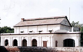
Rewari Junction railway station is a major railway station of the Indian Railways serving the city of Rewari in the Indian state of Haryana. It is in the Jaipur Division of the North Western Railway zone and lies on the Delhi–Ajmer–Ahmedabad route. Six railway lines branch out from this railway station.
Mundawar is a town and tehsil in Khairthal - Tijara district in Indian state of Rajasthan. Mundawar is 15 km from Khairthal city.

Khanpur Ahir or Khanpur Aheer is a village, near Khairthal in Mundawar Mandal in Khairthal-Tijara district in the Indian state of Rajasthan. Khanpur Ahir is 15 km (9.3 mi) from its district headquarters Khairthal city. It is 140 km (87 mi) from its state capital, Jaipur.
Sanoda is a village in Kotkasim tehsil Alwar District in the state of Rajasthan, India.
Moonpur Thakran is a village in Kotkasim tehsil of Alwar District in the state of Rajasthan, India. Moonpur Thakran is a part of the Ahirwal region.

Khanpur Dagran, Khanpur Aheeran, Khanpur Ahir is a village in Kotkasim tehsil Alwar District in the state of Rajasthan, India. Khanpur Dagran part of Ahirwal and about 85 percent of the total population are Yadav. Most of the Yadavs belong to the gotra(clan) of the Dagar. The main language spoken in Ahirwati.
Delhi–Alwar Regional Rapid Transit System is a 164 km long under-construction semi-high speed rail corridor connecting Delhi, Gurgaon, Rewari and Alwar. It is one of the three RapidX corridors planned under Phase-1 of the Rapid Rail Transport System of the National Capital Region Transport Corporation (NCRTC). With maximum speed of 160 km/h and average speed of 105 km/h, the distance between Delhi and Alwar will be covered in 104 minutes. The project is expected to cost ₹37,000 crores.

Rail transport in the state of Haryana, India, is conducted by five rail divisions in three zones: the North Western Railway zone, Northern Railway zone, and North Central Railway zone. The Diamond Quadrilateral high-speed rail network, Eastern Dedicated Freight Corridor, and Western Dedicated Freight Corridor pass through Haryana.
Bharawas is a village in Rewari tehsil of Rewari district in the Indian state of Haryana. It lies on NH15 south of Rewari at about 8 kilometres (5.0 mi) on the Rewari-Bawad road.

