Cuddalore District is one of the 38 districts in the state of Tamil Nadu in India.
Bargur is a selection-grade town panchayat in the Krishnagiri district of the Indian state of Tamil Nadu, that serves as the headquarters of Bargur taluk, one of the seven taluks in Krishnagiri district.

Lalgudi is a prominent municipality located in the Tiruchirapalli district of Tamil Nadu, India. This region has historical and cultural significance, serving as the administrative center for various divisions including Lalgudi taluk, Lalgudi Educational District, and Lalgudi DSP. Its importance stems from its governance structure, educational institutions, and constituency representation, as it has been part of the legislative assembly since 1952.

Parangipettai, historically called Porto Novo, is a coastal panchayat town in Cuddalore district in the Indian state of Tamil Nadu. Parangipettai is located on the north bank of the mouth of the Vellar River at a distance of 30 km from Cuddalore. From the state capital city of Chennai, Parangipettai can be reached through the National Highway NH32 stretch between Cuddalore and Chidambaram.

Pethanaickenpalayam is a town panchayat and headquarters of Pethanaickenpalayam taluk, in Salem district, Tamil Nadu, India.
Srimushnam is a town panchayat, and the headquarters of Srimushnam taluk, in Cuddalore district, Tamil Nadu, India. The town is sacred to Hindus and Buddhists. It is one of the eight Svayam Vyakta Ksetras of Vaishnavism, and is known for Bhu Varaha Swamy temple, which is dedicated to Varaha, the boar-avatar of Vishnu, and his consort, Lakshmi. The Bhuvaraha temple has been visited by Madhva saint Sri Vadiraja Tirtha in sixteenth century and is written in his work Tirtha Prabandha. Jagadguru Madhvacharya visited Bhuvaraha temple many times and took even Chaturmasya deeksha here. During his Chaturmasya deeksha he created a Dhanda Tirtha, a pond with stick which can be seen even today.
Vazhapadi is a town panchayat in Salem district in the Indian state of Tamil Nadu. It is the headquarters of Vazhapadi taluk, one of the 13 taluks of Salem district.

Pichavaram is one of the villages of Parangipettai near Chidambaram in Cuddalore District, Tamil Nadu, India. It is located between the Vellar estuary in the north and Coleroon estuary in the south. The Vellar-Coleroon estuarine complex forms the Killai backwater and the mangroves that are permanently rooted in a few feet of water. It is located at a distance of 243 km from Chennai and 15 km from Chidambaram.
Vazhapadi taluk is one of the thirteen taluks of Salem district in the Indian state of Tamil Nadu. The headquarters of the taluk is the town of Vazhapadi.
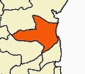
Chidambaram taluk is a taluk of Cuddalore district of the Indian state of Tamil Nadu. The headquarters of the taluk is the town of Chidambaram.Chidambaram is one of the many temple towns in the state which is named after the grooves, clusters or forests dominated by a particular variety of a tree or shrub and the same variety of tree or shrub sheltering the presiding deity. The town used to be called Thillai, following Thillaivanam, derived from the mangrove of Tillai trees that grow here and the nearby Pichavaram wetlands.

The Vellar River is a river in the Indian state of Tamil Nadu. It originates in the Kalrayan Hills, and flows generally eastward through Salem, Perambalur, and Cuddalore districts, before flowing into the Bay of Bengal near Parangipettai. The river has a total length of 150 kilometres (93 mi), and its drainage basin covers an area of 7,504.346 square kilometres (2,897.444 sq mi) in Cuddalore, Perambalur, Salem, Kallakurichi, Ariyalur, Namakkal, Tiruchirappalli, and Dharmapuri districts.

Gariaband District is one of the 33 districts of Chhattisgarh. It has its headquarters at Gariaband town. The district was carved out of Raipur district in 2012.
Anchetty is a small town in the Anchetty taluk of the Krishnagiri district of the Indian state of Tamil Nadu. The village is in the southern half of the taluk, and is the headquarters of one of its seven firkas.
Belur is a first-grade town panchayat in the Vazhapadi taluk of Salem district, in Tamil Nadu, India.
Masinaickenpatti is a census town in the Vazhapadi taluk of Salem district, in Tamil Nadu, India.
Kurichi is a village in the Vazhapadi taluk of Salem district, in Tamil Nadu, India.
Singapuram is a village in the Vazhapadi taluk of Salem district, in Tamil Nadu, India.
Vellalakundam is a village in the Vazhapadi taluk of Salem district, in Tamil Nadu, India.
M.Perumalpalayam is a village in the Vazhapadi taluk of Salem district, in Tamil Nadu, India.
Arasur is a revenue village in the Thiruvennainallur taluk of Viluppuram district, in the Indian state of Tamil Nadu, and the headquarters of Arasur revenue block.