
Thompson Water, Carr and Common is a 154.7-hectare (382-acre) biological Site of Special Scientific Interest north of Thetford in Norfolk. Most of it is managed by the Norfolk Wildlife Trust as Thompson Common. It is a Nature Conservation Review site, Grade I, and part of the Norfolk Valley Fens Special Area of Conservation. It is crossed by the Great Eastern Pingo Trail Local Nature Reserve.

Twywell Gullet is a 17.1-hectare (42-acre) biological Site of Special Scientific Interest east of Kettering in Northamptonshire. It is part of the 54.6 hectare Twywell Hills and Dales nature reserve, which is managed by a partnership of the Woodland Trust and the Rockingham Forest Trust. The site is in turn a small part of the former royal hunting Rockingham Forest.

Bloody Oaks Quarry is a 1.3-hectare (3.2-acre) biological Site of Special Scientific Interest north-west of Great Casterton in Rutland. It is owned and managed by the Leicestershire and Rutland Wildlife Trust.

Little Paxton Wood is a 44.1-hectare biological Site of Special Scientific Interest west of Little Paxton in Cambridgeshire.

Collyweston Great Wood and Easton Hornstocks is a 151.5-hectare (374-acre) biological Site of Special Scientific Interest north of King's Cliffe in Northamptonshire. The site is a National Nature Reserve and a Nature Conservation Review site, Grade I. The site is 14 kilometres (8.7 mi) west of Peterborough and the nearest villages are Collyweston, which is 1 kilometre (0.62 mi) north west of the site, and Duddington which is a similar distance to the west.

Mill Crook is a 5.9-hectare (15-acre) biological Site of Special Scientific Interest east of Towcester in Northamptonshire. Mill Crook and Grafton Regis Meadow are a 7.9-hectare (20-acre) nature reserve managed by the Wildlife Trust for Bedfordshire, Cambridgeshire and Northamptonshire.
Old Sulehay Forest is a 34.8-hectare (86-acre) biological Site of Special Scientific Interest east of King's Cliffe in Northamptonshire. It is part of the 85-hectare (210-acre) Old Sulehay nature reserve, which is managed by the Wildlife Trust for Bedfordshire, Cambridgeshire and Northamptonshire.
River Ise and Meadows is a 13.5-hectare (33-acre) biological Site of Special Scientific Interest along the River Ise in Northamptonshire between Geddington and the Kettering to Corby railway line east of Rushton.

Calender Meadows is a 3.1-hectare (7.7-acre) biological Site of Special Scientific Interest north of Guilsborough in Northamptonshire.

Wakerley Spinney is a 4.4-hectare (11-acre) biological Site of Special Scientific Interest west of King's Cliffe in Northamptonshire.

Short Wood and Southwick Wood is a 54.7-hectare (135-acre) nature reserve north-west of Oundle in Northamptonshire. It is managed by the Wildlife Trust for Bedfordshire, Cambridgeshire and Northamptonshire. Short Wood is a 25.3-hectare (63-acre) biological Site of Special Scientific Interest.

Titsal Wood, Shadingfield is a 14.7-hectare (36-acre) biological Site of Special Scientific Interest south-west of Shadingfield in Suffolk.

Croft Hill is a 2-hectare (4.9-acre) biological Site of Special Scientific Interest north of Croft in Leicestershire.

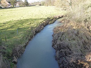
Grantham Canal SSSI is a 9.5-hectare (23-acre) biological Site of Special Scientific Interest which runs along a stretch of the Grantham Canal and its banks between Redmile and Harby in Leicestershire.
King Lud's Entrenchments and The Drift is a 23.9 hectares biological Site of Special Scientific Interest which straddles the border between Lincolnshire and Leicestershire, and is east of Croxton Kerrial. King Lud's Entrenchments is a Scheduled Ancient Monument.

Cliffe Hill Quarry is a 19.2 hectares geological Site of Special Scientific Interest on the western outskirts of Markfield in Leicestershire. It is a Geological Conservation Review site.

Arun Banks is a 25.8-hectare (64-acre) biological Site of Special Scientific Interest north of Arundel in West Sussex.

Bognor Common Quarry is a 25.1-hectare (62-acre) geological Site of Special Scientific Interest east of Petworth in West Sussex. It is a Geological Conservation Review site.
