
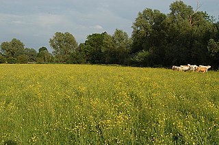
Brampton Meadow is a one hectare biological Site of Special Scientific Interest north-west of Brampton in Cambridgeshire.

Dogsthorpe Star Pit is a 36.4 hectare biological Site of Special Scientific Interest (SSSI)) on the eastern outskirts of Peterborough in Cambridgeshire. It is also designated a Local Nature Reserve, and it is managed by the Wildlife Trust for Bedfordshire, Cambridgeshire and Northamptonshire.

Waresley and Gransden Woods is a 50 hectare nature reserve between Waresley and Great Gransden in Cambridgeshire, England. It is managed by the Wildlife Trust for Bedfordshire, Cambridgeshire and Northamptonshire. The site is a 54.2 hectare biological Site of Special Scientific Interest called Waresley Wood, with slightly different boundaries.

Hardwick Wood is a 15.5 hectare biological Site of Special Scientific Interest south of Caldecote in Cambridgeshire. It is managed by the Wildlife Trust for Bedfordshire, Cambridgeshire and Northamptonshire.
Houghton Meadows is a 4.7 hectare biological Site of Special Scientific Interest (SSSI) between Houghton and St Ives in Cambridgeshire. The SSSI covers three meadows south of Thicket Road; they are part of the 8 hectare Houghton Meadows nature reserve, which is owned and managed by the Wildlife Trust for Bedfordshire, Cambridgeshire and Northamptonshire, and which also includes Browns Meadow to the south.

Woodwalton Marsh is a 0.8 hectare biological Site of Special Scientific Interest north-east of Woodwalton in Cambridgeshire. It is managed by the Wildlife Trust for Bedfordshire, Cambridgeshire and Northamptonshire.

Ashton Wold is a 54.0 hectare biological Site of Special Scientific Interest (SSSI) east of Oundle in Northamptonshire. It is part of the Ashton Estate, which was purchased in 1860 by Lionel de Rothschild, a banker and politician. His grandson, Charles Rothschild, the founder of the Society for the Promotion of Nature Reserves, now The Wildlife Trusts, built Ashton Wold House, which was designed by Wiliam Huckvale. The house and its garden are listed on the Register of Historic Parks and Gardens by English Heritage for their historic interest, and part of the garden is woodland which is designated as Ashton Wold SSSI. Part of the estate is the subject of a Restrictive Covenant between Charles's daughter Miriam Rothschild and the National Trust in 1945.

Warboys and Wistow Woods is a 44.5 hectare biological Site of Special Scientific Interest north of Warboys and west of Wistow in Cambridgeshire. Wistow Wood is an 8.5 hectare nature reserve owned and managed by the Wildlife Trust for Bedfordshire, Cambridgeshire and Northamptonshire.
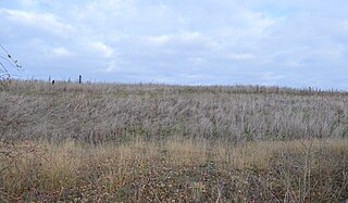
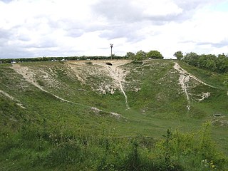
Warboys Clay Pit is a 12.6 hectare geological Site of Special Scientific Interest west of Warboys in Cambridgeshire. It is a Geological Conservation Review site.

Kingston Wood and Outliers is a 47.4 hectare biological Site of Special Scientific Interest south-west of Kingston in Cambridgeshire. The site comprises Kingston Wood itself, Pincote Wood, Hawk's Wood and Lady Pastures Spinney.

Little Paxton Pits is a 127.4 hectare biological Site of Special Scientific Interest in Little Paxton in Cambridgeshire. Part of it is also a 60 hectare Local Nature Reserve (LNR).
Orwell Clunch Pit is a 1.8 hectare biological Site of Special Scientific Interest on the northern outskirts of Orwell in Cambridgeshire. It is owned by Orwell Parish Council and managed by the Clunch Pit Management Trust.

Badsaddle, Withmale Park and Bush Walk Woods is a 25.2 hectare biological Site of Special Scientific Interest north-west of Wellingborough in Northamptonshire.

Banhaw, Spring and Blackthorn's Woods is a 123.4 hectare biological Site of Special Scientific Interest east of Corby in Northamptonshire.

Collyweston Great Wood and Easton Hornstocks is a 151.5 hectare biological Site of Special Scientific Interest north of King's Cliffe in Northamptonshire. The site is a National Nature Reserve and a Nature Conservation Review site, Grade I.

Mill Crook is a 5.9 hectare biological Site of Special Scientific Interest east of Towcester in Northamptonshire. Mill Crook and Grafton Regis Meadow are a 7.9 hectare nature reserve managed by the Wildlife Trust for Bedfordshire, Cambridgeshire and Northamptonshire.
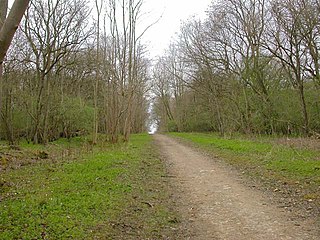
Old Sulehay Forest is a 34.8 hectare biological Site of Special Scientific Interest east of King's Cliffe in Northamptonshire. It is part of the 85 hectare Old Sulehay nature reserve, which is managed by the Wildlife Trust for Bedfordshire, Cambridgeshire and Northamptonshire.

Upper Nene Valley Gravel Pits is a 1,382.4 hectare biological Site of Special Scientific Interest in a chain of flooded gravel pits along 35 kilometres of the valley of the River Nene between Northampton and Thorpe Waterville in Northamptonshire. It is a Ramsar wetland site of international importance, a Special Protection Area under the European Communities Birds Directive and part of the Nene Valley Nature Improvement Area. It is also part of the River Nene Regional Park. Two areas are managed by the Wildlife Trust for Bedfordshire, Cambridgeshire and Northamptonshire, Summer Leys and Titchmarsh Nature Reserve.

Titchmarsh Nature Reserve is a 72.7 hectare Local Nature Reserve north of Thrapston in East Northamptonshire. It is owned and managed by the Wildlife Trust for Bedfordshire, Cambridgeshire and Northamptonshire. It is part of the Upper Nene Valley Gravel Pits Site of Special Scientific Interest.

Aldwincle Marsh is a 2 hectare biological Site of Special Scientific Interest north of Thrapston in Northamptonshire.


