Related Research Articles
Kenneth MacAlpin or Kenneth I was King of Dál Riada (841–850), and King of the Picts (848–858), of likely Gaelic origin. According to the traditional account, he inherited the throne of Dál Riada from his father Alpín mac Echdach, founder of the Alpínid dynasty. Kenneth I conquered the kingdom of the Picts in 843–850 and began a campaign to seize all of Scotland and assimilate the Picts, for which he was posthumously nicknamed An Ferbasach. He fought the Britons of the Kingdom of Strathclyde and the invading Vikings from Scandinavia. Forteviot became the capital of his kingdom and Kenneth relocated relics, including the Stone of Scone from an abandoned abbey on Iona, to his new domain.
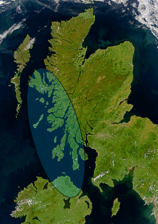
Dál Riata or Dál Riada was a Gaelic kingdom that encompassed the western seaboard of Scotland and north-eastern Ireland, on each side of the North Channel. At its height in the 6th and 7th centuries, it covered what is now Argyll in Scotland and part of County Antrim in Northern Ireland. After a period of expansion, Dál Riata eventually became associated with the Gaelic Kingdom of Alba.

Rathlin Island is an island and civil parish off the coast of County Antrim in Northern Ireland. It is Northern Ireland's northernmost point. As of the 2021 Census there are 141 people living on the island.

The Inner Hebrides is an archipelago off the west coast of mainland Scotland, to the south east of the Outer Hebrides. Together these two island chains form the Hebrides, which experience a mild oceanic climate. The Inner Hebrides comprise 35 inhabited islands as well as 44 uninhabited islands with an area greater than 30 hectares. Skye, Mull, and Islay are the three largest, and also have the highest populations. The main commercial activities are tourism, crofting, fishing and whisky distilling. In modern times the Inner Hebrides have formed part of two separate local government jurisdictions, one to the north and the other to the south. Together, the islands have an area of about 4,130 km2 (1,594 sq mi), and had a population of 18,948 in 2011. The population density is therefore about 4.6 inhabitants per square kilometre.
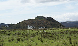
Dunadd is a hillfort in Argyll and Bute, Scotland, dating from the Iron Age and early medieval period and is believed to be the capital of the ancient kingdom of Dál Riata. Dal Riata was a Gaelic kingdom spanning the northern Irish coast to Argyll and the Scottish islands in the early centuries AD, possibly after the Romans had abandoned Southern Britain and at the time when the Anglo-Saxons were crossing the North Sea to counter incursions over Hadrian's Wall by the Picts and Dalriadan Scots.
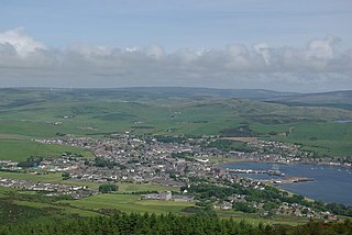
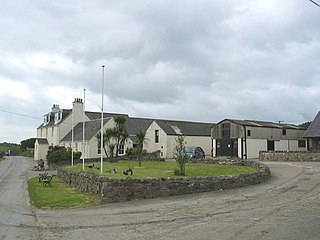
Campbeltown is a town and former royal burgh in Argyll and Bute, Scotland. It lies by Campbeltown Loch on the Kintyre Peninsula. Campbeltown became an important centre for Scotch whisky, and a busy fishing port.
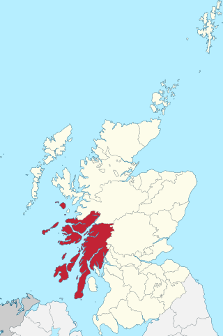
Argyll, sometimes called Argyllshire, is a historic county and registration county of western Scotland. The county ceased to be used for local government purposes in 1975 and most of the area now forms part of the larger Argyll and Bute council area.

Kintyre is a peninsula in western Scotland, in the southwest of Argyll and Bute. The peninsula stretches about 30 miles, from the Mull of Kintyre in the south to East and West Loch Tarbert in the north. The region immediately north of Kintyre is known as Knapdale.

The Mull of Kintyre is the southwesternmost tip of the Kintyre Peninsula in southwest Scotland. From here, the Antrim coast of Northern Ireland is visible on a calm and clear day, and a historic lighthouse, the second commissioned in Scotland, guides shipping in the intervening North Channel. The area has been immortalised in popular culture by the 1977 hit song "Mull of Kintyre" by Kintyre resident Paul McCartney's band of the time, Wings.
Gigha or the Isle of Gigha is an island off the west coast of Kintyre in Scotland. The island forms part of Argyll and Bute and has a population of 163 people. The climate is mild with higher than average sunshine hours and the soils are fertile. The main settlement is Ardminish.

Lord of the Isles or King of the Isles (Scottish Gaelic: Triath nan Eilean or Rìgh Innse Gall; Latin: Dominus Insularum) is a title of nobility in the Baronage of Scotland with historical roots that go back beyond the Kingdom of Scotland. It began with Somerled in the 12th century and thereafter the title was held by a series of his descendants, the Norse-Gaelic rulers of the Isle of Man and Argyll and the islands of Scotland in the Middle Ages. They wielded sea-power with fleets of galleys (birlinns). Although they were, at times, nominal vassals of the kings of Norway, Ireland, or Scotland, the island chiefs remained functionally independent for many centuries. Their territory included much of Argyll, the Isles of Arran, Bute, Islay, the Isle of Man, Hebrides, Knoydart, Ardnamurchan, and the Kintyre peninsula. At their height they were the greatest landowners and most powerful lords after the kings of England and Scotland.
Knapdale forms a rural district of Argyll and Bute in the Scottish Highlands, adjoining Kintyre to the south, and divided from the rest of Argyll to the north by the Crinan Canal. It includes two parishes, North Knapdale and South Knapdale. The area is bounded by sea to the east and west, whilst the sea loch of West Loch Tarbert almost completely cuts off the area from Kintyre to the south. The name is derived from two Gaelic elements: Cnap meaning hill and Dall meaning field.
Cowal is a rugged peninsula in Argyll and Bute, on the west coast of Scotland. It is connected to the mainland to the north, and is bounded by Loch Fyne to the west, by Loch Long and the Firth of Clyde to the east, and by the Kyles of Bute to the south.

Tarbert is a village in the west of Scotland, in the Argyll and Bute council area. It is built at the head of an inlet of Loch Fyne called East Loch Tarbert, on a narrow isthmus which connects Kintyre to the south with Knapdale to the north and separates East Loch Tarbert from the much longer West Loch Tarbert. Tarbert had a recorded population of 1,338 in the 2001 Census.
A clachan is a small settlement or hamlet on the island of Ireland, the Isle of Man and Scotland. Though many were originally kirktowns, today they are often thought of as small villages lacking a church, post office, or other formal building. It is likely that many date to medieval times or earlier – a cluster of small single-storey cottages of farmers and/or fishermen, invariably found on poorer land. They were often related to the rundale system of farming.

There is no standard variety of Scottish Gaelic; although statements below are about all or most dialects, the north-western dialects are discussed more than others as they represent the majority of speakers.

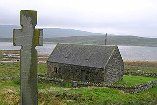
Islay is the southernmost island of the Inner Hebrides of Scotland. Known as "The Queen of the Hebrides", it lies in Argyll and Bute just south west of Jura and around 40 kilometres north of the Northern Irish coast. The island's capital is Bowmore where the distinctive round Kilarrow Parish Church and a distillery are located. Port Ellen is the main port.

Nils Magnus Holmer (1905–1994) was a Swedish linguist.
East Sutherland Gaelic is an extinct dialect of Scottish Gaelic that was spoken in fishing villages on the eastern coast of Sutherland, especially in Brora, Golspie, and Embo.
Arran Gaelic is an extinct dialect of Scottish Gaelic that was spoken on the Isle of Arran, and one of the last of the Southern Dialects to go extinct.
References
- Holmer, Nils M. (1962), The Gaelic of Kintyre, Dublin: Dublin Institute for Advanced Studies, ISBN 978-0-901282-43-9
- Duwe, Kurt C. (April 2012), "Dal Riada & Cinn Tìre (Mid Argyll & Kintyre)" (PDF), Gàidhlig (Scottish Gaelic) Local Studies, 25, Akerbeltz