Kismaros

Last updated
Kismaros
Ulmi Skatulya emlekmu, Kismaros24.jpg
Main Square -Köztársaság Square
Flag of Kismaros.svg
HUN Kismaros Cimer.svg
Hungary location map.svg
Red pog.svg
Kismaros
Location of Kismaros in Hungary
Coordinates: 47°50′16″N19°00′17″E / 47.83775°N 19.00471°E / 47.83775; 19.00471
Country Hungary
Region Central Hungary
County Pest
Subregion Szob
RankVillage
Area
[1]
  Total11.96 km2 (4.62 sq mi)
Population
 (1 January 2009) [2]
  Total2,009
  Density170/km2 (440/sq mi)
Time zone UTC+1 (CET)
  Summer (DST) UTC+2 (CEST)
Postal code
2623
Area code +36 27
KSH code 33738 [1]
Website www.kismaros.hu

Kismaros (German : Kleinmarosch) is a village in Pest county, Hungary.

Contents

Location

Kismaros is located 45 kilometres north of Budapest on the eastern bank of the Danube river, just above the bend where the river changes course and flows south. The village is seated at the foot of the Börzsöny Hills on the outskirts of the Carpathians.

Plaque to commemorate the victims of forced labor - malenkiy robot Koztarsasag ter 3, Kismaros28.jpg
Plaque to commemorate the victims of forced labor - malenkiy robot
Kismaros highroad Kossuth Lajos ut, templom fele nezve, jobbra a konyvtar, Kismaros15.jpg
Kismaros highroad

History

First settlers

The village's history dates back to the 18th century when Germans from the Black Forest came to settle down in the area. The name of the village first appears on the “Vályi” map from 1781. The word Maros derives from the Latin "Mures" word and means waterfront, village or fortress. By the end of 18th century the population of Kismaros reached about 200-250 persons. With the effort of all villagers the catholic church was finished in 1827. Agriculture specifically the cultivation of grapes and other fruits provided livelihood for most residents. At the beginning of the 20th century the most spoken language is German.

"Malenkiy robot"

After the Second World War the Soviets took control in Hungary. Although prior to the war most people of Kismaros claimed Hungarian ethnicity already, their German origin meant that in January 1945 eighty of Kismaros’ youths (aged between 16-19) were taken by the Red Army to the Soviet Union, where they were subjected to forced labor in mines and factories. [3] [4] (Pages not available) About half of them never returned. Survivors remember it, just as the Soviets put it, "Malenkiy robot" or little labour.

Modern life

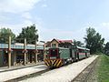
From 1976 until 1990 Kismaros had a joint local government with neighbouring Verőce and was called Verőcemaros. Today's Kismaros is a busy suburban settlement of Budapest. Many of the locals work in the capital city, commuting every day by train or by car. After 1989 Kismaros became a hotspot for Budapesters trying to escape the hassles of city life; many of them settled down in the village permanently. Tourism plays an increasingly important role, providing jobs for local businesses.

Demographics

According to the 2001 national census, Germans account for 6% of the population whereas over 90% claimed Hungarian ethnicity. About 3/4 of all residents are Roman Catholic. [2] The population of the village has been growing constantly in the last decade reaching just over two thousand in 2009. [2]

Tourism

Börzsöny Hills' Children's Railway

Kismaros is the southern terminus for one of Hungary’s oldest light railways. The railway station is located in the centre of the village providing regular service throughout the year. The Börzsöny Hills' Children's Railway is a narrow gauge railway and is very popular among tourists. Every year thousands of people come to Kismaros to take a ride up to the Börzsöny Hills. [5] [6]

Marus Napok

Each year end of September the locals hold the festival “Marus Napok” to celebrate their rich German heritage. The festival's main attraction is when people march through the village with horse-drawn carriages, singing and dancing dressed in traditional clothes. Originally this was to celebrate a good vintage. The festivity is also a unique opportunity for visitors to taste the local cuisine and to listen to some authentic Swabian music.

Kismaros Village Museum

The museum houses a permanent historic exhibition to give visitors some insights into the villagers everyday life. This includes typical old agricultural tools, historic photos and religious relics. The exhibition covers the village life of those ethnic German settlers who arrived in the 18th century to people in present-day Kismaros. [7]

From the capital Budapest, Kismaros can be reached by car or public transport.

By public transport

There are trains running from Budapest West railway station daytime in every 30 minutes. The journey time is approx. 45 minutes.

Twin towns – sister cities

Kismaros is twinned with:

Famous residents

Related Research Articles

<span class="mw-page-title-main">Kikinda</span> City in Vojvodina, Serbia

Kikinda is a city and the administrative center of the North Banat District in Serbia. The city urban area has 38,069 inhabitants, while the city administrative area has 59,453 inhabitants.

<span class="mw-page-title-main">Baja, Hungary</span> City with county rights in Southern Great Plain, Hungary

Baja is a city with county rights in Bács-Kiskun County, southern Hungary. It is the second largest city in the county, after the county seat at Kecskemét, and is home to some 35,000 people. Baja is the seat of the Baja municipality.

<span class="mw-page-title-main">Ferencváros</span> District of Budapest in Central Hungary, Hungary

Ferencváros is the 9th district of Budapest, Hungary.

<span class="mw-page-title-main">Hungarian State Railways</span> National railway operator in Hungary

Hungarian State Railways is the Hungarian national railway company, with divisions "MÁV START Zrt.", "MÁV-Gépészet Zrt." (maintenance), "MÁV-Trakció Zrt." and "MÁV Cargo Zrt". The head office is in Budapest.

<span class="mw-page-title-main">Danube Swabians</span> Historical ethnic group centered around the Danube river valley in southeastern Europe

The Danube Swabians is a collective term for the ethnic German-speaking population who lived in various countries of central-eastern Europe, especially in the Danube River valley, first in the 12th century, and in greater numbers in the 17th and 18th centuries. Most were descended from earlier 18th-century Swabian settlers from Upper Swabia, the Swabian Jura, northern Lake Constance, the upper Danube, the Swabian-Franconian Forest, the Southern Black Forest and the Principality of Fürstenberg, followed by Hessians, Bavarians, Franconians and Lorrainers recruited by Austria to repopulate the area and restore agriculture after the expulsion of the Ottoman Empire. They were able to keep their language and religion and initially developed strongly German communities in the region with German folklore. Thousands also came from Eastern Europe.

<span class="mw-page-title-main">Rétság</span> Town in Nógrád, Hungary

Rétság is a small town in Nógrád county, in Hungary.

<span class="mw-page-title-main">Siege of Budapest</span> 1944–45 battle in the Eastern Front of World War II

The siege of Budapest or battle of Budapest was the 50-day-long encirclement by Soviet and Romanian forces of the Hungarian capital of Budapest, near the end of World War II. Part of the broader Budapest Offensive, the siege began when Budapest, defended by Hungarian and German troops, was encircled on 26 December 1944 by the Red Army and the Romanian Army. During the siege, about 38,000 civilians died through starvation, military action, and mass executions of Jews by the far-right Hungarian nationalist Arrow Cross Party. The city unconditionally surrendered on 13 February 1945. It was a strategic victory for the Allies in their push towards Berlin.

<span class="mw-page-title-main">Békásmegyer</span>

Békásmegyer is a neighbourhood in Budapest, Hungary. It belongs administratively to District III. Békásmegyer consists of two different parts, a huge high-rise housing estate and the traditional Ófalu with older houses. Békásmegyer is divided into two by the Szentendre HÉV line. Békásmegyer bal-oldal (left-side) and Békásmegyer jobb-oldal (right-side). The left side was an independent village until 1 January 1950, when it was merged into Budapest, while the right side was a water reservoir of the Danube river. Today 41,000 people live in Békásmegyer Microdistrict and a few thousand in the former village.

<span class="mw-page-title-main">Poieni, Cluj</span> Commune in Cluj, Romania

Poieni is a commune in Cluj County, Transylvania, Romania. It is composed of eight villages: Bologa (Sebesvár), Cerbești (Kecskéstanya), Hodișu (Hodosfalva), Lunca Vișagului (Viságmező), Morlaca (Marótlaka), Poieni, Tranișu (Tarányos), and Valea Drăganului (Nagysebes).

<span class="mw-page-title-main">MÁVAG</span>

MÁVAG was the largest Hungarian rail vehicle producer. MÁVAG company was the second largest industrial enterprise after the Manfréd Weiss Steel and Metal Works in the Hungarian half of the Austro-Hungarian Monarchy. MÁVAG was the property of the Kingdom of Hungary. After World War II MÁVAG was nationalized, and "Királyi" ("Royal") was removed from its name.

Solymár is an urban village in northwest of Budapest metropolitan area, bordering the 3rd and 2nd districts of the city, as well as Nagykovácsi, Pilisszentiván, Pilisvörösvár, Csobánka, Pilisborosjenő, and Üröm. Its picturesque surroundings and good accessibility the 64, 64A, 164, 264, 157 and 964 city buses from Hűvösvölgy, 218 from Óbuda, a train from Budapest Nyugati, and coaches from Árpád-híd) made it a desirable destination for affluent city-dwellers moving to suburban homes outside of Budapest from the mid-1990s.

<span class="mw-page-title-main">National Blue Trail</span>

The National Blue Trail is a national trail in Hungary incorporated into the European Long Distance Walking Route E4. The route starts atop the Irottkő Mountain on the Austrian-Hungarian border then cuts across Hungary eventually ending 1,168 km later at the village of Hollóháza by the Hungarian-Slovakian border.. The name of the Kéktúra is a reference to the marking of the path itself: it is a horizontal blue stripe between two white stripes. All segments of the trail are freely accessible to the public; no fees have to be paid or permits obtained, there is only one ferry to take over the Danube between Visegràd and Nagymaros where you have to purchase a ticket.

<span class="mw-page-title-main">Abaliget</span> Village in Baranya, Hungary

Abaliget is a village in central Baranya County, Pécs District, in southern Hungary. Until the end of World War II, the majority of the Inhabitants was Danube Swabians, also called locally as Stifolder, because there Ancestors once came at the 17th century and 18th century from Fulda (district). Mostly of the former German Settlers was expelled to Allied-occupied Germany and Allied-occupied Austria in 1945–1948, about the Potsdam Agreement. Only a few Germans of Hungary live there, the majority today are the descendants of Hungarians from the Czechoslovak–Hungarian population exchange. They got the houses of the former Danube Swabians Inhabitants. It is located in the western Mecsek Mountains. The nearby Abaliget Cave and the area's lakes and hiking trails make it a popular tourist destination. Its population at the 2011 Census was 598.

<span class="mw-page-title-main">Zebegény</span> Town in Pest, Hungary

Zebegény is a picturesque historic village in Pest county, Hungary. It is located 60 km north of Budapest in the Danube Bend, next to the Duna-Ipoly National Park. It is a favourite destination for tourists, who love the quiet and the fresh air. Due to its nice beaches, mountains, and forests, the village was nicknamed "The marble of the Danube Bend".

<span class="mw-page-title-main">History of Budapest</span> UNESCO World Heritage Site in Central Hungary, Hungary

The city of Budapest was officially created on 17 November 1873 from a merger of the three neighboring cities of Pest, Buda and Óbuda. Smaller towns on the outskirts of the original city were amalgamated into Greater Budapest in 1950. The origins of Budapest can be traced to Celts who occupied the plains of Hungary in the 4th century BC. The area was later conquered by the Roman Empire, which established the fortress and town of Aquincum on the site of today's Budapest around AD 100. The Romans were expelled in the 5th century by the Huns, who were challenged by various tribes during the next several centuries. The Hungarian conquest of the Carpathian Basin started at the end of the 9th century, and the Kingdom of Hungary was established at the end of the 11th century.

<span class="mw-page-title-main">Nagybörzsöny</span> Village in Central Hungary, Hungary

Nagybörzsöny is a village in Pest County, Hungary.

<span class="mw-page-title-main">Újbuda</span> District of Budapest in Central Hungary, Hungary

Újbuda is the 11th district of Budapest, Hungary. It is the most populous district of Budapest with 137,426 inhabitants (2008). Until the 1890s, Újbuda's present territory was a field south of the historical town of Buda. The construction of a new residential area started in the 1900s, the present district was formed in 1930. From 1880 to 1980, Újbuda's population increased from 1,180 to 178,960. There are boulevards, avenues with tram lines, and communist-era housing estates in the district. Line 4 of the Budapest metro passes through Újbuda.

<span class="mw-page-title-main">Hercegkút</span> Village in Northern Hungary, Hungary

Hercegkút is a village in Borsod-Abaúj-Zemplén County in northeastern Hungary. Swabians— German immigrants — from the Black Forest (Schwarzwald) region of Germany settled here and played a major role in the evolution of the village’s viticulture. The cellars of Gombos Hill and Kőporos are UNESCO World Heritage Sites.

<span class="mw-page-title-main">Máriakéménd</span> Municipality in Southern Transdanubia, Hungary

Máriakéménd is a village and municipality in Baranya County, Hungary.

<span class="mw-page-title-main">Rákosmente</span> District of Budapest in Central Hungary, Hungary

District XVII of Budapest is a suburban district of Budapest on the left bank of the Danube, in the eastern part of the capital. It is Budapest's largest district, with an area of 54.82 km2, and home to nearly 90,000 people, making it the seventh most populous district of Budapest. Towns that were different in nature, but closely connected, were annexed to the capital in 1950 as part of the Greater Budapest plan. It is one of the most beautifully located districts of Pest, which is partly located as high as the 235 meters Gellért Hill. As the district is part of the Pest Plain, which gradually rises from the Danube to the east, the district's area is almost entirely hilly. The 241 meter high Erdő Hill, the highest point of the Pest side and the Pest Plain is also located here.

References