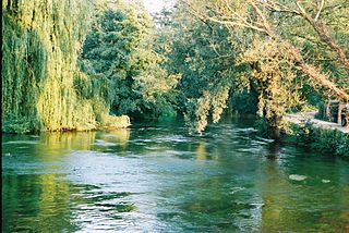
The River Test is a chalk stream in Hampshire in the south of England. It rises at Ashe near Basingstoke and flows southwards for 40 miles (64 km) to Southampton Water. Settlements on the Test include the towns of Stockbridge and Romsey. The river's valley gives its name to the local government district of Test Valley. Below the village of Longparish, the river is broadly followed by the Test Way, a long-distance footpath.

Toddington is a large village and civil parish in the county of Bedfordshire, England. It is situated 5 miles north-north-west of Luton, 4 miles (6 km) north of Dunstable, 6 miles (10 km) south-west of Woburn, and 35 miles north-north-west of London on the B5120 and B579. It is 0.5 miles from Junction 12 of the M1 motorway and lends its name to the nearby motorway service station. The hamlet of Fancott also forms part of the Toddington civil parish.

Luton North is a constituency represented in the House of Commons of the UK Parliament since 2019 by Sarah Owen, of the Labour Party.

Luton Rural District was a local authority in Bedfordshire, England from 1894 to 1974. It covered an area which almost surrounded but did not include the towns of Luton and Dunstable.
Limbury is a suburb of Luton, in the Luton district, in the ceremonial county of Bedfordshire, England, and was formerly a village before Luton expanded around it. The area is roughly bounded by Bramingham Road to the north, Marsh Road to the south, Bramingham Road to the west, and Catsbrook Road, Runfold Avenue, Grosvenor Road, Bancroft Road and Blundell Road to the east.

Leagrave is a former village and now a suburb of Luton, in the Luton district, in the ceremonial county of Bedfordshire, England, in the northwest of the town. The current council ward is roughly bounded by Vincent Road, Torquay Drive and High Street to the north, Roman Road and Stoneygate Road to the south, the M1 to the west, and Marsh Road and Leagrave Park to the east.
Waulud's Bank is a possible Neolithic henge in Leagrave, Luton, England dating from 3,000BC.
Lewsey is a suburb of Luton, about 3 miles (4.8 km) west north-west of the town centre, and a ward of the Borough of Luton, in the ceremonial county of Bedfordshire, England. The suburb is roughly bounded by Leagrave High Street to the north, Dunstable Road to the south, Poynters Road, Dunstable to the west, and the M1 to the east.
Sundon Park is a suburb of north Luton, in the Luton district, in the ceremonial county of Bedfordshire, England. The area is roughly bounded by the edge of Luton to the north, Leagrave Park to the south, the Midland Main Line to the west, and Spinney Woods and the footpath from the woods to the edge of town to the east.
Challney is a district in Luton, in the Luton district, in the ceremonial county of Bedfordshire, England, off the main arterial road leading from Luton into Dunstable. The area is roughly bounded by Rodheath, Stoneygate Road, Roman Road, and Beechwood Road to the north, Hatters Way to the south, the M1 to the west, and Waller Avenue and Chaul End Lane to the east.

Salmons Brook is a minor tributary of the River Lea, located in the London Borough of Enfield.

The Lea Valley Walk is a 50-mile (80 km) long-distance path located between Leagrave, the source of the River Lea near Luton, and the Thames, at Limehouse Basin, Limehouse, east London. From its source much of the walk is rural. At Hertford the path follows the towpath of the River Lee Navigation, and it becomes increasingly urbanised as it approaches London. The walk was opened in 1993 and is waymarked throughout using a swan logo.

Dagenham Brook is a minor tributary of the River Lea located in the London Borough of Waltham Forest, and the traditional eastern limit of Leyton Marshes.

Dunstable is a market town and civil parish in Bedfordshire, England, east of the Chiltern Hills, 30 miles north of London. There are several steep chalk escarpments, most noticeable when approaching Dunstable from the north. Dunstable is the fourth largest town in Bedfordshire and along with Houghton Regis forms the westernmost part of the Luton/Dunstable urban area.

The Broxbourne Mill Stream which diverges from the River Lee Navigation just south of Dobbs Weir, is one of the few remaining 'old river' loops of the River Lea, with a relatively natural channel form and a diverse range of habitats. Broxbourne developed as a small settlement for milling at a river crossing point at Broxbourne Mill. Spital Brook empties into the Mill Stream by Nazeing New Road.

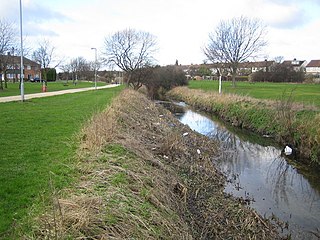
Lewsey Brook is a minor tributary of the River Lea which flows through Luton.

Houghton Brook is a minor tributary of the River Lea. Houghton Brook starts in Houghton Regis and is fed by a number of smaller brooks in the area, mostly supplied by surface water from farmland and the various local villages and housing estates.
Lewsey Farm is a suburb of Luton, Bedfordshire, England. Situated in the north-west of the town, the area is roughly bounded by the Woodside Link to the north, Leagrave High Street to the south, Poynters Road to the west, and Pastures Way to the east. The wider area including nearby districts Lewsey Park and Lewsey are sometimes referred to as Lewsey Farm.
Lewsey Park is a suburb of Luton, Bedfordshire, England. Situated in the north-west of the town, the area is roughly bounded by Woodside Link to the North, Leagrave High Street to the south, Pastures Way to the west, and the M1 to the east.

Fleet Brook is a small river in northern Hampshire, England and tributary of the River Hart.
