

The Millhead Stream is a minor tributary of the River Lea in England. The stream flows north to south across the Waltham Abbey flood plain and through the site of the former Royal Gunpowder Mills.
The Millhead Stream is a minor tributary of the River Lea in England. The stream flows north to south across the Waltham Abbey flood plain and through the site of the former Royal Gunpowder Mills.
The stream is an engineered watercourse which is part of an intricate five mile canal system within the Gunpowder Mills establishment and is fed by water from the River Lea. It provided the main power source for water driven mills in the area before the first gunpowder mills were recorded in 1662. The stream was also used for the smooth and safe delivery of raw materials and collection of gunpowder. [1]
Due to its location the stream remained largely unseen for over 300 years until the site was opened to the general public in 2001. [2]
The stream leaves the Cornmill Stream to flow through the Waltham Abbey Site of Special Scientific Interest within the Royal Gunpowder Mills site, before flowing through late 20th century housing developments. After passing under the B194 road at Highbridge Street the stream merges with the River Lea to flow under the A121 to join the River Lee Flood Relief Channel below the town of Waltham Abbey.
The stream can be seen at Beaulieu Drive close to the entrance of the Gunpowder Mills site. Within the site, where the stream passes through the SSSI access is restricted and can be visited by land train only. [3]
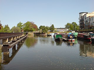
The River Lea is in the East of England and Greater London. It originates in Bedfordshire, in the Chiltern Hills, and flows southeast through Hertfordshire, along the Essex border and into Greater London, to meet the River Thames at Bow Creek. It is one of the largest rivers in London and the easternmost major tributary of the Thames.

The Lee Navigation is a canalised river incorporating the River Lea. It flows from Hertford Castle Weir to the River Thames at Bow Creek; its first lock is Hertford Lock and its last Bow Locks.

Waltham Abbey is a town and civil parish in the Epping Forest District of Essex, within the metropolitan and urban area of London, England, 13.5 miles (21.7 km) north-east of Charing Cross. It lies on the Greenwich Meridian, between the River Lea in the west and Epping Forest in the east, with large sections forming part of the Metropolitan Green Belt.

London is the largest urban area and the capital city of the United Kingdom. It lies in the southeastern part of the island of Great Britain. The London region covers 1,579 square kilometres (610 sq mi), and had a population of 8.982 million in 2019 and a population density of 5,596 people per square km in 2021. A larger area—the London Metropolitan Region or the London Metropolitan Agglomeration—covers 8,382 square kilometres (3,236 sq mi) and had 12,653,500 people, at a density of 1,510 per square kilometre.
Lee Valley Regional Park is a 10,000-acre (40 km2) 26 miles (42 km) long linear park, much of it green spaces, running through the northeast of Greater London, Essex and Hertfordshire. The park follows the course of the River Lea (Lee) along the Lea Valley from Ware in Hertfordshire through Essex and the north east of Greater London, through the Queen Elizabeth Olympic Park to East India Docks Basin on the River Thames. The park is managed by Lee Valley Regional Park Authority and is made up of a diverse mix of countryside areas, urban green spaces, heritage sites, country parks, nature reserves and lakes and riverside trails, as well as leading sports centres covering an area of over 10,000 acres (40 km2). It is crossed by a number of roads and railways.
Enfield Lock is an area in the London Borough of Enfield, north London. It is approximately located east of the Hertford Road between Turkey Street and the Holmesdale Tunnel overpass, and extends to the River Lee Navigation, including the Enfield Island Village. The locality gains its name from the lock on the River Lee Navigation. Today's Enfield Lock was rebuilt in 1922. The area forms part of the Lee Valley Park and the Enfield Lock Conservation Area. On its eastern boundary Enfield Lock has marshland formerly used as a testing site between the Royal Small Arms Factory and the Gunpowder Mills, beyond this is the village of Sewardstone and the Epping forest boundary. To the south is Brimsdown, the north Waltham Cross and to the west Bullsmoor and Freezywater. Enfield Lock forms part of the London boundary.
The Lea Valley, the valley of the River Lea, has been used as a transport corridor, a source of sand and gravel, an industrial area, a water supply for London, and a recreational area. The London 2012 Summer Olympics were based in Stratford, in the Lower Lea Valley. It is important for London's water supply, as the source of the water transported by the New River aqueduct, but also as the location for the Lee Valley Reservoir Chain, stretching from Enfield through Tottenham and Walthamstow.

The Royal Gunpowder Mills are a former industrial site in Waltham Abbey, England. It was one of three Royal Gunpowder Mills in the United Kingdom. Waltham Abbey is the only site to have survived virtually intact.

The River Poddle is a river in Dublin, Ireland, a pool of which gave the city its English language name. Boosted by a channel made by the Abbey of St. Thomas à Becket, taking water from the far larger River Dodder, the Poddle was the main source of drinking water for the city for more than 500 years, from the 1240s. The Poddle, which flows wholly within the traditional County Dublin, is one of around a hundred members of the River Liffey system, and one of over 135 watercourses in the county; it has just one significant natural tributary, the Commons Water from Crumlin.

The Lea Valley Walk is a 50-mile (80 km) long-distance path located between Leagrave, the source of the River Lea near Luton, and the Thames, at Limehouse Basin, Limehouse, east London. From its source much of the walk is rural. At Hertford the path follows the towpath of the River Lee Navigation, and it becomes increasingly urbanised as it approaches London. The walk was opened in 1993 and is waymarked throughout using a swan logo.

The Small River Lea is a minor tributary of the River Lea, which flows through the Lee Valley Park between Cheshunt and Enfield Lock. It forms part of the Turnford and Cheshunt Pits Site of Special Scientific Interest (SSSI) as it flows through the River Lee Country Park.
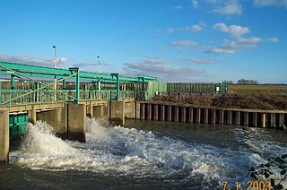
The Lee Flood Relief Channel (FRC) is located in the Lea Valley and flows between Ware, Hertfordshire, and Stratford, east London. Work started on the channel in 1947 following major flooding and it was fully operational by 1976. The channel incorporates existing watercourses, lakes, and new channels. Water from the channel feeds the Lee Valley Reservoir Chain.

The Coppermill Stream is a short waterway near Walthamstow in the Lea Valley. Originally a minor tributary of the River Lea, the approximately 2-mile (3.2 km) long stream is now used as an aqueduct to transport water from the reservoirs in the Lea Valley to Coppermills Water Treatment Works. The stream is part of a Site of Metropolitan Importance.

Waltham Common Lock is a lock on the River Lee Navigation at Waltham Cross in Hertfordshire, England. The lock is located in the River Lee Country Park and stands close to the Broxbourne White Water Canoe Centre. At the tail of the lock is the Powdermill Cut dug in 1806 to connect the Waltham Abbey Royal Gunpowder Mills directly to the then-new navigation.

The River Lee Country Park is located in the Lee Valley Park and is managed by the Lee Valley Regional Park Authority. Covering 1,000 acres (400 ha) on either side of the River Lee Navigation between Waltham Abbey and Broxbourne, it is an area of lakes, watercourses, open spaces and three Sites of Special Scientific Interest (SSSI) linked by footpaths and cycle tracks.

The River Wey is a main tributary of the River Thames in south east England. Its two branches, one of which rises near Alton in Hampshire and the other in West Sussex to the south of Haslemere, join at Tilford in Surrey. Once combined, the flow is eastwards then northwards via Godalming and Guildford to meet the Thames at Weybridge. Downstream the river forms the backdrop to Newark Priory and Brooklands. The Wey and Godalming Navigations were built in the 17th and 18th centuries, to create a navigable route from Godalming to the Thames.

The Cornmill Stream is a minor tributary of the River Lea in the English county of Essex.

The Cornmill Stream and Old River Lea is a 24.6-hectare (61-acre) biological Site of Special Scientific Interest in Waltham Abbey, Essex.

Waltham Abbey SSSI is a 34.2-hectare (85-acre) biological Site of Special Scientific Interest which is located within the Waltham Abbey Royal Gunpowder Mills at Waltham Abbey in Essex.

Lady of the Lea is a spritsail Thames sailing barge, the last such barge to be built in England. She was built in 1931 to carry explosives from Waltham Abbey Royal Gunpowder Mills on the River Lea to Woolwich Arsenal on the River Thames. The barge was later sold and rebuilt. She currently operates as a private yacht and competes in Thames sailing barge matches.