Kolut | |
|---|---|
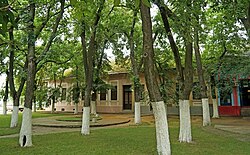 village center | |
 Kolut  Kolut  Kolut | |
| Coordinates: 45°54′N18°56′E / 45.900°N 18.933°E | |
| Country | |
| Province | |
| Region | Bačka (Podunavlje) |
| District | West Bačka |
| Municipality | Sombor |
| Population (2022) | |
• Total | 1,037 |
| Time zone | UTC+1 (CET) |
| • Summer (DST) | UTC+2 (CEST) |
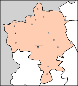
Municipality
of Sombor
●
of Sombor
●
Kolut (Serbian Cyrillic : Колут) is a village in Serbia. It is situated in the Sombor municipality, in the West Bačka District, Vojvodina province. The village has a Serb ethnic majority and its population numbering 1,037 people (2022 census).


